
Old Al Ghanim is a neighborhood of Doha, the capital of Qatar, located in the municipality of Ad Dawhah. It forms a part of Doha's historic downtown. A notable landmark was the New World Centre, a supermarket established in 1987. It has since been relocated. Numerous other local businesses have also been relocated to other parts of Doha by the Ministry of Municipality and Environment so it could carry out massive-scale reconstruction of the neighborhood and clear out portions to make way for the Doha Metro. The Al Ghanim Central Bus station is another important landmark found here.

Umm Ghuwailina is a district in Qatar, located in the municipality of Ad Dawhah.
Sawda Natheel is an area in Qatar, located in the municipality of Al Rayyan. It used to be part of the Jariyan al Batnah municipality before the municipality was incorporated into Al Rayyan.
Shagra is a settlement in Qatar, located in the municipality of Al Wakrah. It was previously located in Mesaieed Municipality before the municipality was incorporated in Al Wakrah Municipality.

Fereej Kulaib is a district in Qatar, located in the municipality of Doha.

Umm Lekhba is a district in Qatar, located in the municipality of Doha. It was previously known as Al Duhail South, or alternatively, South Duhail.
Najma is a district in Qatar, located in the municipality of Doha. Considered to be one of Doha's older districts, the bulk of Najma's commercial and office spaces are located along the arterial roads of Airport Street, C Ring Road and B Ring Road.

Lejbailat is a district in Qatar, located in the municipality of Doha. It has a relatively higher elevation compared to the rest of Doha and provides a vantage point of West Bay, one of Doha's main commercial districts. Imam Muhammad ibn Abd al-Wahhab Mosque, Qatar's state mosque, is situated in the district.

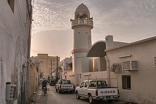
Al Souq is a commercial district in Qatar, located in the municipality of Doha. It was named for its high density of souqs (markets) in the southern section of the district.
Zone 72 is a zone in the municipality of Al-Shahaniya in the state of Qatar. The main district recorded in the 2015 population census was Al Utouriya.
Zone 73 is a zone in the municipality of Al-Shahaniya in the state of Qatar. The main district recorded in the 2015 population census was Al Jemailiya.
Zone 80 is a zone in the municipality of Al-Shahaniya in the state of Qatar. The main district recorded in the 2015 population census was Al-Shahaniya City, the municipal seat.
Zone 82 is a zone in the municipality of Al-Shahaniya in the state of Qatar. The main district recorded in the 2015 population census was Rawdat Rashed.
Zone 85 is a zone in the municipality of Al-Shahaniya in the state of Qatar. The main district recorded in the 2015 population census was Al Nasraniya.
Zone 86 is a zone in the municipality of Al-Shahaniya in the state of Qatar. The main district recorded in the 2015 population census was Dukhan.
Zone 81 is a zone of the municipality of Al Rayyan in the state of Qatar. The main district recorded in the 2015 population census was Mebaireek.
Zone 83 is a zone of the municipality of Al Rayyan in the state of Qatar. The main district recorded in the 2015 population census was Al Karaana.
Zone 96 is a zone of the municipality of Al Rayyan in the state of Qatar. The main district recorded in the 2015 population census was Abu Samra.
Zone 92 is a zone of the municipality of Al Wakrah in the state of Qatar. The main district recorded in the 2015 population census was Mesaieed.
Zone 76 is a zone of the municipality of Al Khor in the state of Qatar. The main district recorded in the 2015 population census was Al Ghuwariyah.