
Ad Dawhah al Jadidah is a district in Qatar, located in the municipality of Ad Dawhah. It is bordered to the north by Mushayrib, Fereej Al Asmakh and Barahat Al Jufairi, to the east by Old Al Ghanim, to the south by Najma and Fereej Bin Durham, and to the west by Fereej Abdel Aziz.

Umm Ghuwailina is a district in Qatar, located in the municipality of Ad Dawhah.

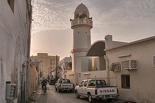
Sawda Natheel is an area in Qatar, located in the municipality of Al Rayyan. It used to be part of the Jariyan al Batnah municipality before the municipality was incorporated into Al Rayyan.

Umm Lekhba is a district in Qatar, located in the municipality of Doha. It was previously known as Al Duhail South, or alternatively, South Duhail.

Duhail is a district in Qatar, located in the municipality of Doha. The district's northern half accommodates the main base of the Internal Security Forces as well as Abdullah bin Khalifa Stadium, which serves as the home grounds for Qatar Stars League club Al-Duhail SC.
Najma is a district in Qatar, located in the municipality of Doha. Considered to be one of Doha's older districts, the bulk of Najma's commercial and office spaces are located along the arterial roads of Airport Street, C Ring Road and B Ring Road.
Zone 78 is a zone of the municipality of Al Shamal in the state of Qatar. The main districts recorded in the 2015 population census were Abu Dhalouf and Zubarah.
Zone 71 is the only zone in the municipality of Umm Salal in the state of Qatar. The main districts recorded in the 2015 population census were Bu Fasseela, Izghawa, Al Kharaitiyat, Umm Salal Ali, Umm Salal Mohammed, Saina Al-Humaidi, Umm Al Amad, and Umm Ebairiya.
Zone 72 is a zone in the municipality of Al-Shahaniya in the state of Qatar. The main district recorded in the 2015 population census was Al Utouriya.
Zone 73 is a zone in the municipality of Al-Shahaniya in the state of Qatar. The main district recorded in the 2015 population census was Al Jemailiya.
Zone 80 is a zone in the municipality of Al-Shahaniya in the state of Qatar. The main district recorded in the 2015 population census was Al-Shahaniya City, the municipal seat.
Zone 84 is a zone in the municipality of Al-Shahaniya in the state of Qatar. The main district recorded in the 2015 population census was Umm Bab.
Zone 85 is a zone in the municipality of Al-Shahaniya in the state of Qatar. The main district recorded in the 2015 population census was Al Nasraniya.
Zone 86 is a zone in the municipality of Al-Shahaniya in the state of Qatar. The main district recorded in the 2015 population census was Dukhan.
Zone 81 is a zone of the municipality of Al Rayyan in the state of Qatar. The main district recorded in the 2015 population census was Mebaireek.
Zone 83 is a zone of the municipality of Al Rayyan in the state of Qatar. The main district recorded in the 2015 population census was Al Karaana.
Zone 96 is a zone of the municipality of Al Rayyan in the state of Qatar. The main district recorded in the 2015 population census was Abu Samra.
Zone 92 is a zone of the municipality of Al Wakrah in the state of Qatar. The main district recorded in the 2015 population census was Mesaieed.
Zone 75 is a zone of the municipality of Al Khor in the state of Qatar. The main districts recorded in the 2015 population census were Al Thakhira, Ras Laffan, and Umm Birka.
Zone 76 is a zone of the municipality of Al Khor in the state of Qatar. The main district recorded in the 2015 population census was Al Ghuwariyah.