The 1811–1812 New Madrid earthquakes were a series of intense intraplate earthquakes beginning with an initial earthquake of moment magnitude 7.2–8.2 on December 16, 1811, followed by a moment magnitude 7.4 aftershock on the same day. Two additional earthquakes of similar magnitude followed in January and February 1812. They remain the most powerful earthquakes to hit the contiguous United States east of the Rocky Mountains in recorded history. The earthquakes, as well as the seismic zone of their occurrence, were named for the Mississippi River town of New Madrid, then part of the Louisiana Territory and now within the U.S. state of Missouri.

The New Madrid Seismic Zone, sometimes called the New Madrid Fault Line, is a major seismic zone and a prolific source of intraplate earthquakes in the Southern and Midwestern United States, stretching to the southwest from New Madrid, Missouri.
The 2005 Lake Tanganyika earthquake occurred at on 5 December with a moment magnitude of 6.8 and a maximum Mercalli intensity of X (Extreme). The shock occurred along the East African Rift, an active continental rift zone in East Africa that is characterized by normal faulting, and initiated at a depth of 22 kilometers (14 mi).
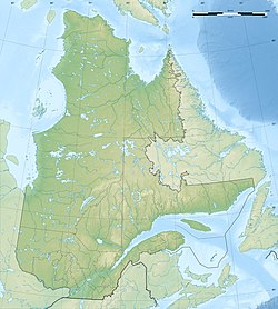
The Saint Lawrence rift system is a seismically active zone paralleling the Saint Lawrence River. The rift system trends northeast and southwest and forms a half-graben that links the Ottawa-Bonnechere and the Saguenay grabens. The rift system extends more than 1,000 km (620 mi) along the Saint Lawrence valley from the Ottawa – Montreal area. Within the system, fault reactivation is believed to occur along late Proterozoic to early Paleozoic normal faults related to the opening of the Iapetus Ocean.
The 1935 Temiskamingue earthquake occurred on November 1 with a moment magnitude of 6.1 and a maximum Mercalli intensity of VII. The event took place in the Western Quebec Seismic Zone in the Abitibi-Témiscamingue region of Quebec.
The 1663 Charlevoix earthquake occurred on February 5 in New France, and was assessed to have a moment magnitude of between 7.3 and 7.9. The earthquake occurred at 5:30 p.m. local time and was estimated to have a maximum perceived intensity of X (Extreme) on the Mercalli intensity scale. The main shock epicentre is suggested to have occurred along the Saint Lawrence River, between the mouth of the Malbaie River on the north and the mouth of the Ouelle River on the south. A large portion of eastern North America felt the effects. Landslides and underwater sediment slumps were a primary characteristic of the event with much of the destruction occurring near the epicentral region of the St. Lawrence estuary and also in the area of the Saguenay Graben.

The 1925 Charlevoix–Kamouraska earthquake struck northeastern North America on February 28, reaching 6.2 on the moment magnitude scale. It was one of the most powerful measured in Canada in the 20th century, with a maximum perceived intensity of VIII (Severe) on the Mercalli intensity scale at its epicentre in the area of Charlevoix-Kamouraska along the Saint Lawrence River near île aux Lièvres and not greater than VI (Strong) in the United States. The quake was felt in Quebec City, Shawinigan, Montreal, as far south as Virginia, and as far west as the Mississippi River.
The 1953 Yenice–Gönen earthquake occurred at 21:06 local time (19:06 UTC on 18 March in the province of Çanakkale and Balıkesir in the Marmara Region at western Turkey. It had a surface wave magnitude of 7.5 and a maximum felt intensity of IX on the Mercalli intensity scale. It caused widespread damage, killing 1,070 and causing damage that was estimated at US$3,570,000 repair value.
The 1918 Shantou earthquake occurred in Shantou, Guangdong, Republic of China. Serious damage and high casualty numbers were reported in Guangdong and the surrounding provinces. It also caused some damage in what was then British Hong Kong.

In the early morning hours of August 16, 1931, a powerful earthquake occurred in West Texas with a maximum Mercalli intensity of VIII (Severe). Estimates of its magnitude range between 5.8–6.4 mb, making it the most powerful earthquake ever recorded in Texas history. Its epicenter was near the town of Valentine, Texas; there, the earthquake caused damage to many homes and buildings. The earthquake may have been caused by movement along oblique-slip faulting in West Texas, the most seismically-active region in the state. Shaking from the earthquake was perceptible within a 400 mi (640 km) radius of the epicenter, affecting four U.S. states and northern Mexico. Several foreshocks and aftershocks accompanied the primary temblor, with the aftershocks continuing until at least November 3, 1931. The main earthquake caused no fatalities, though several people sustained minor injuries; the damage in Valentine amounted to $50,000–$75,000.

Saint-Hilarion is a parish municipality in Charlevoix Regional County Municipality, in the administrative region of Capitale-Nationale of the province of Quebec, in Canada.

The 1940 New Hampshire earthquakes struck on December 20 and again on December 24. Both shocks had an estimated magnitude of 5.6, and a maximum Mercalli intensity of VII. These doublet earthquakes were the largest to hit the state in several hundred years. Damage included minor fractures or knocked over chimneys in a zone extending through New Hampshire and four other states: Maine, New York, Vermont and Massachusetts.
The 1872 North Cascades earthquake occurred at in central Washington Territory. A maximum Mercalli intensity of VIII (Severe) was assessed for several locations, though less intense shaking was observed at many other locations in Washington, Oregon, and British Columbia. Some of these intermediate outlying areas reported V (Moderate) to VII shaking, but intensities as high as IV (Light) were reported as far distant as Idaho and Montana. Due to the remote location of the mainshock and a series of strong aftershocks, damage to structures was limited to a few cabins close to the areas of the highest intensity.
The 1980 Eureka earthquake occurred on November 8 at along the northern coastal area of California in the United States. With a moment magnitude of 7.3 and a maximum Mercalli intensity of VII, this strike-slip earthquake was the largest to occur in California in 28 years. Although damage was considered light, several loss estimates equaled or exceeded $2 million, and six injuries resulted when two vehicles came down with the partial collapse of a highway overpass on US 101 in Fields Landing. The north coast of California experiences frequent plate boundary earthquakes near the Mendocino Triple Junction and intraplate events also occur within the Gorda Plate.

The 1918 San Jacinto earthquake occurred in extreme eastern San Diego County in Southern California on April 21 at . The shock had a moment magnitude of 6.7 and a maximum Mercalli intensity of IX (Violent). Several injuries and one death occurred with total losses estimated to be $200,000.
Seismic intensity scales categorize the intensity or severity of ground shaking (quaking) at a given location, such as resulting from an earthquake. They are distinguished from seismic magnitude scales, which measure the magnitude or overall strength of an earthquake, which may, or perhaps may not, cause perceptible shaking.
An earthquake struck near the Hawaiian island of Lanai on February 19, at 10:11 pm HST with an estimated magnitude of 7.5 on the moment magnitude scale (Mw ). It remains one of the largest seismic event to hit the Hawaiian Islands since the 1868 Ka‘ū earthquake, with its effects being felt throughout the entire archipelago. It caused severe damage on the islands of Lanai, Molokai and Maui. A tsunami may have been generated however there are speculations if it had actually happened. Despite the size of the quake and the extent of damage, there were no deaths.
The 1995 Menglian earthquake or 1995 Myanmar–China earthquake occurred on 12 July at 05:46:43 local time in the Myanmar–China border region. The earthquake had an epicenter on the Myanmar side of the border, located in the mountainous region of Shan State. It registered 7.3 on the Chinese surface wave magnitude scale (Ms ) and 6.8 on the moment magnitude scale (Mw ). With a maximum Mercalli intensity assigned at VIII, the quake killed eleven people and left another 136 injured. Over 100,000 homes in both countries were destroyed and 42,000 seriously damaged. Some damage to structures were also reported in Chiang Mai and Chiang Rai, Thailand. The low death toll from this earthquake was attributed to an early warning issued prior to it happening. Precursor events including foreshocks and some seismic anomalies led to an evacuation of the area before the mainshock struck. It is thought to be one of the few successfully predicted earthquakes in history.

The 1695 Linfen earthquake struck Shanxi Province in North China, Qing dynasty on May 18. Occurring at a shallow depth within the continental crust, the surface-wave magnitude 7.8 earthquake had a maximum intensity of XI on the China seismic intensity scale and Mercalli intensity scale. This devastating earthquake affected over 120 counties across eight provinces of modern-day China. An estimated 52,600 people died in the earthquake, although the death toll may have been 176,365.
The 1895 Charleston earthquake, also known as the Halloween earthquake, occurred on October 31, at 05:07 CST near Charleston, Missouri. It had an estimated moment magnitude of 5.8–6.6 and evaluated Modified Mercalli intensity of VIII (Severe). The earthquake caused substantial property damage in the states of Missouri, Illinois, Ohio, Alabama, Iowa, Kentucky, Indiana, and Tennessee. Shaking was widespread, being felt across 23 states and even in Canada. At least two people died and seven were injured.