
The River Severn, at 220 miles (354 km) long, is the longest river in Great Britain. It is also the river with the most voluminous flow of water by far in all of England and Wales, discharging an average of 107 m3/s (3,800 cu ft/s) into the Bristol Channel at Apperley, Gloucestershire. It rises in the Cambrian Mountains in mid Wales, at an altitude of 2,001 feet (610 m), on the Plynlimon massif, which lies close to the Ceredigion/Powys border near Llanidloes. The river then flows through Shropshire, Worcestershire and Gloucestershire. The county towns of Shrewsbury, Gloucester and the City of Worcester lie on its course.
Glyndŵr's Way is a long-distance footpath in mid Wales. It runs for 135 miles (217 km) in an extended loop through Powys between Knighton and Welshpool, and anchored on Machynlleth to the west.

Powys is a principal area and county, and one of the preserved counties of Wales. It is named after the Kingdom of Powys which was a Welsh successor state, petty kingdom and principality that emerged during the Middle Ages following the end of Roman rule in Britain.

Montgomeryshire, also known as Maldwyn is one of thirteen historic counties and a former administrative county of Wales. It is named after its county town, Montgomery, which in turn is named after one of William the Conqueror's main counsellors, Roger de Montgomerie, who was the 1st Earl of Shrewsbury.
Llanrhaeadr-ym-Mochnant is a town, community and an ecclesiastical parish in the extreme north of Powys, Wales; about 9 miles west of Oswestry and 12 miles south of Llangollen, on the B4580. It lies near the foothills of the Berwyn mountains on the river Rhaeadr. At the top end of the valley is the Pistyll Rhaeadr waterfall, one of the Seven Wonders of Wales in the old rhyme. One mile north of the town is the hill Moel Hen-fache. The community includes the hamlet of Llanarmon Mynydd Mawr.
Llandrinio is a small village and community in Montgomeryshire, Powys, Wales, close to the Wales-England border. It is situated on the B4393 road which travels from the village of Ford, Shropshire to Lake Vyrnwy. The community, Llandrinio and Arddleen includes Arddlin and a small part of Four Crosses, Powys.

Lake Vyrnwy is a reservoir in Powys, Wales, built in the 1880s for Liverpool Corporation Waterworks to supply Liverpool with fresh water. It flooded the head of the Vyrnwy valley and submerged the village of Llanwddyn.

Lake Artemesia is a man-made lake in Prince George's County, Maryland, located within the Lake Artemesia Natural Area in College Park and Berwyn Heights. The lake covers an area of 38 acres (150,000 m2), and the surrounding natural area is administered by Maryland-National Capital Park and Planning Commission and includes aquatic gardens, fishing piers, and hiker-biker trails.

Meifod, formerly also written Meivod, is a small village, community and electoral ward 7 miles north-west of Welshpool in Montgomeryshire, Powys, Wales, on the A495 road and located in the valley of the River Vyrnwy. The River Banwy has a confluence with the Vyrnwy approximately two miles to the west of the village. The village itself had a population of 317. The community includes the village of Bwlch-y-cibau and the hamlet of Allt-y-Main.

Abertridwr is a village in Caerphilly County Borough, Wales, situated about 3 miles (4.8 km) north-west of Caerphilly town. The "three waters" or "three streams" are Nant Cwm-parc, Nant Cwmceffyl and Nant Ilan, which join to form Nant yr Aber.

The Grand Mesa is a large mesa in western Colorado in the United States. It is the largest flat-topped mountain in the world. It has an area of about 500 square miles (1,300 km2) and stretches for about 40 miles (64 km) east of Grand Junction between the Colorado River and the Gunnison River, its tributary to the south. The north side of the mesa is drained largely by Plateau Creek, a smaller tributary of the Colorado. The west side is drained largely by Kannah Creek, which is received to the west by the lower Gunnison River. The mesa rises about 6,000 feet (1,800 m) above the surrounding river valleys, including the Grand Valley to the west, reaching an elevation of about 11,000 feet (3,400 m). Much of the mesa is within Grand Mesa National Forest. Over 300 lakes, including many reservoirs created and used for drinking and irrigation water, are scattered along the top of the formation. The Grand Mesa is flat in some areas, but quite rugged in others.

The River Vyrnwy is a river which flows through northern Powys, Wales, and Shropshire, England. The name derives from Severn, the river of which it is a tributary.

Llyn Brenig is a reservoir located in Wales, in the heart of the Denbigh Moors, at a height of 1200 feet, on the border between the counties of Conwy and Denbighshire. It is used to manage the flow in the River Dee as part of the River Dee regulation system which is designed to protect the water supply for North West England and north-east Wales, particularly Liverpool and its surrounding area. The northern half is in the community of Nantglyn and the southern half in Cerrigydrudion, with the village of Pentre-Llyn-Cymmer situated to the south of the lake.

Bwlch y Groes is the second highest public road mountain pass in Wales, with a summit altitude of 545 metres (1,788 ft). Gospel Pass in south Wales is slightly higher. It lies on minor roads linking Dinas Mawddwy, Llanuwchllyn and Lake Vyrnwy. The view from the pass encompasses the plain of the Dyfi valley, Cadair Idris and a close view of Aran Fawddwy. The cross, just below the summit at the junction of the roads from Vyrnwy and from Dinas Mawddwy, commemorates the place of the pass on a pilgrim route from north Wales.
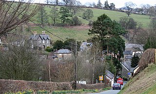
Llanwddyn is a village and community in Montgomeryshire, Powys, Wales. The community is centred on the Lake Vyrnwy reservoir. The original Llanwddyn village, about 2 miles (3.2 km) northwest, was submerged when the reservoir was created in the 1880s.

Jennie Lakes Wilderness is a protected area in the Sierra Nevada, in Tulare County, California. It is located 60 miles (97 km) east of Fresno and managed by the US Forest Service.

Senghenydd is a former mining town in the community of Aber Valley in South Wales, approximately four miles northwest of the town of Caerphilly. Historically within the county of Glamorgan, it is now situated in the county borough of Caerphilly. In the United Kingdom Census 2001, the population of the Aber Valley was 6,696.

The Afon Iwrch is a river near Llanrhaeadr-ym-Mochnant in Clwyd, Wales. It is a tributary of the River Tanat and is 8.9 miles (14.4 km) in length. Its headwaters lie on the eastern slopes of Cadair Berwyn, the highest peak of the Berwyn range, and the river flows broadly southeastwards to join the River Tanat, itself a tributary of the River Vyrnwy.

Dyfnant Forest is a remote forest in northeastern-central Powys, Wales.
Rhiwargor is a hamlet in Powys, Wales. It is located north of Lake Vyrnwy. The hamlet is made up of a few houses with no amenities. It does however, lie next to Rhiwagor Waterfall. The hamlet's nearest church is St Wddyn Church which is near Vyrnwy Dam. The nearest shop is also near Lake Vyrnwy Dam. The bus stop is at Abertridwr.


