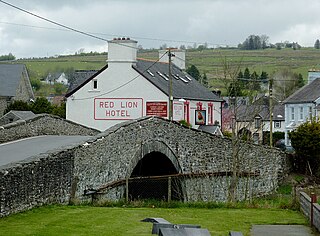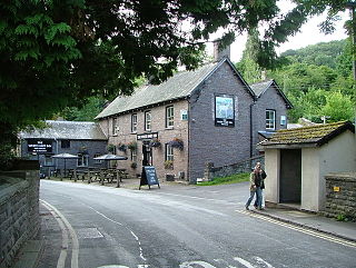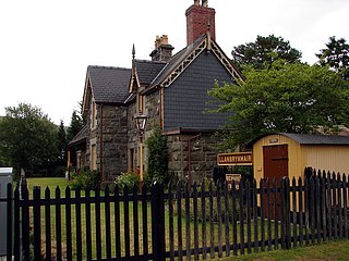
Montgomeryshire, also known as Maldwyn is one of thirteen historic counties and a former administrative county of Wales. It is named after its county town, Montgomery, which in turn is named after one of William the Conqueror's main counsellors, Roger de Montgomerie, who was the 1st Earl of Shrewsbury.

Llan is a village in Powys, Wales, located on the B4518 road to Llanidloes, 1.5 miles (2.4 km) from Llanbrynmair.

Pontrhydfendigaid is a village in Ceredigion, Wales. It lies on the western flank of the Cambrian Mountains, between Devil's Bridge and Tregaron. The village lies on the River Teifi, whose source is just 3 miles (5 km) to the east at Llyn Teifi. The community of Ystrad Fflur, which Pontrhydfendigaid makes most of the population of, had a population of 712 as of 2011 census.

Talybont-on-Usk is a village and community in Powys, Wales, in the historic county of Brecknockshire (Breconshire). It lies on both the River Caerfanell and the Monmouthshire and Brecon Canal, about 1 mile (1.6 km) from the River Usk. In 2001 it had a population of 743, reducing to 719 at the 2011 Census. the community includes the settlements of Llansantffraed, Scethrog, Aber Village, Powys, and Pencelli.

Pontarddulais is both a community and a town in Swansea, Wales. It is 10 miles (16 km) northwest of the city centre. The Pontarddulais ward is part of the City and County of Swansea. Pontarddulais adjoins the village of Hendy in Carmarthenshire. The built-up population was 9,073.

Llangedwyn is a village in Montgomeryshire, Powys, Wales. The population of the community at the 2011 census was 402. The community includes the hamlet of Pen-y-bont Llanerch Emrys.

Llanbrynmair is a village, community and electoral ward in Montgomeryshire, Powys, on the A470 road between Caersws and Machynlleth. Llanbrynmair, in area, is the second largest in Powys. In 2011, it had a population of 920.

Llangynog is a village and community at the confluence of the Afon Eirth and the Afon Tanat at the foot of the Berwyn range in north Powys, Wales.

Staylittle, sometimes referred to colloquially as Y Stay or Y Stae, is a small village set in the shallow upland basin of the Afon Clywedog on the B4518 road, equidistant from Llanidloes and Llanbrynmair in the historic county of Montgomeryshire, Wales, although now administered as part of the unitary authority of Powys.

Llanwddyn is a village and community in Montgomeryshire, Powys, Wales. The community is centred on the Lake Vyrnwy reservoir. The original Llanwddyn village, about 2 miles (3.2 km) northwest, was submerged when the reservoir was created in the 1880s.

Buttington is a village in Powys, Wales, less than 3 km from Welshpool and about 300 m from the River Severn, in the community of Trewern. The Montgomery Canal passes through the village. The village stands on a slight rise above the river's floodplain, by the ancient ford called Rhyd-y-groes, where Offa's Dyke meets the Severn. The ford retained strategic value: reportedly in 1039 a battle took place here between Welsh and English forces.

Dylife is a former mining settlement in Powys, Wales, located at the head of Afon Twymyn in the Cambrian Mountains, one mile west of the road between Llanidloes and Llanbrynmair (B4518). It is in the historic county of Montgomeryshire. The nearby lead mines intermittently sustained mining communities from Roman times until the early 20th century. During the late 19th century, as mining declined after the 1860s so did Dylife's population. The remaining buildings are two former chapels converted into homes and the Star Inn.

Crossgates is a village in Powys, mid Wales, in the historic county of Radnorshire. It is the main settlement of the community of Llanbadarn Fawr, which had a population of 701 in 2011. Crossgates is located three miles northeast of Llandrindod Wells and eight miles southeast of Rhayader, at the point where the A483 and A44 roads intersect. It is notable as the site of a busy service station, and for lending its name to Crossgates Coaches. The population in 2011 was 327 with 47% born in Wales and 48% in England.

Llanfrynach is a village and community in the county of Powys, Wales, and the historic county of Brecknockshire. The population of the community as taken at the 2011 census was 571. It lies just to the southeast of Brecon in the Brecon Beacons National Park. The village sits astride the Nant Menasgin, a right bank tributary of the River Usk. The B4558 passes just to its north and the Monmouthshire and Brecon Canal also passes around the village. The Welsh name signifies the 'church of Brynach'. The community includes the hamlets of Llanhamlach and Groesffordd.

The B4518 road is a road in Powys, central Wales, with a total length of 30.5 miles (49.1 km). It begins at 52°18′5″N3°30′41″W in Rhayader near the junction of the A470 road and the A44 road and leads eventually to the A470 again at Llanbrynmair at 52°36′42″N3°37′38″W. En route going north from Rhayader it passes through the following settlements: St Harmon, Pant-y-Dwr, Tylwch, Llanidloes, Staylittle, Pont Crugnant, Pennant, Bont Dolgadfan, Llan and Plas Esgair. It passes through the Clywedog Valley and Clywedog Reservoir, built in 1964.

Llanbrynmair railway station was a railway station on the Newtown and Machynlleth Railway (N&MR) in Mid-Wales, serving the village of Llanbrynmair.

Pen-y-Bont-Fawr is a small village and community in Montgomeryshire, Powys, Wales located in the Tanat valley. In the 2011 UK Census it had a population of 440 with 58% born in England and 39% in Wales..

Michaelston-le-Pit and Leckwith is a community in the Vale of Glamorgan, Wales. It is located immediately southwest of the city of Cardiff and to the north of the Vale of Glamorgan villages of Llandough and Dinas Powys. As its name suggests, the community includes the small villages of Michaelston-le-Pit and Leckwith. The community population comprises only just under 250 adults.


