Penwyllt

Last updated

Powell Street, Penwyllt (2005) 1-10 Powell Street, Penwyllt - geograph.org.uk - 32681.jpg
Powell Street, Penwyllt (2005)

Penwyllt (Welsh: "wild headland" [1] ) is a hamlet located in the upper Swansea Valley in Wales. It lies within a part of the Brecon Beacons National Park in the traditional county of Brecknockshire; currently administered as part of the unitary authority of Powys.

Contents

A former quarrying village, quicklime and silica brick production centre, its fortunes rose and fell as a result of the Industrial Revolution in South Wales. It is now an important caving centre. It is in the community of Tawe-Uchaf.

Beneath Penwyllt and the surrounding area is the extensive limestone cave system of Ogof Ffynnon Ddu, part of which was the first designated underground national nature reserve in the UK. A corresponding area on the surface is also part of the national nature reserve, on the slopes of Carreg Cadno.

History

Industrialisation

Penwyllt developed primarily as a result of the need for quicklime in the industrial processes in the lower Swansea Valley, taking limestone from the quarries and turning it into quicklime in lime kilns. [2]

Subsequently, Penwyllt also supported the Penwyllt Dinas Silica Brick company, [3] which quarried silica sand at Pwll Byfre from which it manufactured refractory bricks, a form of fire brick, at the Penwyllt brick works (closed 1937 or 1939). The bricks were destined for use in industrial furnaces. A narrow-gauge railway, with a rope worked incline, [4] transported silica sand and stones to the brickworks, which was adjacent to the Neath and Brecon Railway (which on 1 July 1922 became part of the Great Western Railway). [5]

A detailed account of the history of Penwyllt and its industries was provided by Matthews(1991). [6]

Christie 1819-1822

In 1819 Fforest Fawr ("Great Forest of Brecknock") was enclosed or divided up into fields, and large parts of it became the property of John Christie, a Scottish businessman based in London, who had become wealthy through the import of indigo. Christie developed a limestone quarry at Penwyllt, and decided to develop lime kilns there as well. In 1820 he moved to Brecon, and developed the Brecon Forest Tramroad. [7] [8]

The tramroad ran from a depot at Sennybridge through Fforest Fawr by way of the limestone quarries at Penwyllt to the Drim Colliery near Onllwyn. A branch served the Gwaun Clawdd Colliery on the northern slopes of Mynydd y Drum and was extended to the Swansea Canal.

Christie was declared bankrupt in 1827 and most of his assets, including the tramroad, eventually passed to his principal creditor, Joseph Claypon, of the banking house of Garfit & Claypon in Boston, Lincolnshire. [9]

Claypon 1827-1850

Claypon took over Christie's assets, and came to the conclusion that shipping lime, coal, iron ore and quicklime south to the larger industrial premises in the southern Swansea Valley was more productive than trying to serve a small rural population of the Usk valley to the north. They quickly sold or leased the farms and developments north of Fforest Fawr and concentrated on expanding the lime kilns at or around Penwyllt. In total there were fifteen lime kilns at Penwyllt:

Second half of the 19th century

On 29 July 1862, an Act of Parliament created the Dulais Valley Mineral Railway, [13] to transport goods to the docks at Briton Ferry, Neath built by Isambard Kingdom Brunel. The population of Penwyllt grew on this increased transport ability to over 500 citizens by the 1881 Census.

After being authorised to extend the railway to Brecon, it changed its name to the Neath and Brecon Railway. The railway company agreed to co-operate with the Swansea Vale Railway to create the Swansea Vale and Neath and Brecon Junction Railway linking the railway fully into Neath, as well as the South Wales Railway mainline. An early and unsuccessful purchaser of the new Fairlie locomotive, when in 1863 the railway reached Crynant, coal mining quickly expanded. [14]

Craig-y-nos railway station at Penwyllt was in part funded by opera singer Adelina Patti, who lived at and extended the nearby Craig-y-Nos Castle . She built a road from the castle to the station and had a separate waiting room built. The railway supplied her in return with her own railroad car, which she could request to go anywhere within the United Kingdom.

Decline 1870

As industrial activity declined with reducing economic stocks of coal, iron ore and limestone and the development of new technologies on a larger scale on the coast of South Wales, particularly at Port Talbot and Llanwern, Penwyllt declined.

By 1870 the seven blast furnace ironworks of Ynyscedwyn had only one working furnace.

20th century

World War II created the final closure, as the need to scale production upwards for the larger coastal meant the heavily manual process of Penwyllt quarry was uneconomic compared to other British and foreign facilities which could bulk ship by sea. The Penwyllt Inn, [15] or 'Stump' as it was often known, closed in 1948, and in October 1962 all passenger services were withdrawn by British Rail from Neath and Brecon Railway line. The line north of the station closed to Brecon, and by the end of the 1960s the population had fallen to 20 people. The railway line south to Neath remained open until 1977 to serve the quarry until it ceased major production and effectively closed. [16]

Many of the former industrial buildings, commercial properties and houses of Penwyllt were demolished in the early 1980s, being both beyond economic repair and unneeded.

21st century

The former pub survives as private accommodation for cavers. The former Craig-y-nos station survives in reasonable repair as a private holiday cottage. Patti Row, a historic block of back-to-back houses dating from the days of the Brecon Forest Tramroad, [17] survives in a derelict state. The only group of terraced houses still occupied are in Powell Street and form the headquarters of the South Wales Caving Club, [18] and the South & Mid Wales Cave Rescue Team [19] SWCC Cottage [20]

The quarry, though not the railway, re-opened in 2007 to provide limestone for the works associated with a new gas pipeline being laid through South Wales. In 2008 it was again dormant. In 2009 it was operational but at a relatively low level of activity.

In 2006, the Torchwood episode Countrycide was filmed in Penwyllt to stand in for the fictional village of Brynblaidd in the Brecon Beacons, where the titular team faces a group of cannibals. [21]

Related Research Articles

<span class="mw-page-title-main">Ogof Ffynnon Ddu</span> Cave in South Wales, United Kingdom

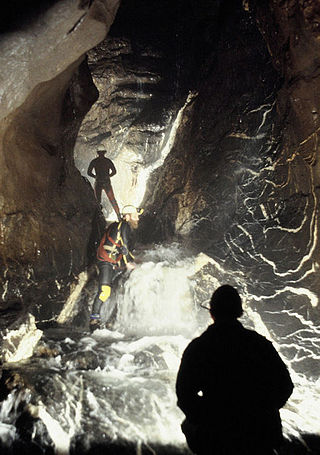
Ogof Ffynnon Ddu, also known informally as OFD, is a cave under a hillside in the area surrounding Penwyllt in the Upper Swansea Valley in South Wales. It is the second longest cave in Wales and the deepest in the United Kingdom.

<span class="mw-page-title-main">Abercraf</span> Village in Powys, Wales

Abercrâf or Abercrave is a village in Powys, Wales, in the community of Ystradgynlais and within the historic boundaries of the county of Brecknockshire.

Dinas Rock is a high promontory of Carboniferous Limestone which rises between the Afon Mellte and its left-bank tributary, the Afon Sychryd on the border between the county of Powys and the county borough of Neath Port Talbot in south Wales. It can be found near the village of Pontneddfechan near Glyn Neath at the head of the Vale of Neath. It derives its name from the presence of Iron Age earthworks on its summit, dinas in Welsh signifying a defensive site or "city".

<span class="mw-page-title-main">Swansea Canal</span>

The Swansea Canal was a canal constructed by the Swansea Canal Navigation Company between 1794 and 1798, running for 16.5 miles (26.6 km) from Swansea to Hen Neuadd, Abercraf in South Wales. It was steeply graded, and 36 locks were needed to enable it to rise 373 feet (114 m) over its length. The main cargos were coal, iron and steel, and the enterprise was profitable.

The Swansea Valley is one of the South Wales Valleys. It is the valley from the Brecon Beacons National Park to the sea at Swansea of the River Tawe in Wales. Administration of the area is divided between the City and County of Swansea, Neath Port Talbot County Borough, and Powys. A distinction may be drawn between the Lower Swansea valley and the Upper Swansea valley; the former was more heavily industrialised during the 19th and 20th centuries.

The Dulas Valley Mineral Railway was incorporated in 1862 to bring coal from the Onllwyn area north-east of Neath to the quays there, and in the following year was reconstituted as the Neath and Brecon Railway. The line was opened as far as Onllwyn in 1863.

The Clydach Gorge is a steep-sided valley in south-east Wales down which the River Clydach flows to the River Usk. It runs for 5.6 kilometres (3.5 mi) from the vicinity of Brynmawr in Blaenau Gwent eastwards and northeastwards to Gilwern in Monmouthshire. The Gorge was one of the first locations in the region to be industrialised though it still retains its natural environment. It has long been an important transport corridor between Abergavenny and the lowlands of Monmouthshire and the northeastern quarter of the South Wales Coalfield. It is now exploited by the A465 Heads of the Valleys trunk road which runs between Abergavenny and Swansea and which serves the Heads of the Valleys sub-region.

<span class="mw-page-title-main">Nedd Fechan</span> River in Powys, Wales

The Nedd Fechan is a river almost wholly within the county of Powys, Wales, currently administered as part of the unitary authority of Powys. It rises on the eastern slopes of Fan Gyhirych in the Fforest Fawr section of the Brecon Beacons National Park and flows south for 7 miles (12 km) to join with the Afon Mellte at Pontneddfechan, their combined waters continuing as the River Neath to the sea near Swansea. The only significant tributary of the Nedd Fechan is the Afon Pyrddin which joins it at Pwll Du ar Byrddin. Downstream of this confluence it forms the boundary between Powys to its east and Neath Port Talbot to its west.

<span class="mw-page-title-main">Fforest Fawr</span> Upland area in Powys, Wales

Fforest Fawr is an extensive upland area in the county of Powys, Wales. Formerly known as the Great Forest of Brecknock in English, it was a royal hunting area for several centuries but is now used primarily for sheep grazing, forestry, water catchment and recreation. It lies within the Brecon Beacons National Park.

<span class="mw-page-title-main">Fan Gyhirych</span> Mountain (725m) in Powys, Wales

Fan Gyhirych is a mountain in the Fforest Fawr section of Brecon Beacons National Park in south Wales. It lies within the county of Breconshire, and administered as part of the unitary authority of Powys.

Fforest Fawr Geopark is a Geopark in the Brecon Beacons National Park, south Wales. It is the first designated Geopark in Wales having gained membership of both the European Geoparks Network and the UNESCO-assisted Global Network of National Geoparks in October 2005. The Geopark aims to promote and support sustainable tourism and other opportunities to improve the economy of the area whilst safeguarding the natural environment. Its aims largely coincide with the statutory duties and purpose of the National Park within which it sits.

<span class="mw-page-title-main">Cribarth</span> Hill (428m) in Powys, Wales

Cribarth is a hill in the Brecon Beacons National Park, Powys, Wales, in the traditional county of Brecknockshire. The summit lies on the broken ridge at an elevation of 428 m (1,404 ft) at OS grid reference SN 831143. To its west is a 426-metre-high (1,398 ft) rounded top at SN 829144 which lies just to the northwest of a mile-long ridge that forms the main bulk of the hill. The ridge attains a height of 423 m (1,388 ft) at its southwest end and this spot is marked by a trig point. Both of these latter high points are adorned by Bronze Age burial cairns.

<span class="mw-page-title-main">Carreg Cadno</span> Hill (538m) in Powys, Wales

Carreg Cadno is a hill five miles northeast of Abercraf in the county of Powys, south Wales. It lies within the Brecon Beacons National Park and Fforest Fawr Geopark. Its summit at OS grid ref SN 874161 reaches a height of 538m / 1763 ft above sea level. The hill is within the Ogof Ffynnon Ddu National Nature Reserve which is owned and managed by the Countryside Council for Wales.

The Brecon Forest Tramroad is an early nineteenth century tramroad, or rather a network of connecting tramroads or waggonways, which stretched across the hills of Fforest Fawr in the historic county of Brecknockshire in south Wales, UK. Its northern terminus was at the village of Sennybridge in the Usk Valley whilst its southern ends lay at Abercraf and Ystradgynlais in the upper Swansea Valley some 20 km to the south.

<span class="mw-page-title-main">Tawe-Uchaf</span>

Tawe-Uchaf is a community in Powys, Wales. Situated north-east of Ystradgynlais in the upper valley of the River Tawe, it includes the villages of Caehopkin, Coelbren, Glyntawe, Pen-y-cae, Penwyllt and Ynyswen. It had a population in 2001 of 1,516, increasing at the 2011 Census to 1,562.

John Christie (1774–1858), was an early industrialist born in Scotland. He is chiefly remembered for his agricultural and industrial activities in South Wales during the early part of the nineteenth century. Christie amassed a fortune through the indigo trade with India and invested it in the purchase of much of Fforest Fawr in what is now the Brecon Beacons National Park in southern Powys. He constructed a network of tramroads between Sennybridge and the upper Swansea Valley, initially with a view to supplying the model farms which he had established with agricultural lime. Connections to coal mines further south were established and to sources of rottenstone and silica sand but these ventures bankrupted him by 1827-28.

<span class="mw-page-title-main">Colbren Junction railway station</span> Former railway station in Wales

Colbren Junction was a railway station on the Neath and Brecon Railway. The station, which was near Coelbren, was completed at the same time as the Swansea Vale and Neath and Brecon Joint Railway opened a seven-mile branch from here to Ynysygeinon in 1873. It was a key junction in the networks operated by the Midland, Neath and Brecon, and Great Western railway companies.

<span class="mw-page-title-main">Pwll Du Tunnel</span>

The Pwll Du Tunnel was the longest horse-powered tramway tunnel to be built in Britain at 1,875 metres (6,152 ft) in length. It started in Blaenavon, Torfaen, Wales, and was originally a coal mine, running northward almost horizontally into a hillside. Later it was extended right through the hill and used to carry limestone from quarries at Pwll Du and Tyla to the ironworks at Blaenavon, and to carry pig iron from Blaenavon to the Garnddyrys Forge. The tramway was extended past Garnddyrys to Llanfoist Wharf on the Brecknock and Abergavenny Canal. The tramway from Pwll Du to the canal fell out of use when the railway came to Blaenavon and the Garnddyrys forge was closed in 1860, but the tunnel continued to be used to carry limestone to Blaenavon until 1926. It is now a scheduled monument and part of a UNESCO World Heritage Site.

This article describes the geology of the Brecon Beacons National Park in mid/south Wales. The area gained national park status in 1957 with the designated area of 1,344 km2 (519 sq mi) including mountain massifs to both the east and west of the Brecon Beacons proper. The geology of the national park consists of a thick succession of sedimentary rocks laid down from the late Ordovician through the Silurian and Devonian to the late Carboniferous period. The rock sequence most closely associated with the park is the Old Red Sandstone from which most of its mountains are formed. The older parts of the succession, in the northwest, were folded and faulted during the Caledonian orogeny. Further faulting and folding, particularly in the south of the park is associated with the Variscan orogeny.

The bedrock geology of Carmarthenshire in west Wales consists largely of Palaeozoic age sedimentary rocks. Unconsolidated deposits of Quaternary age in Carmarthenshire include a dissected cover of glacial till, valley floor alluvium and some scattered peat deposits in both upland and lowland settings. There are extensive beach and tidal flat deposits along the Carmarthenshire coast. The exploitation of the county's mineral riches, particularly coal and limestone, was a key part of the local economy through much of the nineteenth and twentieth centuries.

References

  1. Cardiff Naturalists' Society
  2. 1 2 Penwyllt - Craig-y-nos kilns
  3. Images of Wales
  4. The Colliery Guardian, Vol 85 pp1325-6, 19 June 1903
  5. Barrie, D.S.M., A Regional History of the Railways of Great Britain, Vol. 12 South Wales. David & Charles, 1980. ISBN   0-7153-7970-4
  6. Matthews, Helen, (1991), "Penwyllt Village, Growth, Development and Decline", Local History Dissertation, University College of Swansea (25MB pdf file)
  7. P R Reynolds, The Brecon Forest Tramroad (Swansea, 1979)
  8. Stephen Hughes, The Brecon Forest Tramroads: the archaeology of an early railway system, (Aberystwyth : Royal Commission on the Ancient & Historical Monuments of Wales, 1990)
  9. Victorian Ystradgynlais - The Brecon Forest Tramroad
  10. Penwyllt, Pen-y-foel kilns
  11. Penwyllt - Twyn-disgwylfa kilns
  12. Penwyllt - Twyn-y-ffald kiln
  13. "West Glamorgan Archive Service - Royal Institution papers: Acts of Parliament". Archived from the original on 27 September 2007.
  14. "Neath Port Talbot Museum Service - All For Coal". Archived from the original on 27 April 2007. Retrieved 17 April 2007.
  15. Images of Wales
  16. cyn.JPG :: Craig y Nos Station at Penwyllt looking north on 14 April 2006. The Neath & Brecon line to this point lingered on to serve the adjacent quarry until 1977 (officially closed 1981) [ permanent dead link ]
  17. Hughes, Stephen, The Brecon Forest Tramroads, RCAHM in Wales, 1990, ISBN   1-871184-05-3
  18. South Wales Caving Club
  19. South & Mid Wales Cave Rescue Team
  20. SWCC Cottage
  21. https://www.doctorwholocations.net/locations/penwylltinn

51°49′43″N3°39′51″W / 51.8286°N 3.6642°W / 51.8286; -3.6642