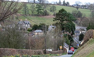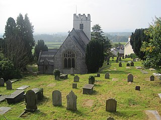
Llanrhaeadr-ym-Mochnant is a village, a community and an ecclesiastical parish in the extreme north of Powys, Wales; about 9 miles west of Oswestry and 12 miles south of Llangollen, on the B4580. It lies near the foothills of the Berwyn mountains on the river Rhaeadr. At the top end of the valley is the Pistyll Rhaeadr waterfall, one of the Seven Wonders of Wales in the old rhyme. One mile north of the village is the hill Moel Hen-fache.

Llanymynech is a village straddling the border between Montgomeryshire/Powys, Wales, and Shropshire, England, about 9 miles (14 km) north of the Welsh town of Welshpool. The name is Welsh for "Church of the Monks". The village is on the banks of the river Vyrnwy, and the Montgomery Canal passes through it.

The River Vyrnwy is a river which flows through northern Powys, Wales, and Shropshire, England. The name derives from Severn, the river of which it is a tributary.
St Harmon is a village in Radnorshire, Powys, Wales. The population of the community at the 2011 census was 593. It is located on the Afon Marteg on the B4518 road running between Llanidloes and Rhayader. The parish church is called Saint Garmon, with many people assuming it has been spelt incorrectly. the community includes the settlement of Pantydwr.

Cilmeri is a village and community in Powys, mid-Wales in the historic county of Brecknockshire, two and a half miles west of Builth Wells on the A483 to Llandovery. The village is served by Cilmeri railway station on the Heart of Wales Line. In the 2001 census, Cilmeri Community had a population of 438 and 191 households. The population at the 2011 had fallen slightly to 431.

Corris is a village and community in the south of Snowdonia in the Welsh county of Gwynedd. It lies in the historic county of Merionethshire/Sir Feirionnydd. Although the Snowdonia National Park covers much of the area around Corris, the village is not within the park.

Llansilin is a village and local government community in Montgomeryshire, Powys, Wales, about 6 miles west of Oswestry. The community, which includes Llansilin village, a large rural area and the hamlets of Moelfre and Rhiwlas as well as the remote parish of Llangadwaladr, had a population of 648 at the 2001 census, increasing to 698 at the 2011 Census. There is also an electoral ward including the nearby village of Llanrhaeadr-ym-Mochnant with a population of 2,295.

Llansantffraid-ym-Mechain is a large village in Powys, mid Wales, close to the border with Shropshire in England, about 7 miles (11 km) south west of Oswestry and 8 miles (13 km) north of Welshpool. It is on the A495 road and is at the confluence of the River Vyrnwy and the Afon Cain. The population as of the 2011 UK Census was 1,415.

Llanbrynmair is a village, community and electoral ward in Montgomeryshire, Powys, on the A470 road between Caersws and Machynlleth. Llanbrynmair, in area, is the second largest in Powys. In 2011, it had a population of 920.

Betws Garmon is a community and small hamlet outside Waunfawr and near Beddgelert in Gwynedd, Wales. It has a population of 249.

Llanwddyn is a village and community in Montgomeryshire, Powys, Wales. The community is centred on the Lake Vyrnwy reservoir. The original Llanwddyn village, about 2 miles (3.2 km) northwest, was submerged when the reservoir was created in the 1880s.

The Milltir Cerrig is a mountain pass in Wales, on the B4391 between Bala and Llangynog (Powys), briefly passing through Denbighshire.

Bodfari is a village and community in Denbighshire, Wales. Until the local government reorganisation of 1974, Bodfari was in the historic county of Flintshire.

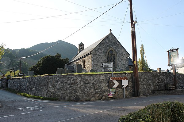
St Melangell's Church, Pennant Melangell is a small church located on a minor road which joins the B4391 near the village of Llangynog, Powys, Wales. It houses the restored shrine of Saint Melangell, reputed to be the oldest Romanesque shrine in Great Britain.

Llanyblodwel is a village and civil parish in Shropshire, England; the spelling "Llanyblodwell" was commonly used in the past, and the village was sometimes simply referred to as "Blodwel". The population of the civil parish at the 2011 census was 767. It lies 7 miles west of the nearest town, Oswestry, in the valley of the River Tanat. Simon Jenkins, in his guide to English churches says of Llanyblodwel that "the Welsh Marches are seldom so lovely as where the River Tanat crosses the border through the steep wooded valleys west of Oswestry."

Duhonw is a rural community in Powys, Wales, to the south of Builth Wells, in the historic county of Breconshire, comprising scattered farms and dwellings. Covering an area of 4,376 hectares (16.90 sq mi), it is bounded to its north by the Afon Irfon, to its south by Mynydd Epynt and Banc y Celyn (472m) and to its east the rivers Duhonw and Wye. Llangammarch Wells' is to its west.

Pentrefoelas is a village and community in Conwy County Borough, Wales. The village lies on the A5 road between Betws-y-Coed to the west and Cerrigydrudion to the east. The Afon Merddwr river, a tributary of the River Conwy, flows through it. The community had a population of 356 at the time of the 2011 census, 70% were able to speak Welsh. It has an area of 53.86 km2 and covers a large region around the village including part of Mynydd Hiraethog, Llyn Alwen and part of Alwen Reservoir. It is in the electoral ward of Llangernyw.

Llanynys is a hamlet and community in Denbighshire, north-east Wales;. It lies in the Vale of Clwyd, a few miles north of Ruthin, and includes the village of Rhewl.

Pen-y-Bont-Fawr is a small village and community in Montgomeryshire, Powys, Wales located in the Tanat valley. In the 2011 UK Census it had a population of 440 with 58% born in England and 39% in Wales..


![]()


