Montgomeryshire is one of thirteen historic counties and a former administrative county of Wales. It is named after its county town, Montgomery, which in turn is named after one of William the Conqueror's main counsellors, Roger de Montgomerie, who was the 1st Earl of Shrewsbury.

Welshpool is a market town and community in Powys, Wales, historically in the county of Montgomeryshire. The town is four miles from the Wales–England border and low-lying on the River Severn; its Welsh language name Y Trallwng means "the marshy or sinking land". The community includes Cloddiau and Pool Quay.

Machynlleth is a market town, community and electoral ward in Powys, Wales and within the historic boundaries of Montgomeryshire. It is in the Dyfi Valley at the intersection of the A487 and the A489 roads. At the 2001 Census it had a population of 2,147, rising to 2,235 in 2011. It is sometimes referred to colloquially as Mach.
Llanrhaeadr-ym-Mochnant is a village, community and an ecclesiastical parish in the extreme north of Powys, Wales; about 9 miles west of Oswestry and 12 miles south of Llangollen, on the B4580. It lies near the foothills of the Berwyn mountains on the river Rhaeadr. At the top end of the valley is the Pistyll Rhaeadr waterfall, one of the Seven Wonders of Wales in the old rhyme. One mile north of the town is the hill Moel Hen-fache. The community includes the hamlet of Llanarmon Mynydd Mawr.

Montgomery is a town and community in Powys, Wales. It is the traditional county town of the historic county of Montgomeryshire to which it gives its name and is within the Welsh Marches border area. The town centre lies about 1 mile (1.6 km) west of the England–Wales border. Montgomery Castle was started in 1223 and its parish church in 1227. Other locations in the town include The Old Bell Museum, the Offa's Dyke Path, the Robber's Grave and the town wall. The large Iron Age hill fort of Ffridd Faldwyn is sited northwest of the town and west of the Castle.

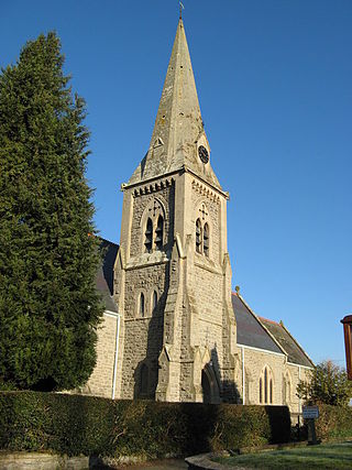
Meifod, formerly also written Meivod, is a small village, community and electoral ward 7 miles north-west of Welshpool in Montgomeryshire, Powys, Wales, on the A495 road and located in the valley of the River Vyrnwy. The River Banwy has a confluence with the Vyrnwy approximately two miles to the west of the village. The village itself had a population of 317. The community includes the village of Bwlch-y-cibau and the hamlet of Allt-y-Main.

Bettws Cedewain, also known as Bettws Cedewen, is a small village and community in Montgomeryshire, Powys, Wales. It lies in a sheltered valley on the banks of the River Bechan, some 3 miles (5 km) north of Newtown, on the B4389 road. The community is known as Betws Cadewain, and includes the hamlets of Highgate and Brooks.
Llandinam is a village and community in Montgomeryshire, Powys, central Wales, between Newtown and Llanidloes, located on the A470. As a community, Llandinam is made up of the village itself, small hamlets including Plas Dinam and Little London and several farms. The village itself has a population of around 576 with 56% born in Wales.

Esgairgeiliog is a village in Powys, Wales, UK. It is situated at the junction of the Afon Glesyrch's and Afon Dulas' valleys.

Mallwyd is a small village at the most southern end of Gwynedd, Wales in the Dinas Mawddwy community, in the valley of the River Dyfi. It lies on the A470 approximately halfway between Dolgellau and Machynlleth, and forms the junction of the A458 towards Welshpool. The nearest villages are Dinas Mawddwy, two miles to the north, and Aberangell a similar distance to the south. The River Dugoed flows into the River Dyfi near the village.

Dinas Mawddwy is a village in the community of Mawddwy in south-east Gwynedd, north Wales. It lies within the Snowdonia National Park, but just to the east of the main A470, and consequently many visitors pass the village by. Its population is roughly 600. The village marks the junction of the unclassified road to Llanuwchllyn which climbs up through the mountains to cross Bwlch y Groes at its highest point, the second highest road pass in Wales. This minor road also provides the closest access to the mountain Aran Fawddwy and is the nearest settlement to Craig Cywarch.

Ffridd Gate was a station on the Corris Railway in Merioneth, Wales, UK. It was built at the level crossing over the B4404 road to Llanwrin, near the hamlet of Fridd. A small hamlet also grew up around the station and a nearby (pre-existent) toll-house. The hamlet and former station are near to the confluence of the Afon Dulas and the River Dyfi, around 2+1⁄4 miles (3.6 km) west of the village of Llanwrin and 1 mile (1.6 km) north of the town of Machynlleth.
Staylittle, sometimes referred to colloquially as Y Stay or Y Stae, is a small village set in the shallow upland basin of the Afon Clywedog on the B4518 road, equidistant from Llanidloes and Llanbrynmair in the historic county of Montgomeryshire, Wales, although now administered as part of the unitary authority of Powys.

Llanfyllin is a market town and community in Powys, Wales. The town population in 2021 was 1,586 and the town's name means church or parish (llan) of St Myllin. The community includes the settlements of Bodfach, Ty Crwyn, Abernaint and several farms.

Llanwddyn is a village and community in Montgomeryshire, Powys, Wales. The community is centred on the Lake Vyrnwy reservoir. The original Llanwddyn village, about 2 miles (3.2 km) northwest, was submerged when the reservoir was created in the 1880s.

Llanfechain is a village and community in Powys, Wales, on the B4393 road between Llanfyllin and Llansantffraid-ym-Mechain. Historically it belonged to Montgomeryshire. The River Cain runs through. The population of 465 at the 2011 Census was estimated at 476 in 2019.
Llangadfan is a small village in Powys, Wales, based in the community of Banwy. The village lies on the A458 between Foel and Llanerfyl, 12 kilometres (7.5 mi) from Llanwddyn. Dyfnant Forest is located nearby. The village is said to be known for its country dances.
Llandyssil is a village in the community of Abermule with Llandyssil, in Powys, Wales, in the traditional county of Montgomeryshire. It is about two miles from the town of Montgomery.

Glantwymyn is a community in the northwest (Montgomeryshire) of Powys, Wales.

Mochdre is a small village in the community of Mochdre with Penstrowed, in Montgomeryshire, Powys, Wales.