Clockwise from top-left: Chanderi fort, Toteshwara Mahadev Temple in Kadwaha, Rakhetra Bhiyadant Caves, Betwa River near Ashoknagar, Kuti Temples in Thubon, vindyvashni temple and many other temple in tumen,
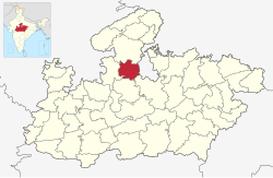
Ashoknagar District is a district of Madhya Pradesh state in central India. The city of Ashoknagar is the administrative headquarters of the district. Ashoknagar district was formed in 2003.
The district has a population of 688,920 (2001 census). It is divided into eight tehsils: Ashoknagar, Chanderi, Isagarh, Mungaoli, Shadora, Naisarai, Piprai and Bahadurpur. The district was created on August 15, 2003, when it was split from Guna District.[1] Ashoknagar also has a great historical importance,It is a part of ancient Ahirwada region, where Yaduvanshi ahirs used to rule. The details of the Block wise population and area is shown in the table below:
The region was ruled by the Scindia family as a part of Isagarh District of the Indian princely state of Gwalior. After the Ujjain victory on his return King Ashoka took a night halt at Pachhar and henceforth Pachhar was called Ashoknagar.
The territory of present Ashoknagar district was part of Chedi kingdom of Shishupal in Mahabharata period and Chedi Janapada in Janapada period. In medieval period was part of Chanderi State. In the 6th century B.C. Chanderi area (territory of Ashoknagar district) was under Avanti, Dasharna and Chedi Janapadas. It was part of Nanda, Maurya, Sunga and Magadh kingdoms. It is believed that the Great Emperor Asoka, while on his trip to conquer Ujjain, had spent one night in Ashoknagar, hence the area been named AshokNagar. After the Magadh, Sungas and Sakas of Naga dynasty ruled over it. Subsequently, after the Guptas and the Maukharias, it formed part of the empire of Harshvardhan. In 8th–9th century AD, it went to the Pratihara dynasty. The seventh descendant of the Pratihara dynasty, Raja Kirtipal founded Chanderi city in the 10th−11th century AD. and made it his capital. After the fall of the Pratihara dynasty, the Chandelas of Jejak bhukti also ruled here briefly. Chanderi kingdom was also affected by repeated invasions of Mahmud Ghaznavi in the 11th century AD. After establishment of Delhi Sultanate, Turks, Afghans and Mughalas ruled it. During the reign of Chanderi's Bundela ruler Morprahalad, Gwalior ruler Daulatrao Scindia sent his general John Baptiste to attack Chanderi. He captured Chanderi and also Isagarh and nearby areas. The last Bundela ruler of Chanderi Raja Mardan Singh made supreme sacrifice as a freedom fighter in 1857–58 AD.
The district was created on August 15, 2003, when it was split from Guna District. Shahdora a town 15km from Ashoknagar had been given tehsil status in September 2008.
In 2011 census, Ashoknagar had population of 845,071.Hindus constitute 92% of the population, in which Yaduvanshi Ahirs are in majority.
The district has a population density of 181 inhabitants per square kilometre (470/sqmi). Its population growth rate over the decade 2001-2011 was 22.66%.[4]
Ashoknagar has a sex ratio of 904 females for every 1000 males,[4] and a literacy rate of 66.42%. 18.19% of the population lives in urban areas. Scheduled Castes and Scheduled Tribes make up 21.44% and 0.87% of the population respectively.[4]
Hindi is the predominant language, spoken by 98.57% of the population.[5]
Average literacy rate of Ashoknagar in 2011 were 67.90 compared to 62.26 of 2001. If things are looked out at gender wise, male and female literacy were 80.22 and 54.18 respectively. For 2001 census, same figures stood at 77.01 and 45.24 in Ashoknagar District. Total literate in Ashoknagar District were 480,957 of which male and female were 299,409 and 181,548 respectively. In 2001, Ashoknagar District had 344,760 in its total region. With regards to Sex Ratio in Ashoknagar, it stood at 900 per 1000 male compared to 2001 census figure of 879. The average national sex ratio in India is 940 as per latest reports of Census 2011 Directorate. Scheduled Castes and Tribes made up 20.80% and 9.71% of the population respectively.
Tourism
In the south, about 35km from Ashoknagar, is the 'Karila Mata Mandir', which is known to be the birthplace of Luv and Kush, sons of Lord Rama and Sita Mata. A huge fair is organized every year on Rangpanchmi in which Rai Dance is performed by Bedni Women. Tumen is also a historical lgrim centre situated at Triveni known for Mata Vindhyavasini temple. There are many more places of religious importance in the district of Ashoknagar.
Chanderi is a tehsil of Ashoknagar district and is a historical & tourist palace. The main occupation of the people of Chanderi is handicraft. Chanderi sarees are known all over the world.[citation needed] These are made by cotton and silk by hand through Khatka. Khatka is a self made machine for preparing sarees. Another place in Ashoknagar district is Shri Anandpur, the world headquarters of Shri Advait Paramhansa Sect. Disciples from across the globe visit Anandpur twice a year during Baisakhi and Guru Purnima to seek blessings from the gurus. Kadwaya, a small village in the district is also known for the ancient Shiv Mandir, Garhi and Mata Mandir.
Chiniya cave near Nanon Village in Piprai Tehsil is a site of cave paintings by prehistoric man.
Chanderi fort is situated on a hill 71 meter above the town . The fortification walls were constructed mainly by the Muslim rulers of Chanderi. The main approach to present fort is through a series of three gates the uppermost of which is known as Hawa Paur and lowermost is called the Khuni Darwaja or the gate of blood. The peculiar name is derived from the fact that criminals were executed at this point by hurling them from the battlements above and thus dashing their bodies into pieces at foot. Within the fort there are only two ruined buildings the Hawa and Nau-Khanda Mahals built by Bundela Chiefs.
To the south west of the fort there is a gateway called katti-ghatti made through hill side. It is 59 meter long 12 meter broad and 24.6 meter high in the middle of its portion of the rock has been view into the shape of a gate, with a points arch, flanked by a slopping towers.
Kaushak Mahal of Chanderi
The Kaushak Mahal of Chanderi is referred to in Tawarikh-i-Ferishta. It is recorded in it that, in A.H. 849(CAD 1445). Mehmood Shah Khilji of Malwa was passing through Chanderi. He ordered a seven storied palace to be built there. Kaushak Mahal is outcome of that order. It is an imposing building – though standing in a half ruined condition. To the south, east and north of the town are the palaces of Ramnagar, Panchamnagar and Singhpur respectively. All are built by Bundela Chiefs of Chanderi in the 18th century.
Isagarh
Kadwaya a small village of Ashoknagar tehsil contains a number of temples. One of these temples has been constructed in the 10th century in Kachhapaghata style of architecture. It has its garbha-griha (sanctum), antaral and mandapa. The temple contains short pilgrimis records of A.D. 1067 and 1105. Another old temple of Kadwaya is known as Chandal math. The village possesses a ruined monastery, from a very old record was picked up which it is stated that to monestor was built to house some members of Shaiva sect known as Matta Mourya. During Akbar's reign Kadwaya was the headquarters of a mahal in the Gwalior's sarkar of the subah of Agra.
Thubonji Siddha Kshetra
Here are a group of 26 temples. This sacred place Thuvonji came to knowledge during the period of the businessman Shri Padashah.[citation needed] It is said[by whom?] that Shri Padashah was dealing in Metal Tin and when he put his Metal Tin here it got converted into Silver. There are a group of 26 temples with many idols. Temple No. 15 is the main among them known as big temple here, with 28 feet high colossus of Lord Adinath in standing posture, installed in Vikram Samvat 1672. Atishay: It is said that sound of various musical instruments is heard in the night as the gods from heaven come here for prayers & worship. It is also said that after completion of this high colossus, so many devotees were unable to install this in standing posture, at that night Head of the function saw a dream and in the next morning he according dream worshiped the colossus and then he alone placed the high colossus standing. Temples: Lord parsvanath Jain Temple – There is a 15 feet high colossus of Lord Parsvanath (23rd Teerthankar) installed in V.S. 1864 with a serpent hood over the head; this hood is made by different serpents and may be seen in both the sides of colossus. Lord Shantinath Jain temple: 18 feet high standing posture of Lord Shantinath (16th Teerthankar). Ajitnath Jain Temple (2nd Teerthankar). Adinath Jain: Temple is also vast with 16 feet high colossus of Lord Adinath. This was installed by Shri Savasingh of Chanderi in V.S. 1873. He also completed the Choubeesee Mandir of Chanderi Chandraprabhu Jain Temple is new modern temple with principal deity Lord Chandraprabhu (8th Teerthankar), 1.5 feet in height in sitting posture (Padmasana). Museum: Some ancient idols are kept there, in them a standing 12 feet high idol.
Employment
The occupation of the people there is mostly agricultural. Many people are engaged in grain merchandise. Business in the field of textiles and provisions is also quite active over there. In recent times, Commodity Exchange Market has also grown along with logistics business.
District Renewable Energy Shop In collaboration with the Ministry of New and Renewable Energy, Government of India and Madhya Pradesh Energy Development Corporation, a renewable energy shop has been opened for the smooth operation and quick maintenance of solar plants and installed plants in the district.
Institutions
Ashoknagar has many English and Hindi medium schools:
Tara Sadan Higher Secondary School
Vardhman Higher Secondary School
Shri Vivekananda Shishu Mandir High School, Kolua road
Ashoknagar is situated at the average elevation of 507 metres(1640ft) above sea level. It is in the plateau region. It has an agricultural topography. The plateau is an extension of the Deccan Traps, formed between 60 and 68 million years ago at the end of the Cretaceous period. In this region, the main classes of soil are black, brown and bhatori (stony) soil. The volcanic, clay-like soil of the region owes its black colour to the high iron content of the basalt from which it is formed. The soil requires less irrigation because of its high capacity for moisture retention. The other two soil types are lighter and have a higher proportion of sand. The year is popularly divided into three seasons: summer, the rains, and winter. Summer extends over the months of Chaitra to Jyestha (mid-March to mid-May). The average daily temperature during the summer months is 35°C, which typically rises to around 46°C on a few days. The rainy season starts with the first showers of Aashaadha (mid-June) and extends to the middle of Ashvin (September). Most of the rain falls during the southwest monsoon spell, and ranges from about 100cm in the west to about 165cm in the east. Ashoknagar and surrounding areas receive an average of 140cm of rainfall a year. The growing period lasts from 90 to 150 days, during which the average daily temperature is below 30°C, but seldom falls below 20°C. Winter is the longest of the three seasons, extending for about five months (mid-Ashvin to Phalgun, i.e., October to mid-March). The average daily temperature ranges from 15°C to 20°C, though on some nights it can fall as low as 5°C. Some cultivators believe that an occasional winter shower during the months of Pausha and Maagha—known as Mawta—is helpful to the early summer wheat and germ crops.
Climate
The climate of Ashoknagar is sub-tropical. In summers, the temperature reaches 47°C, while dropping to 4°C in the winter. Rainfall is adequate and sometimes less.
Myth
A myth which is associated with Ashoknagar city and which is very popular among the residents is that if the Chief Minister of a State visits Ashoknagar, soon after the visit, he loses his position. Many CMs like Dwarka Prasad Mishra, Shri Sundarlal Patwa, Arjun Singh, Digvijay Singh, Uma Bharti, Babulal Gaur, and even Mr. Lalu Prasad Yadav have become victims of this myth. So now CMs have started avoiding any visit to Ashoknagar. Current MP Chief MinisterShivraj Singh Chouhan has also lose his position of cm in 2018 election after visiting ashok nagar in 2017
Tourist places
Chanderi
Anandpur
Shri Chaubisi Jain Temple
Transportation facility
Ashoknagar has good transport facilities. It is connected to main cities of the state as well as the cities around India by Railways and Roadways. It is situated on the Guna-Bina railway section of Western Central Railway. Ashoknagar is situated on the State Highway. It is Well connected with its surrounding district namely Guna, Vidisha and Shivpuri The length of state highways in the District is about 82.20km. Ashoknagar is situated on the Western-Central Railway 's broad gauge line of the Kota-Bina Section. Another rail link, viz., The total rail length in the district is about 141km and the route kilometrage per 100 square KM is 1.27. Trains are available for Kota, Bina, Ujjain, Indore, Jodhpur, Jaipur, Ahamdabad, Bhopal, Sagar, Damoh, Jabalpur, Durg, Varanasi, Gorakhpur, Delhi, Deharadoon, Darbhanga and Gwalior.
Related Research Articles
Datia is the district headquarter of the Datia District in north central Madhya Pradesh, a state of Central India. It is an ancient town, mentioned in the Mahabharata ruled by King Dantavakra. The city is 78 km from Gwalior, 325 km south of New Delhi and 344 km north of Bhopal. About 18 km from Datia is Sonagiri, a sacred Jain hill. Datia is also about 31 km from Jhansi and 52 km from Orchha. The nearest airport is at Gwalior. It was formerly the seat of the eponymous princely state in the British Raj. Datia is situated near Gwalior and on the border with Uttar Pradesh.
Chanderi, is a town of historical importance in Ashoknagar District of the state Madhya Pradesh in India. It is situated at a distance of 127 km from Shivpuri, 37 km from Lalitpur, 55 km from Ashok Nagar and about 46 km from Isagarh. It is surrounded by hills southwest of the Betwa River. Chanderi is surrounded by hills, lakes and forests and is spotted with several monuments of the Bundela Rajputs and Malwa sultans. It is famous for ancient Jain Temples. Its population in 2011 was 33,081.
Ashoknagar is a city and a Municipality Council in Ashoknagar District in Madhya Pradesh state of central India. It is the administrative headquarters of Ashoknagar District. Earlier it was part of Guna district. Ashoknagar is well known for its Grain Mandi and "Sharbati Gaihu", a type of wheat. The nearest city Guna 45 km from the city. Ashoknagar was formerly known as Pachar. The railway line passes from the middle of the city. Ashoknagar has a railway station and Two Bus stations. Ashoknagar is connected to the main cities of Madhya Pradesh by road and railway.
Bhind district is a district in the Chambal division of the Indian state of Madhya Pradesh. The town of Bhind is the district headquarters.Bhind District is situated in Chambal region in the northwest of the state.
Sagar district is a district of Madhya Pradesh state in central India. The town of Sagar serves as its administrative center.
Guna district is one of the 52 districts of Madhya Pradesh in central India. Its administrative headquarters is Guna. The district has a population of 1,241,519. It has an area of 6390 km², and is bounded on the northeast by Shivpuri District, on the east by Ashoknagar District, on the southeast by Vidisha District, on the southwest by Rajgarh District, on the west and northwest by Jhalawar and Baran districts of Rajasthan state. The Sindh River flows northward along the eastern edge of the district, forming part of the boundary with Ashoknagar District, and the Parvati River flows northwestward through the southern portion of the district, forming part of the boundary with Baran District before flowing into Rajasthan.
Lalitpur is one of the 75 districts in the northern Indian state of Uttar Pradesh. Lalitpur district is a part of Jhansi Division. Lalitpur is the main town and administrative headquarters. The district occupies an area of 5,039 km2.
Vidisha District (विदिशा) is in Madhya Pradesh state, in central India. The city of Vidisha is the administrative headquarters of the district.
Shivpuri District is a district of Madhya Pradesh state of India. The town of Shivpuri is the district headquarters. National Highway 3 (NH-3) runs through the district.
Isagarh, is a town in Ashoknagar District of Madhya Pradesh state in central India. It is the administrative headquarters of Isagarh tehsil.
Chanderi District was a former administrative district of British India. It covered most of present-day Lalitpur district of Uttar Pradesh state and the eastern portion of Ashoknagar District of Madhya Pradesh state.
Badagaon Dhasan is a town and a Nagar Parishad in Tikamgarh district in the state of Madhya Pradesh, India.
Mandi Bamora is a census town in Sagar district in the state of Madhya Pradesh, India. This place has a railway station Mandi Bamora. Mandi Bamora located as half- half way in two different district Bina-etawa and Vidisha. Tehsil is Bina. Mandi Bamora is very famous as a name "Great country" because two different districts boundaries separated two places Bamora and Sihora.
Garhakota is a town and a municipality in Sagar district in the state of Madhya Pradesh, India. It iss also a tehsil headquarter.
Pichhore is a town and a nagar panchayat in Shivpuri district in the Indian state of Madhya Pradesh.It is Also linked with Train route from Basai railway station situated 35 km from Pichhore.Also it is situated in Bundelkhand region of MP.
Chanderi Fort located at Chanderi in Ashoknagar District of Madhya Pradesh state in India is situated at a distance of 127 km from Shivpuri and 37 km from Lalitpur and about 45 km from Esagarh and 38 km from Mungoali It is located on a hill southwest of the Betwa River. Chanderi is surrounded by hills, lakes and forests and there are several monuments. Chanderi finds mention in Mahabharata. Shishupal was the king of Mahabharata period.
Chanderi Assembly constituency is one of the 230 Vidhan Sabha constituencies of Madhya Pradesh state in central India. This constituency came into existence in 2008, following the delimitation of the Legislative Assembly constituencies.
Kadwaya is a village in Madhya Pradesh, India. It is located in the Isagarh Tehsil in the Ashoknagar district. The village has a number of temples. The population in 2011 was 4,572.
Ashoknagar tehsil is a fourth-order administrative and revenue division, a subdivision of third-order administrative and revenue division of Ashoknagar district of Madhya Pradesh.
Isagarh tehsil is a fourth-order administrative and revenue division, a subdivision of third-order administrative and revenue division of Ashoknagar district of Madhya Pradesh.
This page is based on this Wikipedia article Text is available under the CC BY-SA 4.0 license; additional terms may apply. Images, videos and audio are available under their respective licenses.