
Jabalpur, formerly Jubbulpore, is a city situated on the banks of Narmada River in the state of Madhya Pradesh, India. According to the 2011 census, it is the third-largest urban agglomeration in Madhya Pradesh and the country's 38th-largest urban agglomeration. Jabalpur is an important administrative, industrial and business center of Madhya Pradesh. It is the judicial capital of Madhya Pradesh as The Madhya Pradesh High Court along with other important administrative headquarters of India and Madhya Pradesh are located in Jabalpur. It is generally accepted that the game of snooker originated in Jabalpur. Jabalpur is the administrative headquarters of Jabalpur district and the Jabalpur division. It also is a major education centre in India. The city is known for the marble rocks on the river Narmada at Bhedaghat.

The Gondi (Gōṇḍī) or Gond people, who refer to themselves as "Koitur", are an ethnolinguistic group in India. Their native language, Gondi, belongs to the Dravidian family. They are spread over the states of Madhya Pradesh, Maharashtra, Chhattisgarh, Uttar Pradesh, Telangana, Andhra Pradesh, Bihar, and Odisha. They are listed as a Scheduled Tribe for the purpose of India's system of reservation.
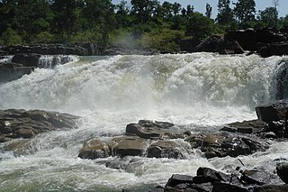
Mandla is a city with municipality in Mandla district in the Indian state of Madhya Pradesh. It is the administrative headquarters of Mandla District. The city is situated in a loop of the Narmada River, which surrounds it on three sides, and for 15 miles between Mandla and Ramnagar, Madhya Pradesh the river flows in a deep bed unbroken by rocks. The Narmada is worshiped here, and many ghats have been constructed on the banks of the river. It was a capital of the Gondwana Kingdom who built a palace and a fort, which in the absence of proper care have gone to ruins.

Damoh is a city in the Indian state of Madhya Pradesh. It is known for The Bade Baba Temple at Kundalpur, a Jain pilgrimage site. It is one of the major cities of Madhya Pradesh. The city is also the district headquarters of Damoh district.
Singrampur is a historical place where final battle fought between Rani Durgawati and Mughal king Akbar's Senapati Asaf Khan. The town in named after Sangram which in Hindi means war.

Badaun district is one of the districts of Uttar Pradesh state of India, with its headquarters in the town of Badaun. The district is part of the Bareilly division, and covers an area of 4,234 km2 (1,635 sq mi). According to legend, Budaun was named after the Ahir prince Budh.

Betul district is a district of Madhya Pradesh state in central India. The city of Betul serves as its administrative headquarters. The district is a part of Narmadapuram Division.

Raisen District is a district of Madhya Pradesh state of India. The town of Raisen is the district headquarters. The district is part of Bhopal Division. Sanchi University of Buddhist-Indic Studies is the first international university located at Sanchi Town.

Sheopur District is a district of Madhya Pradesh state in central India. The district is located in the north of the state and forms part of Chambal division. It is situated on the periphery of Rajasthan, which shows in the influence of Rajasthani culture in this district.

Chhatarpur District is a district of Madhya Pradesh state of central India. The town of Chhatarpur is the district headquarters.

Shahdol District is a district of Madhya Pradesh state in east central India. It old name was Matsya raj or Virat kingdom in the name of great king Maharaja Virata. With a total area of 6,205 km2 (2,396 sq mi) and a population of 10,66,063. Shahdol is an important district of Madhya Pradesh. The town of Shahdol is the district headquarters. The district formerly comprised Shahdol division.
Umaria district is a district of Madhya Pradesh. The town of Umaria is the district headquarters. The district is part of Shahdol Division.

Katni District, also known as Murwara District, is one of the 55 districts of Madhya Pradesh state in central India. The town of Katni (Murwara) is the District headquarters. The District is part of Jabalpur Division. The District occupies an area of 4949.59 km².

Seoni District is a district of Madhya Pradesh state in central India. The town of Seoni is the district headquarters.

Sagar district is a district of Madhya Pradesh state in central India. The town of Sagar serves as its administrative center.

Barwani district is one of the districts of Madhya Pradesh state of India. The administrative headquarters of the district is at Barwani. Barwani district has an area of 5,427 km² and a population 1,385,881. The district lies in the southwestern corner of Madhya Pradesh; the Narmada River forms its northern boundary. The Satpura Range lies to its south. The district is bordered by Maharashtra state to the south, Gujarat state to the west, Dhar District to the north and Khargone District to the east.

Tikamgarh district is one of the 52 districts of Madhya Pradesh state in central India. Tikamgarh town is the district headquarters. The district is part of Sagar Division.

Narsinghgarh is a town and a municipality, near Rajgarh city in Rajgarh district in the Indian state of Madhya Pradesh.
The Garha Kingdom, also called Garha Mandla or Garha Katanga, was an early-modern-era kingdom in India. It was the first large kingdom to be founded by the Gond tribe and dominated much of Central India at its peak.
Patera is a city and a tahsil in the Damoh district of Madhya Pradesh, India.


