Dhar district, India

Last updated

Dhar district
A beautiful Jahaz Mahal.jpg
Bagh Cave 2 Madhya Pradesh 044.jpg
0102721 Bhojshala and Kamal Maula mosque site, Dhar Madhya Pradesh 008.jpg
Dhar Fort, Dhar, Madhya Pradesh 3.jpg
Chhapan Mahal General View.jpg
Clockwise from top-left: Jahaz Mahal at Mandu, Bagh Caves, Dhar Fort, Chhapan Mahal, Bhojshala
MP Dhar district map.svg
Location of Dhar district in Madhya Pradesh
CountryFlag of India.svg  India
State Madhya Pradesh
Division Indore
Headquarters Dhar
Government
   Lok Sabha constituencies Dhar
   Vidhan Sabha constituencies Sardarpur (196)
Gandhwani (197)
Kukshi (198)
Manawar (199)
Dharampuri (200)
Dhar (201)
Badnawar (202)
Area
  Total8,153 km2 (3,148 sq mi)
Population
 (2011)
  Total2,185,793
  Density270/km2 (690/sq mi)
Demographics
   Literacy 60.57 per cent
  Sex ratio961
Time zone UTC+05:30 (IST)
Website dhar.nic.in

Dhar district is a district of Madhya Pradesh state in central India. The historic town of Dhar is administrative headquarters of the district.

Contents

The district has an area 8,153 km2. It is bounded by the districts of Ratlam to the north, Ujjain to the northeast, Indore to the east, Khargone (West Nimar) to the southeast, Barwani to the south, Jhabua and Alirajpur to the west. It is part of the Indore Division of Madhya Pradesh. The population of the district is 2,185,793 (2011 census), an increase of 25.60% from its 2001 population of 1,740,329. Pithampur is a large industrial area comes under Dhar District. Kukshi is the largest tehsil of the district.

Geography

The Vindhya Range runs east and west through the district. The northern part of the district lies on the Malwa plateau. The northwestern portion of the district lies in the watershed of the Mahi River and its tributaries, while the northeastern part of the district lies in the watershed of the Chambal River, which drains into the Ganges via the Yamuna River. The portion of the district south of the ridge of the Vindhyas lies in the watershed of the Narmada River, which forms the southern boundary of the district.

Divisions

Dhar district is divided into 6 sub-divisions: Dhar, Sardarpur, Badnawar, Manawar, Kukshi and Dharampuri (Newly Added). These sub-divisions are further divided into 8 tehsils: Dhar, Badnawar, Dharampuri, Sardarpur, Manawar, Kukshi, Dahi and Gandhwani.

There are seven Vidhan Sabha constituencies in this district: Sardarpur, Gandhwani, Kukshi, Manawar, Dharampuri, Dhar and Badnawar. All of these are part of the only Lok Sabha constituency in this district : Dhar Lok Sabha Constituency.

Villages in Dhar district include Kadod Kala, Tirla, and Tornod.

Demographics

Historical population
YearPop.±% p.a.
1901293,103    
1911343,256+1.59%
1921393,577+1.38%
1931432,482+0.95%
1941473,721+0.91%
1951503,965+0.62%
1961643,774+2.48%
1971842,400+2.73%
19811,057,469+2.30%
19911,367,412+2.60%
20011,740,329+2.44%
20112,185,793+2.31%
source: [1]
Religions in Dhar district (2011) [2]
ReligionPercent
Hinduism
93.84%
Islam
5.31%
Jainism
0.56%
Other or not stated
0.29%

According to the 2011 census Dhar District has a population of 2,185,793, [3] roughly equal to the nation of Latvia [4] or the US state of New Mexico. [5] This gives it a ranking of 208th in India (out of a total of 640). [3] The district has a population density of 268 inhabitants per square kilometre (690/sq mi) . [3] Its population growth rate over the decade 2001-2011 was 25.53%. [3] Dhar has a sex ratio of 961 females for every 1000 males, [3] and a literacy rate of 60.57%. 18.90% of the population lives in urban areas. Scheduled Castes and Scheduled Tribes made up 6.65% and 55.94% of the population respectively. [3]

Languages of Dhar district (2011) [6]

   Hindi (51.28%)
   Malvi (15.62%)
   Nimadi (15.29%)
   Bhili (11.49%)
   Bhilali (3.87%)
  Others (2.45%)

At the time of the 2011 Census of India, 51.28% of the population in the district spoke Hindi, 15.62% Malvi, 15.29% Nimadi, 11.49% Bhili and 3.87% Bhilali as their first language. [6]

Tourist places

Related Research Articles

<span class="mw-page-title-main">Madhya Bharat</span> Former state of India (1947–1957)

Madhya Bharat, also known as Malwa Union, was an Indian state in west-central India, created on 28 May 1948 from twenty-five princely states which until 1947 had been part of the Central India Agency, with Jiwajirao Scindia as its Rajpramukh.

Nimar is the southwestern region of Madhya Pradesh state in west-central India. This region has sub-regions which include Nimar, Khandwa and Harda.

<span class="mw-page-title-main">Osmanabad district</span> District of Maharashtra in India

Osmanabad District, officially known as Dharashiv District, is an administrative district in the Marathwada region in the Indian state of Maharashtra. The district headquarter is located at Osmanabad. The District of Osmanabad derives its name from the last ruler of Hyderabad, the 7th Nizam, Mir Osman Ali Khan, of which the region was a part till 1947. This region was earlier part of The Hyderabad State until Independence.This primarily rural district occupies an area of 7,569 km2 (2,922 sq mi) of which 241.4 km2 (93.2 sq mi) is urban and has a population of 1,657,576 of which 16.96% were urban.

<span class="mw-page-title-main">Sheopur district</span> District of Madhya Pradesh in India

Sheopur District is a district of Madhya Pradesh state in central India. The district is located in the north of the state and forms part of Chambal division. It is situated on the periphery of Rajasthan, which shows in the influence of Rajasthani culture in this district.

<span class="mw-page-title-main">Dewas district</span> District of Madhya Pradesh in India

Dewas District is a district in the Indian state of Madhya Pradesh. The town of Dewas is the district headquarters.

<span class="mw-page-title-main">Rewa district</span> City and district of Madhya Pradesh in India

Rewa district is a district of the Madhya Pradesh state in central India. The city of Rewa is the district headquarter. Rewa is sometimes called – 'Land of White Tigers' as the first White Tiger was discovered here in 1951 by Maharaja of the province, Martand Singh in the nearby jungle of Govindgarh. Rewa was the capital city of once a state – Vindhya Pradesh.

<span class="mw-page-title-main">Khargone district</span> District of Madhya Pradesh in India

Khargone district, formerly known as West Nimar district, is a district of Madhya Pradesh state in central India. The district lies in the Nimar region and is part of the Indore Division. The district headquarters is the city of Khargone, which lies south of the Indore metropolis, the headquarters of Indore district.

<span class="mw-page-title-main">Bhopawar Agency</span>

Bhopawar Agency was a sub-agency of the Central India Agency in British India with the headquarters at the town of Bhopawar, so the name. Bhopawar Agency was created in 1882 from a number of princely states in the Western Nimar and Southern Malwa regions of Central India belonging to the former Bhil Agency and Bhil Sub-agency with the capitals at Bhopawar and Manpur. The agency was named after Bhopawar, a village in Sardarpur tehsil, Dhar District of present-day Madhya Pradesh state. Manpur remained a strictly British territory.

<span class="mw-page-title-main">Barwani district</span> District of Madhya Pradesh in India

Barwani district is one of the districts of Madhya Pradesh state of India. The administrative headquarters of the district is at Barwani. Barwani district has an area of 5,427 km² and a population 1,385,881. The district lies in the southwestern corner of Madhya Pradesh; the Narmada River forms its northern boundary. The Satpura Range lies to its south. The district is bordered by Maharashtra state to the south, Gujarat state to the west, Dhar District to the north and Khargone District to the east.

<span class="mw-page-title-main">Tikamgarh district</span> District of Madhya Pradesh in India

Tikamgarh district is one of the 52 districts of Madhya Pradesh state in central India. Tikamgarh town is the district headquarters. The district is part of Sagar Division.

<span class="mw-page-title-main">Ujjain district</span> District of Madhya Pradesh in India

Ujjain district is a district of Madhya Pradesh state in central India. The historic city of Ujjain is the district headquarters. The district has an area of 6,091 km², and a population of 19,86,864, a 16.12% increase from its 2001 population of 17,10,982.

<span class="mw-page-title-main">Indore district</span> District of Madhya Pradesh, India

The Indore District is a district of Madhya Pradesh state in central India. It is believed that the city is named after its Indreshwar Mahadev Temple, Where Indra is the presiding deity. The Gupta inscriptions name Indore as "Indrapura". It is also called the administrative capital. This district forms part of the Indore Division.

<span class="mw-page-title-main">Lalitpur district, India</span> District in Uttar Pradesh, India

Lalitpur is one of the 75 districts in the northern Indian state of Uttar Pradesh. Lalitpur district is a part of Jhansi Division. Lalitpur is the main town and administrative headquarters. The district occupies an area of 5,039 km2.

<span class="mw-page-title-main">Gwalior district</span> District in Madhya Pradesh, India

Gwalior district is one of the 52 districts of Madhya Pradesh state in central India. The historic city of Gwalior is its administrative headquarters. Other cities and towns in this district are Antari, Bhitarwar, Bilaua, Dabra, Morar Cantonment, Pichhore, and Tekanpur. The district is at the centre of the Gird region.

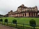
Sardarpur is a town and a nagar panchayat in Dhar district in the Indian state of Madhya Pradesh. It is a town on Mahi river on the Malwa plateau. There is an ancient Shivalinga situated at the bank of Mahi river at a place called Shree Jhineshwar Dham; Shri Mohankheda Jain Thirth and Bhopawar Jain Tirth are located nearby.

Badnawar (or Badnavar) is a Town, former pargana and a Nagar Parishad of the Dhar district in the state of Madhya Pradesh, India. This is a tehsil place having 170 villages. Badnawar is around 95 km from Indore - the business capital of Madhya Pradesh.

Kukshi is a town in Dhar district of Madhya Pradesh state, India. Kukshi has population of around 37,482 making it a Tier-3 city and a Semi-Urban centre. It is a Nagar Parishad. Kukshi is famous for the business of cotton, mirchi, gold and silver, and ready made garments.

Manawar is a town with tehsil in Dhar district in the Indian state of Madhya Pradesh. The name Manawar came from name of river Mān that flows at southern edge of the town. Pin code of Manawar is 454446.

<span class="mw-page-title-main">Alirajpur district</span> District of Madhya Pradesh in India

Alirajpur is one of the 52 districts of Madhya Pradesh state in India. It was created from Alirajpur, Jobat and Bhabra tehsils of the former Jhabua district on 17 May 2008. It is the least literate district in India as per Census 2011. Alirajpur is the administrative headquarters of the district. The district occupies an area of 2,165.24 square kilometres (836.00 sq mi), and at the 2011 census had a population of 728,999. It includes the city of Alirajpur.

<span class="mw-page-title-main">Kukshi Assembly constituency</span> Constituency of the Madhya Pradesh legislative assembly in India

Kukshi is one of the 230 Vidhan Sabha constituencies of Madhya Pradesh state in central India. It was founded in 1951 as one of the 79 Vidhan Sabha constituencies of the erstwhile Madhya Bharat state. It is reserved for candidates of the Scheduled tribes.

References

  1. "Table A-02 Decadal Variation in Population Since 1901: Madhya Pradesh" (PDF). census.gov.in. Registrar General and Census Commissioner of India.
  2. "Table C-01 Population By Religion: Madhya Pradesh". census.gov.in. Registrar General and Census Commissioner of India.
  3. 1 2 3 4 5 6 "District Census Handbook: Dhar" (PDF). Census of India . Registrar General and Census Commissioner of India. 2011.
  4. US Directorate of Intelligence. "Country Comparison:Population". Archived from the original on 27 September 2011. Retrieved 1 October 2011. Latvia 2,204,708 July 2011 est.
  5. "2010 Resident Population Data". U. S. Census Bureau. Archived from the original on 19 October 2013. Retrieved 2011-09-30. New Mexico - 2,059,179
  6. 1 2 "Table C-16 Population by Mother Tongue: Madhya Pradesh". censusindia.gov.in. Registrar General and Census Commissioner of India.

22°36′N75°18′E / 22.600°N 75.300°E / 22.600; 75.300