Related Research Articles

Interstate 80 (I-80) is an east–west transcontinental freeway that crosses the United States from downtown San Francisco, California, to Teaneck, New Jersey, in the New York metropolitan area. The highway was designated in 1956 as one of the original routes of the Interstate Highway System; its final segment was opened in 1986. The second-longest Interstate Highway in the United States after I-90, it runs through many major cities, including Oakland, Sacramento, Reno, Salt Lake City, Omaha, Des Moines, and Toledo and passes within 10 miles (16 km) of Chicago, Cleveland, and New York City.

Brownsville is a borough in Fayette County, Pennsylvania, United States, first settled in 1785 as the site of a trading post a few years after the defeat of the Iroquois enabled a resumption of westward migration after the Revolutionary War. The trading post soon became a tavern and inn and was receiving emigrants heading west, as it was located above the cut bank overlooking the first ford that could be reached to those descending from the Allegheny Mountains. Brownsville is located 40 miles (64 km) south of Pittsburgh along the east bank of the Monongahela River.

West Brownsville is a former important transportation nexus and a present-day borough in Washington County, Pennsylvania, United States and part of the Pittsburgh metropolitan area. The population was 972 at the 2020 census. Culturally, by postal route, and socially, the community is connected to cross-river sister-city Brownsville, for the two were long joined by the Amerindian trail known as Nemacolin's Path that became a wagon road after the American Revolution, but West Brownsville is a separate municipality. Brownsville was the first point where the descent from the Appalachians could safely reach the river down the generally steep banks of the Monongahela River. Between Brownsville and West Brownsville was a shallow stretch, usable as a river ford astride a major Emigrant Trail to the various attractive regions in the Northwest Territory, the first National Road, the Cumberland Pike.

The Monongahela River, sometimes referred to locally as the Mon, is a 130-mile-long (210 km) river on the Allegheny Plateau in north-central West Virginia and Southwestern Pennsylvania. The river flows from the confluence of its west and east forks in north-central West Virginia northeasterly into southwestern Pennsylvania, then northerly to Pittsburgh and its confluence with the Allegheny River to form the Ohio River. The river includes a series of locks and dams that makes it navigable.
The Pittsburgh and Lake Erie Railroad, also known as the "Little Giant", was formed on May 11, 1875. Company headquarters were located in Pittsburgh, Pennsylvania. The line connected Pittsburgh in the east with Youngstown, Ohio in the Haselton neighborhood in the west and Connellsville, Pennsylvania to the east. It did not reach Lake Erie until the formation of Conrail in 1976. The P&LE was known as the "Little Giant" since the tonnage that it moved was out of proportion to its route mileage. While it operated around one tenth of one percent of the nation's railroad miles, it hauled around one percent of its tonnage. This was largely because the P&LE served the steel mills of the greater Pittsburgh area, which consumed and shipped vast amounts of materials. It was a specialized railroad deriving much of its revenue from coal, coke, iron ore, limestone, and steel. The eventual closure of the steel mills led to the end of the P&LE as an independent line in 1992.
Redstone Old Fort — or Redstone Fort or Fort Burd — on the Nemacolin Trail, was the name of the French and Indian War-era wooden fort built in 1759 by Pennsylvania militia colonel James Burd to guard the ancient Indian trail's river ford on a mound overlooking the eastern shore of the Monongahela River in what is now Fayette County, Pennsylvania near, or on the banks of Dunlap's Creek at the confluence. The site is unlikely to be the same as an earlier fort the French document as Hangard dated to 1754 and which was confusedly, likely located on the nearby stream called Redstone Creek. Red sandstones predominate the deposited rock column of the entire region.

The Allegheny County Belt System color codes various county roads to form a unique system of routes in Allegheny County, Pennsylvania, and around the city of Pittsburgh.
The Mon–Fayette Expressway is a partially-completed tolled freeway that is planned to eventually link Interstate 68 near Morgantown, West Virginia with Interstate 376 near Monroeville, Pennsylvania. The ultimate goal of the highway is to provide a high speed north–south connection between Morgantown and the eastern side of Pittsburgh while revitalizing economically distressed Monongahela River Valley towns in Fayette and Washington counties, serving as an alternative to Interstate 79 to the west, as well as relieving the PA 51 alignment from Pittsburgh to Uniontown.

The Ohio Connecting Railroad Bridge is a steel bridge which crosses the Ohio River at Brunot's Island at the west end of Pittsburgh, Pennsylvania, United States. It consists of two major through truss spans over the main and back channels of the river, of 508 feet (155 m) and 406 feet (124 m) respectively, with deck truss approaches.

Transportation in Pittsburgh, Pennsylvania is different than in many other major American cities. A large metropolitan area that is surrounded by rivers and hills, Pittsburgh has an infrastructure system that has been built out over the years to include roads, tunnels, bridges, railroads, inclines, bike paths, and stairways; however, the hills and rivers still form many barriers to transportation within the city.
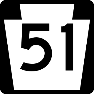
Pennsylvania Route 51 is a major state highway that is located in Western Pennsylvania in the United States. It runs for 89 miles (143 km) from Uniontown to the Ohio state line near Darlington, where it connects with Ohio State Route 14.
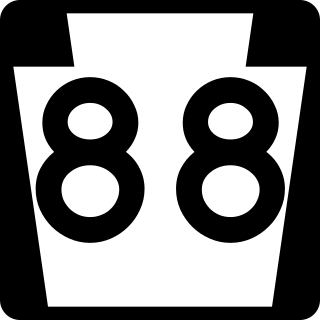
Pennsylvania Route 88 is a 68-mile-long (109 km) north–south state highway located in southwestern Pennsylvania. The southern terminus of the route is at U.S. Route 119 (US 119) in Point Marion less than 2 miles (3 km) from the Pennsylvania-West Virginia border. The northern terminus is at PA 51 in Pittsburgh. PA 88 runs parallel to the Monongahela River for almost its entire length.

Pennsylvania Route 885 is a 14.1 mi (22.69 km) long north–south state highway in the U.S. state of Pennsylvania. It runs from Pennsylvania Route 837 in Clairton north to Interstate 579 in Pittsburgh. The route is entirely within Allegheny County and serves as a connector between the city of Pittsburgh and its southern suburbs.

Turtle Creek is a 21.1-mile-long (34.0 km) tributary of the Monongahela River that is located in Allegheny and Westmoreland counties in the U.S. state of Pennsylvania. Situated at its juncture with the Monongahela is Braddock, Pennsylvania, where the Battle of the Monongahela was fought in 1755.

U.S. Route 40 enters Pennsylvania at West Alexander. It closely parallels Interstate 70 (I-70) from West Virginia until it reaches Washington, where it follows Jefferson Avenue and Maiden Street.In Washington, US 40 passes to the south of Washington & Jefferson College. Following Maiden Street out of town, the road turns southeast toward the town of California. A short limited access highway in California and West Brownsville provides an approach to the Lane Bane Bridge across the Monongahela River. From here, the road continues southeast to Uniontown.

Brownsville Road is a road between Pittsburgh, at Eighteenth Street and South Avenue in Allegheny County, Pennsylvania eastwards through Mount Oliver and generally highlands situated along or near the hilltops often overlooking the Monongahela River. It has had several names over its history, and was also known at the Red Stone Road and the period it was a Plank Road managed as a toll road, the Brownsville Plank Road, or the Brownsville Turnpike, or locally, as the area grew into a city, Southern Avenue.
The Pittsburgh, Virginia and Charleston Railway was a predecessor of the Pennsylvania Railroad in the U.S. state of Pennsylvania. By 1905, when it was merged into the Pennsylvania, it owned a main line along the left (west) side of the Monongahela River, to Pittsburgh's South Side from West Brownsville. Branches connected to the South-West Pennsylvania Railway in Uniontown via Redstone Creek and to numerous coal mines.

The Mon Line is an 85-mile long Norfolk Southern rail line which runs along the Monongahela River for most of its route.

The gaps of the Allegheny, meaning gaps in the Allegheny Ridge in west-central Pennsylvania, is a series of escarpment eroding water gaps along the saddle between two higher barrier ridge-lines in the eastern face atop the Allegheny Ridge or Allegheny Front escarpment. The front extends south through Western Maryland and forms much of the border between Virginia and West Virginia, in part explaining the difference in cultures between those two post-Civil War states. While not totally impenetrable to daring and energetic travelers on foot, passing the front outside of the water gaps with even sure footed mules was nearly impossible without navigating terrain where climbing was necessary on slopes even burros would find extremely difficult.

The unincorporated hamlet of Malden is a bedroom community that is located on the historic 'Old National Pike' in borough of Centerville Washington County, Pennsylvania. Originally an early wagon stop in rural Pennsylvania, it became a small transportation hub during the surge of westward migration to the Northwest Territory after 1790.
References
- ↑ Elevation at point where GoogleEarth locates search to "Blainsburg, West Brownsville, PA"
- ↑ PA Route 88 is an old style two lane highway that connects the business districts of left bank communities in the Mon Valley.
- ↑ Elevations in this section are 'measured' satellite data or USGS reported by GoogleEarth software.

