Mount Pleasant Township, Washington County, Pennsylvania

Last updated
Mount Pleasant Township
Mount Pleasant Township, Washington County, Pennsylvania.jpg
Looking west near 78 Main Street in Hickory
Map of Mount Pleasant Township, Washington County, Pennsylvania Highlighted.png
Location of Mount Pleasant Township in Washington County
Map of Pennsylvania highlighting Washington County.svg
Location of Washington County in Pennsylvania
CountryUnited States
State Pennsylvania
County Washington County
EstablishedMay 10, 1788
Area
[1]
  Total35.67 sq mi (92.39 km2)
  Land35.59 sq mi (92.18 km2)
  Water0.08 sq mi (0.21 km2)
Population
 (2010)
  Total3,515
  Estimate 
(2018) [2]
3,528
  Density98.34/sq mi (37.97/km2)
Time zone UTC-5 (EST)
  Summer (DST) UTC-4 (EDT)
Area code(s) 724
Website www.mpt-pa.com
Historical population
CensusPop.
2000 3,422
2010 3,5152.7%
2018 (est.)3,528 [2] 0.4%
U.S. Decennial Census [3]

Mount Pleasant Township is a township in Washington County, Pennsylvania, in the United States. As of the 2010 census, the township population was 3,515. [4]

Contents

History

Krepps Covered Bridge KREPPS COVERED BRIDGE.jpg
Krepps Covered Bridge

The Krepps Covered Bridge was listed on the National Register of Historic Places in 1979. [5]

Geography

According to the United States Census Bureau, the township has a total area of 35.7 square miles (92 km2), of which 35.6 square miles (92 km2) is land and 0.1 square miles (0.26 km2) (0.22%) is water.

Transportation

Rail

McGugin Tunnel

The McGugin Tunnel is located at latitude - longitude coordinates of N 40.28674 and W -80.33173. The nearest major town is Hickory, Pennsylvania, where it passes under Pennsylvania Route 18. The tunnel is at an elevation of 1,263 feet (385 m).

Hickory Tunnel

The Hickory Tunnel is close to the McGugin Tunnel. It has the same nearest major town, Hickory, where the tunnel passes under Pennsylvania Route 50. The elevation of the tunnel is 1,286 feet (392 m).

Several major roads pass through the township of Mount Pleasant: Pennsylvania Route 519, Pennsylvania Route 50, and Pennsylvania Route 18.

Demographics

As of the census [6] of 2000, there were 3,422 people, 1,279 households, and 1,006 families residing in the township. The population density was 96.0 people per square mile (37.1/km2). There were 1,348 housing units at an average density of 37.8/sq mi (14.6/km2). The racial makeup of the township was 96.49% White, 2.98% African American, 0.09% Asian, and 0.44% from two or more races. Hispanic or Latino of any race were 0.09% of the population.

There were 1,279 households, out of which 32.5% had children under the age of 18 living with them, 66.1% were married couples living together, 9.0% had a female householder with no husband present, and 21.3% were non-families. 18.9% of all households were made up of individuals, and 9.8% had someone living alone who was 65 years of age or older. The average household size was 2.67 and the average family size was 3.06.

In the township the population was spread out, with 24.0% under the age of 18, 7.1% from 18 to 24, 27.7% from 25 to 44, 25.7% from 45 to 64, and 15.6% who were 65 years of age or older. The median age was 40 years. For every 100 females there were 100.0 males. For every 100 females age 18 and over, there were 98.9 males.

The median income for a household in the township was $41,172, and the median income for a family was $48,915. Males had a median income of $35,750 versus $22,917 for females. The per capita income for the township was $18,800. About 3.6% of families and 5.3% of the population were below the poverty line, including 5.9% of those under age 18 and 7.9% of those age 65 or over.

Mount Pleasant Township is home to four (4) small communities: Hickory, Southview, the Cherry Valley Lakeview Estates and Primrose.

It is also home to the Fort Cherry School District.

Related Research Articles

Mount Pleasant Township, Adams County, Pennsylvania Township in Pennsylvania, United States

Mount Pleasant Township is a township in Adams County, Pennsylvania, in the United States. As of the 2010 census, the township population was 4,693.

Sugarcreek Township, Armstrong County, Pennsylvania Township in Pennsylvania, United States

Sugarcreek Township is a township in Armstrong County, Pennsylvania, United States. The population was 1,539 during the 2010 census.

Ohioville, Pennsylvania Borough in Pennsylvania, United States

Ohioville is a borough in Beaver County, Pennsylvania, United States. The population was 3,533 at the 2010 census.

Bullskin Township, Fayette County, Pennsylvania Township in Pennsylvania, United States

Bullskin Township is a township in Fayette County, Pennsylvania, United States. The population was 6,966 at the 2010 census, down from 7,782 at the 2000 census. It is served by the Connellsville Area School District.

Springfield Township, Fayette County, Pennsylvania Township in Pennsylvania, United States

Springfield Township is a township in Fayette County, Pennsylvania, United States. The population was 3,043 at the 2010 census. The Connellsville Area School District serves the township.

Hickory Township, Forest County, Pennsylvania Township in Pennsylvania, United States

Hickory Township is a township in Forest County, Pennsylvania, United States. As of the 2010 census, the township population was 558.

Mountville, Pennsylvania Borough in Pennsylvania, United States

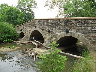
Mountville is a borough in Lancaster County, Pennsylvania, United States. The population was 2,802 at the 2010 census, up from 2,444 at the 2000 census. The original Charles Chips potato chip factory was located here.

North Beaver Township, Lawrence County, Pennsylvania Township in Pennsylvania, United States

North Beaver Township is a township in Lawrence County, Pennsylvania, United States. The population was 4,121 at the 2010 census.

Heidelberg Township, Lehigh County, Pennsylvania Township in Pennsylvania, United States

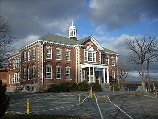
Heidelberg Township is a township in Lehigh County, Pennsylvania, in the United States. It is a suburb of Allentown, Pennsylvania, in the Lehigh Valley region of the state.

Lower Mount Bethel Township, Northampton County, Pennsylvania Place in Pennsylvania, United States

Lower Mount Bethel Township is a township in Northampton County, Pennsylvania, in the United States. Lower Mount Bethel Township is located in the Lehigh Valley region of the state. It is part of Pennsylvania's Slate Belt.

Morris Township, Tioga County, Pennsylvania Township in Pennsylvania, United States

Morris Township is a township in Tioga County, Pennsylvania, in the United States. The population was 606 at the 2010 census.

Cross Creek Township, Washington County, Pennsylvania Township in Pennsylvania, United States

Cross Creek Township is a township in Washington County, Pennsylvania, United States. The population was 1,556 at the 2010 census.

Robinson Township, Washington County, Pennsylvania Township in Pennsylvania, United States

Robinson Township is a township in Washington County, Pennsylvania, United States. The population was 1,931 at the 2010 census. It was formerly an area of interest concerning coal mining. A portion of the Montour Trail passes through Robinson Township.

Mount Pleasant Township, Wayne County, Pennsylvania Second-class township in Pennsylvania, United States

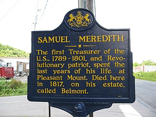
Mount Pleasant is a second-class township in Wayne County, Pennsylvania. The township's population was 1,357 at the time of the 2010 United States Census.

Cook Township, Westmoreland County, Pennsylvania Township in Pennsylvania, United States

Cook Township is a township in Westmoreland County, Pennsylvania, United States. The population was 2,403 at the 2000 census.

Donegal Township, Westmoreland County, Pennsylvania Township in Pennsylvania, United States

Donegal Township is a township in Westmoreland County, Pennsylvania, United States. The population was 2,442 at the 2000 census.

Mount Pleasant, Pennsylvania Borough in Pennsylvania, United States

Mount Pleasant is a borough in Westmoreland County, Pennsylvania, United States. It stands 45 miles (72 km) southeast of Pittsburgh. As of the 2010 census, the borough's population was 4,454.

Mount Pleasant Township, Westmoreland County, Pennsylvania Township in Pennsylvania, United States

Mount Pleasant Township is a township in Westmoreland County, Pennsylvania, United States. As of the 2000 census, the township population was 11,153. Mount Pleasant Township should not be confused with the Borough of Mount Pleasant, which is a separate municipality and comprises the town of that name.

Unity Township, Westmoreland County, Pennsylvania Township in Pennsylvania, United States

Unity Township is a township in Westmoreland County, Pennsylvania, United States. The population was 22,607 at the 2010 census.

Stowe Township, Allegheny County, Pennsylvania Township in Pennsylvania, United States

Stowe Township is a township in Allegheny County, Pennsylvania, United States. The population was 6,362 at the 2010 census.

References

  1. "2016 U.S. Gazetteer Files". United States Census Bureau. Retrieved Aug 14, 2017.
  2. 1 2 Bureau, U. S. Census. "U.S. Census website". United States Census Bureau . US Census Bureau. Retrieved 1 December 2019.
  3. "Census of Population and Housing". Census.gov. Retrieved June 4, 2016.
  4. "U.S. Census website". United States Census Bureau . Retrieved 2017-03-11.
  5. "National Register Information System". National Register of Historic Places . National Park Service. July 9, 2010.
  6. "U.S. Census website". United States Census Bureau . Retrieved 2008-01-31.

Coordinates: 40°19′59″N80°17′59″W / 40.333°N 80.2997°W / 40.333; -80.2997