Chevy Chase Heights is a census-designated place within White Township, Indiana County, Pennsylvania, United States. The population was 1,502 at the 2010 census.

New Eagle is a borough in Washington County, Pennsylvania, United States and is part of the Pittsburgh Metro Area. The population was 2,047 at the 2020 census.
Lynnwood-Pricedale is a census-designated place (CDP) in Fayette and Westmoreland counties in the Pennsylvania. The population was 2,031 at the 2010 census, down from 2,168 at the 2000 census. The community of Lynwood is located in Fayette County's Washington Township, while Pricedale is part of Westmoreland County's Rostraver Township.
Hickory is a census-designated place located in Mount Pleasant Township, Washington County in the state of Pennsylvania. As of the 2010 census the population was 740 residents.
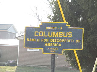
Columbus is a census-designated place located in Columbus Township, Warren County in the state of Pennsylvania, United States. The community is located along the famous U.S. Route 6 in northwestern Warren County. As of the 2010 census, the population was 824 residents. Columbus is within a few miles of the city of Corry, located in Erie County.
Fallowfield Township is an unincorporated community in Washington County, Pennsylvania, United States. It was the sixth township to be established after the 1781 formation of Washington County, and initially stretched from Elrama (north) to the Ten Mile Creek in what are, today, Union and East Bethlehem townships on the Monongahela River. Home to the John H. Nelson House, which was built circa 1895, this township was gradually downsized as various sections were sectioned off into new municipalities. Now roughly 21.3 square miles in size, its population was 4,300, according to the 2010 U.S. Census.

Muse is a census-designated place located in Cecil Township, Washington County, Pennsylvania. The community is located in northern Washington County north of the borough of Canonsburg. As of the 2010 census the population was 2,504 residents.

Boston is a census-designated place located in Elizabeth Township, Allegheny County in the state of Pennsylvania. As of the 2020 census the population was 549.
Greenock is a census-designated place (CDP) in Elizabeth Township, Allegheny County, Pennsylvania, United States. As of the 2020 US Census the population was 1,989.
Edie is a census-designated place located in Lincoln Township, Somerset County in the state of Pennsylvania, United States. As of 2021, the population was estimated to be 62.

Laurelton is a census-designated place located in Hartley Township, Union County in the state of Pennsylvania. It is located in western Union County along Pennsylvania Route 235. As of the 2010 census the population was 221 residents.
Cross Creek is a census-designated place located in Cross Creek Township, Washington County in the state of Pennsylvania. The community is located in northern Washington County about 2 miles southwest of the community of Atlasburg. As of the 2010 census the population was 137 residents.
Hendersonville is a census-designated place located in Cecil Township, Washington County in the state of Pennsylvania. The community is located just to the east of Interstate 79. As of the 2010 census the population was 325 residents.
Joffre is a census-designated place located in Smith Township, Washington County in the state of Pennsylvania. The community is located in northern Washington County about 3 miles east of the borough of Burgettstown. As of the 2022 American Community Survey, the population was 397 residents.
Lawrence is a census-designated place located in Cecil Township, Washington County in the state of Pennsylvania. The community is a Pittsburgh suburb located in northern Washington County near the Allegheny County line. As of the 2010 census the population was 540 residents.
Meadowlands is a census-designated place in Washington County, Pennsylvania, United States. The community is located in Chartiers Township, in central Washington County about 8 miles (13 km) north of the city of Washington. As of the 2020 census the population was 839.
Collinsburg is a census-designated place located in Rostraver Township, Westmoreland County in the state of Pennsylvania, United States. As of the 2010 census the population was 1,125 residents.
Fellsburg is a census-designated place located in Rostraver Township, Westmoreland County in the state of Pennsylvania, United States. It is home to the Fells Church, overlooking the Monongahela and Youhgiogheny Valleys. As of the 2010 census the population was 1,180 residents.
Hostetter is a census-designated place located in Unity Township, Westmoreland County in the state of Pennsylvania, United States. It is located near Pennsylvania Route 981. As of the 2010 census the population was 740 residents.
Level Green is a census-designated place located in Penn Township, Westmoreland County in the state of Pennsylvania, United States. The community is located near Pennsylvania Route 130. As of the 2010 census, the population was 4,020 residents.

