
Byron Township is a civil township of Kent County in the U.S. state of Michigan. As of the 2010 census, the population was 20,317, up from 17,553 at the 2000 census.

Byron Center is an unincorporated community in Kent County in the U.S. state of Michigan. It is a census-designated place (CDP) used for statistical purposes. The population was 5,822 at the 2010 census.

Skytop is an unincorporated community in Barrett Township, Monroe County, Pennsylvania, United States. Located north of Mountainhome, it is accessible by local roads off Route 390. Its elevation is 1,562 feet (476 m), and it is located at 41°13′40″N75°14′18″W. Although Skytop is unincorporated, it has a post office, with the ZIP code of 18357; the ZCTA for ZIP Code 18357 had a population of 87 at the 2000 census.

Crosswicks is an unincorporated community located within Chesterfield Township in Burlington County, New Jersey, United States. The area is served as United States Postal Service ZIP code 08515.
Wheeler is an unincorporated census-designated place (CDP) in northern Union Township, Porter County, in the U.S. state of Indiana. It lies along State Road 130, northwest of the city of Valparaiso, the county seat of Porter County. Its elevation is 666 feet (203 m). Although Wheeler is unincorporated, it has a post office, with the ZIP code of 46393. The population of Wheeler was 443 at the 2010 census. Wheeler has seen small growth, although its unincorporated, but the estimated population of Wheeler at the 2014 estimate was 452. The 2014 population area estimate of and around Wheeler was 1,685. Wheeler is served by the Union Township School Corporation, which includes Wheeler High School, Union Township Middle School, and two elementary schools. Wheeler today is still part of Union Township and has remained as the largest community in the township by population.
Brookfield Township is a civil township of Eaton County in the U.S. state of Michigan. As of the 2010 census, the township population was 1,537.

Franklin Township is a civil township of Lenawee County in the U.S. state of Michigan. The population was 2,939 at the 2000 census.
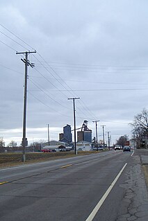
Grindstone is an unincorporated community and census-designated place in Jefferson and Redstone townships, in Fayette County, Pennsylvania, United States. The community was a part of the Grindstone-Rowes Run CDP, before it was split into two separate CDPs for the 2010 census. As of the 2010 census, the population was 498. Its ZIP code is 15442.

Wanamie is an unincorporated community and census-designated place in Newport Township, Luzerne County, Pennsylvania. It is located in the southwest end of the Wyoming Valley and uses the Nanticoke zip code of 18634. The South Branch Newport Creek forms the natural eastern boundary of Wanamie and drains it northeast via the Newport Creek into the Susquehanna River. The village is named after the Wanami tribe of the Lenni Lenape. As of the 2010 census, its population was 612.
Venetia is an unincorporated community in Peters Township, Washington County, Pennsylvania, United States. Although it is unincorporated, it has a post office, with the ZIP code of 15367. This ZIP covers most of the area between McMurray and Gastonville. The population was 8,731 at the 2010 census.
Cadogan is an unincorporated community in Cadogan Township, Armstrong County, Pennsylvania, United States. The community is located along the Allegheny River and Pennsylvania Route 128 5.3 miles (8.5 km) southwest of Kittanning. Cadogan has a post office with ZIP code 16212.
Bakerton is an unincorporated community in the township of West Carroll, Cambria County, Pennsylvania, United States. The community is 4.4 miles (7.1 km) south-southeast of Northern Cambria. Bakerton, is the official town name, but it has an address of Elmora with ZIP code 15737.
Torrance is an unincorporated community in Derry Township, Westmoreland County, Pennsylvania, United States. The community is located on the south side of the Conemaugh River 2.2 miles (3.5 km) east of Blairsville. Torrance has a post office with ZIP code 15779.
Darragh is an unincorporated community in Hempfield Township, Westmoreland County, Pennsylvania, United States. The community is located along Pennsylvania Route 136 1 mile (1.6 km) west of Arona. Darragh has a post office with ZIP code 15625, which opened on July 21, 1892.
Armbrust is an unincorporated community in Hempfield Township, Westmoreland County, Pennsylvania, United States. The community is located along Pennsylvania Route 819 1.8 miles (2.9 km) southeast of Youngwood. Armbrust has a post office with ZIP code 15616, which opened on June 25, 1856.

Pleasant Hall is an unincorporated community in Letterkenny Township in Franklin County, Pennsylvania, United States. Pleasant Hall is located at the intersection of Pennsylvania Route 533 and Pennsylvania Route 997 north of Chambersburg and northeast of the Letterkenny Army Depot.
Drumore is an unincorporated community in Drumore Township in Lancaster County, Pennsylvania, United States. Drumore is located at the intersection of Port Deposit Road and Fishing Creek Road along the east bank of the Susquehanna River at the mouth of Fishing Creek.
Quakake is an unincorporated community located in Rush Township, Schuylkill County, Pennsylvania, United States. The Quakake ZIP code 18245 covers 3.61 sq mi (9.3 km2), a population of 348 and 158 housing units, 141 of them occupied. The community is in Area Code 570, served by the 467 exchange.
Cambra is an unincorporated community in Huntington Township, Luzerne County, Pennsylvania, United States. The community is near Pennsylvania Route 239 and 1.8 miles (2.9 km) north-northwest of New Columbus. Cambra has a post office with ZIP code 18611, which opened on June 10, 1822.
Wysox is an unincorporated community in Bradford County, Pennsylvania, United States. The community is located at the intersection of U.S. Route 6 and Pennsylvania Route 187 2.3 miles (3.7 km) east of Towanda. Wysox has a post office with ZIP code 18854.


