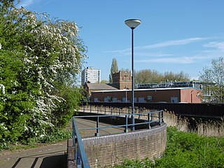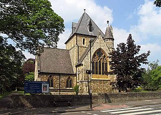
Forestdale is a residential neighbourhood of southeast London in the London Borough of Croydon. It is sometimes considered to be part of Addington, its ancient and ecclesiastical parish. It is located south of Upper Shirley, east of Selsdon, south-west of Addington's historic centre, north-west of New Addington and north of Farleigh and is east of West Wickham.

West Heath is an area of South East London within the London Borough of Bexley. It lies south of Abbey Wood and north of Welling.

Botany Bay is a hamlet in Enfield, England, on the outskirts of north London, located within the London Borough of Enfield. It has a population close to 200. The hamlet is centred at the junction of The Ridgeway – the A1005 road that links Enfield to Potters Bar and the M25 motorway – and East Lodge Lane. Enfield Chase lies to the south and west. It is about a mile from the railway station at Crews Hill.
Westbourne Green is an area of Westbourne, London, the centre of the former hamlet of Westbourne, at the north-western corner of the City of Westminster. It is named for its location west of a bourne.
Bandonhill is a small locality in the London Borough of Sutton, located between Wallington and Beddington.
Chase Cross is a district of the London Borough of Havering in London, England. Chase Cross lies 0.8 miles (1.3 km) east of Collier Row, 15 miles (24 km) northeast of Charing Cross and just under 2 miles (3.2 km) north of Romford. The name is thought to come from its position as a crossroads in the chase or Hainault Forest. The forest was cleared for agriculture in the 1850s, before being developed for housing in the 1930s.

Spring Grove is the north-western district of the town of Isleworth within the Borough of Hounslow in London, England. In general terms it lies east of the district of Lampton; north of the district of Woodlands; west of the Barnes-to-Feltham railway loop line; and south of the district of Osterley. Spring water that rose in the area in the eighteenth century was employed for agricultural and horticultural purposes.

Wall End is a locality in East Ham in East London, located in the borough of Newham. It is a little-used name for the area lying to the north of Beckton between Barking and East Ham. The name stems from an embankment wall that was formerly used to prevent flooding from the river Roding at the 'end' or 'outlying part' of East Ham. Much of the area consists of terraced housing dating from the building-boom of the late 19th century.
Blendon is an area of South East London within the London Borough of Bexley, located between Bexleyheath and Sidcup.

Elmers End is an area of south-east London, England, within the London Borough of Bromley, Greater London and formerly part of the historic county of Kent. It is located south of Beckenham, west of Eden Park, north of Monks Orchard and east of Anerley.
Brentford End is a small area located in the borough of Hounslow, London to the west of Brentford and east of Isleworth. It is little-used name for that section of Brentford situated to the west of the river Brent.
Woodlands is a small area located in the borough of Hounslow, London between Hounslow and Isleworth. It is an area roughly bounded by the Hounslow Loop railway line and the London Road to the north; the Duke of Northumberland's River and Twickenham Road to the east; and Bridge Road / Worton Road to the south and south-west. It includes roads such as Woodlands Road, Woodland Gardens, Woodlands Grove as well as The Woodlands Tavern public house and St John the Baptist's Church on St John's Road.
Grange Mills is a very small area of east Balham in the London Borough of Lambeth, England. Rarely appearing on maps, it is essentially little more than a small industrial estate, located off Weir Road.

Broom Hill, sometimes spelt Broomhill, is a suburb of Orpington in southeast London, England, located in the London Borough of Bromley in Greater London. Prior to 1965 it was within the historic county of Kent. It lies south of Poverest, west of Orpington High Street, north-east of Crofton, and south-east of Petts Wood.

Luxted is a hamlet in the London Borough of Bromley, located to the south of Downe. The area is rural, noted for its abundance of woods and grasslands. It is a part of the largest ward in Greater London, the Darwin (ward), which also includes Downe, Cudham, Leaves Green, Single Street, Berry's Green, and Westerham Hill.
Spring Park is a small area in London, England. It is within the London Borough of Bromley and the London Borough of Croydon, straddling the traditional Kent-Surrey border along The Beck. Spring Park is located north of Addington, west of West Wickham and south of Monks Orchard and Shirley.
Heath Park is an area of the London Borough of Havering situated to the east of Romford. It is a largely Edwardian estate built as a result of railway expansion.

South Chingford is an area of Chingford in east London, England. It is a largely residential area which is the location of the Chingford Hall Estate, Chingford Mount and the former Walthamstow Stadium.
Cannon Hill is a small district of the London Borough of Merton

Copse Hill is a low-rise district of the London Borough of Merton to the south of Wimbledon Common, associated with Raynes Park its nearest railway station. It is on higher ground and has the largest green spaces associated with the Raynes Park/West Wimbledon area surrounding it. It was almost entirely privately developed; the nearest social housing areas are in Wimbledon, and Putney Vale.


