Interstate 68 (I-68) is a 112.9-mile (181.7 km) Interstate Highway in the U.S. states of West Virginia and Maryland, connecting I-79 in Morgantown, West Virginia, to I-70 in Hancock, Maryland. I-68 is also Corridor E of the Appalachian Development Highway System. From 1965 until the freeway's construction was completed in 1991, it was designated as U.S. Route 48 (US 48). In Maryland, the highway is known as the National Freeway, an homage to the historic National Road, which I-68 parallels between Keysers Ridge and Hancock. The freeway mainly spans rural areas and crosses numerous mountain ridges along its route. A road cut at Sideling Hill exposed geological features of the mountain and has become a tourist attraction.

Whitley County is a county in the U.S. state of Kentucky. As of the 2010 census, the population was 35,637. The county seat is at Williamsburg, though the largest city is Corbin, and the county's District Court sits in both cities.

The Daniel Boone National Forest is a national forest in Kentucky. Established in 1937, it includes 708,000 acres (287,000 ha) of federally owned land within a 2,100,000 acres (850,000 ha) proclamation bounty. The name of the forest was changed in 1966 in honor of the explorer Daniel Boone.

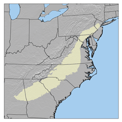
The Cumberland Plateau is the southern part of the Appalachian Plateau in the Appalachian Mountains of the United States. It includes much of eastern Kentucky and Tennessee, and portions of northern Alabama and northwest Georgia. The terms "Allegheny Plateau" and the "Cumberland Plateau" both refer to the dissected plateau lands lying west of the main Appalachian Mountains. The terms stem from historical usage rather than geological difference, so there is no strict dividing line between the two. Two major rivers share the names of the plateaus, with the Allegheny River rising in the Allegheny Plateau and the Cumberland River rising in the Cumberland Plateau in Harlan County, Kentucky.

John Avery was a physician and politician from the U.S. state of Michigan.

South Cumberland State Park is a state park in the middle and southeast portions of Tennessee on the Cumberland Plateau.
Mont Alto State Park is a Pennsylvania state park on 24 acres (9.7 ha) in Quincy Township, Franklin County, Pennsylvania in the United States. The park is on Pennsylvania Route 233 one mile from Mont Alto.

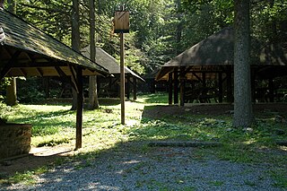
Colonel Denning State Park is a 273-acre (110 ha) Pennsylvania state park in Lower Mifflin Township, Cumberland County, Pennsylvania in the United States. The park is in the Doubling Gap of Blue Mountain on Pennsylvania Route 233 between Newville and Landisburg. Doubling Gap Lake is a man-made lake covering 3.5 acres (1.4 ha). Colonel Denning State Park is surrounded by Tuscarora State Forest.
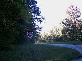
Big Spring State Forest Picnic Area is a 45-acre (18 ha) Pennsylvania state park in Toboyne Township, Perry County, Pennsylvania in the United States. The park is on Pennsylvania Route 274, 5.5 miles (8.9 km) southwest of New Germantown. Big Spring State Forest Picnic Area is a hiking and picnic area. A partially completed railroad tunnel in Conococheague Mountain is a feature of the park.

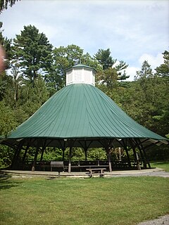
Fowlers Hollow State Park is a 104-acre (42 ha) Pennsylvania state park in Toboyne Township, Perry County, Pennsylvania in the United States. The park is 0.25 miles (400 m) from Blain just off Pennsylvania Route 274. Fowlers Hollow State Park is on the site of a former sawmill, and was developed as a park by the Works Progress Administration during the Great Depression.

The Cumberland Plain is a relatively flat region lying to the west of Sydney CBD in New South Wales, Australia. Cumberland Basin is the preferred physiographic and geological term for the low-lying plain of the Permian-Triassic Sydney Basin found between Sydney and the Blue Mountains, and it is a structural sub-basin of the Sydney Basin.

Charles Clinton Ellsworth was a politician from the U.S. state of Michigan.

Cumberland Falls State Resort Park is a park located just southwest of Corbin, Kentucky and is contained entirely within the Daniel Boone National Forest. The park encompasses 1,657 acres (671 ha) and is named for its major feature, 68-foot-tall (21 m) Cumberland Falls. The falls are one of the few places in the western hemisphere where a moonbow can frequently be seen on nights with a full moon. The park is also the home of 44-foot (13 m) Eagle Falls. The section of the Cumberland River that includes the falls was designated a Kentucky Wild River by the Kentucky General Assembly through the Office of Kentucky Nature Preserves' Wild Rivers Program.
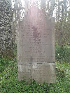
Charles Irving Thornton was an American infant from the state of Virginia. His tombstone, located in Cumberland State Forest in Cumberland County, Virginia, is listed on the Virginia Landmarks Register and the National Register of Historic Places as one of only two gravestones in the world, and the only one in the United States, known to exist with an epitaph by Charles Dickens.
Charles Swindall was a U.S. Representative from Oklahoma.
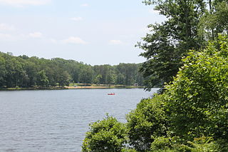
Bear Creek Lake State Park is a 326-acre (132 ha) state park located in Cumberland, Virginia, United States. It is a recreational and camping facility that surrounds an artificial 40-acre (16 ha) lake situated in the 16,000-acre (6,500 ha) Cumberland State Forest.

The Libertarian Party of Pennsylvania is the Pennsylvania affiliate of the Libertarian Party. The state chair is Drew Bingaman of the Susquehanna Valley Libertarian Party.
Niday Place State Forest is a Virginia state forest located on John's Creek Mountain in Craig County. 254 acres (1.03 km2) in size, it is a wildlife sanctuary and is used as an outdoor laboratory; it contains mainly mountain hardwoods. It is managed by Appomattox-Buckingham and Cumberland State Forests. Land for the state forest was donated by Anne H. Cutler of Williamsburg, Virginia.

Stone box graves were a method of burial employed by Native Americans of the Mississippian culture in the American Midwest and Southeast. Their construction was especially common in the Cumberland River Basin around Nashville, Tennessee