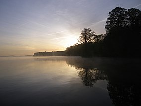
The Great Dismal Swamp National Wildlife Refuge was created in 1974 to help protect and preserve a portion of the Great Dismal Swamp, a marshy region on the Coastal Plain of southeastern Virginia and northeastern North Carolina between Norfolk, Virginia, and Elizabeth City, North Carolina in the United States. It is located in parts of the independent cities of Chesapeake and Suffolk in Virginia, and the counties of Camden, Gates, and Pasquotank in North Carolina.
Ridgefield National Wildlife Refuge is a wildlife refuge, one of the national wildlife refuges operated by the United States Fish and Wildlife Service, located in the westernmost part of Clark County, Washington. The refuge protects more than 5,200 acres (2,100 ha) of marshes, grasslands, and woodlands. The refuge was established in 1965, in response to a need to establish vital winter habitat for wintering waterfowl with an emphasis on the dusky Canada goose whose nesting areas in Alaska were severely impacted by the violent earthquake of 1964. Ridgefield NWR is part of the Ridgefield National Wildlife Refuge Complex, headquartered in Ridgefield, Washington, which oversees the management of four refuges in the southwestern part of the state: Ridgefield, and three refuges in the Columbia River Gorge: Franz Lake, Pierce, and Steigerwald Lake. This place was closed in spring of 2019 to cut down Douglas fir and change the trail. In fall of 2020, the construction of a new multi-purpose building began. The new multi-purpose building will be a construction type V-B and consist of a 4,415 square foot single story building with an associated balcony and basement area. The building is being constructed to provide the fish and wildlife staff office space, meeting space, and an area for public visitors including volunteers and conservation partners.

The Little Pend Oreille National Wildlife Refuge is a wildlife preserve, one of the national wildlife refuges operated by the United States Fish and Wildlife Service. The refuge is located east of Colville, Washington, along the west slope of the Selkirk Mountain Range. It lies mostly in eastern Stevens County, with a small part extending eastward into western Pend Oreille County. It is the only mountainous, mixed-conifer forest refuge outside Alaska and the largest in Washington state.

The Okefenokee National Wildlife Refuge is a 402,000‑acre (1,627 km2) National Wildlife Refuge located in Charlton, Ware, and Clinch Counties of Georgia, and Baker County in Florida, United States. The refuge is administered from offices in Folkston, Georgia. The refuge was established in 1937 to protect a majority of the 438,000 acre (1,772 km2) Okefenokee Swamp. The name "Okefenokee" is a Native American word meaning "trembling earth."

Fisherman Island is the southernmost island on the Delmarva Peninsula chain of barrier islands. Located at the entrance to the Chesapeake Bay, the island is subject to great changes in its landscape from waves and runoff. It first formed about 200 to 250 years ago.

The Ohio River Islands National Wildlife Refuge (ORINWR) is a National Wildlife Refuge (NWR) in non-contiguous sites consisting of islands along 392 miles (631 km) of the Ohio River, primarily in the U.S. state of West Virginia. There are also two islands upstream in Beaver County, Pennsylvania, and a pair downstream in Lewis County, Kentucky. Going downstream, the refuge is currently located in parts of these counties: Beaver, Brooke, Ohio, Marshall, Wetzel, Tyler, Pleasants, Wood, Jackson, Mason, and Lewis. All counties are in West Virginia, with the exceptions in Pennsylvania and Kentucky mentioned above. The ORINWR was established in 1990 and consists of 3,354 acres (13.57 km2) of land and underwater habitat on 22 islands and four mainland properties. The refuge headquarters and visitor center is located in Williamstown, West Virginia.

Presquile National Wildlife Refuge in the U.S. state of Virginia is one of four refuges that comprise the Eastern Virginia Rivers National Wildlife Refuge Complex. The refuge is a 1,329-acre (5.38 km2) island in the James River, located approximately 20 miles (32 km) south of Richmond. It is located in the easternmost part of Chesterfield County, northeast of Hopewell.

The Eastern Shore of Virginia National Wildlife Refuge is a 1,127-acre (4.56 km2) wildlife refuge located in Northampton County, Virginia, at the southern end of the Eastern Shore and near the tip of the Delmarva Peninsula. It is managed by the United States Fish and Wildlife Service.

Elizabeth Hartwell Mason Neck National Wildlife Refuge is a National Wildlife Refuge of the United States located in Virginia. It is part of the Potomac River National Wildlife Refuge Complex. It is on Mason Neck, a peninsula in the Potomac River that forms part of the shoreline of Belmont Bay. The refuge is adjacent to Mason Neck State Park.

The Featherstone National Wildlife Refuge is a National Wildlife Refuge located along the Potomac River in Virginia, at the point where it meets Neabsco Creek. The 325 acres (1.32 km2) of tidal marsh has been administered by the United States Fish and Wildlife Service since 1970; currently, it is part of the Potomac River National Wildlife Refuge Complex. The refuge covers wetlands and woodlands, and has a railroad right-of-way bordering its western edge. It is currently accessible only by boat, but has been considered as a possible portion of the route for the Potomac Heritage National Scenic Trail.
The Eastern Virginia Rivers National Wildlife Refuge Complex is a complex of four National Wildlife Refuges in Virginia whose management is overseen by the United States Fish and Wildlife Service. The four refuges are:

The Nansemond National Wildlife Refuge is a National Wildlife Refuge of the United States located along the Nansemond River in Suffolk, Virginia. It is managed by the United States Fish and Wildlife Service as a satellite of Great Dismal Swamp National Wildlife Refuge. In 1973 about 207 acres (0.84 km2) of salt marsh were transferred to the Service by the United States Navy to form the refuge. An additional 204 acres (0.83 km2) were transferred in 1999.
The Occoquan Bay National Wildlife Refuge is a National Wildlife Refuge located where the Occoquan River meets the Potomac River in Woodbridge, Virginia, United States between Belmont Bay and Occoquan Bay. The 644-acre (2.61 km2) site, about half of which is wetlands, was a popular tourist spot known as Dawson Beach until the 1940s, after which it was used for military research by the U.S. Army's Harry Diamond Laboratories from the 1960s to the 1990s. When the land was purchased from the military, it was temporarily called the Marumsco National Wildlife Refuge. The refuge was formally established and renamed in 1998, and is now managed by the United States Fish and Wildlife Service as part of the Potomac River National Wildlife Refuge Complex.

The Plum Tree Island National Wildlife Refuge is a National Wildlife Refuge in Poquoson, Virginia, located on the southwestern corner of the Chesapeake Bay. The 3,501-acre (14.17 km2) refuge is located at about the midpoint of the Atlantic Flyway, and is one of four refuges that comprise the Eastern Virginia Rivers National Wildlife Refuge Complex.

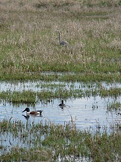
The Rappahannock River Valley National Wildlife Refuge was established in 1996 to protect and enhance fish, wildlife, plants and their habitats for future generations. On the Rappahannock River Valley National Wildlife Refuge, birds raise their young in native habitats of field, forest and marsh. They find rest and nourishment during migration and a haven in winter. U.S. Fish & Wildlife staff manage refuge lands and waters with an emphasis on species whose populations have declined, assisting them on the road to recovery.
The Atchafalaya National Wildlife Refuge is located about 30 miles (48 km) west of Baton Rouge, Louisiana, and one mile (1.6 km) east of Krotz Springs, Louisiana, lies just east of the Atchafalaya River. In 1988 under the administration of Governor Foster the "Atchafalaya Basin Master Plan" was implemented that combined the 11,780-acre (4,770 ha) Sherburne Wildlife Management Area (WMA), the 15,220-acre (6,160 ha) Atchafalaya National Wildlife Refuge, and the 17,000-acre (6,900 ha) U.S. Army Corps of Engineers' Bayou Des Ourses into the Sherburne Complex Wildlife Management Area.

Glenn Martin National Wildlife Refuge includes the northern half of Smith Island, which lies 11 miles (18 km) west of Crisfield, Maryland, and Watts Island, which is located between the eastern shore of Virginia and Tangier Island. Both islands are situated in the lower Chesapeake Bay.
McNary National Wildlife Refuge is a wildlife preserve, one of the national wildlife refuges operated by the United States Fish and Wildlife Service. Extending along the east bank of the Columbia River in southeastern Washington, from the confluence of the Snake River to the mouth of the Walla Walla River, and downstream into Oregon, McNary NWR is located in rural Burbank, but very close to the rapid development of the Tri-Cities. In fact, the refuge meets the definition of an "urban refuge." Few areas in North America support waterfowl populations in the extraordinary numbers found here. Visitors enjoy spectacular concentrations of Canada geese, mallards, and other waterfowl. More than half the mallards in the Pacific Flyway overwinter at some time in this portion of the Columbia River Basin.
The Pierce National Wildlife Refuge is in southwest Washington within the Columbia River Gorge National Scenic Area. It encompasses wetlands and uplands along the north shore of the Columbia River west of the town of North Bonneville. Refuge habitats include wetlands, Columbia River riparian corridor blocks, transitional woodlands from willows to cottonwood/ash to white oak to Douglas fir, improved pastures with some native grasses, and numerous creeks, seeps, and springs.
Salinas River National Wildlife Refuge is located approximately 11 miles north of Monterey, California, and 3 miles south of Castroville, California, at the point where the Salinas River empties into Monterey Bay. The 367-acre (1.49 km2) refuge encompasses several habitat types including sand dunes, pickleweed salt marsh, river lagoon, riverine habitat, and a saline pond. The refuge was established in 1974 because of its "particular value in carrying out the national migratory bird management program."