Tegar, also known as Kyagar, is a high-altitude village in the Leh district of Ladakh, India. It is located in the Nubra tehsil, in the Nubra Valley.
Hundar Dok is a village in the Leh district of Ladakh, India. It is located in the Nubra tehsil.
Chamshan and Charasa is a village in the Leh district of Ladakh, India. It is located in the Nubra tehsil. The road to Chamshen valley is very accessible all throughout the season while Charasa, having closest village to Chamshen because of the river in between still need to take a long way from Koyak Bridge by stretching approximately 40km more.
Partap Pore or Pratap Pur is a village in the Leh district of Ladakh, India. It is located in the Nubra tehsil near Hundar.
Skanpuk is a village in the Leh district of Ladakh, India. It is located in the Nubra tehsil.
Digger is a village in the Leh district of Ladakh, India. It is located in the Nubra tehsil.
Skuru is a village in the Leh district of Ladakh, India. It is located in the Nubra tehsil.
Warisfistan is a village in the Leh district of Ladakh, India. It is located in the Nubra tehsil, on the bank of Siachin third glacier River. The Chogling Gompa is located nearby.
Khemakhungiu is a village in the Leh district of Ladakh, India. It is located in the Nubra tehsil.
Durbuk or Darbuk, is a village and the headquarters of the eponymous subdivision and block in the Leh district of Ladakh, India. It is located in the Durbuk tehsil, and falls between Chang La mountain pass and Tangste village on the way to Pangong Tso Lake.

Hundar is a village in the Leh district of Ladakh, India famous for Sand dunes, Bactrian camels. It is located in the Nubra tehsil, on the banks of the Shyok River. The Hunder Monastery is located here.
Udmaru is a village in the Leh district of Ladakh, India. It is located in the Nubra tehsil, on the banks of Shyok River.
Terchey is a village in the Leh district of Ladakh, India. It is located in the Nubra tehsil.
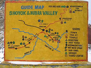
Khalsar is a village in the Leh district of Ladakh, India. It is located in the Nubra tehsil.

Khardong is a village in the Leh district of Ladakh, India. It is located in the Nubra tehsil, 31 km by road north of Khardung La.
Khemi is a village in the Leh district of Ladakh, India. It is located in the Nubra tehsil.
Tangyar is a village in the Leh district of Ladakh, India. It is located in the Nubra tehsil.
Largiab is a village in the Leh district of Ladakh, India. It is located in the Nubra tehsil.
Kubed is a village in the Leh district of Ladakh, India. It is located in the Nubra tehsil.
Panamic or Panamik is a village in the Leh district of Ladakh in India. It is located in the Nubra tehsil. Hot sulphur springs are found in the village. Panamik is a contraction of སྤང་ན་ཆུ་མིག་ 'Spang na Chumik', meaning 'the spring in the meadows'. A hot water-spring flows through the village meadows, hence the name ...


