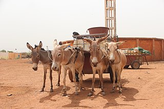
Doumega Douméga | |
|---|---|
Commune and village | |
 | |
| Country | |
| Region | Dosso |
| Department | Dogondoutchi |
| Population (2010) | |
• Total | 35,469 |
| Time zone | UTC+1 (WAT) |
Doumega Douméga | |
|---|---|
Commune and village | |
| | |
| Country | |
| Region | Dosso |
| Department | Dogondoutchi |
| Population (2010) | |
• Total | 35,469 |
| Time zone | UTC+1 (WAT) |

Ehlerange is a small town in the commune of Sanem, in south-western Luxembourg. As of 2024, the town has a population of 983.
Ranérou Ferlo department is one of the departments of Senegal, located in the Matam region of the country.

Ampasy Nahampoa is a rural municipality in Madagascar. It belongs to the district of Taolanaro, which is a part of Anosy Region. The population of the commune was estimated to be approximately 6,000 in 2001 commune census. It is situated at a distance of 7 km from Fort-Dauphin.
Itaetê is a municipality in the state of Bahia in the North-East region of Brazil.
Bana, Niger is a village and rural commune in Niger.
Bengou is a village and rural commune in Niger. The elevation in Bengou is 571 ft (174m). A 2012 census reports the Bengou population at 13,452.
Deoule is a village and rural commune in Niger.
Dioundiou is a village and rural commune in the Dioundiou Department of the Dosso Region of Niger. As of 2012, it had a population of 54,157.
Farey, Niger is a village and rural commune in Niger. As of 2012, it had a population of 40,302.
Golle, Niger is a village and rural commune in Niger. As of 2012, it had a population of 27,860.
Guecheme is a village and rural commune in Niger. As of 2012, it had a population of 108,778.
Kargiubangou is a village and rural commune in Niger.
Sambera is a village and rural commune in Niger. As of 2012, it had a population of 50,820.
Sinder is a rural commune located in the Tillabéri region of Niger and is home to the Wogo people. The primary language spoken is Wogo ciné, which belongs to the Songlai/Zarma family of languages. The primary occupations in Sinder are agriculture and fishing. Staple crops in the region include rice, maize, pepper, onions, and cereals such as manioc, millet, and sorghum, as well as Okoro during the rainy season.
Tajae is a village and rural commune in Niger. As of 2012, it had a population of 78,080.
Tanda, Niger is a village and rural commune in Niger.
Tessa, Niger is a village and rural commune in Niger.
Yelou is a village and rural commune in Niger.
Oudhref is a town and commune in the Gabès Governorate, Tunisia. As of 2004 it had a population of 9,058.
Capunda Cavilongo, called Olivença-a-Nova during the colonial period, is a town and commune of Angola, located in the province of Huíla.
| | This Niger location article is a stub. You can help Wikipedia by expanding it. |