Zermou | |
|---|---|
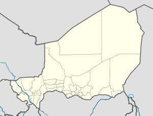 Zermou Location in Niger | |
| Coordinates: 13°42′40″N9°09′20″E / 13.71111°N 9.15556°E | |
| Country | |
| Region | Zinder Region |
| Area | |
| • Total | 92.9 sq mi (240.5 km2) |
| Population (2012 census) | |
| • Total | 32,486 |
| • Density | 350/sq mi (140/km2) |
| Time zone | UTC+1 (WAT) |
Zermou | |
|---|---|
| Zermou Location in Niger | |
| Coordinates: 13°42′40″N9°09′20″E / 13.71111°N 9.15556°E | |
| Country | |
| Region | Zinder Region |
| Area | |
| • Total | 92.9 sq mi (240.5 km2) |
| Population (2012 census) | |
| • Total | 32,486 |
| • Density | 350/sq mi (140/km2) |
| Time zone | UTC+1 (WAT) |
Zermou is located in the Sahel region. The average annual rainfall is around 350 millimeters. [2] Zermou's neighbouring municipalities are Mazamni to the north, Guidimouni to the east, Hamdara to the south-east, Mirriah to the south-west and Gaffati to the west. The settlements in the municipality include 85 villages, 27 hamlets and 4 camps. The main town of the rural municipality is the village of Zermou. [3]
Sultan Ibrahim dan Sélimane of Zinder, who ruled from 1822 to 1841 and from 1843 to 1850, [4] encouraged Tuareg from the Aïr to settle in his sultanate. He made land available to their enslaved farmers, the Ikelan, near the villages of Zermou, Baban Tapki, Dogo, Droum and Gouna. [5] At the end of the 19th century, the markets of Zermou and other villages in the region provided the important Zinder-based trader Malan Yaroh with the handicrafts, furs, animal skins and henna he needed for the trans-Saharan trade. The Zermou market was one of the small markets in the region that were authorised by the French administration at the beginning of the 20th century. [6] The British travel writer A. Henry Savage Landor visited the village in 1906 during his twelve-month crossing of Africa. [7]
The rural municipality of Zermou emerged from the canton of Zermou in 2002 as part of a nationwide administrative reform.
In the 2012 census, the municipality had 32,486 inhabitants. [8] The village of Zermou had 3,212 inhabitants. [9] In ethnic terms, the municipality is a settlement area of Damagarawa and Ikelan. Most inhabitants speak the Hausa language. In addition, Fulbe, who practise nomadism and transhumance, move through the municipality with their herds of cattle.
| Census | Population |
|---|---|
| 2001 | 17,818 |
| 2012 | 32,486 |
The majority of the rural community consists of sandy soils on which millet is grown. The rockier parts of Zermous are used for grazing. The unfavourable soil conditions, combined with low rainfall, have led to recurring famines for generations.

The Departments of Niger are subdivided into communes. As of 2005, in the seven Regions and one Capital Area, there were 36 départements, divided into 265 communes, 122 cantons and 81 groupements. The latter two categories cover all areas not covered by Urban Communes or Rural Communes, and are governed by the Department, whereas Communes have elected councils and mayors. Additional semi-autonomous sub-divisions include Sultanates, Provinces and Tribes (tribus). The Nigerien government estimates there are an additional 17000 Villages administered by Rural Communes, while there are over 100 Quartiers administered by Urban Communes.
Mirriah is a town and urban commune in Niger.
Bande, Niger is a village and rural commune in the Magaria Department of the Zinder Region of Niger.
Dakoussa is a village and rural commune in the Takeita Department of the Zinder Region of Niger. As of 2012, it had a population of 61,779.
Damagaram Takaya is a village and rural Department in Niger. As of 2012, it had a population of 61,580.
Dantchiao is a village and rural commune in the Magaria Department of the Zinder Region of Niger. As of 2012, it had a population of 71,018.
Falenko is a village and rural commune in the Tanout Department of the Zinder Region of Niger. As of 2012, it had a population of 13,993.
Gaffati is a village and rural commune in the Mirriah Department of the Zinder Region of Niger. As of 2012, it had a population of 46,379.
Garagoumsa is a village and rural commune in the Takeita Department of the Zinder Region of Niger. As of 2012, it had a population of 69,028.
Gouchi is a village and rural commune in the Dungass Department of the Zinder Region of Niger. As of 2012, it had a population of 71,612.
Guidiguir is a village and rural commune in the Goure Department of the Zinder Region of Niger. As of 2012, it had a population of 62,731.
Hamdara is a village and rural commune in the Guidimouni Department of the Zinder Region of Niger. As of 2012, it had a population of 39,574.
Kelle, Niger is a village and rural commune in the Goure Department of the Zinder Region of Niger. As of 2012, it had a population of 74,425.
Kolleram is a village and rural commune in the Mirriah Department of the Zinder Region of Niger. As of 2012, it had a population of 29,583.
Kwaya, Niger is a village and rural commune in the Magaria Department of the Zinder Region of Niger. As of 2012, it had a population of 32,510.
Malawa, Niger is a village and rural commune in the Dungass Department of the Zinder Region of Niger. As of 2012, it had a population of 88,954.
Ollelewa is a village and rural commune in the Tanout Department of the Zinder Region of Niger. As of 2012, it had a population of 116,895.
Sassoumbroum is a village and rural commune in the Magaria Department of the Zinder Region of Niger. As of 2012, it had a population of 78,163.
Tenhya is a village and rural commune in Niger. As of 2012, it had a total population of 31,057 people. Tenhya is located in the northern Sahel. The neighboring municipalities are Aderbissinat in the northwest, the northeast Tabelot, Tesker to the east and south and Tarka in the west. The rural community of Tenhya was founded in 2002 as an administrative unit. The main ethnic groups are the Fulani subgroup Wodaabe and the Tuareg subgroups Ichiriffen, Imdan, Inesseliman, Kel Ates, Kel Iferwane and Ifoghas, mainly engaged in pastoral farming.
Zinder I is an urban commune in Niger. It is a commune of the city of Zinder.