
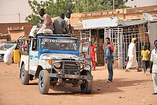
Niamey is the capital and largest city of Niger. Niamey lies on the Niger River, primarily situated on the east bank. Niamey's population was counted as 1,026,848 as of the 2012 census. As of 2017, population projections show the capital district growing at a slower rate than the country as a whole, which has the world's highest fertility rate. The city is located in a pearl millet growing region, while manufacturing industries include bricks, ceramic goods, cement, and weaving.

The regions of Niger are subdivided into 63 departments. Before the devolution program on 1999–2005, these departments were styled arrondissements. Confusingly, the next level up (regions) had, before 2002-2005 been styled departments. Prior to a revision in 2011, there had been 36 departments. Until 2010, arrondissements remained a proposed subdivision of departments, though none were used. The decentralisation process, begun in the 1995-1999 period replaced appointed Prefects at Departmental or Arrondissement level with elected councils, first elected in 1999. These were the first local elections held in the history of Niger. Officials elected at commune level are then selected as representatives at Departmental, regional, and National level councils and administration. The Ministry of Decentralisation was created to oversee this task, and to create a national consultative council of local officials.

Dosso is a city in the south-west corner of Niger. It lies 130–140 kilometres (81–87 mi) south-east of the capital Niamey at the junction of the main routes to Zinder and Benin. The eighth-most populous town in Niger and the largest in Dosso Region, it had an official population during the 2001 census of 43,561. The population grew to 58,671 in the 2012 census. It is the capital of its region - which covers five departments in the southwestern corner of the nation - as well as of its own department, Dosso Department. The city itself lies at the centre of its own Urban Commune.
Tillabéri is one of the seven Regions of Niger; the capital of the Region is Tillabéri. Tillabéri Region was created in 1992, when Niamey Region was split, with Niamey and its immediate hinterland becoming a new capital district enclaved within Tillabéri Region.
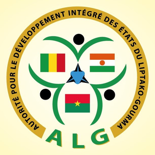
The Liptako–Gourma Authority is a regional organization seeking to develop the contiguous areas of Mali, Niger, and Burkina Faso.

Téra is a city in the Tillabéri Region, Tera Department of Niger. It is situated 175 km north-west of the capital Niamey, close to the border with Burkina Faso. It is mainly inhabited by Songhai, Fulani, Gourmantche and Buzu ethnic groups. The majority of the population are farmers.
The Departments of Niger are subdivided into communes. As of 2005, in the seven Regions and one Capital Area, there were 36 départements, divided into 265 communes, 122 cantons and 81 groupements. The latter two categories cover all areas not covered by Urban Communes or Rural Communes, and are governed by the Department, whereas Communes have elected councils and mayors. Additional semi-autonomous sub-divisions include Sultanates, Provinces and Tribes (tribus). The Nigerien government estimates there are an additional 17000 Villages administered by Rural Communes, while there are over 100 Quartiers administered by Urban Communes.
Say (Saayi) is a town in southwest Niger, situated on the Niger River. It is the capital of the Say Department in the Tillabéri Region. Say was a small Songhai town prior to the arrival of the Fulani marabout Alfa Mohamed Diobo in the nineteenth century who converted the town to a center for Islamic learning and established the Emirate of Say. The municipality has 58,290 inhabitants, and its economy is dominated by agriculture, herding and small trade. Today, the inhabitants of Say are mostly Peulh, Songhai and Zarma.

The Zarma people are an ethnic group predominantly found in westernmost Niger. They are also found in significant numbers in the adjacent areas of Nigeria and Benin, along with smaller numbers in Burkina Faso, Ivory Coast, Ghana, Togo, and Sudan. In Niger, the Zarma are often considered by outsiders to be of the same ethnicity as the neighboring Songhaiborai, although the two groups claim differences, having different histories and speaking different dialects. They are sometimes lumped together as the Zarma-Songhay or Songhay-Zarma.

Say is a department of the Tillabéri Region in Niger. Its capital city is Say, and includes the towns of Guéladjo, Tamou, and Torodi. It abuts the urban Region of Niamey, and lies across the Niger River to the southwest of the capital. It extends to the Burkina Faso border over 60 km to the west, and the northernmost border with Benin in the south. The Say area is today divided between the riverine valley in the east of the Department, and the more sparsely populated areas to the west, which are intercut with a series of eastward flowing tributaries. The Niger river, a broad shallow channel at Niamey and at Say, passes through a series of gorges and cataracts, called the "W" bend for the shape the river takes, in the south of the Say Department. To the west of these rapids lies what is now the W Regional Park, a sparsely populated area historically plagued by insect borne diseases of both humans and cattle. Now a park and tourist attraction, its history as a "no mans land" has made it a refuge for remaining wild animals, as well as several undisturbed archeological sites. From at least the 16th century CE, the Songhai proper moved south into this area from the north around what is now Tera. The inhabitants at the time were related to the Gourma people, who form most of the population of the northwestern part of the Department today. In the 18th and 19th century, the town of Say was founded by Fulani migrants from the Gao region of modern Mali, with others expanding from what is now northeast Burkina Faso. Between 1810 and the arrival of European writer Heinrich Barth in 1854, Fulani Muslims led by Alfa Mohamed Diobo of Djenné had established the Emirate of Say. The reputation for piety and learning of Mohamed Diobo and his followers helped turn Say from a small river village into a town of 30,000, famed across West Africa as a center of learning.
Téra is a department of the Tillabéri Region in Niger. Its capital is the city of Téra. As of 2011, the department had a total population of 579,658 people.
The Kurtey people are a small ethnic group found along the Niger River valley in parts of the West African nations of Niger, Benin, Mali, and Nigeria. They are also found in considerable numbers in Ghana, Togo, Ivory Coast, and Burkina Faso.
Liptako is an historic region of West Africa. It today falls in eastern Burkina Faso, southwestern Niger and a small portion of southeast central Mali. A hilly region beginning on the right back of the Niger river, Liptako is usually associated with the Liptako Emirate, an early 19th-century Fulani Islamic state, founded by Brahima Saidu. A modern remnant of the emirate continues to exist as a non-sovereign monarchy. The current emir, Ousmane Amirou Dicko, lives in Dori.
Bankilaré is a village and rural commune in Niger. Bankilaré commune, centered on the town of the same name, is in Téra Department, Tillabéri Region, in the northwestern corner of the country. The town lies 60 km north of Departmental capital Téra, and around the same distance from the Burkina Faso border and the Mali border. As of 2012, it had a population of 84,893.
Garhanga is a village and rural commune in Niger. It is located in the Keita Department of the Tahoua region. As of 2012, it has a population of 69,712.

Hamdallaye is a village and rural commune in Niger. In 2012, it had a registered population of 57,002 inhabitants. It is located in the southwest of the country, near the Niger River, the border with Mali and Burkina Faso and the national capital, Niamey. It is the location of a U.S. Peace Corps training site, a weekly market and a mosque.

Harikanassou is a large village and rural commune in the Boboye Department of the Dosso Region of southwest Niger, 90.7 kilometres (56.4 mi) by road southeast of the capital of Niamey. At the time of the 2012 census, the rural community had 23,567 residents living in 3,340 households. Onion cultivation is a chief source of income for many, along with the cultivation of lettuce, beans, squashes, and tomatoes.
Tamaske is a city and rural commune in Niger. It is located in the Keita Department, in the Tahoua Region.
Tamou is a village and "Rural commune" in Niger. The town is capital of its Rural Commune in the Say Department of Tillabéri Region, in the far southwest of the nation. It is southwest of Niamey, on the right (western) bank of the Niger River, between the departmental capital Say and the border of Burkina Faso. Tamou Commune is home to the Tamou Total Reserve, a wildlife reserve which is part of the larger W National Park and Transborder Reserve. The Tamou Reserve, in which local people also live, is primarily dedicated to the protection of African Elephant populations which migrate through the region.
Tenhya is a village and rural commune in Niger. As of 2012, it had a total population of 31,057 people. Tenhya is located in the northern Sahel. The neighboring municipalities are Aderbissinat in the northwest, the northeast Tabelot, Tesker to the east and south and Tarka in the west. The rural community of Tenhya was founded in 2002 as an administrative unit. The main ethnic groups are the Fulani subgroup Wodaabe and the Tuareg subgroups Ichiriffen, Imdan, Inesseliman, Kel Ates, Kel Iferwane and Ifoghas, mainly engaged in pastoral farming.

