Energy, Illinois

Last updated
Energy
Energy-village-sign-il.jpg
Village of Energy sign along Pershing Street (IL 148)
Williamson County Illinois Incorporated and Unincorporated areas Energy Highlighted.svg
Location of Energy in Williamson County, Illinois.
Illinois in United States (US48).svg
Location of Illinois in the United States
Coordinates: 37°46′21″N89°1′32″W / 37.77250°N 89.02556°W / 37.77250; -89.02556
CountryUnited States
StateIllinois
County Williamson
Area
[1]
  Total1.21 sq mi (3.14 km2)
  Land1.19 sq mi (3.09 km2)
  Water0.02 sq mi (0.05 km2)
Elevation
[2]
459 ft (140 m)
Population
 (2020)
  Total974
  Density815.75/sq mi (315.01/km2)
Time zone UTC-6 (CST)
  Summer (DST) UTC-5 (CDT)
ZIP Code
62933
Area code 618
FIPS code 17-24166
GNIS feature ID2398834 [2]
FIPS code 17-24166
GNIS ID 2398834
Wikimedia CommonsEnergy, Illinois
Website www.villageofenergy.com

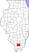
Energy is a village in Williamson County, Illinois, United States. The population was 974 at the 2020 census. The community was named for local "Energy" brand coal. [3]

Contents

History

What is now Energy was originally known as "Fordville," which was established in the early 1900s as a stop along the Coal Belt Railway. It was named for Wiley Ford and his son, William, who platted the village. A post office opened in 1905, and the village incorporated the following year. [4]

In 1909, Herbert Taylor (18761937) purchased the coal mining operations in the area. He marketed his company's coal under the name "Energy," and in 1913 he convinced the Fordville village council to adopt this name for the village. The post office changed its name the same year. [5]

Geography

Energy is located at 37°46′21″N89°1′32″W / 37.77250°N 89.02556°W / 37.77250; -89.02556 (37.772398, -89.025519). [6]

According to the 2010 census, Energy has a total area of 1.198 square miles (3.10 km2), of which 1.18 square miles (3.06 km2) (or 98.5%) is land and 0.018 square miles (0.05 km2) (or 1.5%) is water. [7]

Demographics

Historical population
CensusPop.Note
1910 885
1920 792−10.5%
1930 554−30.1%
1940 458−17.3%
1950 5039.8%
1960 5070.8%
1970 81260.2%
1980 1,13840.1%
1990 1,106−2.8%
2000 1,1756.2%
2010 1,146−2.5%
2020 974−15.0%
U.S. Census [8] [ failed verification ];[ citation needed ] for 2020

As of the 2000 United States Census, [9] there were 1,175 people, 481 households, and 304 families residing in the village.[ failed verification ] The population density was 990.9 inhabitants per square mile (382.6/km2). There were 519 housing units at an average density of 437.7 per square mile (169.0/km2). The racial makeup of the village was 97.62% White, 0.94% African American, 0.09% Native American, 0.43% Asian, and 0.94% from two or more races. Hispanic or Latino of any race were 0.60% of the population.

There were 481 households, out of which 24.1% had children under the age of 18 living with them, 50.9% were married couples living together, 10.0% had a female householder with no husband present, and 36.6% were non-families. 30.4% of all households were made up of individuals, and 12.5% had someone living alone who was 65 years of age or older. The average household size was 2.19 and the average family size was 2.71.

In the village, the population was spread out, with 17.5% under the age of 18, 9.4% from 18 to 24, 24.5% from 25 to 44, 28.3% from 45 to 64, and 20.3% who were 65 years of age or older. The median age was 44 years. For every 100 females, there were 84.7 males. For every 100 females age 18 and over, there were 80.8 males.

The median income for a household in the village was $28,750, and the median income for a family was $39,554. Males had a median income of $27,446 versus $21,250 for females. The per capita income for the village was $14,656. About 7.5% of families and 12.1% of the population were below the poverty line, including 12.5% of those under age 18 and 4.9% of those age 65 or over.

Related Research Articles

<span class="mw-page-title-main">Franklin County, Illinois</span> County in Illinois, United States

Franklin County is a county in Southern Illinois. At the 2020 census, it had a population of 37,804. The largest city is West Frankfort and the county seat is Benton. This area of Southern Illinois is known locally as "Little Egypt".

<span class="mw-page-title-main">Dalzell, Illinois</span> Village in Illinois, United States

Dalzell is a village in Bureau and LaSalle counties in the U.S. state of Illinois. The population was 663 at the 2020 census, down from 717 at the 2010 census. It is part of the Ottawa Micropolitan Statistical Area. Dalzell was founded on November 24, 1903 and certified on February 11, 1904.

<span class="mw-page-title-main">Buckner, Illinois</span> Village in Illinois, United States

Buckner is a village in Franklin County, Illinois, United States. The population was 409 at the 2020 census. The current mayor is Aaron Eubanks.

<span class="mw-page-title-main">Freeman Spur, Illinois</span> Village in Illinois, United States

Freeman Spur is a village in Williamson and Franklin Counties, Illinois, United States. The population was 287 at the 2010 census.

<span class="mw-page-title-main">North City, Illinois</span> Village in Illinois, United States

North City is a village in Franklin County, Illinois, United States. As of the 2020 census, the population was 509. North City is also known as "Coello". The current mayor is Curtis Overton.

<span class="mw-page-title-main">Valier, Illinois</span> Village in Illinois, United States

Valier is a village in Franklin County, Illinois, United States. The population was 669 at the 2010 census.

<span class="mw-page-title-main">Williamson, Illinois</span> Village in Illinois, United States

Williamson is a village in Madison County, Illinois, United States. The population was 183 at the 2020 census, down from 230 in 2010.

<span class="mw-page-title-main">Muddy, Illinois</span> Village in Illinois, United States

Muddy is a small incorporated village located in the Harrisburg Township in Saline County, Illinois, United States. The population was 78 at the 2000 census.

<span class="mw-page-title-main">Caseyville, Illinois</span> Village in Illinois, United States

Caseyville is a village in St. Clair County, Illinois, United States. The population was 4,245 at the 2010 census, a decline from 4,310 in 2000.

<span class="mw-page-title-main">Freeburg, Illinois</span> Village in Illinois, United States

Freeburg is a village in St. Clair County, Illinois, United States. Located within Greater St. Louis, it is a southeastern exurb with many residents commuting to Downtown St. Louis or the Belleville area for employment. As of 2010, Freeburg had a population of 4,354.

<span class="mw-page-title-main">Bush, Illinois</span> Village in Illinois, United States

Bush is a village in Williamson County, Illinois, United States. As of the 2000 census, the village population was 257.

<span class="mw-page-title-main">Cambria, Illinois</span> Village in Illinois, United States

Cambria is a village in northwestern Williamson County, Illinois, United States. The population was 1,228 at the 2010 census.

<span class="mw-page-title-main">Colp, Illinois</span> Village in Illinois, United States

Colp is a village in Williamson County, Illinois, United States. The population was 225 at the 2010 census.

<span class="mw-page-title-main">Crainville, Illinois</span> Village in Illinois, United States

Crainville is a village in Williamson County, Illinois, United States. The population was 1,254 at the 2010 census.

<span class="mw-page-title-main">Herrin, Illinois</span> Place in Illinois, United States

Herrin is a city in Williamson County, Illinois. The population was 12,352 at the 2020 census. The city is part of the Marion-Herrin Micropolitan Area and is a part of the Carbondale-Marion-Herrin, Illinois Combined Statistical Area with 123,272 residents, the sixth most populous Combined statistical area in Illinois.

<span class="mw-page-title-main">Hurst, Illinois</span> City in Illinois, United States

Hurst is a city in Williamson County, Illinois, United States. The population was 795 at the 2010 census.

<span class="mw-page-title-main">Johnston City, Illinois</span> City in Illinois, United States

Johnston City is a city in Williamson County, Illinois, United States. The population was 3,348 at the 2020 census. This was a center of coal mining in the early 20th century, having a peak of population in the 1920s. The mining jobs attracted many immigrants from Europe.

<span class="mw-page-title-main">Pittsburg, Illinois</span> Village in Illinois, United States

Pittsburg is a village in Williamson County, Illinois. The population was 572 at the 2010 census.

<span class="mw-page-title-main">Spillertown, Illinois</span> Village in Illinois, United States

Spillertown is a village in Williamson County, Illinois, United States. The population was 203 at the 2010 census and as of 2018, the population has grown to an estimated 272.

Whiteash is a Census designated place in Williamson County, Illinois, United States. The population was 268 at the 2000 census, and dropped to 248 in the 2010 census. This village dissolved in 2014.

References

  1. "2020 U.S. Gazetteer Files". United States Census Bureau. Retrieved March 15, 2022.
  2. 1 2 U.S. Geological Survey Geographic Names Information System: Energy, Illinois
  3. Moyer, Armond; Moyer, Winifred (1958). The origins of unusual place-names. Keystone Pub. Associates. p. 45.
  4. Barbara Barr Hubbs, "Fordville History," Williamson County Illinois Historical Society website. Accessed 13 June 2021.
  5. Barbara Barr Hubbs, "Energy History," Williamson County Illinois Historical Society website. Accessed 13 June 2021.
  6. "US Gazetteer files: 2010, 2000, and 1990". United States Census Bureau. 2011-02-12. Retrieved 2011-04-23.
  7. "G001 - Geographic Identifiers - 2010 Census Summary File 1". United States Census Bureau. Archived from the original on 2020-02-13. Retrieved 2015-08-03.
  8. Census of Population and Housing, U.S. Census Bureau
  9. "U.S. Census website". United States Census Bureau . Retrieved 2008-01-31.