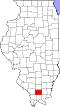
Cambria, Illinois

Last updated
Cambria
Cambria-Maple-St-il.jpg
Maple Street
Williamson County Illinois Incorporated and Unincorporated areas Cambria Highlighted.svg
Location of Cambria in Williamson County, Illinois.
Illinois in United States (US48).svg
Location of Illinois in the United States
Coordinates: 37°46′59″N89°7′7″W / 37.78306°N 89.11861°W / 37.78306; -89.11861 Coordinates: 37°46′59″N89°7′7″W / 37.78306°N 89.11861°W / 37.78306; -89.11861
CountryUnited States
StateIllinois
County Williamson
Area
[1]
  Total1.46 sq mi (3.78 km2)
  Land1.42 sq mi (3.66 km2)
  Water0.04 sq mi (0.11 km2)
Elevation
[2]
427 ft (130 m)
Population
 (2020)
  Total1,505
  Density1,063.60/sq mi (410.67/km2)
Time zone UTC-6 (CST)
  Summer (DST) UTC-5 (CDT)
ZIP Code
62915
Area code 618
FIPS code 17-10630
GNIS feature ID2397537 [2]
Wikimedia CommonsCambria, Illinois

Cambria is a village in northwestern Williamson County, Illinois, United States. The population was 1,228 at the 2010 census.

Contents

History

Cambria was established in the early 1900s by brothers Tom and Evan John, owners of the Carterville and Big Muddy Coal Company, which had opened a mine in the area around 1904. The community was originally known as Lauder, but was changed to Cambria, the old Latin name for Wales, from which the John brothers hailed. A post office known as Reeves opened in 1905, but its name was changed to Cambria in 1911. [3]

Geography

Cambria is located at 37°46′59″N89°7′7″W / 37.78306°N 89.11861°W / 37.78306; -89.11861 (37.783054, -89.118533). [4]

According to the 2010 census, Cambria has a total area of 1.403 square miles (3.63 km2), of which 1.36 square miles (3.52 km2) (or 96.94%) is land and 0.043 square miles (0.11 km2) (or 3.06%) is water. [5]

Demographics

Historical population
CensusPop.
1910 658
1920 77918.4%
1930 8154.6%
1940 687−15.7%
1950 625−9.0%
1960 568−9.1%
1970 79840.5%
1980 1,09036.6%
1990 1,23012.8%
2000 1,3308.1%
2010 1,228−7.7%
2020 1,50522.6%
U.S. Census [6]

As of the census [7] of 2000, there were 1,330 people, 564 households, and 367 families residing in the village. The population density was 974.3 inhabitants per square mile (376.2/km2). There were 649 housing units at an average density of 475.4 per square mile (183.6/km2). The racial makeup of the village was 95.04% White, 2.26% African American, 0.45% Native American, 0.08% Asian, 0.75% from other races, and 1.43% from two or more races. Hispanic or Latino of any race were 1.73% of the population.

There were 564 households, out of which 35.3% had children under the age of 18 living with them, 47.9% were married couples living together, 14.5% had a female householder with no husband present, and 34.8% were non-families. 28.4% of all households were made up of individuals, and 10.5% had someone living alone who was 65 years of age or older. The average household size was 2.36 and the average family size was 2.91.

In the village, the population was spread out, with 26.3% under the age of 18, 13.4% from 18 to 24, 32.0% from 25 to 44, 17.7% from 45 to 64, and 10.7% who were 65 years of age or older. The median age was 30 years. For every 100 females, there were 91.9 males. For every 100 females age 18 and over, there were 86.0 males.

The median income for a household in the village was $25,870, and the median income for a family was $34,688. Males had a median income of $27,262 versus $20,750 for females. The per capita income for the village was $12,913. About 18.7% of families and 23.2% of the population were below the poverty line, including 25.4% of those under age 18 and 25.0% of those age 65 or over.

73.7% of the total village population has their high school diploma or equivalent. This is below the national average of 80.4%. The percentage of the total population that holds a bachelor's degree or above is also below the national average of 24.4%. Only 12.9% of citizens hold college level degrees.

Government

Village board meetings are held every first and third Tuesday of the month at the Cambria Village Hall located in the old Cambria Grade School.

Education

Cambria is located in the Carterville School District Unit 5. The Cambria Grade School closed in 2001 when the Tri-C communities of Carterville, Cambria, and Crainville consolidated all Kindergarten through middle school grade levels.

Cambria is located near John A. Logan College located in Carterville and Southern Illinois University in Carbondale.

Religion

Cambria is home to three churches.

Notable person

Related Research Articles

<span class="mw-page-title-main">Panama, Illinois</span> Village in Illinois, United States

Panama is a village in Montgomery and Bond counties, Illinois, United States. The population was 337 at the 2020 census.

<span class="mw-page-title-main">Aviston, Illinois</span> Village in Illinois, United States

Aviston is a village in Clinton County, Illinois, United States. The population was 2,340 at the 2020 census, up from 1,945 at the 2010 census.

<span class="mw-page-title-main">Damiansville, Illinois</span> Village in Illinois, United States

Damiansville is a village in Clinton County, Illinois, United States. The population was 564 at the 2020 census, up from 491 at the 2010 census.

<span class="mw-page-title-main">Buckner, Illinois</span> Village in Illinois, United States

Buckner is a village in Franklin County, Illinois, United States. The population was 409 at the 2020 census. The current mayor is Aaron Eubanks.

<span class="mw-page-title-main">North City, Illinois</span> Village in Illinois, United States

North City is a village in Franklin County, Illinois, United States. As of the 2020 census, the population was 509. North City is also known as "Coello". The current mayor is Curtis Overton.

<span class="mw-page-title-main">Campbell Hill, Illinois</span> Village in Illinois, United States

Campbell Hill is a village in Jackson County, Illinois, United States. The population was 309 at the 2020 census.

<span class="mw-page-title-main">Gorham, Illinois</span> Village in Illinois, United States

Gorham is a village in Jackson County, Illinois, United States. The population was 236 at the 2010 census. It is known locally for its near-annihilation during the deadly Tri-State Tornado of 1925.

<span class="mw-page-title-main">Hamel, Illinois</span> Village in Illinois, United States

Hamel is a village in Madison County, Illinois, United States. The population was 929 at the 2020 census. It is a part of the Illinois Metro East portion of the Greater St. Louis metropolitan area.

<span class="mw-page-title-main">Taylor Springs, Illinois</span> Village in Illinois, United States

Taylor Springs is a village in Montgomery County, Illinois, United States. The population was 690 at the 2010 census.

<span class="mw-page-title-main">Walshville, Illinois</span> Village in Illinois, United States

Walshville is a small village in Montgomery County, Illinois, United States. The population was 89 at the 2000 census.

<span class="mw-page-title-main">Rockwood, Illinois</span> Village in Illinois, United States

Rockwood is a village in Randolph County, Illinois, United States. The population was 42 at the 2010 census. It is the headquarters of the Middle Mississippi River National Wildlife Refuge.

<span class="mw-page-title-main">Buffalo, Illinois</span> Village in Illinois, United States

Buffalo is a village in Mechanicsburg Township in Sangamon County, Illinois, United States. The population was 503 at the 2010 census. It is part of the Springfield, Illinois Metropolitan Statistical Area.

<span class="mw-page-title-main">German Valley, Illinois</span> Village in Illinois, United States

German Valley is a village in Stephenson County, Illinois, United States. German Valley is located four miles south of U.S. Route 20 between Freeport and Rockford. German Valley had a population of 463 at the 2010 census, down from 481 in 2000.

<span class="mw-page-title-main">North Pekin, Illinois</span> Village in Illinois, United States

North Pekin is a village in Tazewell County, Illinois, United States. The population was 1,573 at the 2010 census. North Pekin is a suburb of Peoria and is part of the Peoria, Illinois Metropolitan Statistical Area.

<span class="mw-page-title-main">Alto Pass, Illinois</span> Village in Illinois, United States

Alto Pass is a village in Union County, Illinois, United States. The population was 391 at the 2010 census, an increase from 388 in 2000. The Bald Knob Cross and Bald Knob Wilderness are nearby. Alto Pass lies roughly 5.1 miles to the northwest of downtown Cobden, Illinois.

<span class="mw-page-title-main">Bush, Illinois</span> Village in Illinois, United States

Bush is a village in Williamson County, Illinois, United States. As of the 2000 census, the village population was 257.

<span class="mw-page-title-main">Carterville, Illinois</span> City in Illinois, United States

Carterville is a city in Williamson County, Illinois, United States. At the 2020 census, the city's population was 5,848. The city is part of the Carbondale-Marion combined statistical area and has grown considerably as a residential community of Carbondale and Marion.

<span class="mw-page-title-main">Crainville, Illinois</span> Village in Illinois, United States

Crainville is a village in Williamson County, Illinois, United States. The population was 1,254 at the 2010 census.

<span class="mw-page-title-main">Carterville, Missouri</span> City in Missouri, United States

Carterville is a city in Jasper County, Missouri, United States. The population was 1,855 at the 2020 census. It is part of the Joplin, Missouri Metropolitan Statistical Area.

<span class="mw-page-title-main">Elderon, Wisconsin</span> Village in Wisconsin, United States

Elderon is a village in Marathon County, Wisconsin, United States. It is part of the Wausau, Wisconsin Metropolitan Statistical Area. The population was 179 at the 2010 census.

References

  1. "2020 U.S. Gazetteer Files". United States Census Bureau. Retrieved March 15, 2022.
  2. 1 2 U.S. Geological Survey Geographic Names Information System: Cambria, Illinois
  3. Barbara Barr Hubbs, "Cambria History," Williamson County Illinois Historical Society website. Accessed 13 June 2021.
  4. "US Gazetteer files: 2010, 2000, and 1990". United States Census Bureau. 2011-02-12. Retrieved 2011-04-23.
  5. "G001 - Geographic Identifiers - 2010 Census Summary File 1". United States Census Bureau. Archived from the original on 2020-02-13. Retrieved 2015-08-02.
  6. Census of Population and Housing, U.S. Census Bureau
  7. "U.S. Census website". United States Census Bureau . Retrieved 2008-01-31.