Spillertown is a village in Williamson County, Illinois, United States. The population was 203 at the 2010 census.

Whiteash was a village in Williamson County, Illinois, United States. The population was 268 at the 2000 census, and dropped to 248 in the 2010 census. This village dissolved in 2014.

DeWitt Township is one of thirteen townships in DeWitt County, Illinois, USA. As of the 2010 census, its population was 479 and it contained 215 housing units. It was renamed from its original name of Marion Township on June 7, 1859.

Field Township is one of sixteen townships in Jefferson County, Illinois, USA. As of the 2010 census, its population was 1,468 and it contained 637 housing units.

Rome Township is one of sixteen townships in Jefferson County, Illinois, USA. As of the 2010 census, its population was 1,669 and it contained 771 housing units.
Chamness is a former unincorporated community in Williamson County, Illinois that disappeared with the establishment of the Ordill in the late 1930s and takeover by the Department of War in 1941 following the Japanese attack on Pearl Harbor. The site of the community is now located within the Crab Orchard National Wildlife Refuge southwest of Marion.
Blairsville Precinct, formerly township, is Congressional Township 8 South, Range 1 East of the Third Principal Meridian located in Williamson County, Illinois. It is named for the village of Blairsville, Illinois.
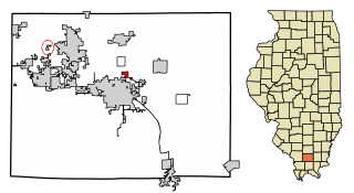
Carterville Precinct, formerly township, is Congressional Township 9 South, Range 1 East of the Third Principal Meridian located in Williamson County, Illinois. It is named for the community of Carterville, Illinois.
East Marion Precinct, formerly township, is Congressional Township 9 South, Range 3 East of the Third Principal Meridian located in Williamson County, Illinois. It is named for the community of Marion, Illinois.
Crab Orchard Precinct, formerly township, is Congressional Township 9 South, Range 4 East of the Third Principal Meridian located in Williamson County, Illinois. It is named for the community of Crab Orchard, Illinois.
Creal Springs Precinct, formerly township, is Congressional Township 10 South, Range 3 East of the Third Principal Meridian located in Williamson County, Illinois. It is named for the community of Creal Springs, Illinois.
Corinth Precinct, formerly township, is Congressional Township 8 South, Range 4 East of the Third Principal Meridian located in Williamson County, Illinois. It is named for the historical community of Corinth, Illinois. It was first known as Northern Precinct.
Southern Precinct, formerly township, is Congressional Township 10 South, Range 2 East of the Third Principal Meridian located in Williamson County, Illinois. Its name is generic as there have never been any large communities or trade centers within it, though it is home to Pulley's Mill. The most well-known institution that lies within the precinct is the United States Penitentiary, Marion, which lies in the north-central part of the precinct. The Lake of Egypt Dam is also located in the Precinct, as is the northwestern part of the lake itself. The 2010 census reported a population of 3,273 inhabitants in Southern Precinct. The nearest city is Marion, Illinois, not far to its north-northeast.
Stonefort Precinct, formerly township, is Congressional Township 10 South, Range 4 East of the Third Principal Meridian located in Williamson County, Illinois. It is named for the community of Stonefort, Illinois.
Grassy Precinct, formerly township, is Congressional Township 10 South, Range 1 East of the Third Principal Meridian located in Williamson County, Illinois. It is named for Grassy Creek, which has since been used to create Little Grassy Lake.
Herrin Precinct, formerly township, is Congressional Township 8 South, Range 2 East of the Third Principal Meridian located in Williamson County, Illinois. It is named for the community of Herrin, Illinois.
Lake Creek Precinct, formerly township, is Congressional Township 8 South, Range 3 East of the Third Principal Meridian located in Williamson County, Illinois. It is named for Lake Creek. The largest community within the precinct is Johnston City, Illinois.
Halfway, Illinois was an unincorporated community in northeastern Williamson County, Illinois located about halfway between the county seat of Marion and Corinth. A post office operated from 1895 to 1911 in a country store.

The Williamson County Courthouse is a government building in Marion, the county seat of Williamson County, Illinois, United States. Built in 1971, it is the fourth courthouse in Marion's history.


