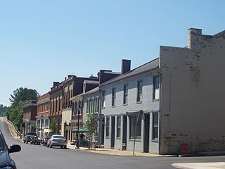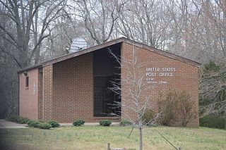
Goochland County is a county located in the Piedmont of the Commonwealth of Virginia. Its southern border is formed by the James River. As of the 2020 census, the population was 24,727. Its county seat is Goochland.

Charlottesville, colloquially known as C'ville, is an independent city in Virginia, United States. It is the seat of government of Albemarle County, which surrounds the city, though the two are separate legal entities. It is named after Queen Charlotte. At the 2020 census, the population of the city was 46,553. The Bureau of Economic Analysis combines the City of Charlottesville with Albemarle County for statistical purposes, bringing its population to approximately 160,000. Charlottesville is the heart of the Charlottesville metropolitan area, which includes Albemarle, Buckingham, Fluvanna, Greene, and Nelson counties.

Albemarle is a city in and the county seat of Stanly County, North Carolina, United States. The population was 16,432 in the 2020 census.

Crozet is a census-designated place (CDP) in Albemarle County in the Commonwealth of Virginia, United States. It sits along the I-64 corridor, about 12 miles (19 km) west of Charlottesville and 21 miles (34 km) east of Staunton. Crozet is part of the Charlottesville Metropolitan Statistical Area. The population of Crozet was 5,565 at the 2010 census.

Madison Heights is a census-designated place (CDP) in Amherst County, Virginia, United States. The population was 10,893 at the 2020 census. It is part of the Lynchburg Metropolitan Statistical Area.

Scottsville is a town in Albemarle and Fluvanna counties in the U.S. state of Virginia. The population was 566 at the 2010 census. It is part of the Charlottesville Metropolitan Statistical Area.

Keene is an unincorporated community in Albemarle County, Virginia, United States. As of the 1990 census, the town had a total population of 10.

Guilford is an unincorporated community located in Howard County in the state of Maryland. The location is named after the Guilford Mill. Guilford is near Kings Contrivance, one of the nine "villages" of Columbia.

Buckingham is a census-designated place in and the county seat of Buckingham County, Virginia, United States. The population as of the 2010 Census was 133.

Aldie is an unincorporated community and census-designated place (CDP) located between Chantilly and Middleburg in Loudoun County, Virginia, United States. The historic village of Aldie is located on the John Mosby Highway in a gap between the Catoctin Mountains and Bull Run Mountains, through which the Little River flows. Aldie traditionally serves as the gateway to the Loudoun Valley and beyond.

Coinjock is an unincorporated community and census-designated place (CDP) in Currituck County, North Carolina, United States. As of the 2010 census it had a population of 335. It is located on U.S. Route 158 between Barco and Grandy, about 20 miles (32 km) south of the Virginia state line, and is at mile marker 50 on the southern portion of the Albemarle and Chesapeake Canal, on the Intracoastal Waterway. Church's Island to the east of Coinjock in the Currituck Sound has a village called Waterlily, which uses the postal address of Coinjock as well. The island's name is due to a decayed church that was once a landmark of the tiny community. Coinjock is bordered by Currituck Sound to the east; the North River lies to the west. Its ZIP Code is 27923.

Rennerdale is an unincorporated community and census-designated place in Collier Township, Allegheny County, Pennsylvania, United States, about 9 miles (14 km) southwest of Pittsburgh. As of the 2020 census it had a population of 1,103.

Keswick is a census-designated place in Albemarle County, Virginia, United States, about six miles east of Charlottesville.

Free Union is a census-designated place (CDP) in Albemarle County, Virginia, United States, ten miles north-northwest of Charlottesville. The population as of the 2020 Census was 187. It is a very small hamlet consisting of a private school, a doctor's office, a post office, a homebuilder, and several dozen homes. Otherwise it is entirely rural in character.

Covesville is an unincorporated community in Albemarle County, Virginia, United States. Covesville is located 15.7 miles (25.3 km) southwest of Charlottesville, Virginia and has a post office with ZIP code 22931.
Yancey Mills is an unincorporated community in Albemarle County, Virginia, United States.

Ivy is a census-designated place (CDP) in Albemarle County, Virginia, United States. The population as of the 2010 Census was 905. It is a small unincorporated community located on U.S. Route 250, just west of Charlottesville.
Proffit is an unincorporated community in Albemarle County, Virginia. There is no commercial activity, with only houses lining the road and a bridge under which Norfolk Southern's Piedmont Division, Washington District line runs. It is recognized as a Virginia Landmark and the Proffit Historic District was listed on the National Register of Historic Places in 1999.
Founded in 1886, Weems is an unincorporated community and census-designated place (CDP) in Lancaster County in the U. S. state of Virginia. It was first drawn as a CDP prior to the 2020 census.

Christ Church Glendower is the oldest of the historic Episcopal church buildings in St. Anne's Parish, Albemarle County, Virginia near Scottsville. Christ Church Glendower is located in Keene, built of brick in 1831 in the Roman Revival style. It features a full Doric order entablature with pediments at each end containing lunette windows, and is surrounded by a contributing cemetery. The remaining two historic churches in St. Anne's parish are also discussed below.


