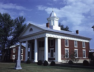
Greene County is a county in Virginia in the eastern United States. As of the 2010 census, the population was 18,403. Its county seat is Stanardsville.

Fluvanna County is a county located in the Piedmont region of the Commonwealth of Virginia. As of the 2010 census, the population was 25,691. Its county seat is Palmyra.

Charlottesville, colloquially known as C'ville, is an independent city in the Commonwealth of Virginia. It is the county seat of Albemarle County, which surrounds the city, though the two are separate legal entities. It is named after the British Queen consort Charlotte of Mecklenburg-Strelitz, who as the wife of George III was Virginia's last Queen. In 2019, an estimated 47,266 people lived within the city limits. The Bureau of Economic Analysis combines the City of Charlottesville with Albemarle County for statistical purposes, bringing its population to approximately 150,000. Charlottesville is the heart of the Charlottesville metropolitan area, which includes Albemarle, Buckingham, Fluvanna, Greene, and Nelson counties.

Albemarle County is a county located in the Piedmont region of the Commonwealth of Virginia. Its county seat is Charlottesville, which is an independent city and enclave entirely surrounded by the county. Albemarle County is part of the Charlottesville Metropolitan Statistical Area. As of the 2010 census, the population was 98,970, in 2018, it was estimated at 108,718.

Albemarle is a small city and the county seat of Stanly County, North Carolina. The population was 15,903 in the 2010 Census. Gerald R. "Ronnie" Michael serves as Mayor and Albemarle has a seven-member City Council elected in a combination of at-large and district seats. Albemarle has operated under the Council-Manager form of government since 1962. Michael Ferris has served as City Manager since December 2014 and previously served as Assistant City Manager for nearly two decades. The City Manager is appointed by the City Council, and is responsible for the day-to-day administration of City government. The City's Department Heads report directly to the City Manager, who is also responsible for development and administration of the City's annual budget.

Walter Daniel Leake served as a United States Senator from Mississippi (1817–1820) and as third Governor of Mississippi (1822–1825). He was the first Governor of Mississippi to die in office.

The Roanoke River is a river in southern Virginia and northeastern North Carolina in the United States, 410 miles (660 km) long. A major river of the southeastern United States, it drains a largely rural area of the coastal plain from the eastern edge of the Appalachian Mountains southeast across the Piedmont to Albemarle Sound. An important river throughout the history of the United States, it was the site of early settlement in the Virginia Colony and the Carolina Colony. An 81-mile (130 km) section of its lower course in Virginia between the Leesville Lake and Kerr Lake is known as the Staunton River, pronounced, as is the Shenandoah Valley city of that name. It is impounded along much of its middle course to form a chain of reservoirs.

Wilson Cary Nicholas was an American politician who served in the U.S. Senate from 1799 to 1804 and was the 19th Governor of Virginia from 1814 to 1816.
Albemarle County, Virginia

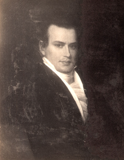
William Cabell Rives was an American lawyer, planter, politician and diplomat from Virginia. Initially a Jackson Democrat as well as member of the First Families of Virginia, Rives served in the Virginia House of Delegates representing first Nelson County, then Albemarle County, Virginia, before service in both the U.S. House and Senate. Rives also served two separate terms as U.S. Minister to France. During the Andrew Jackson administration, Rives negotiated a treaty whereby the French agreed to pay the U.S. for spoliation claims from the Napoleonic Wars. During the American Civil War, Rives became a Delegate to the Provisional Confederate Congress and the Confederate House of Representatives.

Gypsy is a census-designated place (CDP) in Harrison County, West Virginia, USA. As of the 2010 census, its population was 328.

Greenwood is an unincorporated community in Albemarle County, Virginia, United States. It is home to the Greenwood Country Store and the Greenwood Community Center, which has the area's only roller skating rink. Greenwood has a post office with ZIP code 22943 The Greenwood Tunnel, built by Claudius Crozet for the Blue Ridge Railroad and used by the Chesapeake and Ohio Railway until its abandonment during World War II, is near Greenwood by the Buckingham Branch Railroad tracks.

Yancey Mills is an unincorporated community in Albemarle County, Virginia, United States. Today, Yancey Mills is the site of the intersection of U.S. Route 250 and Interstate 64, the location of Western Albemarle High School, Henley Middle School, Brownsville Elementary School, and a pair of gas stations.

Hollymead is a census-designated place (CDP) in Albemarle County, Virginia, United States. The population as of the 2010 Census was 7,690. It is located about seven miles north of Charlottesville, near Charlottesville-Albemarle Airport.

Rosena is an unincorporated community in Albemarle County, Virginia. It lies at the intersection of Rt. 20 and Rt. 640, within the Stony Point community. The sole service is a single general store, "Grand Junction," which long did business under the name of "Bobbi's." As of 1904, the United States Geological Survey designated it as a "post village," indicating that at that time there was a post office. And as of 1910, the population was great enough to warrant a stop by the "traveling library stations" of the Virginia State Library.

Solaris is an unincorporated community in Albemarle County, Virginia. Solaris is 580 feet above sea level and is about 5 miles from the Charlottesville-Albemarle Airport.

Stonehenge is an unincorporated community in Albemarle County, Virginia, United States. Its elevation is 420 feet (128 m).

Hansford is an unincorporated community in Kanawha County, West Virginia, United States. Hansford is located along the Kanawha River and West Virginia Route 61 adjacent to Pratt. Hansford has a post office with ZIP code 25103.

Ben Lomond is an unincorporated community in Mason County, West Virginia, U.S. It is located on the Ohio River at the junction of West Virginia Route 2 and County Route 56, some 9.7 miles (15.6 km) south-southwest of Point Pleasant.

Bleak is an unincorporated community in Fauquier County, Virginia, United States.


