
The Grand Union Canal in England is part of the British canal system. Its main line starts in London and ends in Birmingham, stretching for 137 miles (220 km) with 166 locks. It has arms to places including Leicester, Slough, Aylesbury, Wendover and Northampton.

The River Great Ouse is a river in England, the longest of several British rivers called "Ouse". From Syresham in Northamptonshire, the Great Ouse flows through Buckinghamshire, Bedfordshire, Cambridgeshire and Norfolk to drain into the Wash and the North Sea near Kings Lynn. With a course of about 143 miles (230 km), mostly flowing north and east, it is the fifth longest river in the United Kingdom. The Great Ouse has been historically important for commercial navigation, and for draining the low-lying region through which it flows; its best-known tributary is the Cam, which runs through Cambridge. Its lower course passes through drained wetlands and fens and has been extensively modified, or channelised, to relieve flooding and provide a better route for barge traffic. The unmodified river would have changed course regularly after floods.
Gravesend is an ancient town in northwest Kent, England, situated 21 miles (35 km) east-southeast of Charing Cross on the south bank of the Thames Estuary and opposite Tilbury in Essex. Located in the diocese of Rochester, it is the administrative centre of the Borough of Gravesham.

Steeles Avenue is an east–west street that forms the northern city limit of Toronto and the southern limit of York Region, Ontario, Canada. It stretches 77.3 km (48.0 mi) across the western and central Greater Toronto Area from Appleby Line in Milton in the west to the Toronto-Pickering city limits in the east, where it continues east into Durham Region as Taunton Road, which itself extends 58 km (36 mi) across the length of Durham Region to its boundary with Northumberland County.

New Hampshire Route 16 is a 149.75-mile (241.00 km), north–south state highway in New Hampshire, United States, the main road connecting the Seacoast region to the Lakes Region and the White Mountains. Much of its length is close to the border with Maine. The section from Portsmouth to Milton is a controlled-access toll highway known as the Spaulding Turnpike. Between Milton and Chocorua, and between Conway and Glen, it is known as the White Mountain Highway. It is known as Chocorua Mountain Highway between Chocorua and Conway and various other local names before crossing into Maine about 20 miles (32 km) south of the Canadian border. Portions of NH 16 run concurrent with U.S. Route 4 (US 4), US 202, NH 25, and US 302, and US 2.

The A689 is a road in northern England that runs east from the A595, 3.1 miles (5.0 km) to the west of Carlisle in Cumbria, to Hartlepool in County Durham.
Route 28 is a 151.9329-mile-long (244.5123 km) nominally south–north state highway in the U.S. state of Massachusetts, running from the town of Eastham via Boston to the New Hampshire state line in Methuen. Following the route from its nominally southern end, Route 28 initially heads south to the town of Chatham then turns west to follow along the south shore of Cape Cod. In Falmouth, Route 28 turns north and continues through the western reaches of Plymouth and Norfolk counties, and travels for a while through Route 25. It then cuts through downtown Boston before heading north via Lawrence to the New Hampshire state line, where it continues as New Hampshire Route 28. Coincidentally, Route 28 travels through 28 municipalities.
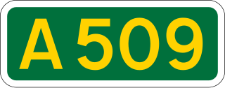
The A509 is a short A-class road for north-south journeys in south central England, forming the route from Kettering in Northamptonshire to the A5 in Milton Keynes, via M1 J14.

The A422 is an "A" road for east-west journeys in south central England, connecting the county towns of Bedford and Worcester by way of Milton Keynes, Buckingham, Banbury and Stratford-upon-Avon. For most of its length, it is a narrow single carriageway.

The Rivanna River is a 42.1-mile-long (67.8 km) tributary of the James River in central Virginia in the United States. The Rivanna's tributaries originate in the Blue Ridge Mountains; via the James River, it is part of the watershed of Chesapeake Bay.

Navigation Road is a station that serves both Northern Trains and Manchester Metrolink located in the east of Altrincham, in Greater Manchester, England. It consists of a Northern-operated heavy rail station on the Mid-Cheshire Line, and an adjoining light rail stop on the Altrincham Line of Greater Manchester's Metrolink network. The original heavy rail element of the station was opened by the Manchester, South Junction and Altrincham Railway in 1931, and the Metrolink element opened in 1992. A level crossing operates at the southern end of the station.

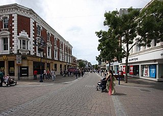
The Milton Keynes redway system is an over 200 mi (322 km) network of shared use paths for cyclists and pedestrians in Milton Keynes, Buckinghamshire, England. It is generally surfaced with red tarmac, and criss-crosses most of MK.
Delaware Route 16 (DE 16) is an east-west state highway in Delaware, mainly across northern Sussex County, with a small portion near the Maryland border in extreme southwestern Kent County. It runs from Maryland Route 16 (MD 16) at the Maryland border in Hickman to the Delaware Bay at Broadkill Beach. The route runs through rural areas, passing through the towns of Greenwood, Ellendale, and Milton. DE 16 intersects U.S. Route 13 (US 13) and DE 36 in Greenwood, US 113 in Ellendale, DE 30 and DE 5 in the Milton area, and DE 1 between Milton and Broadkill Beach. West of DE 1, the route serves as part of a connection between the Baltimore–Washington Metropolitan Area and the Delaware Beaches. DE 16 was built as a state highway during the 1920s and 1930s. By 1936, the route was designated onto its current alignment.

The A507 is an A-class road in England, linking the M1 motorway near Milton Keynes to the A10 at Buntingford.

The Oregon Railroad and Navigation Company (OR&N) was a railroad that operated a rail network of 1,143 miles (1,839 km) running east from Portland, Oregon, United States, to northeastern Oregon, northeastern Washington, and northern Idaho. It operated from 1896 as a consolidation of several smaller railroads.

Delaware Route 5 (DE 5) is a 19.49-mile-long (31.37 km) state highway in Sussex County, Delaware. The route runs from River Road and Oak Orchard Avenue on the Indian River Bay in Oak Orchard north to DE 1, north of Milton. Along the way, DE 5 passes through rural areas along with the communities of Long Neck, Harbeson, and Milton. The route has concurrencies with DE 23 and DE 24 in the Long Neck area and crosses U.S. Route 9 (US 9)/DE 404 in Harbeson and DE 16 in Milton. DE 5 features one alternate route, DE 5 Alternate, which provides a bypass of Milton. DE 5 was built as a state highway in the 1920s and 1930s. The road between Long Neck and north of Milton, including present-day DE 5 north of DE 24, was designated as part of a short-lived DE 22 in the 1930s. DE 5 was designated to its current alignment by 1938. DE 5 Alt. was designated by 2001.
National Cycle Route 6 is a route of the National Cycle Network, running from London to the Lake District.

Pennsylvania Route 642 is a 21.4-mile-long (34.4 km) state highway located in Union, Northumberland, Montour, and Columbia Counties in Pennsylvania. The western terminus is at the intersection of Third Street and Broad Street in West Milton near an interchange with U.S. Route 15. The eastern terminus is at PA 254 and PA 44 in Jerseytown.
National Cycle Route 51 is an English long distance cycle route running broadly east-west connecting Colchester and the port of Harwich to Oxford via Ipswich, Bury St Edmunds, Cambridge, Bedford, Milton Keynes, Bicester, and Kidlington.
Route 230A, also known as Old Bonavista Highway, is a 16.2-kilometre-long (10.1 mi) alternate route of Route 230 at the southwestern corner of the Bonavista Peninsula on the island of Newfoundland. It represents the former route of Route 230 through Clarenville, Milton, and George's Brook.


