
Fluvanna County is a county located in the Piedmont region of the Commonwealth of Virginia. As of the 2010 census, the population was 25,691. Its county seat is Palmyra.
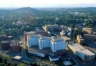
Charlottesville, colloquially known as C'ville, is an independent city in the Commonwealth of Virginia. It is the county seat of Albemarle County, which surrounds the city, though the two are separate legal entities. It is named after the British Queen consort Charlotte of Mecklenburg-Strelitz, who as the wife of George III was Virginia's last Queen. In 2019, an estimated 47,266 people lived within the city limits. The Bureau of Economic Analysis combines the City of Charlottesville with Albemarle County for statistical purposes, bringing its population to approximately 150,000. Charlottesville is the heart of the Charlottesville metropolitan area, which includes Albemarle, Buckingham, Fluvanna, Greene, and Nelson counties.

Albemarle County is a county located in the Piedmont region of the Commonwealth of Virginia. Its county seat is Charlottesville, which is an independent city and enclave entirely surrounded by the county. Albemarle County is part of the Charlottesville Metropolitan Statistical Area. As of the 2010 census, the population was 98,970, in 2018, it was estimated at 108,718.

Crozet is a census-designated place (CDP) in Albemarle County in the Commonwealth of Virginia, United States. It sits along the I-64 corridor, about 12 miles (19 km) west of Charlottesville and 21 miles (34 km) east of Staunton. Originally called "Wayland's Crossing," it was renamed in 1870 in honor of Colonel Claudius Crozet, the French-born civil engineer who directed the construction of the Blue Ridge Tunnel. The cornerstone of Crozet is believed to have been Pleasant Green, a property also known as the Ficklin-Wayland Farm, located just about 100 30 yards from the actual Wayland Crossing. Claudius Crozet is said to have lodged in that property while surveying the land that today honors his name. The population of Crozet was 5,565 at the 2010 census. Crozet is part of the Charlottesville Metropolitan Statistical Area.

Lake Monticello, a private gated community, is a census-designated place (CDP) in Fluvanna County, Virginia, United States. The population was 9,920 at the 2010 census, an increase of over 44% from 2000. The community is centered on a lake of the same name, which is formed by a dam on a short tributary of the nearby Rivanna River. Lake Monticello is part of the Charlottesville Metropolitan Statistical Area. Lake Monticello was developed in the 1960s as a summer vacation home community but quickly evolved into a bedroom community of Charlottesville, and to a smaller extent of Richmond. It also has a sizable retirement age population.
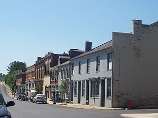
Scottsville is a town in Albemarle and Fluvanna counties in the U.S. state of Virginia. The population was 566 at the 2010 census. It is part of the Charlottesville Metropolitan Statistical Area.
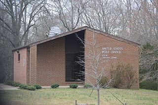
Keene is an unincorporated community in Albemarle County, Virginia, United States. As of the 1990 census, the town had a total population of 10.
The Charlottesville Metropolitan Statistical Area is a Metropolitan Statistical Area (MSA) in the Piedmont region of the Commonwealth of Virginia as defined by the Office of Management and Budget (OMB). The combined population is: 201,559, 218,615 & 235,232

Alexander Rives was a Virginia attorney, politician and plantation owner. He served in both houses of the Virginia General Assembly, as a Justice of the Supreme Court of Virginia and as a United States District Judge of the United States District Court for the Western District of Virginia.
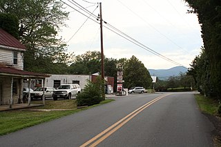
Free Union is a census-designated place (CDP) in Albemarle County, Virginia, United States, ten miles north-northwest of Charlottesville. The population as of the 2010 Census was 193. It is a very small hamlet consisting of a private school, a doctor's office, a post office, a country store, a homebuilder, and several dozen homes. Otherwise it is entirely rural in character. A few miles north of this hamlet is a winery.

Covesville is an unincorporated community in Albemarle County, Virginia, United States. Covesville is located 15.7 miles (25.3 km) southwest of Charlottesville, Virginia and has a post office with ZIP code 22931.

Esmont is a census-designated place (CDP) in Albemarle County, Virginia, United States. The population as of the 2010 Census was 528.

Ivy is a census-designated place (CDP) in Albemarle County, Virginia, United States. The population as of the 2010 Census was 905. It is a small unincorporated community located on U.S. Route 250, just west of Charlottesville.

Proffit is an unincorporated community in Albemarle County, Virginia. There is no commercial activity, with only houses lining the road and a bridge under which Norfolk Southern's Piedmont Division, Washington District line runs. It is recognized as a Virginia Landmark and the Proffit Historic District was listed on the National Register of Historic Places in 1999.

Rivanna is an unincorporated community in Albemarle County, Virginia, north of Charlottesville.

Pantops is a census-designated place in Albemarle County, Virginia. The population as of the 2010 Census was 3,027. It is a suburban area located just across the Rivanna River east of Charlottesville, and includes Pantops Mountain.

Piney Mountain is a census-designated place in Albemarle County, Virginia. The population as of the 2010 Census was 1,130. It is a suburban area located about ten miles north of Charlottesville, near the base of Piney Mountain, largely composed of the Briarwood and Camelot neighborhoods.

Rivanna is a census-designated place (CDP) in Albemarle County, Virginia, just east of Shadwell. The population as of the 2010 Census was 1,860. It consists mainly of the Glenmore gated community.

University of Virginia is a census-designated place in Albemarle County, Virginia. The population as of the 2010 Census was 7,704. As the name infers, the CDP encompasses the University of Virginia grounds, along with several adjacent off-grounds housing areas, including University Heights, which was formerly its own CDP.
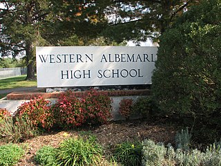
Albemarle County Public Schools (ACPS) is a school district serving Albemarle County, Virginia. Its headquarters are in the City of Charlottesville. ACPS serves approximately 14,000 students in preschool through grade 12 in Albemarle County, Virginia, the sixth largest county by area in the Commonwealth of Virginia. A diverse locality of 726 square miles in the heart of Central Virginia, Albemarle County is a blend of primarily rural, but also suburban and urban settings.


