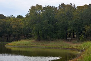
Quivira National Wildlife Refuge in south central Kansas, United States, includes rare inland marshes. Located near the town of Stafford, it lies mostly in northeastern Stafford County, but small parts extend into southwestern Rice and northwestern Reno Counties. Its proximity to the Central Flyway migration route and the salt marshes on the refuge combine to endow the refuge with a large variety of birds. Many of these birds are uncommon in other parts of Kansas or even the central part of the continent.

The Deep Fork National Wildlife Refuge (DFNWR) is part of the United States system of National Wildlife Refuges, and is a critical resource for wildfowl that migrate along the Central Flyway in Spring and Fall. It is located in Eastern Oklahoma, near the city of Okmulgee. The preserve runs along both banks of the Deep Fork River for about 20 miles (32 km). According to TravelOK, DFNWR receives about 45,000 visitors every year.
Catoosa Wildlife Management Area is a large game-management area on the Upper Cumberland Plateau in Morgan, Cumberland and Fentress counties in Tennessee in the United States. It comprises 96,000 acres (332 km2) of wild land administered by the Tennessee Wildlife Resources Agency (TWRA). The Management Area is funded by hunters and fishermen, and is popular with all outdoors enthusiasts, including backpackers, and whitewater rafters. It has many trails for hiking, of which the most notable is the Cumberland Trail. It also has gravel roads and dirt track four-wheel drive roads for motorized exploration. Catoosa ranges from gentle rolling hills to some of the most rugged and extreme terrain in the country. Many rivers and streams have cut deep canyons into the Cumberland Plateau and Cumberland Mountains of the Management area allowing for beautiful vistas.

The Cibola National Forest is a 1,633,783 acre United States National Forest in New Mexico, US. The name Cibola is thought to be the original Zuni Indian name for their pueblos or tribal lands. The name was later interpreted by the Spanish to mean "buffalo." The forest is disjointed with lands spread across central and northern New Mexico, west Texas and Oklahoma. The Cibola National Forest is divided into four Ranger Districts: the Sandia, Mountainair, Mt. Taylor, and Magdalena. The Forest includes the San Mateo, Magdalena, Datil, Bear, Gallina, Manzano, Sandia, Mt. Taylor, and Zuni Mountains of west-central New Mexico. The Forest also manages four National Grasslands that stretch from northeastern New Mexico eastward into the Texas Panhandle and western Oklahoma. The Cibola National Forest and Grassland is administered by Region 3 of the United States Forest Service from offices in Albuquerque, New Mexico. Elevation ranges from 5,000 ft to 11,301 ft. The descending order of Cibola National Forest acres by county are: Socorro, Cibola, McKinley, Catron, Torrance, Bernalillo, Sandoval County, New Mexico, Lincoln, Sierra, and Valencia counties in New Mexico. The Cibola National Forest currently has 137,701 acres designated as Wilderness. In addition to these acres, it has 246,000 acres classified as Inventoried Roadless Areas pursuant to the Roadless Area Conservation Rule.

Tosohatchee Wildlife Management Area is located along the St. Johns River east of Orlando in Christmas on Taylor Creek Road, off SR 50.

The Mingo National Wildlife Refuge is a 21,676-acre (87.7-km2) National Wildlife Refuge located in northwestern Stoddard and southeastern Wayne counties in Missouri. Its southwesternmost portion lies on the shores of Lake Wappapello. Named after the Mingo tribe, it was established to preserve bottomland hardwoods and provide waterfowl and other migratory birds in the Mississippi Flyway with nesting, feeding, brooding, and resting habitat.

The Daniel Webster Wildlife Sanctuary is a sanctuary owned by the Massachusetts Audubon Society, the largest conservation organization in New England, in the town of Marshfield, Massachusetts. The sanctuary, formerly the farm of Edward Dwyer, statesman Daniel Webster and the William Thomas family of Marshfield, the first English landowner to live on the sanctuary land, was purchased by Mass Audubon in 1984 thanks to the volunteer efforts of the Committee for the Preservation of Dwyer Farm for the People of Marshfield. The sanctuary contains 507 acres (2.1 km2) of mixed cultural grasslands, red maple swamps, a five-tiered wet panne, Webster Pond and a section of the Green Harbor River. It is the site of the annual Daniel Webster Farm Day celebration. Surrounding lands owned by the town of Marshfield and the Marshfield Airport increase the local open space area to more than 1000 acres (4 km2).

The Lake George State Forest is a designated protected area and state forest in the U.S. state of Florida. The 21,176-acre (8,570 ha) forest is located in northwestern Volusia County, Florida, near Lake George and the communities of Pierson, Barberville, and Volusia. It is overseen by the Florida Forest Service within the Florida Department of Agriculture and Consumer Services.
Wasque ("way-squee") or Wasque Beach is a 200-acre (0.81 km2) nature reserve on Chappaquiddick Island, Martha's Vineyard, Massachusetts. The site was established as a reservation for the public in 1967 and is one of five conservation areas on "the Vineyard" managed by the Trustees of Reservations. Wasque contains a sandy strand the Boston Globe calls "a magnificent beach." Travel + Leisure named Wasque Beach the number one beach in New England and WHDH-TV reports "It's pristine, serene, and rain or shine, it's a beach-goers' delight." Off the shore of Wasque Beach is Katama Bay, "a vast and pristine salt water bay that includes many acres of productive shellfish beds."

Green Bottom Wildlife Management Area is located on former plantation lands of U.S. Congressman and Confederate General Albert G. Jenkins. The 1,096 acres (444 ha) in Cabell County and Mason County are located along the banks of the Ohio River about 16 miles (26 km) north of Huntington, West Virginia. The Green Bottom WMA land is a mixture of farmland, mixed hardwood forest, wetlands, and open water. The Jenkins Plantation Museum is located on Corps of Engineers land adjacent to the WMA. The museum is located in the original 1835 Green Bottom Plantation House, and is operated by the West Virginia Division of Culture and History.

Black Pond Wildlife Management Area is a 526-acre (213 ha) New York State Wildlife Management Area (WMA) that lies on the eastern shore of Lake Ontario, and at the northern limit of an unusual region of sandy barrier beaches and lagoons. Much of the barrier beach in Black Pond WMA has forested sand dunes that are about 60 feet (18 m) high; these are the highest sand dunes in the northeast United States excepting Cape Cod. Immediately north of the WMA is the 360-acre (150 ha) El Dorado Beach Preserve, which is a bird refuge owned by The Nature Conservancy. North of the outlet from Black Pond to Lake Ontario, the shoreline is a weathered, flat bedrock shelf that is "calcareous" instead of sandy.
The San Luis National Wildlife Refuge Complex is located in the northern San Joaquin Valley, within Merced County and Stanislaus County of California. The complex, with four federal National Wildlife Refuges, is managed by the U.S Fish & Wildlife Service.

The Massachusetts Division of Fisheries and Wildlife, sometimes referred to as MassWildlife, is an agency of the Massachusetts Department of Fish and Game, within the Executive Office of Energy and Environmental Affairs. The Massachusetts Division of Fisheries and Wildlife (DFW) is responsible for the conservation - including restoration, protection and management - of fish and wildlife resources for the benefit and enjoyment of the public. MassWildlife was founded as a state fisheries commission in 1866 in response to citizen concerns about the loss of Atlantic salmon to dams and pollution. The agency's activities are mainly supported by revenue from the sale of hunting, trapping and fishing licenses, stamps and permits; returns from federal taxes on hunting and fishing equipment; various bond initiatives (primarily for land purchase. Additional funding is derived from voluntary donations from businesses, conservation organizations, and individuals.

Hagerman National Wildlife Refuge (HNWR), a haven for migratory birds and other wildlife, lies in northwestern Grayson County, Texas, on the Big Mineral Arm of Lake Texoma, on the Red River between Oklahoma and Texas. This National Wildlife Refuge is made up of water, marsh, and upland habitat. Visitors can hike, observe wildlife, hunt, and fish throughout the year.

Hatchville is a neighborhood within the town of Falmouth, Massachusetts, on Cape Cod in the United States. The mailing address for the area is East Falmouth, to the south of Hatchville.

Red Creek Wildlife Management Area was established from land owned by the U.S. Forest Service and is located within the De Soto National Forest off Mississippi Highway 15. Red Creek WMA lies within Stone, George, and Jackson Counties, southeast of Wiggins, Mississippi, and contains approximately 23,000 acres (93 km2).

Virginia Wildlife Management Areas (WMAs) are state-managed protected areas that exist primarily for the benefit of wildlife. Within the Commonwealth of Virginia, 46 tracts of land have been protected as WMAs, covering a total of over 216,000 acres. They are managed and maintained by the Virginia Department of Wildlife Resources.

Mattaponi Wildlife Management Area is a 2,542-acre (10.29 km2) Wildlife Management Area (WMA) in Caroline County, Virginia. Located west of Bowling Green, the area protects a mixture of wetlands and upland forests at the confluence of the Mattaponi and South rivers.
Smith Mountain Cooperative Wildlife Management Area is a 4,996-acre (20.22 km2) Wildlife Management Area (WMA) in Bedford and Pittsylvania counties, Virginia. Located on the shores of Smith Mountain Lake, the WMA is owned by Appalachian Power and cooperatively managed by the Virginia Department of Game and Inland Fisheries and the Virginia Outdoors Foundation through a conservation easement that permits public access.


