
108 Mile Ranch is a residential community of 700 homes situated in the South Cariboo region of British Columbia located in a historic area of ranches and lakes.

100 Mile House is a district municipality located in the South Cariboo region of central British Columbia, Canada.
Highway 97 is a major highway in the Canadian province of British Columbia. It is the longest continuously numbered route in the province, running 2,081 km (1,293 mi) and is the only route that runs the entire north–south length of the British Columbia, connecting the Canada–United States border near Osoyoos in the south to the British Columbia–Yukon boundary in the north at Watson Lake, Yukon.
Thompson Rivers University is a public teaching and research university offering undergraduate and graduate degrees and vocational training. Its main campus is in Kamloops, British Columbia, Canada, and its name comes from the two rivers which converge in Kamloops, the North Thompson and South Thompson. The university has a satellite campus in Williams Lake, BC and a distance education division called TRU-Open Learning. It also has several international partnerships through its TRU World division. TRU is accredited by the Northwest Commission on Colleges and Universities (NWCCU) at the associate, baccalaureate and master's degree levels.

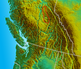
The Cariboo is an intermontane region of British Columbia, Canada, centered on a plateau stretching from Fraser Canyon to the Cariboo Mountains. The name is a reference to the caribou that were once abundant in the region.

Williams Lake is a city in the Central Interior of British Columbia, in the central part of a region known as the Cariboo. Williams Lake is one of the largest cites, by population of metropolitan area, in the Cariboo after neighbouring Quesnel. The city is famous for the Williams Lake Stampede, which was once the second largest professional rodeo in Canada, after only the Calgary Stampede.
Cariboo was a federal electoral district in British Columbia, Canada, that was represented in the House of Commons of Canada from 1871 to 1892.

The Cariboo Gold Rush was a gold rush in the Colony of British Columbia, which later became the Canadian province of British Columbia. The first gold discovery was made at Hills Bar in 1858, followed by more strikes in 1859 on the Horsefly River, and on Keithley Creek and Antler Creek in 1860. The actual rush did not begin until 1861, when these discoveries were widely publicized. By 1865, following the strikes along Williams Creek, the rush was in full swing.

The Cariboo Mountains are the northernmost subrange of the Columbia Mountains, which run down into the Spokane area of the United States and include the Selkirks, Monashees and Purcells. The Cariboo Mountains are entirely within the province of British Columbia, Canada. The range is 7,700 square kilometres (3,000 sq mi) in area and about 245 km in length (southeast–northwest) and about 90 km at its widest (southwest–northeast).

The Quesnel River is a major tributary of the Fraser River in the Cariboo District of central British Columbia. It begins at the outflow of Quesnel Lake, at the town of Likely and flows for about 100 kilometres (60 mi) northwest to its confluence with the Fraser at the city of Quesnel.
Cariboo was one of the twelve original electoral districts created when British Columbia became a Canadian province in 1871. Roughly corresponding to the old colonial electoral administrative district of the same name, it was a three-member riding until the 1894 election, when it was reduced through reapportionment and became a two-member riding until the 1916 election, after which it has been a single-member riding. It produced many notable Members of the Legislative Assembly (MLAs), including George Anthony Boomer Walkem, third and fifth holder of the office of Premier of British Columbia and who was one of the first representatives elected from the riding; John Robson, ninth Premier of British Columbia; and Robert Bonner, a powerful minister in the W.A.C. Bennett cabinet, and later CEO of MacMillan Bloedel and BC Hydro.
Cariboo River Provincial Park is a provincial park in British Columbia, Canada, located between Barkerville and Likely in the upper Cariboo River basin.
Cariboo Mountains Provincial Park is a provincial park in British Columbia, Canada, located northeast of Likely. Comprising 113,469 ha., the park is located in the Cariboo Mountains between Bowron Lakes Provincial Park (NW) and Wells Gray Provincial Park (SE).
Green Lake Provincial Park is a provincial park in British Columbia, Canada, located around Green Lake in the South Cariboo-Interlakes district just east of 70 Mile House.
School District 27 Cariboo-Chilcotin is a school district in central British Columbia. It covers a large geographic area in the Chilcotin and Cariboo districts, from 100 Mile House in the south to Williams Lake in the north.

The British Columbia Interior, popularly referred to as the BC Interior or simply the Interior, is a geographic region of the Canadian province of British Columbia. While the exact boundaries are variously defined, the British Columbia Interior is generally defined to include the 14 regional districts that do not have coastline along the Pacific Ocean or Salish Sea, and are not part of the Lower Mainland. Other boundaries may exclude parts of or even entire regional districts, or expand the definition to include the regional districts of Fraser Valley, Squamish–Lillooet, and Kitimat–Stikine.
The Quesnel Highland is a geographic area in the Central Interior of the Canadian province of British Columbia. As defined by BC government geographer in Landforms of British Columbia, an account and analysis of British Columbia geography that is often cited as authoritative, the Highland is a complex of upland hill and plateau areas forming and defined as being the buffer between the Cariboo Plateau and the Cariboo Mountains, as a sort of highland foothills along the eastern edge of the Interior Plateau running southeast from a certain point southeast of the city of Prince George to the Mahood Lake area at the southeast corner of the Cariboo. Beyond Mahood Lake lies another separately classified area dubbed by Holland the Shuswap Highland which spans similar terrain across the North Thompson and Shuswap Lake-Adams River drainage basins, forming a similar upland-area buffer between the Thompson Plateau and the Monashee Mountains. A third area, the Okanagan Highland, extends from the southern end of the Shuswap Highland in the area of Vernon and Enderby in the northern Okanagan region into Washington State, and also abuts the Monashee Mountains.
The Old Cariboo Road is a reference to the original wagon road to the Cariboo gold fields in what is now the Canadian province of British Columbia. It should not be confused with the Cariboo Road, which was built slightly later and used a different route.

The Cariboo River is a tributary of the Quesnel River, one of the main tributaries of the Fraser River, in the Canadian province of British Columbia. It flows through the Cariboo region of the British Columbia Interior, southeast of Prince George. Above Cariboo Lake it was formerly known as the Swamp River. The name was adopted, and replaced the former names, in 1936 in association with Cariboo Lake.
