Washington County is located in the western part of the U.S. state of Maryland. As of the 2020 census, the population was 154,705. It is the most populous county in the Western Maryland region and its county seat is Hagerstown.

Mount Vernon is a neighborhood of Baltimore, Maryland, located immediately north of the city's downtown district. Designated a city Cultural District, it is one of the oldest neighborhoods originally home to the city's wealthiest and most fashionable families. The name derives from Mount Vernon, the home of George Washington, given the original Washington Monument, a massive pillar commenced in 1815 to commemorate the first president of the United States, is the defining feature of the neighborhood.

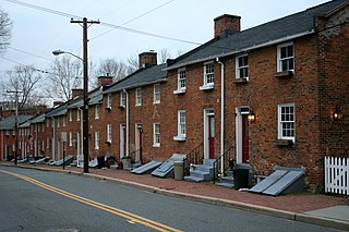
Oella is a mill town on the Patapsco River in western Baltimore County, Maryland, United States, located between Catonsville and Ellicott City. It is a 19th-century village of millworkers' homes.

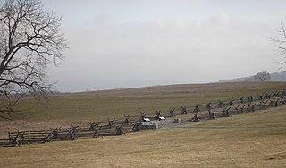
Antietam National Battlefield is a National Park Service-protected area along Antietam Creek in Sharpsburg, Washington County, northwestern Maryland. It commemorates the American Civil War Battle of Antietam that occurred on September 17, 1862.

Maryland Route 144 is a collection of state highways in the U.S. state of Maryland. These highways are sections of old alignment of U.S. Route 40 between Cumberland and Baltimore. Along with US 40 Scenic, US 40 Alternate, and a few sections of county-maintained highway, MD 144 is assigned to what was once the main highway between the two cities, connecting those endpoints with Hancock, Hagerstown, Frederick, New Market, Mount Airy, Ellicott City, and Catonsville. MD 144 has seven disjoint sections of mainline highway that pass through the Appalachian Mountains in Allegany and Washington counties and the rolling Piedmont of Frederick, Carroll, Howard, and Baltimore counties.

The Maryland Theatre is a music and entertainment venue located in the Arts and Entertainment District of downtown Hagerstown, Maryland. It was built in 1915, partially destroyed by fire in 1974, reopened in 1978, and expanded into a full performing arts complex in 2019. The theatre's seating capacity is 1,279 people, and it hosts performances of symphony orchestras, country artists, comedians, children's shows, pop stars, recitals, stage shows, and others. Over 81,000 patrons attended performances at the Maryland Theatre in 2005, making it one of Maryland's premier venues for the performing arts. The Maryland Symphony Orchestra performs there regularly and has been headquartered in the building since 2019. The theater features a fully restored Wurlitzer theatre organ.

U.S. Route 11 (US 11) is a part of the United States Numbered Highway System that runs from New Orleans, Louisiana, to Rouses Point, New York. In Maryland, the federal highway runs 12.83 miles (20.65 km) from the West Virginia state line at the Potomac River in Williamsport north to the Pennsylvania state line near Maugansville. US 11 is the primary north–south surface highway in central Washington County, connecting Hagerstown with Williamsport to the south and Hagerstown Regional Airport to the north. The federal highway was once a major long-distance highway, but that role has been assumed by Interstate 81 (I-81), which parallels US 11 not only in Maryland but for most of its course from Tennessee to Upstate New York. US 11 is maintained by the Maryland State Highway Administration except for the municipally-maintained portions within the corporate limits of Williamsport and Hagerstown.

Western Maryland Railway No. 202 is a preserved 4-6-2 "pacific" steam locomotive built in 1912 by the Baldwin Locomotive Works for the Western Maryland Railway. The locomotive was used for pulling various passenger trains of the WM over the course of 40 years. In 1938, the locomotive was refitted with Walschaert valve gear, replacing its original Baker valve gear. In 1947, it was converted to burn oil and stayed east of Cumberland after the conversion. No. 202 pulled its last revenue freight assignment in 1952, and it was subsequently retired and donated "to the children of Hagerstown", to be displayed in City Park, Hagerstown, Maryland. It is one of only two surviving Western Maryland steam locomotives and the only surviving mainline WM steam locomotive.

Chestertown Historic District is a historic district in Chestertown, Maryland. It was listed on the National Register of Historic Places and designated a National Historic Landmark in 1970, and its area was increased in 1984. The town on the Chester River, became the chief port for tobacco and wheat on the Eastern Shore of Maryland between 1750 and 1790. The port declined thereafter, as Baltimore became the major port for such activity. In consequence, Chestertown acquired a collection of more than fifty Georgian style town houses. The 18th-century residential area survived without harm a 1910 fire that destroyed the central business district of Chestertown.

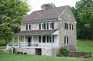
The Hager House is a two-story stone house in Hagerstown, Maryland, United States that dates to c. 1740. The house was built by Jonathan Hager, a German immigrant from Westphalia, who founded Hagerstown. The basement contains two spring-fed pools of water, providing a secure water source. Hager sold the property, then known as Hager's Fancy to Jacob Rohrer. The house remained in the Rohrer family until 1944, when it was acquired by the Washington County Historical Society. The restored house was given to the City of Hagerstown in 1954 and opened to the public in 1962 as a historic house museum.

The Price–Miller House is a historic home located in Hagerstown, Washington County, Maryland, United States. It is a 2+1⁄2-story, brick Neoclassical-style townhouse that rests on a high-cut stone foundation, and was built circa 1824–1825.

Houses At 16-22 East Lee Street is a block of historic homes located at Hagerstown, Washington County, Maryland, United States. They area group of five, 2+1⁄2-story frame rowhouses. The buildings rest on brick and stone foundations and have two inner open passageways leading from the street to the rear elevations. They are an important example of lower middle class domestic architecture in Hagerstown, erected about 1894.

Hagerstown is a city in and the county seat of Washington County, Maryland, United States. The population was 43,527 at the 2020 census. Hagerstown ranks as Maryland's sixth-largest incorporated city and is the largest city in the Maryland Panhandle.

Boonsboro Historic District is a national historic district at Boonsboro, Washington County, Maryland, United States. The district includes 562 contributing elements. Its component buildings chronicle the town's development from its founding in 1792 through the mid 20th century. Most of the late 18th and early 19th century development in Boonsboro occurred along Main Street, then part of a principal market road between Williamsport, Hagerstown, Frederick, and Baltimore, Maryland. They are mainly of log, frame, or brick construction, with a few stone buildings interspersed. The majority of the buildings in the district date from the 1820-1850 period coinciding with peak use years of the National Road. Other features of the district include the Boonsboro Cemetery laid out about 1855 in a 19th-century curving plan with a number of exceptionally artistic gravestones, and the office/depot of the Hagerstown-Boonsboro Electric Railway. The period of significance, from 1792 to 1959 tracks the continuous growth and evolution of the town through the date by which the district had substantially achieved its current form and appearance.

Hagerstown Commercial Core Historic District is a national historic district at Hagerstown, Washington County, Maryland, United States.

Hagerstown Historic District is a national historic district at Hagerstown, Washington County, Maryland, United States. The district contains the downtown commercial and governmental center as well as several surrounding urban residential neighborhoods and industrial areas. It includes the original plat of Hagerstown, laid out in the 1760s, as well as areas of expansion that developed generally prior to or just after the turn of the 20th century. Some 2,500 Confederate dead lie in Rose Hill Cemetery on South Potomac Street, most of whom died at the Battle of Antietam.

Oak Hill Historic District is a national historic district at Hagerstown, Washington County, Maryland, United States. The district consists of a residential neighborhood of approximately 76 acres (310,000 m2) in northern Hagerstown. It is characterized generally by large scale houses built in the first third of the 20th century and standing in a garden city type setting. The houses are generally Colonial or Georgian revival in stylistic influences.

South Prospect Street Historic District is a national historic district at Hagerstown, Washington County, Maryland, United States. The district is a 19th and early 20th century residential neighborhood which was once the address of many of Hagerstown's leading citizens. The street is lined with more than 50 structures representing America's varied and strong architectural heritage and includes both domestic and ecclesiastical buildings, such as Saint John's Church and the Presbyterian Church. The architectural styles represented range from the Neoclassical of the early 19th century to the classical revivals of the early 20th century.

Wilson's Bridge is a bridge near Hagerstown, Washington County, Maryland, United States. It originally carried the Hagerstown and Conococheague Turnpike, the National Road, across Conococheague Creek 7 miles (11 km) west of Hagerstown. The five-arched structure, the longest of the county's stone bridges, is 210 feet (64 m) in length and is constructed of coursed local limestone. The bridge was erected in 1819 by Silas Harry, who had built similar bridges in Pennsylvania. The bridge was closed in June 1972 when it was damaged by floods which occurred during Tropical Storm Agnes.


