Point Lookout State Park

Last updated
Point Lookout State Park
2016-05-18 10 43 22 View north from Point Lookout Lighthouse in Point Lookout State Park, St. Mary's County, Maryland.jpg
View north from the lighthouse at Point Lookout
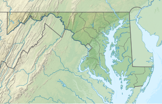
USA Maryland relief location map.svg
Red pog.svg
Location in Maryland
Location11175 Point Lookout Road, Scotland, Maryland
Nearest town Lexington Park, Maryland
Coordinates 38°02′15″N76°19′18″W / 38.03750°N 76.32167°W / 38.03750; -76.32167 [1]
Area1,083 acres (4.38 km2) [2]
Designation Maryland state park
Established1964 [3]
Administrator Maryland Department of Natural Resources
Website Point Lookout State Park

Point Lookout State Park is a public recreation area and historic preserve occupying Point Lookout, the southernmost tip of a peninsula formed by the confluence of Chesapeake Bay and the Potomac River in St. Mary's County, Maryland. The state park preserves the site of an American Civil War prisoner of war camp and the Point Lookout Light, which was built in 1830. [4] It is the southernmost spot on Maryland's western shore, the coastal region on the western side of the Chesapeake Bay.

Contents

Colonial period

Captain John Smith, the famed explorer who surveyed the Mid-Atlantic region for the British Crown, came ashore at Point Lookout in 1608. [5] [6] [7] He surveyed the lands and waters of the area, including the mouth of the Potomac River on the south side of Point Lookout and its small nearby tributary, the St. Mary's River. Smith gave very favorable reports on the area to the king of England, remarking on the abundant game and fishing opportunities, the fertile soil and the strategic military value of the area, overlooking the confluence of the Potomac River, Patuxent River and the St. Mary's River, along with its key vantage point on the Chesapeake Bay itself. All of these factors led him to describe it as a prime spot for a potential British colony.

The first settlement in Maryland occurred in 1634, in nearby St. Mary's City. At that time, Point Lookout became part of St. Michael's Manor, one of the main holdings of Leonard Calvert, the leader of the new colony and the first proprietary governor of colonial Maryland.

Because of its strategic position, Point Lookout was raided by British forces during the American Revolution. [4] [8]

War of 1812

Private of Marines.jpg
Royal Marines were stationed at Point Lookout during the British occupation in 1814 of the Chesapeake Campaign in the War of 1812.
UK-Col-Marine.jpg
British Colonial Marines of the Corps of Colonial Marines were stationed at Point Lookout during the British occupation in 1814 of the Chesapeake Campaign in the War of 1812.

Origin of area name, "Point Lookout"

The area got its name from its role as a lookout post, used to watch British ship movements during the War of 1812. [9]

During the War of 1812 the Chesapeake Bay was a major route for British War ships, who established a naval and military base at near-by Tangier Island in Virginia for the Royal Navy under Rear Admiral George Cockburn with Fort Albion there, which constantly raided Chesapeake Bay waterfront towns, villages and farms and scattered community residents, and also eventually attacked and burned Washington, D.C., and unsuccessfully attacked the City of Baltimore during 1813 and 1814.

Citizen militia post riders

During the War of 1812, a local citizen militia in St. Mary's County established a clandestine base on Point Lookout to monitor movements of British warships on Chesapeake Bay. The militia also established a secret nighttime system of post riders to send intelligence reports from Point Lookout to Washington, D.C., in order to keep President James Madison up to date on British movements. St. Mary's County's roads were notoriously rough at the time, and the trek by horse was more than 80 miles, so a relay system was set up, passing messages from one rider to the next.

British forces take Point Lookout

The citizen militia worked clandestinely in the area for over a year, until the British came ashore, seized and occupied Point Lookout. The militia was no match for the overwhelming power and number of seasoned British ground troops. This had the effect of blinding American intelligence efforts in the region, and is thought to have contributed to the eventual Burning of Washington in August 1814 by British troops. President Madison and United States Secretary of War, John Armstrong, Jr. was later faulted for not aiding the militia in Point Lookout.

American Civil War

Camp Cross, a Union Army camp at Point Lookout, Maryland from 1863-1864 A history of the Fifth Regiment, New Hampshire Volunteers, in the American Civil War, 1861-1865 (electronic resource) (1893) (14762393642).jpg
Camp Cross, a Union Army camp at Point Lookout, Maryland from 1863–1864

Establishment of prisoner-of-war camp

Sidney Lanier - Project Gutenberg eText 16622.jpg
Sidney Lanier, poet, musician and academic, was a Confederate prisoner in Point Lookout
Point Lookout Prisoner of War Camp (American Civil War) Historical Marker Cropped.jpg
Point Lookout prisoner of war camp historical marker

In 1862, during the American Civil War, much of the land around Point Lookout was transformed into a bustling port and temporary city of civilians and military personnel and numerous buildings, including a large Union Army hospital, a United States Army garrison at Fort Lincoln, and a Union prisoner of war camp to hold Confederate States Army soldier captives.

Prisoners of war held, conditions

At the Battle of Gettysburg in July 1863, Union forces captured thousands of Confederate soldiers. Point Lookout was one of numerous military facilities hastily established as prisoner of war camps. Officially named Camp Hoffman, the 40-acre prison compound was established north of Hammond Hospital. A 15-foot tall wooden fence surrounded the compound, while guards kept watch from a gallery at the top of the fence. [9]

According to the Maryland Department of Natural Resources, of the 50,000 soldiers held in the army prison camp at Lookout Point, all of whom were housed in tents, nearly 4,000 died. [9] [10] The death rate of 8 percent was less than half of the death rate among soldiers who were in the field with their own armies. [4] The camp, originally built to hold 10,000 men, swelled to between 12,000 and 20,000 prisoners after the exchange of prisoners between armies was placed on hold. [9] The result was crowded conditions with up to sixteen men to a tent in poor sanitary conditions. [11] It was the largest Union-run prison camp and its reputation was one of the worst. [12] [13] [14]

War memorial and cemetery

Mass grave

The mass grave [9] holds 3,384 Confederate prisoners of war who died at the prison camp. The grave is marked by a pillar inscribed at its base with the names of the dead. [15] The privately funded Confederate Memorial Park occupies a three-acre site next to the cemetery. [9] [16] Although a United States flag is flown in front of the memorial, a prominent Confederate flag is situated on a flagpole just outside the gates of the grounds, in memory of those dead Southern soldiers.

Archeological remains

Because of the extensive water erosion of the Chesapeake Bay shoreline in the last 150 years, half of the original site of the prisoner of war stockade has been obliterated and washed away by the bay. [17] [9]

State park and beaches

Today, Point Lookout State Park retains Point Lookout Light, the original lighthouse built in 1830, a fishing pier, boat launch facilities, public beaches and facilities, overnight camping, Civil War historical remains, and, reputedly, ghosts. [18] [19] [20]

Notable people

An expansion pack for the 2008 video game Fallout 3, entitled Point Lookout, is set in a post-apocalyptic version of Point Lookout and its surrounding areas. [22]

See also

Related Research Articles

<span class="mw-page-title-main">St. Mary's County, Maryland</span> County in Maryland, United States

St. Mary's County, established in 1637, is a county located in the U.S. state of Maryland. As of the 2020 census, the population was 113,777. Its county seat is Leonardtown. The name is in honor of Mary, the mother of Jesus. St. Mary's County comprises the California-Lexington Park, Maryland Metropolitan Statistical Area, which also is included in the Washington-Baltimore-Arlington, DC-MD-VA-WV-PA Combined Statistical Area. It is part of the Southern Maryland region. The county was the home to the first Maryland Colony, and the first capital of the Colony of Maryland. Settled by English Catholics, it is considered to be the birthplace of religious freedom in North America, at a time when the British colonies were settled primarily by Protestants. The county is home to the Patuxent River Naval Air Station and St. Mary's College of Maryland. Traditionally, St. Mary's County has been known for its unique and historic culture of Chesapeake Bay tidewater farming, fishing, and crabbing communities. But with the advent of the military bases, growth of an extensive defense contractor presence, and the growth of St. Mary's College of Maryland, as well as increasing numbers of long-distance Washington, D.C. commuters, it has been undergoing a decades-long transformation which has seen the county's population double since 1970.

<span class="mw-page-title-main">Southern Maryland</span> Place in Maryland, United States

Southern Maryland, also referred to as SoMD, is a geographical, cultural and historic region in Maryland composed of the state's southernmost counties on the Western Shore of the Chesapeake Bay. According to the state of Maryland, the region includes all of Calvert, Charles, and St. Mary's counties and the southern portions of Anne Arundel and Prince George's counties. It is largely coterminous with the region of Maryland that is part of the Washington metropolitan area. Portions of the region are also part of the Baltimore Metropolitan Area and the California-Lexington Park Metropolitan Statistical Area. As of the 2020 Census, the region had a population of 373,177. The largest community in Southern Maryland is Waldorf, with a population of 81,410 as of the 2020 Census.

CSS <i>Teaser</i> US Civil War ship

CSS Teaser had been the aging Georgetown, D.C. tugboat York River until the beginning of the American Civil War, when she was taken into the Confederate States Navy and took part in the famous Battle of Hampton Roads. Later, she was captured by the United States Navy and became the first USS Teaser.

<span class="mw-page-title-main">Rock Island Arsenal</span> Miltary production site in Illinois, United States

The Rock Island Arsenal comprises 946 acres and is located on Arsenal Island, originally known as Rock Island, on the Mississippi River between the cities of Davenport, Iowa, and Rock Island, Illinois. Rock Island was previously used as the summer camp site for Sauk Native Americans, and the dispute over tribal ownership led to the Black Hawk War of 1832, after the primary leader of the Sauk, Black Hawk. It is now home to the United States Army First Army Headquarters, and the United States Army Center of Excellence for Additive Manufacturing.

<span class="mw-page-title-main">Fort Frederick State Park</span> State park in Maryland, US

Fort Frederick State Park is a public recreation and historic preservation area on the Potomac River surrounding the restored Fort Frederick, a fortification active in the French and Indian War (1754–1763) and the American Revolutionary War (1775-1783). The state park lies south of the town of Big Pool, Maryland. The Chesapeake and Ohio Canal runs through the park grounds. The site was designated a National Historic Landmark in 1973.

<span class="mw-page-title-main">Johnson's Island</span> Historic site in Ottawa County, Ohio

Johnson's Island is a 300-acre (120 ha) island in Sandusky Bay, located on the coast of Lake Erie, 3 miles (4.8 km) from the city of Sandusky, Ohio. It was the site of a prisoner-of-war camp for Confederate officers captured during the American Civil War. Initially, Johnson's Island was the only Union prison camp exclusively for Confederate officers but eventually it held privates, political prisoners, persons sentenced to court martial and spies. Civilians who were arrested as guerrillas, or bushwhackers, were also imprisoned on the island. During its three years of operation, more than 15,000 men were incarcerated there.

<span class="mw-page-title-main">Harry Gilmor</span>

Harry Ward Gilmor served as the Baltimore City Police Commissioner, head of the Baltimore City Police Department in the 1870s, and a Confederate cavalry officer during the American Civil War. Gilmor's daring raids, including Gilmor's Raid through northern and central Maryland in July 1864 during the third major Confederate invasion of the North gained his partisans fame as "Gilmor's Raiders".

<span class="mw-page-title-main">Maryland in the American Civil War</span> States participation as a Union slave state; a border state

During the American Civil War (1861–1865), Maryland, a slave state, was one of the border states, straddling the South and North. Despite some popular support for the cause of the Confederate States of America, Maryland did not secede during the Civil War. Governor Thomas H. Hicks, despite his early sympathies for the South, helped prevent the state from seceding.

Scotland, in St. Mary's County, Maryland, United States, (Us) is a small settlement near the southernmost end of the state, on the western shore of the Chesapeake Bay. The ZIP Code for Scotland is 20687. There is a summer camp, operated by the Metropolitan Police Department and the Greater Washington Area Boys and Girls Club.

<span class="mw-page-title-main">Point Lookout Light</span> Lighthouse in Maryland, United States

Point Lookout Light is a lighthouse that marks the entrance to the Potomac River at the southernmost tip of Maryland's western shore of the Chesapeake Bay, south of the town of Scotland in Saint Mary's County, Maryland, USA. The lighthouse is located in Point Lookout State Park. It is not open to the public.

<span class="mw-page-title-main">Maryland Army National Guard</span> American military unit, founded 1634

The Maryland Army National Guard is the United States Army component of the U.S. state of Maryland. It is headquartered at the old Fifth Regiment Armory at the intersection of North Howard Street, 29th Division Street, near Martin Luther King, Jr. Boulevard in Baltimore and has additional units assigned and quartered at several regional armories, bases/camps and other facilities across the state.

<span class="mw-page-title-main">George H. Steuart (militia general)</span>

George Hume Steuart (1790–1867) was a United States general who fought during the War of 1812, and later joined the Confederate States of America during the Civil War. His military career began in 1814 when, as a captain, he raised a company of Maryland volunteers, leading them at both the Battle of Bladensberg and the Battle of North Point, where he was wounded. After the war he rose to become major general and commander-in-chief of the First Light Division, Maryland Militia.

St. Inigoes, sometimes called St. Inigoes Shores, is a small, rural, unincorporated farming, fishing and crabbing community at the southern end of St. Mary's County in the U.S. state of Maryland that is undergoing a transition to small residential subdevelopment plots. Its western side is bordered by a number of coves and creeks that are connected to the St. Marys River, a brackish tidal tributary, near where it feeds into the mouth of the Potomac River and close to its entry point into the Chesapeake Bay.

Federal Hill Park is a 10.3 acres park located in Baltimore, Maryland on the south shore of the Inner Harbor. The park is a signature Baltimore landmark and offers visitors some of the most noted views in the city often photographed looking north to the downtown skyline of skyscrapers across the Inner Harbor of the Northwest Branch of the Patapsco River / Baltimore Harbor. The Federal Hill surrounding neighborhood to the west and south is named for the prominent hill and is also known as old South Baltimore. The now graded grass lawn hill and park, was originally a jagged cliffs and bluffs of red clay which was mined in the 18th and 19th centuries after being first sighted and described by Captain John Smith of England on his voyages of exploration of the Chesapeake Bay from the first English colony at Jamestown, Virginia in 1608. The noted famous site today is bounded by Francis Scott Key Highway along the waterfront to the north, Battery Avenue to the west, Warren Avenue to the south, and Covington Street to the east. Baltimore city acquired the hill as public property in 1880 after it was used and fortified as a fort with heavy artillery by the Union Army during the American Civil War (1861-1865). It was established then as a city park operated and maintained by the city Department of Recreation and Parks.

<span class="mw-page-title-main">Oswald Tilghman</span> American politician

Oswald Tilghman was an officer of the Confederate States Army during the American Civil War; a lawyer; Maryland politician; Maryland Senator, Talbot County, (1894–96); Secretary of State of Maryland (1904–08); affiliate of the Maryland Democratic Party; author; and was active in veteran affairs. Native of Talbot County, Maryland.

<span class="mw-page-title-main">Parole camp</span>

A parole camp was a place during the American Civil War in which Union or Confederate soldiers on parole could be kept by their own side, in a non-combat role. They could be restored to a combat role if some prisoners of war were traded to the other side. That would enable them to be returned to a combat role as an exchange for the newly-freed prisoners of war. Conditions in the camps were unpleasant; the parolees refused to do guard duty or routine work and claimed that would violate their parole. Many escaped to go home.

<span class="mw-page-title-main">American Civil War prison camps</span> Lists of prisoner of war camps

Between 1861 and 1865, American Civil War prison camps were operated by the Union and the Confederacy to detain over 400,000 captured soldiers. From the start of the Civil War through to 1863 a parole exchange system saw most prisoners of war swapped relatively quickly. However, from 1863 this broke down following the Confederacy's refusal to treat black and white Union prisoners equally, leading to soaring numbers held on both sides.

<span class="mw-page-title-main">Alton Military Prison</span> Archaeological site in Illinois, United States

The Alton Military Prison was a prison located in Alton, Illinois, built in 1833 as the first state penitentiary in Illinois and closed in 1857. During the American Civil War, the prison was reopened in 1862 to accommodate the growing population of Confederate prisoners of war and ceased to be prison at the end of the war in 1865. The prison building was demolished not long after the Civil War. All that remains of the former prison site is a section of ruin wall that is maintained by the State of Illinois as an historic site. The prison site is included in the U.S. National Register of Historic Places.

<span class="mw-page-title-main">Second Battle of St. Michaels</span> Small battle of the War of 1812

The Second Battle of St. Michaels was a raid conducted on Maryland's Eastern Shore by British soldiers during the War of 1812. The raid occurred on August 26, 1813, at points between Tilghman Island and the town of St. Michaels, Maryland. Local militia defended against the raiders.

References

  1. "Point Lookout". Geographic Names Information System . United States Geological Survey, United States Department of the Interior.
  2. "DNR Lands Acreage Report" (PDF). Maryland Department of Natural Resources. 2022. p. 9. Retrieved March 15, 2023.
  3. "Maryland State Park History". Maryland DNR. Retrieved March 15, 2023.
  4. 1 2 3 "Point Lookout State Park History". Maryland DNR. Retrieved March 15, 2023.
  5. Hoobler, Dorothy; Hoobler, Thomas (2006), Captain John Smith: Jamestown and the Birth of the American Dream, Hoboken, NJ: John Wiley & Sons, Inc., pp.  153–59, 212–13, ISBN   978-0-471-48584-1 .
  6. Horn, James (2005), A Land As God Made It: Jamestown and the Birth of America , New York: Basic Books (published 2006), pp.  83–87, 170–71, ISBN   978-0-465-03094-1
  7. Grizzard, Frank E.; Hoobler, Thomas (2007), Jamestown Colony: A Political, Social and Cultural History, Santa Barbara, CA: ABC-CLIO (published 2006), pp. 203–07, ISBN   978-1-85109-637-4 .
  8. Peter Himmelheber; Philip Davis; Linda Davis Reno (October 2002). "St. Mary's County, Maryland: Proprietary Manors". St. Mary's Families. Retrieved March 15, 2023.
  9. 1 2 3 4 5 6 7 "Point Lookout Confederate Cemetery: Ridge, Maryland". National Park Service. Retrieved March 15, 2023.
  10. "Point Lookout Confederate Cemetery". U.S. Department of Veterans Affairs. Retrieved December 26, 2013.
  11. "Point Lookout Prison Camp Records". University of Michigan. Archived from the original on February 26, 2005. Retrieved December 26, 2013.
  12. "Prison History". Descendants of Point Lookout POW Organization. Retrieved January 28, 2020.
  13. "Point Lookout Prisoner of War Camp". The American Civil War. mycivilwar.com. Retrieved December 26, 2013.
  14. Ken Stover. "Civil War Prison Camps". Civil War Academy.com. Retrieved December 26, 2013.
  15. "Point Lookout Confederate Cemetery". Interment.net. Retrieved December 26, 2013.
  16. "Confederate Memorial Park". Confederate Memorial Park, Inc. Retrieved December 26, 2013.
  17. "Point Lookout State Park". Maryland DNR. Retrieved November 24, 2014.
  18. "The Spirits of Point Lookout". Maryland Department of Natural Resources. Retrieved 25 March 2024.
  19. "Point Lookout State Park". National Park Service . Retrieved 25 March 2024.
  20. "Point Lookout State Park, Civil War Museum & Lighthouse". Visit St Mary's MD. Retrieved 25 March 2024.
  21. "Sidney Lanier". Encyclopedia of Alabama. Retrieved 25 March 2024.
  22. Subhan, Ishraq (11 May 2022). "This Fallout 4 mod recreates all of Fallout 3's Point Lookout DLC". PCGamesN . Retrieved 25 March 2024.