Kattang Nature Reserve

Last updated

Kattang Nature Reserve
New South Wales
IUCN category II (national park)

Perpendicular Point Kattang.JPG

Perpendicular Point, Kattang Nature Reserve
Australia New South Wales relief location map.png
Red pog.svg
Kattang Nature Reserve
Nearest town or city Laurieton
Coordinates 31°38′28″S152°50′54″E / 31.64111°S 152.84833°E / -31.64111; 152.84833 Coordinates: 31°38′28″S152°50′54″E / 31.64111°S 152.84833°E / -31.64111; 152.84833
Established March 1984 (1984-03) [1]
Area 0.58 km2 (0.2 sq mi) [1]
Managing authorities NSW National Parks and Wildlife Service
Website Kattang Nature Reserve
See also Protected areas of
New South Wales

The Kattang Nature Reserve is a protected nature reserve that is located in the Mid North Coast region of New South Wales, on the eastern coast of Australia. The 68-hectare (170-acre) reserve is situated 7 kilometres (4.3 mi) from Laurieton, 47 kilometres (29 mi) south of Port Macquarie and 10 kilometres (6.2 mi) east of the Pacific Highway, near Kew. [2]

State park protected area managed at the federated state level

State parks are parks or other protected areas managed at the sub-national level within those nations which use "state" as a political subdivision. State parks are typically established by a state to preserve a location on account of its natural beauty, historic interest, or recreational potential. There are state parks under the administration of the government of each U.S. state, some of the Mexican states, and in Brazil. The term is also used in the Australian state of Victoria. The equivalent term used in Canada, Argentina, South Africa and Belgium, is provincial park. Similar systems of local government maintained parks exist in other countries, but the terminology varies.

Nature reserve protected area for flora, fauna or features of geological interest

A nature reserve is a protected area of importance for flora, fauna or features of geological or other special interest, which is reserved and managed for conservation and to provide special opportunities for study or research. Nature reserves may be designated by government institutions in some countries, or by private landowners, such as charities and research institutions, regardless of nationality. Nature reserves fall into different IUCN categories depending on the level of protection afforded by local laws. Normally it is more strictly protected than a nature park.

Mid North Coast Region in New South Wales, Australia

The Mid North Coast is a country region in the north-east of the state of New South Wales, Australia. The region covers the mid to north coast of the state, beginning at Seal Rocks, 275 km (171 mi) north of Sydney, and extending as far north as Woolgoolga, 562 km (349 mi) north of Sydney, a distance of roughly 400 km (250 mi).

Contents

Features

The reserve has a variety of different vegetation communities, such as exposed headlands, dry eucalyptus woodland, wet and dry heathland. Two small littoral rainforest patches remain, they are floristically similar to those at Sea Acres National Park not far to the north. [3] There is speculation that the extremely rare Scented Acronychia grows at Kattang. [4] Perpendicular Point has cliffs that descend 40 metres (130 ft) suddenly to the sea below. Bushwalking is popular, particularly in late winter and early spring when the abundant wildflowers are in season.

<i>Eucalyptus</i> genus of plants

Eucalyptus is a genus of over seven hundred species of flowering trees, shrubs or mallees in the myrtle family, Myrtaceae commonly known as eucalypts. Plants in the genus Eucalyptus have bark that is smooth, fibrous or stringy, leaves with oil glands, and sepals and petals that are fused to form a "cap" or operculum over the stamens. The fruit is a woody capsule commonly referred to as a "gumnut". Australia is covered by 92,000,000 hectares of eucalypt forest, comprising three quarters of the area covered by native forest.

Rainforest type of forest with high rainfall

Rainforests are forests characterized by high rainfall, with annual rainfall in the case of tropical rainforests between 250 and 450 centimetres, and definitions varying by region for temperate rainforests. The monsoon trough, alternatively known as the intertropical convergence zone, plays a significant role in creating the climatic conditions necessary for the Earth's tropical rainforests.

Sea Acres National Park Protected area in New South Wales, Australia

The Sea Acres National Park is a national park that is located in the Mid North Coast region of New South Wales, in eastern Australia. The 76-hectare (190-acre) park is situated near the town of Port Macquarie. The park is a popular tourist area with a 1.3-kilometre (0.81 mi) long boardwalk through a remnant of seaside rainforest. There is also an education centre and cafe. The park was initially declared as a nature reserve in 1987; and gazetted as a national park in October 2010.

See also

Related Research Articles

Bouddi National Park Protected area in New South Wales, Australia

The Bouddi National Park is a protected national park that is located in the Central Coast region of New South Wales, in eastern Australia. The 1,532-hectare (3,790-acre) national park is situated 46 kilometres (29 mi) northeast of Sydney. A section of the national park extends into the Tasman Sea, creating fully protected land, shore and marine habitats. The park contains one of the last mature temperate rainforests on the Central Coast, Fletchers Glen.

Cocoparra National Park Protected area in New South Wales, Australia

The Cocoparra National Park is a protected national park that is located in the Riverina region of New South Wales, in eastern Australia. The 8,357-hectare (20,650-acre) national park is situated 457 kilometres (284 mi) southwest of Sydney and 25 kilometres (16 mi) northeast of Griffith.

Mallanganee National Park Protected area in New South Wales, Australia

The Mallanganee National Park is a protected national park located in the Northern Rivers region of New South Wales, Australia. The 1,144-hectare (2,830-acre) park is located approximately 570 kilometres (350 mi) north of Sydney and can be located via Kyogle via the Bruxner Highway and the Summerland Way.

Willi Willi National Park Protected area in New South Wales, Australia

The Willi Willi National Park is a protected national park located on the North Coast region of New South Wales, Australia. Gazetted in 1996, the 29,870-hectare (73,800-acre) park is situated 325 kilometres (202 mi) northeast of Sydney and 60 kilometres (37 mi) west of Wauchope.

Broulee Island Nature Reserve Protected area in New South Wales, Australia

The Broulee Island Nature Reserve is a protected nature reserve located on the south coast of New South Wales, Australia. The 43 ha reserve was created in 1972 and is managed by the NSW National Parks & Wildlife Service. The reserve is situated 23 kilometres (14 mi) south of Batemans Bay and is adjacent to the village of Broulee.

Boorganna Nature Reserve Protected area in New South Wales, Australia

The Boorganna Nature Reserve is a protected nature reserve located northwest of Taree on the Comboyne Plateau in New South Wales, Australia. The 396-hectare (980-acre) reserve, managed by the NSW National Parks & Wildlife Service, was gazetted in 1904 and is the second oldest nature reserve in the state. The reserve features various forest types, including stands of sub tropical rainforest of which the large rosewood, yellow carabeen and small leaf fig are particularly noteworthy. The reserve is a remnant of the former extensive rainforest on the Comboyne Plateau. The plateau was cleared between 1900 and 1925. Australian red cedar was logged in the area in the nineteenth century. Originally proposed to be part of the world heritage rainforest group. The exploration, knowledge, uses and history of this area by Indigenous Australians is not well known in the present day.

Mount Hyland Nature Reserve Protected area in New South Wales, Australia

The Mount Hyland Nature Reserve is a protected nature reserve that is located in the New England region of New South Wales, in eastern Australia. The 2,519-hectare (6,220-acre) reserve is situated approximately 35 kilometres (22 mi) west of Dorrigo.

Wilsons Peak Flora Reserve Protected area in New South Wales, Australia

The Wilsons Peak Flora Reserve is a protected nature reserve that is located in the Northern Rivers region in the state of New South Wales, in eastern Australia. The reserve is bounded to the north by the border between New South Wales and the state of Queensland. The nearest town is the Queensland settlement of Killarney.

Davis Scrub Nature Reserve Protected area in New South Wales, Australia

The Davis Scrub Nature Reserve is a protected nature reserve that is located in the Northern Rivers region of New South Wales, Australia. The 13-hectare (32-acre) reserve is a sub tropical jungle remnant of the Big Scrub and is situated at 170 metres (560 ft) above sea level on an undulating high rainfall plain near Alstonville.

Andrew Johnston Big Scrub Nature Reserve Protected area in New South Wales, Australia

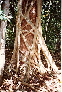
The Andrew Johnston Big Scrub Nature Reserve is a protected nature reserve that is located in the Northern Rivers region of New South Wales, Australia. The 21-hectare (52-acre) reserve is a sub tropical jungle remnant of the Big Scrub and is situated approximately 19 kilometres (12 mi) northeast of Lismore. Far less than one percent of the original Big Scrub now remains.

Iluka Nature Reserve Protected area in New South Wales, Australia

The Iluka Nature Reserve in a protected nature reserve that is located in the Northern Rivers region of New South Wales, Australia. The 135-hectare (330-acre) reserve is situated near the coastal town of Iluka.

Hayters Hill Nature Reserve Protected area in New South Wales, Australia

The Hayters Hill Nature Reserve is a protected nature reserve that is located in the Northern Rivers region in the state of New South Wales, in eastern Australia. The 8-hectare (20-acre) forest remnant is located on high ground some 5 kilometres (3.1 mi) southwest of Byron Bay.

Mann River Nature Reserve Protected area in New South Wales, Australia

The Mann River Nature Reserve is a protected nature reserve that is located on the eastern edge of the Great Dividing Range on the Northern Tablelands in the New England region of New South Wales, in eastern Australia. The 7,128-hectare (17,610-acre) reserve is situated approximately 57 kilometres (35 mi) east of the town of Glen Innes, some 145 kilometres (90 mi) west of Grafton, and approximately 155 kilometres (96 mi) north-east of Armidale. The reserve is located to the south of the Gwydir Highway on the Old Grafton Road. The Mann River bisects the reserve.

Gamilaroi Nature Reserve Protected area in New South Wales, Australia

The Gamilaroi Nature Reserve is a protected nature reserve, part of the southern Brigalow Belt, that is located in the North West Slopes region of New South Wales, in eastern Australia. The 113-hectare (280-acre) reserve is situated 48 kilometres (30 mi) southeast of Moree, and about 6 kilometres (3.7 mi) south of Terry Hie Hie, at an elevation of 340 metres (1,120 ft) above sea level. The reserve is one of seven sites in the state where ooline occurs naturally. For this reason, the reserve is not promoted for recreation; and visits are not encouraged.

Brunswick Heads Nature Reserve Protected area in New South Wales, Australia

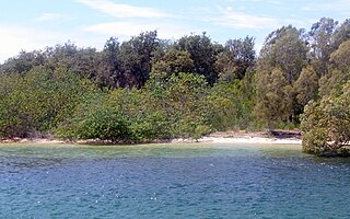
The Brunswick Heads Nature Reserve is a protected nature reserve located in the Northern Rivers region of New South Wales, Australia. The 221-hectare (550-acre) reserve is situated near Brunswick Heads and contains an intact segment of littoral rainforest.

Ukerebagh Island Protected area in New South Wales, Australia

The Ukerabagh Island is a river island, contained within the Ukerabagh Island Nature Reserve, a protected nature reserve, that is located in the mouth of the Tweed River, in the Northern Rivers region of New South Wales in eastern Australia. The 125-hectare (310-acre) reserve is situated near Tweed Heads and 1 kilometre (0.62 mi) south of a section that defines the border between the states of New South Wales and Queensland. The island and reserve is an important site for coastal birds.

Wamberal Lagoon, an intermittently closed intermediate saline coastal lagoon, is located on the Central Coast region of New South Wales, Australia. Wamberal Lagoon is located between the beachside settlements of Forresters Beach and Wamberal, and adjacent to the east coast, about 87 kilometres (54 mi) north of Sydney.

Little Llangothlin Nature Reserve Protected area in New South Wales, Australia

The Little Llangothlin Nature Reserve is a protected wetland nature reserve that is located on the Northern Tablelands in the New England region of New South Wales, in eastern Australia. The 257-hectare (640-acre) reserve is situated approximately 10 kilometres (6.2 mi) north-east of the rural locality of Llangothlin, and some 20 kilometres (12 mi) north-east of Guyra.

Murrumbidgee Valley National Park Protected area in New South Wales, Australia

The Murrumbidgee Valley National Park is a protected national park that is located in the Riverina region of New South Wales, in eastern Australia. The 47,703-hectare (117,880-acre) national park is located approximately 6 kilometres (3.7 mi) east of Hay, and approximately 15 kilometres (9.3 mi) west of Narrandera. The park protects part of what is now the largest continuous tract of river red gum forest in the world.

References

  1. 1 2 "Kattang Nature Reserve: Park management". Office of Environment and Heritage. Government of New South Wales . Retrieved 27 September 2014.
  2. "Kattang Nature Reserve: How to get there". Office of Environment and Heritage. Government of New South Wales . Retrieved 15 September 2012.
  3. Floyd, A. G. (1990). Australian Rainforests in New South Wales. 2. p. 56. ISBN   0-949324-32-9.
  4. "Kattang Nature Reserve Fire Management Plan" (PDF). NSW National Parks and Wildlife Service (PDF). Government of New South Wales . Retrieved 15 September 2012.
National Parks and Wildlife Service (New South Wales) part of the Office of Environment and Heritage (New South Wales) - the main government conservation agency in New South Wales, Australia

The National Parks and Wildlife Service (NPWS) is part of the Office of Environment and Heritage - the main government conservation agency in New South Wales, Australia.

Government of New South Wales state government of New South Wales, Australia

The Government of New South Wales, also referred to as the New South Wales Government or NSW Government, is the Australian state democratic administrative authority of New South Wales. It is currently held by a coalition of the Liberal Party and the National Party. The Government of New South Wales, a parliamentary constitutional monarchy, was formed in 1856 as prescribed in its Constitution, as amended from time to time. Since the Federation of Australia in 1901, New South Wales has been a state of the Commonwealth of Australia, and the Constitution of Australia regulates its relationship with the Commonwealth. Under the Australian Constitution, New South Wales ceded legislative and judicial supremacy to the Commonwealth, but retained powers in all matters not in conflict with the Commonwealth.

International Standard Book Number Unique numeric book identifier

The International Standard Book Number (ISBN) is a numeric commercial book identifier which is intended to be unique. Publishers purchase ISBNs from an affiliate of the International ISBN Agency.