Cumberland County is a county in the U.S. state of Maine. As of the 2020 census, the population was 303,069, making it the most populous county in Maine. Its county seat is Portland. Cumberland County was founded in 1760 from a portion of York County, Province of Massachusetts Bay, and named for William, Duke of Cumberland, a son of King George II.
South Cumberland Islands is a national park in Queensland, Australia, 831 km northwest of Brisbane. It is famous for the Marine stingers which can be found in the waters of the park between October and May.

Cumberland is the northeasternmost town in Providence County, Rhode Island, United States, first settled in 1635 and incorporated in 1746. The population was 36,405 at the 2020 census, making it the seventh-largest municipality and the largest town in the state.

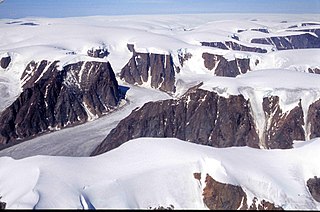
The Penny Ice Cap, formerly Penny Icecap, is a 6,000 km2 (2,300 sq mi) ice cap in Auyuittuq National Park of Baffin Island, Nunavut, Canada. It forms a 2,000 m (6,562 ft) high barrier on the Cumberland Peninsula, an area of deep fjords and glaciated valleys. It is a remnant of the last ice age. During the mid-1990s, Canadian researchers studied the glacier's patterns of freezing and thawing over centuries by drilling ice core samples.

Akshayuk Pass formerly Pangnirtung Pass is a mountain pass in the Baffin Mountains of Nunavut, Canada. It is found within Auyuittuq National Park. To the southwest is Mount Thor, about 17 km (11 mi), and Pangnirtung, about 64 km (40 mi) and to the northeast is Qikiqtarjuaq, about 109 km (68 mi).
Qaqulluit (Inuktitut syllabics: ᖃᖁᓪᓗᐃᑦ formerly Qaqaluit Island is one of eastern Baffin Island's small, offshore, uninhabited islands, located in the Arctic Archipelago in the Qikiqtaaluk Region, Nunavut. Along with Paallavvik and Aggijjat, it is situated off Cumberland Peninsula within Davis Strait's Merchants Bay.
Angijak Island is an uninhabited island in the Qikiqtaaluk Region of Nunavut, Canada. It is located in Davis Strait, off southeastern Baffin Island's Cumberland Peninsula. Other islands in the immediate vicinity include Akuglek Island, Kekertaluk Island, Kekertuk Island, and Nuvuktik Island.
Akuglek Island is an uninhabited island in the Qikiqtaaluk Region of Nunavut, Canada. It is located in Davis Strait, southeast of Sakiak Fiord, off southeastern Baffin Island's Cumberland Peninsula. Angijak Island is to its northeast, Nuvuktik Island to its south. Other islands in the immediate vicinity include Kekertaluk Island and Kekertuk Island.
Kekertuk Island is an uninhabited island in the Qikiqtaaluk Region of Nunavut, Canada. It is located in Davis Strait, off southeastern Baffin Island's Cumberland Peninsula. Other islands in the immediate vicinity include Akuglek Island, Angijak Island, Kekertaluk Island, and Nuvuktik Island.
Nuvuktik Island is an uninhabited island in the Qikiqtaaluk Region of Nunavut, Canada. It is in Davis Strait, off southeastern Baffin Island's Cumberland Peninsula. Other islands in the immediate vicinity include Akuglek Island, Angijak Island, Kekertaluk Island, and Kekertuk Island.
Wareham Island is an uninhabited island in the Qikiqtaaluk Region of Nunavut, Canada. It is located in the Cumberland Sound, off Baffin Island's Cumberland Peninsula, southwest of the mouth of Kumlien Fiord. Akulagok Island, Kekerten Island, Kekertukdjuak Island, Miliakdjuin Island, Tesseralik Island, and Tuapait Island are in the vicinity.
Akulagok Island is an uninhabited island in the Qikiqtaaluk Region of Nunavut, Canada. It belongs to the Kikastan Islands, located in the Cumberland Sound, off Baffin Island's Cumberland Peninsula. On its south side, Kekerten Harbour lies between Akulagok and Kekerten Island, while to the north lies Tuapait Island. Aupaluktok Island, Beacon Island, Kekertukdjuak Island, Miliakdjuin Island, Tesseralik Island, and Ugpitimik Island are in the vicinity.

Kekerten Island is an uninhabited island in the Qikiqtaaluk Region of Nunavut, Canada. Southernmost of the Kikastan Islands, it is located in the Cumberland Sound, off Baffin Island's Cumberland Peninsula. Akulagok Island forms Kekerten Harbour with the island. Tuapait Island lies to the north. Beacon Island, Kekertukdjuak Island, Miliakdjuin Island, Tesseralik Island, and Ugpitimik Island are in the vicinity.
Miliakdjuin Island is an uninhabited island in the Qikiqtaaluk Region of Nunavut, Canada. It is located southeast of the Kikastan Islands in the Cumberland Sound, off Baffin Island's Cumberland Peninsula. Akulagok Island, Kekerten Island, Kekertukdjuak Island, Tesseralik Island, Tuapait Island, and Wareham Island are in the vicinity.
Tesseralik Island is an uninhabited island in the Qikiqtaaluk Region of Nunavut, Canada. It is located in the Cumberland Sound, off Baffin Island's Cumberland Peninsula, and is one of the islands forming Brown Harbour. Akulagok Island, Aupaluktok Island, Beacon Island, Kekerten Island, Kekertukdjuak Island, Miliakdjuin Island, Tuapait Island, and Ugpitimik Island are in the vicinity.
Tuapait Island is an uninhabited island in the Qikiqtaaluk Region of Nunavut, Canada. It is one of the Kikastan Islands, located in the Cumberland Sound, off Baffin Island's Cumberland Peninsula. To its south lie Akulagok Island and Kekerten Island. Aupaluktok Island, Beacon Island, Kekertukdjuak Island, Miliakdjuin Island, Tesseralik Island, and Ugpitimik Island are in the vicinity.
Upajjana (ᐅᐸᔾᔭᓇ) formerly Beacon Island is an uninhabited island in the Qikiqtaaluk Region of Nunavut, Canada. It lies in the Cumberland Sound, at the mouth of the Pangnirtung Fiord, near Pangnirtung off Baffin Island's Cumberland Peninsula. Akulagok Island, Aupaluktok Island, Imigen Island, Kekerten Island, Kekertukdjuak Island, Tesseralik Island, Tuapait Island, and Ugpitimik Island are in the vicinity.
Utaqqiurviarjuruluk formerly Ugpitimik Island is an uninhabited island in the Qikiqtaaluk Region of Nunavut, Canada. It is located at the mouth of Pangnirtung Fiord, in the Cumberland Sound, off Baffin Island's Cumberland Peninsula. Akulagok Island, Aupaluktok Island, Upajjana, Kekerten Island, Kekertukdjuak Island, Tesseralik Island, and Tuapait Island are in the vicinity.
Anarnittuq Island is an uninhabited island in the Qikiqtaaluk Region of Nunavut, Canada. It is located in Baffin Island's Cumberland Sound. It lies at the combined mouths of Clearwater and Shark Fiord, between Clear Passage Island and Kekertelung Island. The Sanigut Islands, Iglunga Island, and Nunatak Island are in the vicinity.


