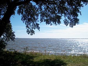
This island is a hunting and fishing community. It has numerous duck hunting blinds located in the bay as well as on land and is home to the Swan Island Hunting Club, a guided duck hunting club located across the bay on Swan Island. It is a favorite winter travel destination of artist/painter Bob Timberlake, among others.
Over the years, many residents of the former Outer Banks community of Wash Woods, Virginia moved across the sound to settle on Knotts Island.[2] Eventually, Wash Woods became a ghost town, but descendants continue to live on Knotts Island to this day.
The island supports an elementary school, two churches, a post office, and a community park.
There are several businesses located on the island. Knotts Island Market is the original general store on the island. Next to the market now there is a Dollar General store. The only restaurant and bar on the island is Pearl's Bay Villa, commonly referred to as "Pearl's" in reference to the former owner. There are no lodgings except for a single Airbnb on Knotts Island Bay.
There is also a winery on the Island: Martin Farm and Winery which offers waterfront views with a wine tasting room and ‘pick-your-own’ peaches, apples, and muscadine grapes.
Knotts Island hosts a Peach Festival every year in June.[3]
Hyde County is a county located in the U.S. state of North Carolina. As of the 2020 census, the population was 4,589, making it the second-least populous county in North Carolina. Its county seat is Swan Quarter. The county was created in 1705 as Wickham Precinct. It was renamed Hyde Precinct in 1712 and gained county status in 1739.
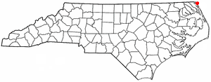
Currituck County is the northeasternmost county in the U.S. state of North Carolina. As of the 2020 census, the population was 28,100. Its county seat is Currituck. The county was formed in 1668 as a precinct of Albemarle County and later gained county status in 1739. The name is "traditionally said to be an indigenous word for wild geese; Coratank." Currituck County is included in the Virginia Beach-Chesapeake, VA-NC Combined Statistical Area. It is in the northeastern section of the state and is bounded by the Atlantic Ocean, Currituck Sound, Camden County, Dare County and the Commonwealth of Virginia. Currituck Court House, mentioned as early as 1755, was the name of the county seat. Today the words "Court House" have been dropped and only Currituck is used as the community name.
Corolla is an unincorporated community located in Poplar Branch township, Currituck County, North Carolina, United States, along the northern Outer Banks. It has a permanent population of approximately 500 people; during the summer vacation season, the population surges into the thousands. Corolla is home to the Currituck Beach Lighthouse, one of the seven North Carolina coastal lighthouses.
Colington Island is an island located to the west of Kill Devil Hills in Dare County, North Carolina, United States. The island is located at the converging point of Albemarle Sound, Currituck Sound, Croatan Sound, and Roanoke Sound. While it is commonly referred to as one island, there are actually two separate islands, Big Colington Island and Little Colington Island. Colington Harbour is a gated community located on Big Colington Island.
Back Bay National Wildlife Refuge in southeastern Virginia is located in the independent city of Virginia Beach. Established in 1938 in an isolated portion of the former Princess Anne County, it is managed by the U.S. Fish & Wildlife Service. The administrative office is located on Sandbridge Road at Sigma between Lago Mar and Sandbridge Beach. The Visitor Contact Center is accessed via Sandpiper Road from the Sandbridge area of Virginia Beach, which is the southernmost area of development on the Atlantic Coast of Virginia.
False Cape State Park is a 4,321-acre (17.49 km2) state park located on the Currituck Banks Peninsula, a one-mile-wide (1.6 km) barrier spit between the Back Bay of the Currituck Sound and the Atlantic Ocean, within the city of Virginia Beach, adjacent to the state border with North Carolina, and just north of Mackay Island National Wildlife Refuge.
Wash Woods was an unincorporated town on the coast of the Atlantic Ocean in the former Princess Anne County, in the southeastern corner of Virginia. It has been abandoned since the 1930s, except for the Life Saving Station which remained operational until the mid-1950s. The site of the former town is located within False Cape State Park in Virginia Beach.
The Outer Banks are a 200 mi (320 km) string of barrier islands and spits off the coast of North Carolina and southeastern Virginia, on the east coast of the United States. They line most of the North Carolina coastline, separating Currituck Sound, Albemarle Sound, and Pamlico Sound from the Atlantic Ocean. A major tourist destination, the Outer Banks are known for their wide expanse of open beachfront and the Cape Hatteras National Seashore. The seashore and surrounding ecosystem are important biodiversity zones, including beach grasses and shrubland that help maintain the form of the land.
Sandbridge, in the U.S. state of Virginia, is a coastal community of Virginia Beach, located along the coastline on the Currituck Banks Peninsula at the northern end of the Outer Banks. The Atlantic Ocean is to the east, the Back Bay of the Currituck Sound is to the west, and the Back Bay National Wildlife Refuge and False Cape State Park lie to the south. To the north, Sandbridge borders the U.S. Navy's Dam Neck facility. Located near the southern end of Sandbridge is Little Island Park, which is managed by the City of Virginia Beach. Sandbridge Beach runs approximately 4.5 miles from north to south along the oceanfront.
Currituck Sound is a lagoon located in northeastern part of North Carolina and extreme southeastern Virginia.
North Carolina Highway 615 (NC 615) is a primary state highway in the U.S. state of North Carolina. It connects Knotts Island with mainland North Carolina via the Currituck–Knotts Island Ferry.
The North Carolina Department of Transportation Ferry Division is a branch of NCDOT that is responsible for the operation of over two dozen ferry services that transport passengers and vehicles to several islands along the Outer Banks of North Carolina.
The Inner Banks is a neologism made up by developers and tourism promoters to describe the inland coastal region of eastern North Carolina. Without historical precedent, the term "Inner Banks" is an early 21st-century construct that is part of an attempt to rebrand the mostly agrarian coastal plain east of I-95 as a more attractive region for visitors and retirees.
Currituck is an unincorporated community in extreme northeastern North Carolina, United States. Situated along the Currituck Sound, it serves as the county seat for Currituck County. Currituck is part of the Inner Banks region and is one of the state's few unincorporated county seats. The community harbors the Knotts Island Ferry, which provides free shuttles across the sound to Knotts Island. North Carolina Highway 168 and Courthouse Road are the community's most prominent roads. The Currituck Beach Lighthouse is not located on mainland Currituck but is located across the sound on the Outer Banks.
Carova Beach or Carova is an unincorporated community in Currituck County in the extreme northeastern corner of North Carolina, United States. The community, begun in the 1960s, is found on Currituck Banks, north of Bodie Island, and can be accessed only by boat or by four-wheel drive vehicle. There are no paved roads connecting Carova to the town of Corolla, North Carolina. The neighboring settlement of Sandbridge in Virginia Beach, Virginia, is not accessible by vehicle from Carova. In the 1960s, when development began in Carova, there were plans to construct a paved road from Sandbridge south to Carova through the Back Bay National Wildlife Refuge, but these never materialized. Today, there is a permanent fence from ocean to sound to keep vehicles from crossing and, more importantly, to keep the wild horses from migrating to the Virginia side of the border. To reach Carova, four-wheel drive vehicles must drive north along the beach from Corolla into the community, as access from Virginia is limited to pedestrians and bicyclists.
Bodie Island is a long, narrow barrier peninsula that forms the northernmost portion of the Outer Banks. The land that is most commonly referred to as Bodie Island was at one time a true island, but in 1811 Roanoke Inlet, which had separated it from the Currituck Banks in the north, closed. As a result, the Currituck Banks and Bodie Island are now one contiguous peninsula, joined at the Nags Head area, where the inlet once flowed. Today, either name can be used to refer to peninsula as a whole, but both portions colloquially retain their historical names.
Currituck Banks North Carolina National Estuarine Research Reserve is a component site of the North Carolina National Estuarine Research Reserve on the Currituck Banks, north of Corolla, North Carolina. Currituck Banks is one of three original National Estuarine Research Reserve sites dedicated by NOAA in 1985. The reserve encompasses 965 acres of varied habitat and is bordered by the Currituck Sound. The Currituck banks are part of a 70-mile long barrier spit that extends from Virginia Beach to Oregon Inlet.
Mackay Island National Wildlife Refuge was established in 1960 to provide habitat for migratory waterfowl, primarily the greater snow goose. It is located almost entirely on Knotts Island in the Currituck Sound between Back Bay in Virginia Beach, Virginia and the open sound in North Carolina. Most of the refuge lies within North Carolina but some of it is in Virginia. The refuge is primarily made up of marsh habitat. This area has long been recognized for supporting significant migratory waterfowl populations and sport fishery resources, and is part of the Charles Kuralt Trail.
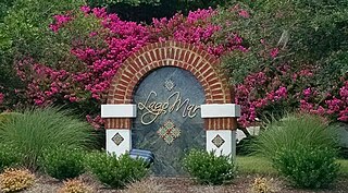
Lago Mar is a neighborhood on the north end of the Currituck Sound in the Princess Anne area of southeastern Virginia Beach, Virginia, United States. The name translated from Spanish to English means "lake" and "sea". It is derived from its proximity to the Atlantic Ocean and Brinson's Inlet Lake, as well as from the neighboring community of Ocean Lakes. The street names within Lago Mar are also of Spanish origin with the notable exception of Atwoodtown, which is what the area was called prior to being renamed in the 1960s. Today, neighboring communities Ashby's Bridge, Lotus Creek, Mirasol, Parkway Estates, and parts of Sigma are sometimes included in greater Lago Mar, especially for real estate marketing or demographic purposes.
Maple is an unincorporated community in Crawford Township, Currituck County, North Carolina, United States, located at the intersection of NC Highway 168 and SR 1246. Maple is located at latitude 36.4148780 North, and longitude -76.0040925 West. The elevation is three feet. Maple appears on the Currituck U.S. Geological Survey Map.
This page is based on this Wikipedia article Text is available under the CC BY-SA 4.0 license; additional terms may apply. Images, videos and audio are available under their respective licenses.