Mountains-to-Sea Trail

Last updated

Mountains-to-Sea Trail
NearClingmansDome.jpg
Sunset view from Clingman's Dome, the western terminus of the trail
Length1,175 mi (1,891 km)
Location North Carolina, United States
Designation National Recreation Trail
North Carolina State Trail
Trailheads Jockey's Ridge, Clingman's Dome
UseHiking
Elevation change 6,684 ft (2,037 m)
Highest point Mount Mitchell
Lowest point Pamlico Sound
DifficultyModerate to Strenuous
Sights Appalachian Mountains
Sauratown Mountains
Multiple rivers
Outer Banks
Hazards American alligator
American black bear
Biting flies
Chiggers
Diarrhea from water
Dog attacks
Limited water
Mosquitos
Poison ivy
Severe weather
Steep grades
Tick-borne diseases
Traffic collisions
Venomous snakes
Yellowjackets
Surface Natural, sand, gravel, boardwalk, asphalt
Website https://mountainstoseatrail.org/

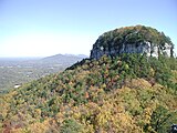
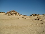
The Mountains-to-Sea State Trail (MST) is a long-distance trail in the US for hiking and backpacking, that traverses North Carolina from the Great Smoky Mountains to the Outer Banks. Its western endpoint is at Clingman's Dome, where it connects to the Appalachian Trail in the Great Smoky Mountains National Park. Its eastern endpoint is in Jockey's Ridge State Park on the tallest sand dune on the east coast. The trail is envisioned as a scenic backbone of an interconnected trail system spanning the state. As such, its route attempts to connect as many trail systems and natural scenic areas as practicable. A little over half of the trail is complete in multiple segments across the state.

Contents

The Mountains-to-Sea State Park Trail was made an official land-based unit of the state park system by the North Carolina General Assembly on August 2, 2000. [1] Since that time, the state trail unit has grown to encompass 691 acres (280 ha) in three tracts and 87 acres (35 ha) in conservation easements. [2] Each of these tracts is leased to local governments for management as nature parks, under the guidance of the NC Division of Parks and Recreation (NCDPR). The vast majority of the foot trail is located on lands not directly managed as part of a state park unit.

The trail is a part of the North Carolina State Trails System, which is a section of NCDPR and, by January 2019, 669 miles (1,077 km) of trail had been designated as a part of the MST by NCDPR. [2]

The segments of MST along the Blue Ridge Parkway were designated as a National Recreation Trail in 2005.

The MST has the distinction of being the highest elevation long-distance trail in the eastern United States as it crosses Mount Mitchell at 6,684 feet (2,037 m).[ citation needed ]

Incorporated trails

The MST incorporates several other notable trails as part of its route.

Camping

Hikers should be aware that the Mountains-To-Sea State Trail does contain camping restrictions across its route. Hikers should research and follow all rules and regulations for camping, as the MST does cross through lands managed by various public and private land agencies and individuals.

In the mountain section, starting in the Great Smoky Mountains National Park, camping is allowed at permissible campsites with a back-country permit. The GSMNP back-country office can provide permit and reservation information.

Camping within the Blue Ridge Parkway corridor is prohibited except for permissible parkway campgrounds (Doughton Park, Julian Price Park, Linville Falls, Crabtree Meadows and Mt. Pisgah). In some areas, hikers can cross the BRP boundary lines into the Nantalhala and Pisgah National Forests to camp at well-established campsites. Planning is being done to create designated, private campsites for the MST on parkway land, but the only backpack site currently[ when? ] open is in Julian Price Park.

On the North Carolina Piedmont section of the MST, camping is not permitted along the Sauratown Trail section (from Pilot Mountain to Hanging Rock State Parks) since the trail is managed and maintained on land leased from private landowners. A list of nearby campgrounds and lodging is maintained on the Sauratown Trails Association website. There are three privately managed campgrounds a short distance off the Sauratown Trail.

Camping inside the North Carolina State Parks is only allowed at permissible camping sites and campgrounds. Large sections of the Falls Lake State Recreation Area and neighboring public lands managed by the Army Corps of Engineers also prohibit camping.

Stealth camping or any illegal camping along the MST is highly discouraged. Possible citations and fines may be enforced if such camping is found by the managing land agency.

Park lands

The MST as a State Trail unit of the state park system encompasses 691 acres (280 ha) of land in three tracts. The North Carolina Division of Parks and Recreation (NCDPR) leases each of these tracts to local governments for operation as nature parks.

Shallow Ford Natural Area

Shallow Ford Natural Area consists of 191 acres (77 ha) located in Alamance County along the banks of the Haw River, and it is managed by the Alamance County Recreation and Parks Department. The natural area has a small, volunteer built trail network, which includes the MST, a few primitive campsites, a canoe access and a picnic area. The natural area was acquired to help fill in a gap in the MST.

Richardson-Taylor Preserve

The Richardson-Taylor Preserve, formally known as the Morton-Richardson Tract, is a new[ when? ]440-acre (180 ha) nature preserve that was jointly acquired by the Guilford County Open Space Program and the State of North Carolina. The preserve was acquired in two parts, the Taylor Tract and the Richardson Tract. The 196-acre (79 ha) Taylor Tract was bought by the state park system from the Morton family, who also sold Grandfather Mountain to the state. The Richardson Tract was bought by Guilford County, partly using grants from the state. Both tracts are intended to be managed together as a buffer for the Greensboro Watershed and as a corridor for the MST to reach Haw River State Park from the watershed trails. The Greensboro Parks & Recreation Department manages the preserve with guidance from the Guildford County Open Space Committee and the NC Division of Parks and Recreation.

Clayton River Walk

A third tract was leased to the Town of Clayton for use as part of the Clayton River Walk which serves as an extension of the Neuse River Trail into Johnston County, and it is also utilized as part of the East Coast Greenway's route. NCDPR owns the northernmost property the River Walk crosses.

List of destinations
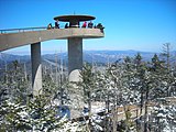
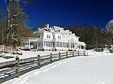
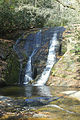
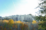
The trail currently[ when? ] passes or is planned to pass through several notable natural areas in North Carolina. This list notes them from west to east:

These are images of or along the MST going from west to east:

Related Research Articles

<span class="mw-page-title-main">Blue Ridge Parkway</span> Scenic parkway in the United States

The Blue Ridge Parkway is a National Parkway and All-American Road in the United States, noted for its scenic beauty. The parkway, which is America's longest linear park, runs for 469 miles (755 km) through 29 Virginia and North Carolina counties, linking Shenandoah National Park to Great Smoky Mountains National Park. It runs mostly along the spine of the Blue Ridge, a major mountain chain that is part of the Appalachian Mountains. Its southern terminus is at U.S. Route 441 (US 441) on the boundary between Great Smoky Mountains National Park and the Qualla Boundary of the Eastern Band of Cherokee Indians in North Carolina, from which it travels north to Shenandoah National Park in Virginia. The roadway continues through Shenandoah as Skyline Drive, a similar scenic road which is managed by a different National Park Service unit. Both Skyline Drive and the Virginia portion of the Blue Ridge Parkway are part of Virginia State Route 48 (SR 48), though this designation is not signed.

<span class="mw-page-title-main">Pilot Mountain (North Carolina)</span> Mountain in United States of America

Pilot Mountain, a metamorphic quartzite monadnock rising to a peak 2,421 feet (738 m) above sea level, is one of the most distinctive natural features in the U.S. state of North Carolina. It is a remnant of the ancient chain of Sauratown Mountains. The Saura Native Americans, the region's earliest known inhabitants, called the mountain "Jomeokee", meaning "great guide".

<span class="mw-page-title-main">Geography of North Carolina</span> Geography of the US state of North Carolina

The geography of North Carolina falls naturally into three divisions — the Appalachian Mountains in the west, the central Piedmont Plateau, and the eastern Atlantic Coastal Plain. North Carolina covers 53,819 square miles (139,391 km2) and is 503 miles (810 km) long by 150 miles (241 km) wide. The physical characteristics of the state vary from the summits of the Smoky Mountains, an altitude of near seven thousand feet (2,130 m) in the west, sloping eastward to sea level along the coast and beaches of the Atlantic Ocean.

<span class="mw-page-title-main">Falls Lake State Recreation Area</span>

Falls Lake State Recreation Area is a North Carolina state park in Durham and Wake counties, North Carolina in the United States. Near Wake Forest, North Carolina, it covers 5,035 acres (20.38 km2) along the shores of 12,410-acre (50.2 km2) Falls Lake.

<span class="mw-page-title-main">Gorges State Park</span> State park in North Carolina, United States

Gorges State Park is a 7,709-acre (31.20 km2) North Carolina state park in Transylvania County, North Carolina in the United States and along with other conservation lands is part of a 100,000+ acre conservation corridor stretching some 80 miles along the NC/SC state line. The land, along Jocassee Gorges, was purchased by the state from Duke Energy Corporation in 1999. It is North Carolina's westernmost state park and one of the state's newest. The park is adjacent to part of the Pisgah National Forest and the N.C. Wildlife Resources Commission's Toxaway Game Land. Gorges State Park provides the principal access to the Horsepasture River on these adjoining public lands.

<span class="mw-page-title-main">Hanging Rock State Park</span> State park in North Carolina, United States

Hanging Rock State Park is a 9,011-acre (3,647 ha) North Carolina state park in Stokes County, North Carolina in the United States. The park is 30 miles (48 km) north of Winston-Salem and is located approximately 2 miles (3.2 km) from Danbury in Stokes County.

<span class="mw-page-title-main">Morrow Mountain State Park</span> State park in North Carolina, United States

Morrow Mountain State Park is a state park in Stanly County, North Carolina, U.S. Located near Albemarle, the park includes 5,881 acres (23.80 km2) within the Uwharrie Mountains.

<span class="mw-page-title-main">Mount Mitchell State Park</span>

Mount Mitchell State Park is a 4,789-acre (1,938 ha) North Carolina state park in Yancey County, North Carolina in the United States. Established in 1915 by the state legislature, it became the first state park of North Carolina. By doing so, it also established the North Carolina State Parks System within the same bill.

<span class="mw-page-title-main">Mount Pisgah (mountain in North Carolina)</span> Mountain in North Carolina, USA

Mount Pisgah is a mountain in the Appalachian mountain range and part of the Blue Ridge Mountains of North Carolina, United States. The mountain's height is 5,721 feet above sea level, and it sits approximately 15 miles southwest of Asheville, near the crossing of the boundaries of Buncombe, Haywood, Henderson and Transylvania counties. It is located on the border of Buncombe and Haywood counties, close to the point where Henderson and Transylvania meet them, but not actually within the latter two counties. The mountain is easily accessible via a hiking trail from the Blue Ridge Parkway, near the Pisgah Inn.

<span class="mw-page-title-main">Pisgah National Forest</span> National forest in North Carolina

Pisgah National Forest is a National Forest in the Appalachian Mountains of western North Carolina. It is administered by the United States Forest Service, part of the United States Department of Agriculture. The Pisgah National Forest is completely contained within the state of North Carolina. The forest is managed together with the other three North Carolina National Forests from common headquarters in Asheville, North Carolina. There are local ranger district offices located in Pisgah Forest, Mars Hill, and Nebo.

<span class="mw-page-title-main">Western North Carolina</span> Geographic region of the U.S. state of North Carolina

Western North Carolina is the region of North Carolina which includes the Appalachian Mountains; it is often known geographically as the state's Mountain Region. It contains the highest mountains in the Eastern United States, with 125 peaks rising to over 5,000 feet in elevation. Mount Mitchell at 6,684 feet, is the highest peak of the Appalachian Mountains and mainland eastern North America. The population of the region, as measured by the 2010 U.S. Census, is 1,473,241, which is approximately 15% of North Carolina's total population.

The Haw River State Trail is a 80-mile (130 km) long multi-use trail currently being built through the North Carolina Piedmont. The trail follows the path of the Haw River from Haw River State Park on the Rockingham/Guilford County line to Jordan Lake State Recreation Area. The NC General Assembly authorized its addition to the State Trails System in June 2023.

<span class="mw-page-title-main">Julian Price Memorial Park</span>

Julian Price Memorial Park is a park of 4,200 acres (17 km2) at the foot of Grandfather Mountain in North Carolina, named in honor of Julian Price. It is at milepost 297 on the Blue Ridge Parkway and directly adjacent to the Moses H. Cone Memorial Park. Together these parks comprise the largest developed area set aside for public recreation on the Parkway. The park is managed by the National Park Service which received the lands from the Jefferson Pilot Standard Life Insurance Company shortly after Price's death when they received it through his will. The grounds are also known for the fact that the nation's largest National Lumberjack Association rally is held here annually.

<span class="mw-page-title-main">Richland Balsam</span>

Richland Balsam is a mountain in the Great Balsam Mountains in the U.S. state of North Carolina. Rising to an elevation of 6,410 feet (1,950 m), it is the highest mountain in the Great Balsam range, is among the 20 highest summits in the Appalachian range, and is the ninth highest peak in the East of the United States. The Blue Ridge Parkway reaches an elevation of 6,053 feet (1,845 m)— the parkway's highest point— as it passes over Richland Balsam's southwestern slope. The Jackson County-Haywood County line crosses the mountain's summit.

<span class="mw-page-title-main">Neusiok Trail</span>

The Neusiok Trail is a 20.4-mile (32.8 km) hiking trail located in the Croatan National Forest in Carteret County, North Carolina. The trail traverses the forest from a sandy beach on the Neuse River to a salt marsh on the Newport River, and along the way, it crosses cypress swamps, hardwood ridges, longleaf-pine savannah and pocosin—shrubby bogs The entire Neusiok is part of the Mountains-to-Sea Trail (MST) which spans North Carolina, and the MST in the Croatan is a designated National Recreation Trail.

<span class="mw-page-title-main">Tanawha Trail</span>

The Tanawha Trail, stretching 13.5 miles (21.7 km) from Julian Price Park to Beacon Heights parallels the Blue Ridge Parkway on Grandfather Mountain in North Carolina, in the United States. Tanawha, the Cherokee word for fabulous hawk or eagle is an appropriate name for this trail that offers hikers views of distant mountains. Completed in 1993, the Tanawha Trail, like the final section of the Parkway it mirrors, is unique in construction. The trail traverses a fragile and ancient ecosystem and leads hikers through a surprising range of biological and geological terrains. Some sections tunnel through thickets of laurel and rhododendron. Others dip down into remote hardwood coves and then ascend into evergreen glens. Boulder fields and cascading streams punctuate the landscape.

<span class="mw-page-title-main">Doughton Park</span>

The Glenwood Cluster is a region in the George Washington and Jefferson National Forests recognized by The Wilderness Society for its rich biodiversity, scenery, wildflower displays, cold-water trout streams and horse trails. It offers a unique habitat for rare plants, salamanders and other rare species. The Blue Ridge Parkway and the Appalachian Trail traverse the area, giving ready access with views to the east of the Piedmont region and to the west of the Valley of Virginia.

The Fonta Flora State Trail is a unit of the North Carolina state park system in Buncombe, McDowell, and Burke Counties, North Carolina in the United States, and it consists of 90 acres (36 ha) of conservation land and 19 miles (31 km) designated multi-use trail. The State Trail is planned as a continuous route for hikers and cyclists from Asheville to Morganton, with a loop around Lake James. The trail is a collaboration between local governments, local land conservancies the US Forest Service, and the state, with development coordinated by the North Carolina Division of Parks and Recreation (NCDPR).

<span class="mw-page-title-main">Protected areas of North Carolina</span> North Carolina protected areas

The protected areas of North Carolina cover roughly 3.8 million acres, making up 11% of the total land in the state. 86.5% of this protected land is publicly owned and is managed by different federal and state level authorities and receive varying levels of protection. Some areas are managed as wilderness while others are operated with acceptable commercial exploitation. The remainder of the land is privately owned, but willingly entered into conservation easement management agreements, or are owned by various nonprofit conservation groups such as the National Audubon Society and The Nature Conservancy. North Carolina contains 1 National Park, and various other federally owned protected land including 2 National Seashores, 5 National Forests, 12 Wildlife Refuges, and the southern half of the Blue Ridge Parkway. North Carolina has an extensive state park system of 42 open units, 35 of which are state parks, 4 that are recreation areas, and 3 staffed state natural areas, along with other designated units managed by the North Carolina Department of Natural and Cultural Resources.

References

  1. "Session Law 2000-157". Raleigh, North Carolina: General Assembly of North Carolina. August 2, 2000. Section 1. Retrieved March 4, 2019. The General Assembly authorizes the Department of Environment and Natural Resources to add the Mountains to Sea State Park Trail to the State Parks System as provided in G.S. 113-44.14(b).
  2. 1 2 "Size of the North Carolina State Parks System" (PDF). North Carolina Division of Parks and Recreation. January 1, 2013. pp. 1–4. Archived from the original (PDF) on April 6, 2011. Retrieved March 20, 2013.