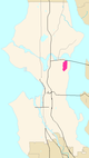
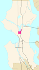
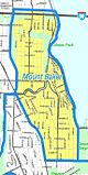
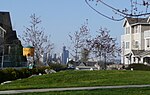
The city of Seattle, Washington, contains many districts and neighborhoods. The city's former mayor Greg Nickels has described it as "a city of neighborhoods".[1][2][3] Early European settlers established widely scattered settlements on the surrounding hills, which grew into neighborhoods and autonomous towns. Conurbations tended to grow from such towns or from unincorporated areas around trolley stops during the 19th and early 20th centuries; the city has consequently suffered from transportation and street-naming problems.[4]
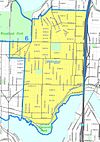
This 1909 map of Seattle shows many neighborhood names that remain in common use today—for example, Ballard, Fremont, Queen Anne Hill, Capitol Hill, West Seattle, and Beacon Hill—but also many that have fallen out of use—for example, "Ross" and "Edgewater" on either side of Fremont, "Brooklyn" for today's University District, and "Renton Hill" near the confluence of Capitol Hill, First Hill, and the Central DistrictEarly annexations to Seattle
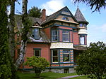
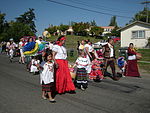
Seattle was established during an economic boom fueled by the timber industry; its early years were characterized by hasty expansion and development, under which residential areas were loosely defined by widely scattered plats.[5] This arrangement was further solidified by the establishment of locally initiated community clubs, public libraries, public schools, and public parks, which created a sense of community and civic participation.[citation needed] At the beginning of the 20th century, Seattle's community clubs became influential in the organization of public improvements. These had a significant effect upon the character of their neighborhoods and allowed them to remain distinct from the surrounding areas.[6][7] Some community clubs used covenants to restrict the ethnicity of residents.[8]
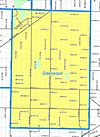
Establishing public library branches can define districts as well as neighborhoods. Public libraries are among the most heavily used buildings.[9] Seattle elected its city council at large from 1910 to 2014, and community clubs lobby councilors for the interests of local residents– such as for a library branch. The community organizations build a voting constituency, and in so doing define a neighborhood. In the absence of ward politics, this and campaign finance legislation are seen as more open alternatives. The Greenwood-Phinney Commercial Club was particularly active in organizing toward the Greenwood branch that opened in 1928.[10] The Lake City Branch Library opened in 1935 as a few shelves of books in part of a room in Lake City School, shared with the Works Progress Administration (WPA), sponsored by the Pacific Improvement Club community group. The library moved into a new building in 1955.[11]
Elementary public schools effectively defined many neighborhoods, which are often synonymous with the name of the elementary school when the neighborhood and school were established. Many of the neighborhoods contain a few smaller neighborhoods. Mann and Minor neighborhoods in the Central District, were built around their schools. The University Heights school (1903) in the north of the University District was named for the neighborhood, as was the Latona School (1906) in Wallingford.[12][13][14]
Parks similarly define some neighborhoods. Madrona Beach and Cowen and Ravenna Parks were privately established to encourage residential development upon otherwise unusable land.[15] The plan for Olmsted Parks fulfilled its goal and significantly influenced the character of neighborhoods around parks and playgrounds.[16] East Phinney and West Meridian neighborhoods are sometimes called Woodland Park, as well as South Green Lake or North Wallingford for Meridian.[17]
Covenants and racial restrictions
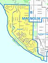
Housing covenants became common in the 1920s and were validated by the U.S. Supreme Court in 1926. Minorities were effectively limited to the International District and parts of some neighborhoods in south-east Seattle for Asian- and Native Americans; or the Central District for people of African ancestry, clearly defining those neighborhoods.[18] Ballard– Sunset Hill, Beacon Hill, Broadmoor, Green Lake, Laurelhurst, Magnolia, Queen Anne, South Lake City, and other Seattle neighborhoods and blocks had racially or ethnically restrictive housing covenants, such as the following sample:
No person or persons of [any of several minorities] blood, lineage, or extraction shall be permitted to occupy a portion of said property ... except a domestic servant or servants who may actually and in good faith be employed by white occupants.[19]
Further restrictions on conveyance (rental, lease, sale, transfer) were often included, effectively defining most of the neighborhoods in Seattle during the first decades after establishment.
The Supreme Court ruled in 1948 that racial restrictions would no longer be enforced. The Seattle Open Housing Ordinance became effective in 1968. Although unenforceable, legal complications prevent the covenants from being expunged from property title documents.[19][20]
Wards and Little City Halls
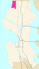
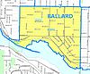
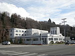
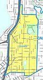
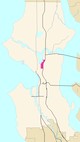
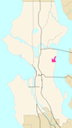
Seattle initially adopted a ward system; however, in 1910, this system was replaced by non-partisan, at-large representation. Variations on ward systems were proposed and rejected in 1914,[21] 1926,[22] 1974, 1995,[23] and 2003[24] and convictions for campaign-related money laundering followed the 1995 campaign.[25] Critics claimed that district-style elections of the city council would result in Tammany Hall-style politics. In 1973, inspired by Boston's model, Mayor Wes Uhlman's administration implemented a system of Little City Halls, where Community Service Centers (CSCs) assumed responsibility for coordinating municipal services. Uhlman's political opponents called the CSCs a thinly disguised ward system designed to promote Uhlman's reelection.[26] CSCs became a setting for political arguments between the city council and the mayor; controversies over accountability, cronyism, and ward politics occurred in 1974, 1976, and 1988. In 1991 the CSCs were renamed Neighborhood Service Centers (NSCs) and were placed under the jurisdiction of the Department of Neighborhoods.[26] More recently, their number has been reduced. As of 2011, there are NSCs located in Ballard, Lake City, the University District, the Central District, West Seattle, Southeast Seattle, and Delridge.[27]
Local improvement districts
A local improvement district (LID) is a method by which a group of property owners can share the cost of transportation infrastructure improvements. This involves improving the street, building sidewalks and installing stormwater management systems. Without Seattle's LID assessment system, the city would be unable to maintain its rapid growth in population and territory.[28] LIDs have helped define neighborhoods by localizing decisions about issues like sidewalks, vegetation and other features of the public space, permitting neighborhoods to remain distinct from their neighbors. [citation needed]
Informal districts
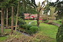
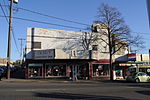
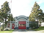
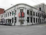
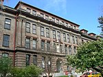
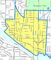
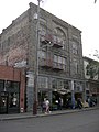
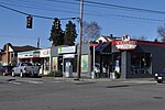
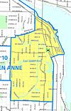
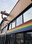
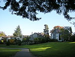
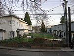
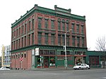
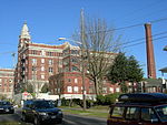
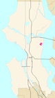
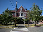
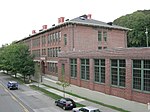
University District Neighborhood Service Center (storefront at right)
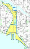
No official neighborhood boundaries have existed in Seattle since 1910.[21][29] Districts and neighborhoods are thus informal;[30] their boundaries may overlap and multiple names may exist for a single district. Boundaries and names can be disputed or change over time. In 2002 a Department of Neighborhoods spokeswoman said, "I've seen my area go from the 'CD' to 'Madrona' to 'Greater Madison Valley' and now 'Madrona Park.' "[3] Some neighborhoods, such as northwest Seattle, do not have widely recognized names for their greater districts.
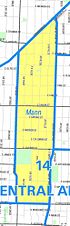
Throughout Seattle one can find signs indicating the boundaries of neighborhoods; the locations of these signs have been specified by the city's many community councils. However, the boundaries suggested by these signs routinely overlap and differ from delineations on maps. For example, signs indicate that Lake City Way NE is the southeastern boundary of the Maple Leaf neighborhood,[31][32] while the city clerk's archival map places that district's southern boundary at 85th Street.[33]
Another example of boundary ambiguity is "Frelard," which local residents call the area shared by Fremont and Ballard between 3rd and 8th Avenues NW. Signs facing opposite directions on NW Leary Way reveal the overlap.[12]
Further difficulty in defining neighborhoods can result from residents' identification with neighborhoods different from those marked on signs and maps. After an acrimonious development dispute in 1966, a group of concerned Wallingford citizens enlisted the University of Washington Community Development Bureau to survey their neighborhood; the survey revealed that more residents of southwest Wallingford considered themselves citizens of Fremont than of Wallingford.[12][13]
Transportation
Minor arterial roads are generally located along the boundaries of neighborhoods, with streets and highways built according to the street classification system.[34] These effectively help define neighborhoods.[35]
Development in accordance with the street classification system maintains the quality of life of city neighborhoods and improves efficiency of the road system. The classification system discourages rat running through local neighborhood streets.[36]
Transportation hubs, such as business zones and transit stations, such as Park and Ride facilities, provide focal points for districts of neighborhoods the same way trolley stops defined neighborhoods before cars.[citation needed]
Designated Historic Districts
The Department of Neighborhoods designates a number of Historic Districts, which have a similar status to Seattle Landmarks. As of 2021[update] these are:
Despite complications in Seattle's system of neighborhoods and districts, the names and boundaries in the following list are generally accepted and widely used.[38] They are based on the Seattle City Clerk's Neighborhood Map Atlas,[39] which in turn is based on a variety of sources, including a 1980 neighborhood map produced by the now-defunct Department of Community Development,[40]Seattle Public Library indexes, a 1984-1986 "Neighborhood Profiles" feature series in the Seattle Post-Intelligencer,[41] numerous park, land use and transportation planning studies, as well as records in the Seattle Municipal Archives.
The following table is largely based on maps from the Seattle City Clerk's Neighborhood Atlas, but also includes designations from other sources.
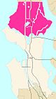
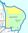
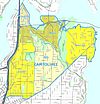
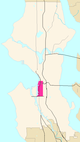
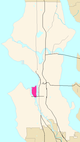
[56] Before annexation to Seattle, Lake City was a township for 5 years.[citation needed] Lake City neighborhoods are now also known as Sand Point-Magnuson Park and neighborhoods northwest of Sand Point.[citation needed]
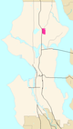
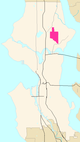
Of the area the Seattle City Clerk's Neighborhood Atlas designates as "Windermere", many consider the area west of Sand Point Way to be a separate neighborhood, Hawthorne Hills.
[70] Known in the 1890s and 1900s as Brooklyn.[71] The main campus of the University of Washington is itself divided into the main (central) campus, plus the large South Campus (south of NE Pacific Street) and East Campus (east of Montlake Boulevard NE), and a smaller North Campus (north of NE 45th Street) and miscellaneous buildings west of 15th Avenue NE that are collectively known as West Campus.[72][73] Beyond the university, the district has a shopping district known as "The Ave" and older neighborhoods such as University Heights and University Park that are nowadays rarely distinguished from the U. District as such.[74]
Primarily, the name 'University Village' refers to a shopping center at a corner of what the City Clerk considers part of Ravenna,[66] but it is also commonly used for the surrounding neighborhood on all sides, which ranges into what the City Clerk's maps consider Ravenna to the north and west and the east portion of the University District to the west. (To the south is the East Campus of the University of Washington.)
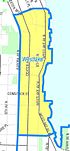
[97] The Seattle City Clerk's Neighborhood Atlas map of the Broadway District shown here extends farther to the east and west than most present-day Seattleites would call Broadway. It appears to correspond roughly the portion of Capitol Hill that falls within the original 1869 city limits, and which was known as Broadway before the name Capitol Hill was introduced.
The Pike-Pine Corridor, running east-west through what the Seattle City Clerk's Neighborhood Atlas considers the "Broadway" District, has gained a strong identity in the early 21st century.
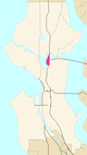
[102] The Seattle City Clerk's Neighborhood Atlas classifies Montlake as part of Capitol Hill, but a valley along Boyer Avenue separates it from the hill.
[103] The name "Stevens" does not have much currency for most of this area except for the immediate vicinity of the Stevens School at 19th Avenue E and E Galer Street. The small neighborhood just north of that is often called Interlaken, after Interlaken Park; the area centered around 19th Avenue and E Madison Street was known in the early 20th century as Renton Hill, but that name has largely passed out of use.
Consisting largely of Interlaken Park and Louisa Boren Park, the neighborhood between Capitol Hill proper and Montlake also contains a small number of private homes and the Seattle Hebrew Academy.
Although the name has largely fallen out of use, the Renton Hill Community Improvement Club, founded June 18, 1901, was Seattle's first community club.[7]
[104] Annexed 1883 south of E Galer St; the remainder in 1891.[44] The Seattle City Clerk's Neighborhood Atlas classifies Madison Park as part of Capitol Hill, but a valley through the Washington Park Arboretum separates it from Capitol Hill proper.
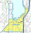
The City Clerk's Neighborhood Atlas uses the term "Cascade" to refer to much of the area around Lake Union (see map here), but that use is not at all common.
The City Clerk's Neighborhood Atlas uses the term "Cascade" to refer to much of the area around Lake Union (see image here), but that use is not at all common.
Cascade, south and east of Lake Union originally extended west to Terry Avenue (though it is now generally considered to end at Fairview,[citation needed] south to Denny Hill (now the Denny Regrade) east to Melrose Avenue E (from which it is through the area now cut off by Interstate 5.[105]
Belltown currently is largely residential with some commercial office buildings, with 1st street containing a large concentration of nightlife dining and drinking establishments. The intersection of 2nd ave and Virginia is the highest point in the Downtown neighbourhood area.
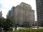
[114] Widely known as "Pill Hill" for its many hospitals, this neighborhood immediately east of Downtown was once the city's most desirable residential area.
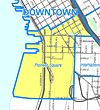
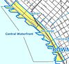
[115] The original center of Seattle, the southwest part of present-day Downtown. Probable origin of the term "Skid Road" for a neighborhood. Includes the Pioneer Square-Skid Road Historic District. Pioneer Square as defined by the City Clerk's Neighborhood Atlas also includes the tide lands platted 1895, filled 1902, that are now the site of two professional sports stadiums.
[116] Includes former tide lands platted 1895, filled 1902.[44] Southeast Downtown. Sometimes referred to as "Chinatown", the neighborhood also includes Little Saigon east of Interstate 5, and remnants of the historic Japantown, especially around 6th Avenue and Main Street.
The downtown area of both the Central Business District and Belltown from roughly halfway between First and Second Avenues to Alaskan Way (but not including the piers themselves) is sometimes called the Seattle's "West Edge".
[122] The name Mann for this area around Garfield High School does not have much currency. It comes from the old Horace Mann School, later Nova, just north of Garfield.
[136] The lakeshore next to this neighborhood was once called Brighton Beach, but has since been subsumed into Seward Park in common parlance and according to the Seattle City Clerk's Neighborhood Map Atlas[citation needed]
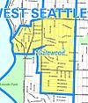
The northern part of the Seward Park neighborhood is sometimes referred to as "Lakewood"; the entire neighborhood also sometimes referred to as "Lakewood/Seward Park". The historic Lakewood Community Club is now called the Lakewood/Seward Park Community Club.[citation needed]
[148]Tide lands west of Beacon Hill platted 1895, filled 1902. Other portions annexed 1907 along with West Seattle, Southeast Seattle, and South Park; 1910 with Georgetown.[44]
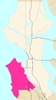
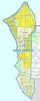
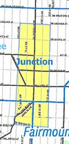
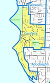
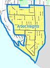
[152] Tide lands platted 1895, filled 1902 (although the Seattle City Clerk's Neighborhood Atlas places even the tidelands on the west side of the Duwamish in the Industrial District rather than West Seattle). West Seattle (including portions of Delridge) was a town for 5 years before being annexed in 1907.[44] Some additional annexations 1950, 1954, and 1956, mainly in Arbor Heights.[137]
Seattle annexed eight municipalities between 1905 and 1910, nearly doubling the area size of the city. Annexations by law were begun by the annexee and had to be approved by the Seattle City Council. The appeal of the inexpensive and accessible electric power and water system services of the public utilities were the primary motivations for the annexation movements.
Ballard was its own incorporated town for 17 years, annexed as its own ward. West Seattle incorporated in 1902, then annexed Spring Hill, Riverside, Alki Point, and Youngstown districts. It was the largest of the incorporated towns to be annexed. Southeast Seattle merged the towns of Hillman City and York with other Rainier Valley neighborhoods, then incorporated for the only reason of being annexed.[170] Similarly, the town of South Seattle consisted of mostly industrial Duwamish Valley neighborhoods (except Georgetown); one enclave adjacent to Georgetown omitted at this time was annexed 1921; some land near the river in this area remains part of unincorporated King County. In 1910 Georgetown was the last of this sequence of small incorporated cities and towns to be annexed to Seattle before the 1954 annexation of Lake City.
The following previously incorporated cities and towns were annexed by Seattle. This list is in order of annexation. Other areas annexed to Seattle, were unincorporated before annexation. Examples of the latter include the northern part of Queen Anne Hill, the University District, and the northern area of the city that were once part of then-unincorporated Shoreline.
Town of South Seattle, incorporated 1905, annexed 20 October 1905.
City of Columbia (Columbia City), incorporated 1892, annexed 3 May 1907
Town of Ravenna, incorporated 1906, annexed 15 January 1907
Southeast Seattle—Hillman City, York, and other Rainier Valley neighborhoods except Columbia City—incorporated July 1906, annexed 7 January 1907
Town of South Park, incorporated 1902, annexed 3 May 1907.
City of Ballard, incorporated January 1890, annexed 29 May 1907
City of West Seattle, incorporated April 1902, annexed 24 July 1907
Because of the cost of providing city services, low-density residential neighborhoods represent a net revenue loss for municipalities.[172] Because vehicle-license revenue is no longer used to subsidize unincorporated areas, these neighborhoods have become increasingly orphaned.[citation needed]
In April 2004, the City Council voted to defer a decision on Mayor Nickels' proposal to designate the West Hill and North Highline neighborhoods, part of unincorporated King County, as potential annexation areas (PAAs) for at least a year. Because of the tax revolt that took place in Washington in the late 1990s and early 21st century, the county's budget has been reduced and the county has said it is unlikely to be able to maintain adequate levels of funding for urban services in unincorporated areas. The nearby city of Burien, however, has issued a 2004 draft report for its own annexation of all or part of North Highline.
↑ Phelps, p. 34; Chapter 16, "Street Names and House Numbering", pp. 225-235; Chapter 15, "Annexation", pp. 216–224, map "to 1921", p. 217; map "to 1975", p. 224, map key table pp.222-3.
↑ Wilma, David (May 21, 2001). "Seattle Landmarks: West Queen Anne Walls (1913)". HistoryLink.org Essay 3198. Retrieved April 21, 2006. Cf. "West Queen Anne Walls, 'W'". Historic Preservation:: Department of Neighborhoods > Individual Landmarks & the Designation Process > Landmarks A-Z. May 21, 2006. Retrieved April 21, 2006.
1 2 Gregory, James (2004–2011). "Segregated Seattle". Seattle Civil Rights and Labor History Project. The University of Washington. Retrieved April 18, 2011.
↑ Maria Christensen, Newcomer's Handbook for Moving to and Living in Seattle: Including Bellevue, Redmond, Everett, and Tacoma, Newcomer's Handbooks, First Books, 2007, ISBN0-912301-73-2. p. 17. "Unlike many other major cities, Seattle neighborhoods do not have official borders."
↑ Other well-documented interpretations of names and boundaries of Seattle's neighborhoods can be found in the following:
"Seattle Neighborhoods" from the HistoryLinkEncyclopedia of Washington State History (particularly their "Thumbnail Histories", many of which reference records of neighborhood organizations and public library branches).
Myra Phelps, A Narrative History (a history of Seattle through Engineering Department records and notes).
The "Neighbors"[dead link] project of the Seattle Post-Intelligencer (1996-2000), currently updated as the "Webtowns" section of the online Post-Intelligencer.
Neighborhood articles in the archives of the Post-Intelligencer,The Times, and local district newspapers. (Post-Intelligencer archives before 1986 are not available online. The Seattle Times archives before 1990 are not available online.)
↑ "List of Neighborhoods". Seattle City Clerk's Neighborhood Map Atlas. Retrieved April 29, 2009. Shenk, Pollack, Dornfeld, Frantilla, and Neman (authors of the Seattle Atlas) drew largely upon primary sources. Phelps is also a high quality secondary source, since much of her sources were Department archives of official documents and reports, in addition to professional journal articles, as well as books and articles back to the early 20th century. Phelps and Shenk et al. have complete citations in this article's Bibliography. The Seattle City Clerk's Neighborhood Map Atlas was "not designed or intended as an 'official' City of Seattle neighborhood map ... [but] to define neighborhood district names and boundaries in a way that improves document indexing and retrieval." As such, some of its designations have no existence outside of the city's map and indexing system, such as Pike Market (Pike Place Market in actuality), Mann, Minor, and Mid Beacon Hill. In addition, the map's attempt to reduce the number of top-level districts has led to certain discrepancies from facts on the ground, such as Harrison/Denny-Blaine being included in the Central District and Madison Park being included in Capitol Hill.
↑ The Seattle Post-Intelligencer's "Neighborhood Profiles" are not available online. The concept has been revisited 1996-2000 as the "Neighbors"[dead link] project, currently updated as the "Webtowns" section.
↑ [1869] means part of Seattle as incorporation, December 1869. Otherwise, year listed is actual annexation, not the date of the prerequisite enabling city ordinance. The State Legislature incorporated the town of Seattle in January 1865, disincorporated January 1867 after petition, reincorporated December 1869. The initial incorporation was with a board of trustees. The second incorporation was with a mayor and town council. Lange, Greg; Tate, Cassandra (November 4, 1998). "Legislature incorporates the Town of Seattle for the first time on January 14, 1865". HistoryLink.org Essay 168. Retrieved April 21, 2006.
↑ Parts of Crown Hill annexed 1907 as part of Ballard
↑ Crown Hill, Seattle City Clerk's Neighborhood Atlas. Retrieved April 24, 2011.
↑ Greenwood, Seattle City Clerk's Neighborhood Atlas. Retrieved April 24, 2011.
1 2 3 4 5 Northgate, Seattle City Clerk's Neighborhood Atlas. Retrieved April 24, 2011.
↑ Haller Lake, Seattle City Clerk's Neighborhood Atlas. Retrieved April 24, 2011.
↑ Pinehurst, Seattle City Clerk's Neighborhood Atlas. Retrieved April 24, 2011.
↑ North College Park, Seattle City Clerk's Neighborhood Atlas. Retrieved April 24, 2011.
↑ Maple Leaf, Seattle City Clerk's Neighborhood Atlas. Retrieved April 24, 2011.
1 2 3 4 5 6 Lake City, Seattle City Clerk's Neighborhood Atlas. Retrieved April 24, 2011.
↑ Cedar Park, Seattle City Clerk's Neighborhood Atlas. Retrieved April 24, 2011.
↑ Matthews Beach, Seattle City Clerk's Neighborhood Atlas. Retrieved April 24, 2011.
↑ Meadowbrook, Seattle City Clerk's Neighborhood Atlas. Retrieved April 24, 2011.
↑ Olympic Hills, Seattle City Clerk's Neighborhood Atlas. Retrieved April 24, 2011.
↑ Victory Heights, Seattle City Clerk's Neighborhood Atlas. Retrieved April 24, 2011.
↑ Wedgwood, Seattle City Clerk's Neighborhood Atlas. Retrieved April 24, 2011.
↑ View Ridge, Seattle City Clerk's Neighborhood Atlas. Retrieved April 24, 2011.
↑ Sand Point, Seattle City Clerk's Neighborhood Atlas. Retrieved April 24, 2011.
↑ Roosevelt, Seattle City Clerk's Neighborhood Atlas. Retrieved April 24, 2011.
1 2 Ravenna, Seattle City Clerk's Neighborhood Atlas. Retrieved April 24, 2011.
↑ Bryant, Seattle City Clerk's Neighborhood Atlas. Retrieved April 24, 2011.
↑ Windermere, Seattle City Clerk's Neighborhood Atlas. Retrieved April 24, 2011.
↑ Laurelhurst, Seattle City Clerk's Neighborhood Atlas. Retrieved April 24, 2011.
↑ Windermere, Seattle City Clerk's Neighborhood Atlas. Retrieved April 24, 2011.
↑ Souvenir guide of the Alaska-Yukon-Pacific Exposition– held at Seattle, Washington, June 1st to October (Seattle 1909), p.11. Image online.
↑ "Northeast Campus Map". UW Home > UWIN > About the UW > Campus Maps. University of Washington Computing and Communications, Facilities Services. May 5, 2010. Retrieved April 18, 2011.
↑ Publication Services & UW Facility Services (July 1996). The University of Washington Campus & Vicinity (map). Seattle: University of Washington.
↑ University of Washington Publication Services (September 1991). The University of Washington Campus & Vicinity (map). Seattle: University of Washington. Compiled, designed, drafted in cooperation between Physical Plant and the Department of Geography, August 1971, revised Sherman (August 1991).
↑ Wallingford, Seattle City Clerk's Neighborhood Atlas. Retrieved April 24, 2011.
↑ Green Lake, Seattle City Clerk's Neighborhood Atlas. Retrieved April 24, 2011.
↑ Fremont, Seattle City Clerk's Neighborhood Atlas.
↑ Erica C. Barnett, The Death of Pike/Pine, The Stranger, November 29, 2006. Retrieved June 17, 2011.
↑ A somewhat cryptic older note here says "1891, E of 15th, N of E Galer, N of E Lynn, 1891, Phelps. 1950, 1952, 1953.[citation needed]This needs clarification: This would have the farthest part of Montlake from the city center annexed in 1891, and the rest more than half a century later.
↑ Montlake, Seattle City Clerk's Neighborhood Atlas.
↑ Stevens, Seattle City Clerk's Neighborhood Atlas.
↑ Portage Bay, Seattle City Clerk's Neighborhood Atlas.
↑ Mann, Seattle City Clerk's Neighborhood Atlas. Retrieved May 11, 2011.
↑ Minor, Seattle City Clerk's Neighborhood Atlas. Retrieved May 11, 2011.
↑ Atlantic, Seattle City Clerk's Neighborhood Atlas. Retrieved May 11, 2011.
↑ Merritt, Mike; Goldsmith, Steven (July 13, 1994). "The neighborhood that time forgot". Neighbors, History and background on Judkins Park, Neighbors project. Seattle Post-Intelligencer. Retrieved April 21, 2006.[dead link]
↑ Judkins Foundation (February 9, 1999). "Where is Judkins Park?". Judkins Park Review. City of Seattle. Archived from the original on March 23, 2006. Retrieved April 21, 2006.
↑ Madrona, Seattle City Clerk's Neighborhood Atlas. Retrieved May 11, 2011.
↑ Brighton, Seattle City Clerk's Neighborhood Atlas. Retrieved May 11, 2011.
1 2 3 4 Cline, Scott, City Archivist (2006). "Annexed Cities (9100)". "Seattle Municipal Archives Record Descriptions", A Guide To The Archives Of The City Of Seattle, second edition. Office of the Seattle City Clerk. Archived from the original on September 26, 2007. Retrieved April 21, 2006.{{cite web}}: CS1 maint: multiple names: authors list (link)
↑ Dunlap, Seattle City Clerk's Neighborhood Atlas. Retrieved May 12, 2011.
↑ Rainier Beach, Seattle City Clerk's Neighborhood Atlas. Retrieved May 12, 2011.
↑ Rainier View, Seattle City Clerk's Neighborhood Atlas. Retrieved May 12, 2011.
↑ Seward Park, Seattle City Clerk's Neighborhood Atlas. Retrieved May 12, 2011.
1 2 3 4 5 Beacon Hill, Seattle City Clerk's Neighborhood Atlas. Retrieved May 12, 2011.
↑ North Beacon Hill, Seattle City Clerk's Neighborhood Atlas. Retrieved May 13, 2011.
↑ Mid Beacon Hill, Seattle City Clerk's Neighborhood Atlas. Retrieved May 13, 2011.
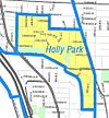
1 2 Holly Park, Seattle City Clerk's Neighborhood Atlas. Retrieved May 13, 2011.
1 2 (Untitled page), NewHolly community section of seattlehousing.org (SHA). Retrieved May 13, 2011.
1 2 South Beacon Hill, Seattle City Clerk's Neighborhood Atlas. Retrieved May 13, 2011.
↑ Alki, Seattle City Clerk's Neighborhood Atlas. Retrieved May 13, 2011.
1 2 North Admiral, Seattle City Clerk's Neighborhood Atlas. Retrieved May 13, 2011.
1 2 North Admiral, Seattle City Clerk's Neighborhood Atlas. Retrieved May 13, 2011.
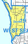
1 2 Seaview, Seattle City Clerk's Neighborhood Atlas. Retrieved May 13, 2011.
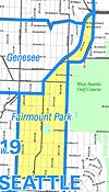
↑ Fairmount Park, Seattle City Clerk's Neighborhood Atlas. Retrieved May 13, 2011.
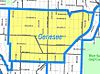
↑ Genesee, Seattle City Clerk's Neighborhood Atlas. Retrieved May 13, 2011.
↑ Gatewood, Seattle City Clerk's Neighborhood Atlas. Retrieved May 13, 2011.
↑ Fauntleroy, Seattle City Clerk's Neighborhood Atlas. Retrieved May 13, 2011.
↑ Arbor Heights, Seattle City Clerk's Neighborhood Atlas. Retrieved May 13, 2011.
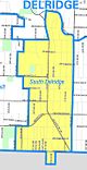
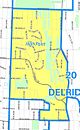
1 2 Delridge, Seattle City Clerk's Neighborhood Atlas. Retrieved May 14, 2011.
1 2 North Delridge, Seattle City Clerk's Neighborhood Atlas. Retrieved May 14, 2011.
↑ Who We Are, pigeonpoint.org (Pigeon Point Neighborhood Council). Retrieved May 15, 2011.
1 2 Riverview, Seattle City Clerk's Neighborhood Atlas. Retrieved May 14, 2011.
1 2 Highland Park, Seattle City Clerk's Neighborhood Atlas. Retrieved May 14, 2011.
1 2 South Delridge, Seattle City Clerk's Neighborhood Atlas. Retrieved May 15, 2011.
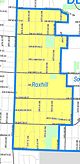
1 2 Roxhill, Seattle City Clerk's Neighborhood Atlas. Retrieved May 15, 2011.
1 2 High Point, Seattle City Clerk's Neighborhood Atlas. Retrieved May 15, 2011.
↑ Rainier Valley neighborhoods south of Hanford Street to Rainier Beach at Kenyon Street, generally east of 24th Avenue S. - Phelps, pp. 216–218, 222–224
"Ballard". Seattle City Clerk's Neighborhood Map Atlas. June 13–17, 2002. Retrieved April 21, 2006. Maps "NN-1120S", "NN-1130S", "NN-1140S".Jpg [sic] dated 13 June; "NN-1030S", "NN-1040S".jpg dated 17 June 2002.
"Downtown". Seattle City Clerk's Neighborhood Map Atlas. June 13–17, 2002. Retrieved April 21, 2006. Maps "NN-1120S", "NN-1130S", "NN-1140S".Jpg [sic] dated 13 June; "NN-1030S", "NN-1040S".jpg dated 17 June 2002.
"Map home". Seattle City Clerk's Neighborhood Map Atlas. June 13–17, 2002. Retrieved April 21, 2006. Full city map, not titled. Maps "NN-1120S", "NN-1130S", "NN-1140S".Jpg [sic] dated 13 June; "NN-1030S", "NN-1040S".jpg dated 17 June 2002.
"Lake City". Seattle City Clerk's Neighborhood Map Atlas. Office of the Seattle City Clerk. June 17, 2002. Retrieved April 21, 2006.
"Neighborhood Resources". Department of Neighborhoods. City of Seattle. 2005. Archived from the original on February 23, 2006. Retrieved April 21, 2006.
"List of Neighborhoods". Seattle City Clerk's Neighborhood Map Atlas. Retrieved April 21, 2006. Hierarchical list of neighborhoods by districts, largely in geographical order from north to south.
"Northgate". Seattle City Clerk's Neighborhood Map Atlas. Office of the Seattle City Clerk. June 17, 2002. Retrieved April 21, 2006.
"PDF Note". Principal, Minor and Collector arterials. Seattle Department of Transportation. 2005. Archived from the original on June 14, 2006. Retrieved April 21, 2006.
Phelps, Myra L. (1978). Public works in Seattle. Seattle: Seattle Engineering Department. ISBN0-9601928-1-6.
"Rainier Valley, map". Seattle City Clerk's Neighborhood Map Atlas. Office of the Seattle City Clerk. June 13–17, 2002. Retrieved April 21, 2006. Maps "NN-1030S", "NN-1040S".jpg 17 June 2002, maps "NN-1120S", "NN-1130S", "NN-1140S".Jpg [sic] 13 June.
Shenk, Carol; Pollack, Laurie; Dornfeld, Ernie; Frantilla, Anne; Neman, Chris (June 26, 2002). "About neighborhood maps". Seattle City Clerk's Office Neighborhood Map Atlas. Information Services, Seattle City Clerk's Office. Retrieved April 21, 2006. Sources for this atlas and the neighborhood names used in it include a 1980 neighborhood map produced by the Department of Community Development (relocated to the Department of NeighborhoodsArchived February 23, 2006, at the Wayback Machine and other agencies), Seattle Public Library indexes (Special Collections, Seattle Collection in the Seattle Room), a 1984-1986 Neighborhood Profiles feature series in the Seattle Post-Intelligencer, numerous parks, land use and transportation planning studies, and records in the Seattle Municipal Archives. [Maps "NN-1120S", "NN-1130S", "NN-1140S".Jpg [sic] dated 13 June 2002; "NN-1030S", "NN-1040S".jpg dated 17 June 2002.] "The Neighbors[dead link] project was published weekly in the Seattle Post-Intelligencer from 1996 to 2000. The page remained available for archival purposes for some years after being superseded by the P-I's Webtowns section.
"Webtowns". Seattle Post-Intelligencer. Retrieved April 21, 2006.
Further reading
Detailed city map, Seattle City Clerk's Office Neighborhood Map Atlas. Detailed city map, otherwise not titled. Click on a number or name for the more detailed north, central, or south city map or a map of a selected neighborhood.
"Seattle City Clerk Thesaurus". April 19, 2004. Archived from the original on February 9, 2006. Retrieved April 21, 2006. Provides a language for indexing and retrieving legislation and other records in the City Clerk's Office. For more details on how to use the thesaurus, read the Introduction.
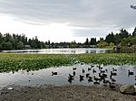
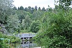
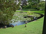
The Union Bay Natural Area (UBNA) in Seattle, Washington, also known as Union Bay Marsh, is the restored remainder of the filled former Union Bay and Union Bay Marsh. It is located at the east end of the main University of Washington campus, south of NE 45th Street and west of Laurelhurst. Ravenna Creek is connected to University Slough, thence to Union Bay, and Lake Washington. Drainage Canal is one of three or four areas of open water connected with Lake Washington around Union Bay Marsh. The canal extends from NE 45th Street, between the driving range and IMA Sports Field 1, south to the bay, ending southeast of the Husky Ballpark baseball grandstand. The Drainage Canal that carries Ravenna Creek past UBNA to Union Bay is locally sometimes called University Slough.
Union Bay is a body of water located in Seattle, Washington. Part of Lake Washington, it is bounded by the Laurelhurst neighborhood to the north and the Montlake and Madison Park neighborhoods to the south. The Evergreen Point Floating Bridge, which carries State Route 520, crosses over a portion of the bay.
Roosevelt is a neighborhood in north Seattle, Washington. Its main thoroughfare, originally 10th Avenue, was renamed Roosevelt Way upon Theodore Roosevelt's death in 1919. The neighborhood received the name as the result of a Community Club contest held eight years later, in 1927.
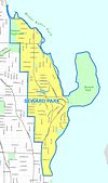
Seward Park is a neighborhood in southeast Seattle, Washington just west of the park of the same name. It is part of Seattle's South End. The park occupies all of Bailey Peninsula.
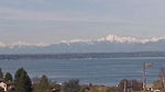
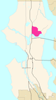
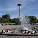
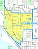
Queen Anne is a neighborhood and geographic feature in Seattle, Washington, United States, located northwest of downtown. Queen Anne covers an area of 7.3 square kilometers (2.8 sq mi), and has a population of about 28,000. It is bordered by Belltown to the south, Lake Union to the east, the Lake Washington Ship Canal to the north and Interbay to the west.
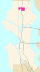
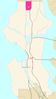
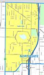
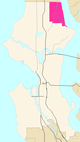
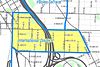
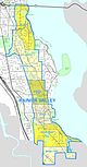
Northgate is a neighborhood in north Seattle, Washington, named for and surrounding Northgate Mall, the first covered mall in the United States. Its north-south principal arterials are Roosevelt Way NE and Aurora Avenue N, and its east-west principal arterials are NE Northgate Way and 130th Street. Minor arterials are College Way-Meridian Avenue N, 1st, 5th, and 15th avenues NE. Interstate 5 runs through the district. Besides the eponymous mall, the most characteristic distinctions of the area are North Seattle College (NSC) and the south fork of the Thornton Creek watershed and Seattle Kraken Iceplex center.
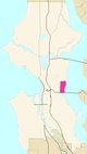
University Village is a shopping mall in Seattle, Washington, United States, located in the south corner of the Ravenna neighborhood to the north of the Downtown area. It is an open-air shopping center which offers restaurants, locally owned boutiques, and national retailers, and is a popular retail destination in the region for home furnishings, popular fashions, gift items, and restaurants.
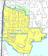
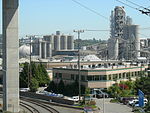
The Industrial District is the principal industrial area of Seattle, Washington. It is bounded on the west by the Duwamish River and Elliott Bay, beyond which lies Delridge of West Seattle; on the east by Interstate 5, beyond which lies Beacon Hill; on the north by S King and S Dearborn Streets, beyond which lie Pioneer Square and southwest International District of Downtown; and on the south by the main lines of the BNSF Railway and Union Pacific Railroad, or about S Lucille Street, beyond which is Georgetown. SoDo is the name of the northwest portion of the neighborhood, named for its being South of Downtown. SoDo is the location of T-Mobile Park, home of the Seattle Mariners, and Lumen Field, home of the Seattle Seahawks and Seattle Sounders FC. Lumen Field was also the site of the former Kingdome.
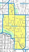
Ravenna is a neighborhood in northeastern Seattle, Washington named after Ravenna, Italy. Though Ravenna is considered a residential neighborhood, it also is home to several businesses, many of which are located in the University Village, a shopping mall.
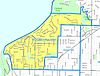
Beacon Hill is a hill and neighborhood in southeast Seattle, Washington. It is roughly bounded on the west by Interstate 5, on the north by Interstate 90, on the east by Rainier Avenue South, Cheasty Boulevard South, and Martin Luther King Junior Way South, and on the south by the Seattle city boundary. It is part of Seattle's South End.
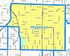
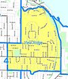
Wedgwood is a middle class residential neighborhood of northeast Seattle, Washington with a modest commercial strip. Wedgwood is located about two miles (3.2 km) north, and slightly east, of the University of Washington; it is about six miles (9.7 km) northeast of Downtown. The neighborhood is further typical of Seattle neighborhoods in having more than one name and having different, overlapping, but well-documented definitions of the neighborhood.
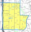
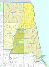
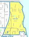
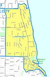
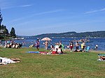
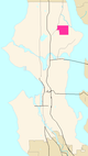
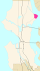
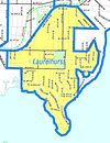
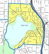
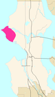
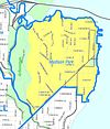
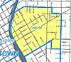
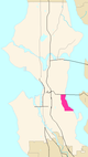
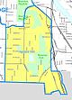
Lake City is the northeast region of Seattle, centered along Lake City Way NE (SR-522), 7–8 miles (11–13 km) northeast of Downtown Seattle. A broader definition of the Lake City area includes all the land between 15th Avenue NE and Lake Washington, and between NE 95th and 98th streets to the Seattle city limits at NE 145th Street. Lake City encompasses much of the Thornton Creek watershed, the focus of a long restoration campaign by citizens and Seattle Public Utilities staff to enhance the residential environment of Lake City.
Licton Springs or North College Park is a neighborhood in the informal Northgate district of North Seattle. It is bounded by Interstate 5 to the east, beyond which is Maple Leaf neighborhood and the Northgate Mall; Aurora Avenue N to the west, beyond which is Greenwood; N 85th Street to the south, beyond which is Green Lake, and N Northgate Way to the north, beyond which is Haller Lake.
Matthews Beach is a neighborhood in Seattle, Washington; it and Meadowbrook are the southern neighborhoods of the annexed township of Lake City (1954). Matthews Beach lies about 2 miles (3.2 km) northeast of the University of Washington, about 8 miles (13 km) northeast of Downtown.
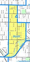
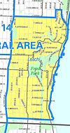
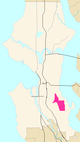
Atlantic is a neighborhood in the Central District of Seattle, Washington, United States. It is the northernmost neighborhood in the Rainier Valley area, located between Mount Baker Ridge and Beacon Hill, and may also be considered part of South Seattle. It is home to the Judkins Park neighborhood.
Rainier Beach is a set of neighborhoods in Seattle, Washington that are mostly residential. Also called Atlantic City, Rainier Beach can include Dunlap, Pritchard Island, and Rainier View neighborhoods.
Northgate Station is an enclosed shopping mall in Seattle, Washington, United States. It is located in the Northgate neighborhood on Interstate 5, adjacent to Northgate Way and Northgate station, a light rail station. The mall is anchored by Barnes & Noble, and Nordstrom Rack.
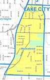
Meadowbrook is a neighborhood in the Lake City district of Seattle, Washington. Meadowbrook is centered on open fields adjacent to the Community Center, Meadowbrook swimming pool, and Nathan Hale High School. It is bounded on the south by NE 95th Street and the Wedgwood neighborhood, on the north by NE 120th Street and Cedar Park, on the west by Lake City Way NE and Victory Heights, and on the east by 35th Avenue NE and Matthews Beach.
The Duwamish tribe is a Native American tribe in western Washington, and the indigenous people of metropolitan Seattle. The Duwamish tribe today includes the People of the Inside (Dxw'Dəw?Abš), for Elliott Bay environs today; and the People of the Large Lake (Xacuabš), for those around Lake Washington of today.
Broadway is a major north–south thoroughfare in Seattle, Washington. The 1.6-mile-long (2.6 km) arterial runs north from Yesler Way at Yesler Terrace through the First Hill and Capitol Hill neighborhoods to East Roy Street. Broadway East continues north to East Highland Drive. North of there the street is made up of shorter segments: one from just south of East Blaine Street to just north of East Miller Street, another from East Roanoke Street to East Shelby Street, and the last from East Allison Street to Fuhrman Avenue East.
This page is based on this Wikipedia article Text is available under the CC BY-SA 4.0 license; additional terms may apply. Images, videos and audio are available under their respective licenses.