Civic services and issues

King County Metro bus routes link Westwood, Delridge, and Thistle with the rest of Seattle.
A popular blog tracks housing development and civic activities in the Westwood area. [1]
Westwood is a neighborhood in Seattle, Washington, United States. It is located in the southwest part of the city known as West Seattle, close to the neighboring CDP of White Center. Westwood is known for its International Baccalaureate high school, Chief Sealth High.
The area is so named because of the huge copses of elm and maple trees in the area, especially along Elmgrove between 35th and 27th.
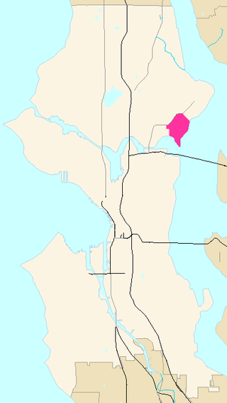
The neighborhood is bounded by Roxhill and Arbor Heights to the south, Highpoint to the north, Delridge to the east and Fauntleroy and Gatewood to the west.
King County Metro bus routes link Westwood, Delridge, and Thistle with the rest of Seattle.
A popular blog tracks housing development and civic activities in the Westwood area. [1]
Westwood is home to numerous parks and greenspaces. Nearby landmarks include the Southwest Pool and Sports Complex, Westwood Village, and Chief Sealth High School. The school was designated an International high school in 2010 (with Denny Middle School receiving the same designation as a middle school). Its curriculum includes languages and multi-cultural education. [2]
Popular nearby attractions include Lincoln Park and Colman Pool, a heated saltwater swimming pool on the banks of Puget Sound.

Algonquin is a village in McHenry and Kane counties, Illinois, in the United States. It is a suburb of Chicago, located approximately 40 miles (64 km) northwest of the Loop. As of the 2020 census, the village's population was 29,700.

Bryn Mawr-Skyway is a census-designated place (CDP) in King County, Washington, United States. The population was 17,397 at the 2020 census.

Shoreline is a city in King County, Washington, United States. It is located between the city limits of Seattle and the Snohomish County border, approximately 9 miles (14 km) north of Downtown Seattle. As of the 2020 census, the population of Shoreline was 58,608, making it the 22nd largest city in the state. Based on per capita income, one of the more reliable measures of affluence, Shoreline ranks 91st of 522 areas in the state of Washington to be ranked.

Haller Lake is a small lake and neighborhood in north central Seattle, Washington, named for Theodore N. Haller, who platted the neighborhood in 1905. His father, Granville O. Haller, was one of Seattle's early settlers, an army officer who amassed a large estate in the region.
Longfellow Creek is a stream in the Delridge district of West Seattle, in Seattle, Washington. It runs about 3.38 miles (5.4 km) from Roxhill Park north to the Duwamish West Waterway at Elliott Bay. The Duwamish called the creek "Smelt", denoting smelt fish. The creek was a traditional fishery dating back to the 14th century.

Green Lake is a neighborhood in north central Seattle, Washington. Its centerpiece is the lake and park after which it is named.

Seward Park is a neighborhood in southeast Seattle, Washington just west of the park of the same name. It is part of Seattle's South End. The park occupies all of Bailey Peninsula.

West Seattle is a conglomeration of neighborhoods in Seattle, Washington, United States. It comprises two of the thirteen districts, Delridge and Southwest, and encompasses all of Seattle west of the Duwamish River. It was incorporated as an independent town in 1902 before being annexed by Seattle five years later. Among the area's attractions are its saltwater beach parks along Elliott Bay and Puget Sound, including Alki Beach Park and Lincoln Park. The area is also known for its views of the Olympic Mountains to the west and the Cascade Range to the east. One-third of Seattle's green space and urban forest is located in West Seattle, much of it in the West Duwamish Greenbelt.

Wallingford is a neighborhood in north central Seattle, lying on a hill above the north shore of Lake Union about four miles from the downtown core. The neighborhood developed quickly during the early 20th century after the establishment of the University of Washington to the east. With trolley tracks laid through the neighborhood as early as 1907, Wallingford is a classic streetcar suburb, typified by its many 1920s era box houses and bungalows. Commercial development is primarily concentrated along North 45th Street where a number of iconic structures stand including the neon "WALLINGFORD" sign, the Wallingford Center, and the original Dick's Drive-In. With its central location, numerous public amenities, including the world-renowned Gas Works Park, and views of both the Olympic and Cascade mountains, Wallingford has long been home to many middle and upper-class families. While Wallingford is mostly residential in nature, the neighborhood's southern edge, along Lake Union, has historically been an industrial and commercial business strip. In recent years, numerous office buildings have been developed as an extension of the burgeoning business center in neighboring Fremont. In 2014 Brooks Sports moved its headquarters from Bothell to a new six-story office building at the southwestern edge of Wallingford.

Greenwood is a neighborhood in north central Seattle, Washington, United States. The intersection of Greenwood Avenue North and North 85th Street is the commercial center. Greenwood is known for its numerous bars, restaurants, coffee houses, theatres and specialty stores. Greenwood's main thoroughfares are Greenwood Avenue North and N. 85th streets.
Laurelhurst is a residential neighborhood in Seattle, Washington, US. It is bounded on the northeast by Ivanhoe Place N.E., beyond which is Windermere; on the northwest by Sand Point Way N.E. and N.E. 45th Street, beyond which are Hawthorne Hills, Ravenna, and University Village; on the west by Mary Gates Memorial Drive N.E., beyond which is the East Campus of the University of Washington; on the southwest by Union Bay; and on the east by Lake Washington. Seattle Children's Hospital is located in its northwest corner. Once a seasonal campground of the Duwamish people, the neighborhood has been a part of Seattle since its annexation in 1910.

Madison Park is a neighborhood in east central Seattle, Washington, United States. It is named after the city park at the foot of Madison Street on the Lake Washington shore. The neighborhood is generally bounded on the east by Lake Washington; on the south by East Prospect Street, beyond which is Denny-Blaine; on the west by Lake Washington Boulevard E.; and on the north by Union Bay. Madison Park generally consists of single-family housing with a small business district near the park.

Delridge is a district in Seattle, Washington, United States that stretches along Delridge Way, an arterial that follows the eastern slope of the valley of Longfellow Creek, from near its source just within the southern city limits north to the West Seattle Bridge over the Duwamish River. It is generally associated with the neighborhing district of West Seattle, or even considered a sub-district of West Seattle.

Mount Baker is a neighborhood in southeast Seattle. The neighborhood's name comes from the view of Mount Baker in Whatcom County, that is seen by looking north over Lake Washington. It is bounded by Lake Washington to the east, Interstate 90 and then Leschi to the north, Rainier Valley to the west, and Columbia City to the south. The neighborhood has a community club and a rowing team. It hosts Seattle's annual Seafair, which includes an airshow featuring the U.S. Navy Blue Angels, hydroplane races, a fireworks show, and other festivities. Franklin High School and Garfield High School serve this area. It is part of Seattle's South End.

Chief Sealth International High School (CSIHS) is a public high school in the Seattle Public Schools district of Seattle, Washington. Opened in 1957 in southern West Seattle, Chief Sealth students comprise one of the most ethnically and culturally diverse student bodies in Washington State. The school is named for Chief Seattle, a Duwamish chief and a recognized leader amongst the local peoples at the time of the arrival of European American settlers in the area. The school shares a campus with Denny International Middle School (DIMS).
The Fairmount Park neighborhood of West Seattle in Seattle, Washington. It runs southwest along both sides of Fauntleroy Way, from SW Graham Street in the south to SW Edmunds Street in the north. Neighborhood features include Fairmount Playfield, a city park, and Fairmount Park Elementary School, part of the Seattle Public Schools system.

Cedar Park is a neighborhood in the Lake City district of Seattle, Washington. The name generally refers to the residential neighborhoods east of Lake City adjoining Lake Washington.

Arbor Heights is a neighborhood in West Seattle, Washington, made up of the area south of SW Roxbury Street, north and east of Puget Sound, but excluding the downhill portion on the west side of this region. It is the southernmost section of West Seattle.

Frank B. Cooper Elementary School, usually called Cooper School, serves students from kindergarten through 5th grade. Located in the Pigeon Point neighborhood of Delridge, Seattle, Washington, it is part of the Seattle Public Schools district. The school's 14-acre (57,000 m2) site is immediately adjacent to the 182-acre (0.74 km2) West Duwamish Greenbelt, one of Seattle's largest wildlife habitat corridors. This rich natural environment enhances the school's environmental education program.

Denny International Middle School (DIMS) is a middle school in West Seattle, the southwest portion of Seattle, Washington. Operated by Seattle Public Schools. It is named for David T. Denny, one of Seattle’s early settlers and an early member of the Seattle School Board. The school shares a campus with Chief Sealth International High School (CSIHS) which together provide a joint facility for students in grades 6-12. The school's student population is racially and culturally diverse and the programs offered reflect this.
47°31′35″N122°22′03″W / 47.52639°N 122.36750°W
| | This King County, Washington state location article is a stub. You can help Wikipedia by expanding it. |