
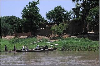
This is a list of rivers in Central African Republic. This list is arranged by drainage basin, with respective tributaries indented under each larger stream's name.
This is a list of rivers in Central African Republic. This list is arranged by drainage basin, with respective tributaries indented under each larger stream's name.

Congo may refer to either of two countries that border the Congo River in central Africa:

The Democratic Republic of the Congo, informally Congo-Kinshasa, DR Congo, the DRC, the DROC, or the Congo, and formerly and also coloquially Zaire, is a country in Central Africa. It is, by area, the second largest country in Africa, and the 11th-largest in the world. With a population of around 92 million, the Democratic Republic of the Congo is the most populous officially Francophone country in the world. It is a member of the United Nations, Non-Aligned Movement, African Union, COMESA, and the East African Community. The capital and largest city is Kinshasa, which is also the world's most populous Francophone city.

The White Nile is a river in Africa, one of the two main tributaries of the Nile, the other being the Blue Nile. The name comes from colouring due to clay carried in the water.
The Chari River, or Shari River, is a 1,400 kilometres (870 mi) long river, flowing in Central Africa. It is Lake Chad's main source of water.
Avukaya is an ethnic group of South Sudan. Some members of this ethnic have fled to the Democratic Republic of the Congo due to persecution. About 50,000 members of this ethnic group live in South Sudan. Many members of this ethnic group belong to the Christian minority of South Sudan. The Avukaya traditionally live in a rain-forest area in Equatoria close to the Democratic Republic of Congo in Southern Sudan.

The Kadéï River is a tributary of the Sangha River that flows through Cameroon and the Central African Republic. Its total drainage basin is 24,000 km2. The river rises from the eastern Adamawa Plateau, southeast of Garoua-Boulaï in Cameroon's East Province. The Kadéï is swelled by two tributaries, the Doumé at Mindourou and the Boumbé, before flowing east into the Central African Republic. At Nola, the Kadéï meets the Mambéré and becomes the Sangha. The Kadéï is part of the Congo River basin.

Bahr al-Arab is a river which flows approximately 800 kilometres (500 mi) through the southwest of Sudan and marks part of its international border with South Sudan. It is part of the Nile river system, being a tributary of Bahr el Ghazal, which is a tributary of the White Nile.

Heuglin's spurfowl is a species of bird in the family Phasianidae. It is found in Central African Republic, Democratic Republic of the Congo, South Sudan, and Uganda. The German explorer Theodor von Heuglin first described the species.
The black-backed cisticola or black-necked cisticola is a species of passerine bird in the family Cisticolidae. It is found in Burkina Faso, Chad, Republic of the Congo, Democratic Republic of the Congo, Ivory Coast, Eritrea, Ethiopia, Ghana, Guinea, Guinea-Bissau, Kenya, Mali, Nigeria, Senegal, Sierra Leone, South Sudan, Tanzania, Togo, and Uganda. Its natural habitats are subtropical or tropical dry lowland grassland and subtropical or tropical seasonally wet or flooded lowland grassland.

The Jur River is a river in western South Sudan, flowing through the Bahr el Ghazal and Equatoria regions. About 485 kilometres (301 mi) long, it flows north and northeast, joining the Bahr el Ghazal River on the western side of the Sudd wetlands. The Jur River is part of the Nile basin, as the Bahr al-Ghazal flows into the White Nile.

The Bahr el Ghazal is a river in South Sudan. The South Sudanese region of Bahr el Ghazal takes its name from the river.

The geography of South Sudan describes the physical features of South Sudan, a country in East Africa. South Sudan is a landlocked country and borders – clockwise – Sudan from the north, Ethiopia from the east, Kenya, Uganda and the Democratic Republic of the Congo from the south and the Central African Republic from the west.
The Kuru River, or Chel River is a stream in the South Sudanese states of Western Bahr el Ghazal and Northern Bahr el Ghazal. It is a headwater of the Lol River.

The Congo-Nile Divide is the continental divide that separates the drainage basins of the Nile and Congo rivers. It is about 2,000 kilometres (1,200 mi) long.
Amada-Gaza is a sub-prefecture of Mambéré-Kadéï in the Central African Republic.
The Barambu are an ethnic group who live in the northeast of the Democratic Republic of the Congo.
The Tonj River, also called the Ibba River or Nyatt Ayok, is a river of South Sudan. It is a right tributary of the Bahr el Ghazal River.
| Wikimedia Commons has media related to Rivers of the Central African Republic . |
