List of urban local bodies in Telangana

Last updated

The article lists all the urban local bodies, covering municipal corporations, municipalities and nagar panchayats in the Indian state of Telangana. The statistical data is based on the 2011 Census of India, conducted by The Office of the Registrar General and Census Commissioner, under the Ministry of Home Affairs, Government of India. Some of the Nagar Panchayats were upgraded to municipalities in 2011. [1]

Contents

Municipal Corporations

India Telangana location map.svg
Purple pog.svg
3
Purple pog.svg
1
Purple pog.svg
2
Purple pog.svg
4
Purple pog.svg
5
Purple pog.svg
6
Purple pog.svg
7
Municipal Carporations in Telangana, Greater Hyderabad Municipal Corporation surrounded by 7 Newly Created Corporation denoted by Numbers on Map
India location map.svg
Purple pog.svg
3
Purple pog.svg
1
Purple pog.svg
2
Purple pog.svg
4
Purple pog.svg
5
Purple pog.svg
6
Purple pog.svg
7
List of urban local bodies in Telangana (India)

The state of Telangana has a total of 13 municipal corporations. [2] [3] [4]

DistrictMunicipal CorporationsTotal Ref
Hyderabad

Medchal Malkajgiri

Ranga Reddy

Sangareddy

GHMC 1
Hanamkonda

Warangal

GWMC 1
Nizamabad Nizamabad 1
Karimnagar Karimnagar 1
Peddapalli Ramagundam 1
Khammam Khammam 1
Ranga Reddy Badangpet, Bandlaguda Jagir, Meerpet–Jillelguda 3
Medchal Malkajgiri Boduppal, Peerzadiguda, Jawaharnagar, Nizampet 4
Total13

Source:

Cantonment Boards

The state of Telangana has one Cantonment Board in Hyderabad Dist

DistrictCantonment BoardsTotal Ref
Hyderabad Secunderabad Cantonment Board 1
Total1

Municipalities

India Telangana location map.svg
Red pog.svg
1
Red pog.svg
2
Blue pog.svg
4
Blue pog.svg
5
Blue pog.svg
3
Red pog.svg
7
Blue pog.svg
8
Blue pog.svg
9
Purple pog.svg
10
Purple pog.svg
6
Red pog.svg
11
Red pog.svg
12
Red pog.svg
14
Purple pog.svg
13
Purple pog.svg
15
Purple pog.svg
16
Purple pog.svg
17
Red pog.svg
18
Blue pog.svg
19
Purple pog.svg
20
Purple pog.svg
21
Purple pog.svg
22
Purple pog.svg
23
Purple pog.svg
24
Purple pog.svg
25
Purple pog.svg
26
Blue pog.svg
27
Purple pog.svg
28
Red pog.svg
29
Purple pog.svg
30
Purple pog.svg
31
Purple pog.svg
32
Purple pog.svg
33
Red pog.svg
34
Blue pog.svg
35
Purple pog.svg
36
Purple pog.svg
37
Blue pog.svg
38
Red pog.svg
39
Blue pog.svg
40
Purple pog.svg
41
Red pog.svg
42
Purple pog.svg
43
Purple pog.svg
44
Purple pog.svg
45
Purple pog.svg
46
Purple pog.svg
47
Purple pog.svg
48
Purple pog.svg
49
Purple pog.svg
50
Red pog.svg
51
Purple pog.svg
100
Purple pog.svg
53
Purple pog.svg
54
Purple pog.svg
55
Purple pog.svg
56
Purple pog.svg
57
Red pog.svg
58
Purple pog.svg
59
Purple pog.svg
60
Purple pog.svg
61
Purple pog.svg
62
Purple pog.svg
63
Purple pog.svg
64
Blue pog.svg
65
Red pog.svg
66
Purple pog.svg
67
Purple pog.svg
68
Red pog.svg
69
Blue pog.svg
70
Purple pog.svg
71
Red pog.svg
72
Blue pog.svg
73
Purple pog.svg
74
Blue pog.svg
75
Purple pog.svg
76
Red pog.svg
77
Purple pog.svg
78
Red pog.svg
79
Purple pog.svg
80
Purple pog.svg
81
Purple pog.svg
82
Purple pog.svg
83
Purple pog.svg
84
Purple pog.svg
85
Purple pog.svg
86
Purple pog.svg
87
Purple pog.svg
88
Purple pog.svg
89
Blue pog.svg
90
Red pog.svg
91
Purple pog.svg
92
Purple pog.svg
93
Blue pog.svg
94
Purple pog.svg
95
Purple pog.svg
96
Blue pog.svg
97
Red pog.svg
98
Purple pog.svg
99
Blue pog.svg
100
Purple pog.svg
101
Purple pog.svg
102
Purple pog.svg
103
Purple pog.svg
104
Red pog.svg
105
Purple pog.svg
106
Blue pog.svg
107
Purple pog.svg
108
Red pog.svg
109
Purple pog.svg
110
Purple pog.svg
111
Purple pog.svg
112
Blue pog.svg
113
Red pog.svg
114
Purple pog.svg
115
Purple pog.svg
116
Purple pog.svg
117
Purple pog.svg
118
Red pog.svg
119
Purple pog.svg
120
Purple pog.svg
121
Purple pog.svg
122
Purple pog.svg
123
Red pog.svg
124
Purple pog.svg
125
Purple pog.svg
126
Purple pog.svg
127
Purple pog.svg
128
Yellow pog.svg
129
Yellow pog.svg
130
Yellow pog.svg
131
Yellow pog.svg
132
Yellow pog.svg
133
Municipalities in Telangana, Red District headquarters, Blue existing & Purple Newly created Municipalities, Yellow Census Towns
India location map.svg
Red pog.svg
1
Red pog.svg
2
Blue pog.svg
4
Blue pog.svg
5
Blue pog.svg
3
Red pog.svg
7
Blue pog.svg
8
Blue pog.svg
9
Purple pog.svg
10
Purple pog.svg
6
Red pog.svg
11
Red pog.svg
12
Red pog.svg
14
Purple pog.svg
13
Purple pog.svg
15
Purple pog.svg
16
Purple pog.svg
17
Red pog.svg
18
Blue pog.svg
19
Purple pog.svg
20
Purple pog.svg
21
Purple pog.svg
22
Purple pog.svg
23
Purple pog.svg
24
Purple pog.svg
25
Purple pog.svg
26
Blue pog.svg
27
Purple pog.svg
28
Red pog.svg
29
Purple pog.svg
30
Purple pog.svg
31
Purple pog.svg
32
Purple pog.svg
33
Red pog.svg
34
Blue pog.svg
35
Purple pog.svg
36
Purple pog.svg
37
Blue pog.svg
38
Red pog.svg
39
Blue pog.svg
40
Purple pog.svg
41
Red pog.svg
42
Purple pog.svg
43
Purple pog.svg
44
Purple pog.svg
45
Purple pog.svg
46
Purple pog.svg
47
Purple pog.svg
48
Purple pog.svg
49
Purple pog.svg
50
Red pog.svg
51
Purple pog.svg
100
Purple pog.svg
53
Purple pog.svg
54
Purple pog.svg
55
Purple pog.svg
56
Purple pog.svg
57
Red pog.svg
58
Purple pog.svg
59
Purple pog.svg
60
Purple pog.svg
61
Purple pog.svg
62
Purple pog.svg
63
Purple pog.svg
64
Blue pog.svg
65
Red pog.svg
66
Purple pog.svg
67
Purple pog.svg
68
Red pog.svg
69
Blue pog.svg
70
Purple pog.svg
71
Red pog.svg
72
Blue pog.svg
73
Purple pog.svg
74
Blue pog.svg
75
Purple pog.svg
76
Red pog.svg
77
Purple pog.svg
78
Red pog.svg
79
Purple pog.svg
80
Purple pog.svg
81
Purple pog.svg
82
Purple pog.svg
83
Purple pog.svg
84
Purple pog.svg
85
Purple pog.svg
86
Purple pog.svg
87
Purple pog.svg
88
Purple pog.svg
89
Blue pog.svg
90
Red pog.svg
91
Purple pog.svg
92
Purple pog.svg
93
Blue pog.svg
94
Purple pog.svg
95
Purple pog.svg
96
Blue pog.svg
97
Red pog.svg
98
Purple pog.svg
99
Blue pog.svg
100
Purple pog.svg
101
Purple pog.svg
102
Purple pog.svg
103
Purple pog.svg
104
Red pog.svg
105
Purple pog.svg
106
Blue pog.svg
107
Purple pog.svg
108
Red pog.svg
109
Purple pog.svg
110
Purple pog.svg
111
Purple pog.svg
112
Blue pog.svg
113
Red pog.svg
114
Purple pog.svg
115
Purple pog.svg
116
Purple pog.svg
117
Purple pog.svg
118
Red pog.svg
119
Purple pog.svg
120
Purple pog.svg
121
Purple pog.svg
122
Purple pog.svg
123
Red pog.svg
124
Purple pog.svg
125
Purple pog.svg
126
Purple pog.svg
127
Purple pog.svg
128
Yellow pog.svg
129
Yellow pog.svg
130
Yellow pog.svg
131
Yellow pog.svg
132
Yellow pog.svg
133
List of urban local bodies in Telangana (India)

The state of Telangana has a total of 128 municipalities. [5] [3] [2]

DistrictMunicipalitiesTotal Ref
Adilabad Adilabad 1
Bhadradri Kothagudem Kothagudem, Palwancha, Yellandu, Manuguru 4
Hanamkonda Parkal 1
Jagtial Jagtial, Korutla, Metpalli, Raikal, Dharmapuri 5
Jangaon Jangaon 1 [6]
Jayashankar Bhupalpally Bhupalpally 1
Jogulamba Gadwal Gadwal, Ieeja, Waddepalle, Alampur 4
Kamareddy Kamareddy, Banswada, Yellareddy 3
Karimnagar Huzurabad, Jammikunta, Choppadandi, Kothapalli 4
Khammam Sathupalli, Madhira, Wyra 3
Komaram Bheem Kagaznagar 1
Mahbubabad Mahabubabad, Dornakal, Maripeda, Thorrur 4
Mahbubnagar Mahabubnagar, Badepalle, Bhoothpur,3
Mancherial Mancherial, Bellampally, Mandamarri, Luxettipet, Chennur, Naspur, Kyathanpally 7 [7]
Medak Medak, Narsapur, Ramayampet, Toopran 4 [7]
Medchal Malkajgiri Medchal, Dammaiguda, Nagaram, Pocharam, Ghatkesar, Gundla Pochampalli, Tumkunta, Kompally, Dundigal 9
Nagarkurnool Nagarkurnool, Kollapur, Achampet, Kalwakurthy 4
Nalgonda Nalgonda, Miryalaguda, Devarakonda, Nakrekal, Nandikonda, Chityal, Haliya, Chandur 8
Narayanpet Narayanpet, Makthal, Kosgi 3
Nirmal Nirmal, Bhainsa, Khanapur 3 [7]
Nizamabad Bodhan, Armoor, Bheemgal 3 [8]
Peddapalli Peddapalli, Manthani, Sultanabad 3
Rajanna Sircilla Sircilla, Vemulawada 2 [7]
Ranga Reddy Shadnagar, Pedda Amberpet, Ibrahimpatnam, Jalpally, Shamshabad, Turkayamjal, Manikonda, Narsingi, Adibatla, Shankarpally, Tukkuguda, Amangal 12
Sangareddy Sangareddy, Sadasivpet, Zaheerabad, Andole-Jogipet, Narayankhed, IDA Bollaram, Tellapur, Ameenpur 8
Siddipet Siddipet, Husnabad, Gajwel, Dubbak, Cheriyal 5 [7]
Suryapet Suryapet, Kodad, Huzurnagar, Neredcherla, Thirumalagiri 5
Vikarabad Vikarabad, Tandur, Parigi, Kodangal 4
Wanaparthy Wanaparthy, Kothakota, Pebbair, Atmakur, Amarchinta 5 [7]
Warangal Narsampet, Wardhannapet parkala 3 [7]
Yadadri Bhuvanagiri Bhongir, Choutuppal, Aler, Yadagirigutta, Mothkur, Pochampally 6 [9]
No. of Municipalities128

Source:

Related Research Articles

<span class="mw-page-title-main">Karimnagar</span> City in Telangana, India

Karimnagar is also known as Elagandula is a city and District Headquarters in the Indian state of Telangana. Karimnagar is a major urban agglomeration and third largest city in the state. It is governed by the Municipal Corporation and is the headquarters of the Karimnagar district It is situated on the banks of Manair River, which is a tributary of the Godavari River. It is the third largest and fastest growing urban settlement in the state, according to 2011 census. It has registered a population growth rate of 45.46% and 38.87% respectively over the past two decades between 1991 and 2011, which is highest growth rate among major cities of Telangana. It serves as a major educational and health hub for the northern districts of Telangana. It is a major business center and widely known for its agricultural and granite industries, earning the nickname "City of Granites."

<span class="mw-page-title-main">Bhadrachalam</span> Temple town in Telangana, India

Bhadrachalam is a census town in Bhadradri Kothagudem district in the Indian state of Telangana. It is an important Hindu pilgrimage town with the Bhadrachalam Temple of Lord Rama, situated on the banks of Godavari river. It is located 312 kilometres (194 mi) east of state capital, Hyderabad,115 kilometres (71 mi) from Khammam,178 kilometres (111 mi) from Suryapet,180 kilometres (112 mi) from Warangal,187 kilometres (116 mi) from Vijayawada,220 kilometres (137 mi) and 350 kilometres (217 mi) from Visakhapatnam.

<span class="mw-page-title-main">Jagtial</span> Place in Telangana, India

Jagtial is a city and the district headquarters of Jagtial district of Telangana, India. It has an average elevation of 293 metres (961 ft). It is located about 190 kilometres (118 mi) north of the state capital Hyderabad.

<span class="mw-page-title-main">Hanamkonda district</span> District of Telangana in India

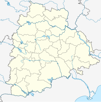
Hanumakonda district, is a district located in the northern region of the Indian state of Telangana. The district headquarters are located at Hanumakonda. The district borders the districts of Jangaon, Karimnagar, Warangal, Bhupalpally and Siddipet.

<span class="mw-page-title-main">Ramagundam</span> City in Telangana, India

Ramagundam is a city under municipal corporation in Ramagundam district of the Indian state of Telangana. It is the most populous city in the district and falls under the Ramagundam revenue division. It is located on the banks of the Godavari River. As of the 2011 census, the city had a population of 229,644, making it the 6th most populous in the state, and an urban agglomeration population of 242,979. It is located about 225 km from the state capital Hyderabad.

<span class="mw-page-title-main">Siddipet</span> City in Telangana, India

Siddipet is a city in the Indian state of Telangana. It is a municipality and serves as the headquarters of Siddipet district. It is located about 100 kilometres (62 mi) north of the state capital, Hyderabad, and 92 kilometres (57 mi) from Warangal. The District Headquarters and police Commissionerate is located at Siddipet City.

<span class="mw-page-title-main">Jammikunta</span> Town in Telangana, India

Jammikunta is a town and mandal in Karimnagar district of the state of Telangana, India. At the 2011 census it had a population of 32,645, 16,894 males and 15,751 females.

<span class="mw-page-title-main">Huzurabad</span> Town in Telangana, India

Huzurabad is a town in the Huzurabad mandal of Karimnagar district in the Indian state of Telangana. It is a municipality in the district. It is located about 41 kilometres (25 mi) from Karimnagar and 38 kilometres (24 mi) from Warangal.

Banswada is a Town and Revenue division in Kamareddy district of the Indian state of Telangana.

<span class="mw-page-title-main">Peddapalli</span> Town & District Headquarter in Telangana, India

Peddapalli is a town, Revenue Division and has a Railway Junction in Peddapalli District in the Indian state of Telangana. It is the headquarters of the Peddapalli District and Peddapalli mandal. It is located about 197 kilometres North of the state capital Hyderabad, 36 kilometres from Karimnagar, 28 kilometres from Ramagundam. Peddapalli has a railway junction named PDPL which connects PDPL - KRMR - NZB railway line and New Delhi (NDLS) - Chennai Central (MAS) railway line. There are two trains that terminate here. Karimnagar Tirupati express rail engine changes to electric engine here. In future there’s a proposal to develop a bypass railway station named Peddapalli Town which directly connects Kazipet-Karimnagar without entering peddapalli junction station.As of 2011 census of India, Peddapalli has a population of 41,171. In 2016 due to population Increase, the civic body of Peddapalli was upgraded from Nagar Panchayat to Municipal council Post upgradation to Council.

Husnabad is a town in the Siddipet district of the Indian state of Telangana. It was a part of Karimnagar district before re-organisation of districts in the state. It is located in Husnabad mandal.

<span class="mw-page-title-main">Godavari Valley Coalfield</span>

Godavari Valley Coalfield is located in the districts of Adilabad, Karimnagar, Khammam and Warangal in the Indian state of Telangana. It is the only coalfield in South India. It lies in the basin of the Godavari River.

<span class="mw-page-title-main">Telangana Police</span> Indian state police force

The Telangana State Police Department is the law enforcement agency for the state of Telangana in India. It has jurisdiction concurrent with the 33 revenue districts of the state. The police force was created from the remnants of the Andhra Pradesh Police after Telangana state was formed. It is headed by the Director general of police, Anjani Kumar, and headquartered in Hyderabad, Telangana.

References

  1. "Eight panchayatsto be upgraded". The Hindu. Hyderabad. 18 June 2011. Retrieved 18 February 2015.
  2. 1 2 "ULBs" (PDF). Directorate of Town and Country Planning. Archived from the original (PDF) on 15 June 2016. Retrieved 13 June 2016.
  3. 1 2 "Statistical Year Book 2016" (PDF). Telangana State Portal. Directorate of Economics and Statistice - Government of Telangana. pp. 13, 38–43. Retrieved 3 May 2017.
  4. "KCR launches new district at auspicious time". The Hindu. Retrieved 3 May 2017.
  5. "List of District-wise 72 ULBs in Telangana state". www.cdma.telangana.gov.in. Retrieved 3 May 2017.
  6. "District at a Glance". Official website of Nizamabad District. National Informatics Centre. Archived from the original on 30 April 2015. Retrieved 29 May 2015.
  7. 1 2 3 4 5 6 7 "Commissioner & Director of Municipal Administration". cdma.telangana.gov.in. Archived from the original on 18 June 2014.
  8. "Nizamabad District Profile at a Glance". Official website of Nizamabad District. National Informatics Centre. Archived from the original on 6 May 2015. Retrieved 29 May 2015.
  9. "Municipalities of Karimanagar district". Karimanagar district website. Retrieved 3 April 2015.