Sketch map of the route of the projected line from Achnasheen to Aultbea
Technical
Line length
37miles 620yards (60.113km)
The Loch Maree and Aultbea Railway was one of several branch railway-lines proposed for the North-West Highlands of Scotland in the early 1890s. Although a full survey was conducted in 1892 and a Private Bill was submitted to the Westminster Parliament on 18 November 1892,[1] the necessary Act to permit construction did not receive approval and the plan was dropped.
In 1890 and 1891, six lines connecting the west of north Scotland to the central spine were to be considered by two Parliamentary Commissions.[2][3] These were:
All six lines were designed to open up transport facilities for fish-catches, passengers and mail on the west coast, and - for the last four named above - specifically for steamer services to Stornoway. The two extensions to Mallaig and Kyle of Lochalsh were completed, however none of the four additional proposals were ever built.
Proposal and route
A scheme for a railway to run between Achnasheen and Aultbea was first proposed in early 1889 by landowners in the Gairloch and Loch Ewe area.[4] The main proposers were: Sir Kenneth Mackenzie of Gairloch; the 2nd Earl of Lovelace; Duncan Darroch of Gourock and Torridon; Paul Liot Bankes of Letterewe; and John Dixon of Inveran. Dixon was the principal driver in the campaign to attract support and funding. Between 1890 and 1892, he composed dozens of letters, memoranda and pamphlets, and sent them to the Scottish Office, MPs and Cabinet Ministers in London; and he organised or encouraged public meetings in the Gairloch area and on the Isle of Lewis.[5] As well as stressing the advantages for fisheries and passenger-traffic, the campaign flagged up the potential for increased tourist-traffic to the area. Many of the arguments put forward were deliberately phrased to show that the Aultbea proposal was far better than the rival Garve to Ullapool railway which, in August 1890, had already received Parliamentary approval.
Victoria Falls, named following a visit by Queen Victoria.
The route was surveyed by the firm of Thomas Meik & Sons in the autumn of 1892. Their plans[6] showed the line branching off the Dingwall to Skye line about 150 yards (137m) south-west of Achnasheen station, at a height of around 520 feet (158m) above sea-level. It circled round the back of Ledgowan Lodge, passed south of Loch a’Chroisg, and remained well south of the road to take advantage of the hillside contours, before looping in a reverse S-shape north, east and then west to enter Glen Docherty. There was an ascent up the hill to the highest point on the line (750 feet (229m)); a descent of the glen on its southern slope at a gradient of 1:33 for 3 miles (4.8km); down to the western end of the glen; then it circled south of the village of Kinlochewe on a tall viaduct; and then rejoined the road (now the A832). Then it hugged the south shore of Loch Maree as far as Slattadale, passing the famous Victoria Falls en route. Where the road then veered due west towards Gairloch, the railway instead headed north along the shore, straight for Poolewe. Two tunnels would have to be built near the north-west end of Loch Maree. After bending around the south side of Poolewe, the line headed northwards along the east shore of Loch Ewe, passing round the back of Osgood Mackenzie's Inverewe estate and terminating at the shore-end of the pier at Aultbea. A new pier was to be constructed, 180 yards (165m) in length. The total measured distance of the line from Achnasheen to Aultbea was just over thirty-seven miles (60km) - to be precise: 37 miles 2 furlongs 9 chains and 20 yards. The total cost was estimated to be in the region of £200,000.
Abandonment
Despite all the efforts of Dixon and his fellow-proposers, the proposal was completely rejected by the 'North-West Coast of Scotland Railways Committee' which was tasked in 1891 with recommending which of the six railways (above) should receive Governmental approval.[3] This rejection did not prevent the backers from arranging their Private Bill. [7] But, despite the Bill receiving a second reading in the House of Commons in April 1893,[8] no further support was forthcoming, no Act was passed, and the scheme was dropped.[9]
↑ See correspondence from John Dixon et al to Scottish Office, 1889-1892: National Records of Scotland - refs AF67/202-210 and AF67/236
↑ Thomas Meik and Sons – Loch Maree and Aultbea Railway Railway – Bound Plans, Sections and Book of Reference: National Records of Scotland - ref RHP82306
↑ Letter from Durnford & Co to W.C.Dunbar, 16 December 1892: National Records of Scotland - ref: AF67/209
↑ House of Commons Papers, Paper 75, Volume 72, page 87: Return of Private Bills and Provisional Orders relating to Scotland, 1888-97 (p.7). Printed 21 February 1898.
Further reading
Drummond, Andrew (2020). A Quite Impossible Proposal. Edinburgh, UK: Birlinn. ISBN978-1-912476-88-6.
Roake, John (1998). "Ross Pies in the Skye - I: The Loch Maree and Aultbea Railway". Highland Railway Society Journal. 3 (45): 12ff.
Thomas, John (1991). The Skye Railway. Nairn, UK: David St John Thomas. ISBN978-0-946537-62-4.
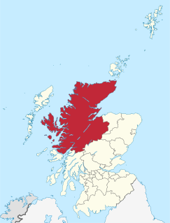
Highland is a council area in the Scottish Highlands and is the largest local government area in the United Kingdom. It was the 7th most populous council area in Scotland at the 2011 census. It shares borders with the council areas of Aberdeenshire, Argyll and Bute, Moray and Perth and Kinross. Their councils, and those of Angus and Stirling, also have areas of the Scottish Highlands within their administrative boundaries.
Gairloch is a village, civil parish and community on the shores of Loch Gairloch in Wester Ross, in the North-West Highlands of Scotland. A tourist destination in the summer months, Gairloch has a golf course, a museum, several hotels, a variety of shops, takeaway restaurants, a community centre, a leisure centre with sports facilities, a local radio station, beaches and nearby mountains. Gairloch is one of the principal villages on the North Coast 500 route.
Ross and Cromarty, sometimes referred to as Ross-shire and Cromartyshire, is a variously defined area in the Highlands and Islands of Scotland. There is a registration county and a lieutenancy area in current use, the latter of which is 8,019 square kilometres in extent. Historically there has also been a constituency of the Parliament of the United Kingdom, a local government county, a district of the Highland local government region and a management area of the Highland Council. The local government county is now divided between two local government areas: the Highland area and Na h-Eileanan Siar. Ross and Cromarty border Sutherland to the north and Inverness-shire to the south.
Ross is a region of Scotland. One of the provinces of Scotland from the 9th century, it gave its name to a later earldom and to the counties of Ross-shire and, later, Ross and Cromarty. The name Ross allegedly derives from a Gaelic word meaning "headland", perhaps a reference to the Black Isle. Another possible origin is the West Norse word for Orkney – Hrossey – meaning horse island; the area once belonged to the Norwegian earldom of Orkney. Ross is a historical comital region, perhaps predating the Mormaerdom of Ross. It is also a region used by the Kirk, with the Presbytery of Ross being part of the Synod of Ross, Sutherland and Caithness.
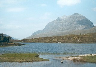
Loch Maree is a loch in Wester Ross in the Northwest Highlands of Scotland. At 21.7 km (13.46 mi) long and with a maximum width of four kilometres, it is the fourth-largest freshwater loch in Scotland; it is the largest north of Loch Ness. Its surface area is 28.7 km2 (11.08 sq mi).
The Kyle of Lochalsh line is a primarily single-track railway line in the Scottish Highlands, from Dingwall to Kyle of Lochalsh. Many of the passengers are tourists, but there are also locals visiting Inverness for shopping, and commuters. All services are provided by ScotRail and run beyond Dingwall to Inverness. In the past there were some through services to and from Glasgow, Edinburgh or Aberdeen. None of the line is electrified, and all trains on the line are diesel-powered, as are all other trains in the Scottish Highlands.
Wester Ross is an area of the Northwest Highlands of Scotland in the council area of Highland. The area is loosely defined, and has never been used as a formal administrative region in its own right, but is generally regarded as lying to the west of the main watershed of Ross, thus forming the western half of the county of Ross and Cromarty. The southwesternmost part of Ross and Cromarty, Lochalsh, is not considered part of Wester Ross by the local tourist organisation, Visit Wester Ross, but is included within the definition used for the Wester Ross Biosphere Reserve.
Achanalt is a railway halt in Strath Bran, Ross and Cromarty, in the Scottish council area of Highland. It is served by a railway station on the Kyle of Lochalsh Line from Inverness to Kyle of Lochalsh.
Kinlochewe is a village in Wester Ross in the Northwest Highlands of Scotland. It is in the parish of Gairloch, the community of Torridon and Kinlochewe and the Highland council area. It lies near the head of Loch Maree in its magnificent valley, and serves as a junction between the main Ullapool road north, and that which heads west to the coast at Loch Torridon. Loch Maree was at one time also known as Loch Ewe, hence the village's apparently confused name.
Garve railway station is a railway station on the Kyle of Lochalsh Line, serving the village of Garve in the north of Scotland. Garve is located at the eastern edge of Loch Garve, measured 11 miles 65 chains (19.0 km) from Dingwall, and is the first stop on the line before Lochluichart. ScotRail, who manage the station, operate all services.
Achnasheen railway station is a remote railway station on the Kyle of Lochalsh Line, serving the village of Achnasheen in the north of Scotland. The station is 27 miles 72 chains (44.9 km) from Dingwall, between Achanalt and Achnashellach. ScotRail, who manage the station, operate all services.
Ross-shire is a historic county in the Scottish Highlands. The county borders Sutherland to the north and Inverness-shire to the south, as well as having a complex border with Cromartyshire – a county consisting of numerous enclaves or exclaves scattered throughout Ross-shire's territory. Ross-shire includes most of Ross along with Lewis in the Outer Hebrides. Dingwall is the traditional county town. The area of Ross-shire is based on that of the historic province of Ross, but with the exclusion of the many enclaves that form Cromartyshire.
Aultbea is a small fishing village in the North-West Highlands of Scotland. It is situated on the southeast shore of Loch Ewe, about 30 km west of Ullapool. The village has a Primary School and a small Post Office.
Garve is a village on the Black Water river, in Ross-shire, and is in the Highland Council area of Scotland. It is situated 5 miles (8 km) northwest of Contin, on the A835, the main road to Ullapool on the west coast, close to where the A832 branches off towards Achnasheen.
The Northwest Highlands are located in the northern third of Scotland that is separated from the Grampian Mountains by the Great Glen. The region comprises Wester Ross, Assynt, Sutherland and part of Caithness. The Caledonian Canal, which extends from Loch Linnhe in the south-west, via Loch Ness to the Moray Firth in the north-east splits this area from the rest of the country. The city of Inverness and the town of Fort William serve as gateways to the region from the south.
The A835 is a road in the Scottish Highlands linking Inverness to Ullapool and the Far North of Scotland.
The Dingwall and Skye Railway was authorised on 5 July 1865 with the aim of providing a route to Skye and the Hebrides. However, due to local objections, another Act of Parliament was required before work could commence. This was passed on 29 May 1868.
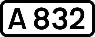
The A832 is a road in the Scottish Highlands, linking Cromarty, on the east coast, to Gairloch on the west coast, and beyond Gairloch to Braemore Junction. It is 126 miles (203 km) long and runs entirely in the former county of Ross and Cromarty. The road forms part of the Wester Ross Coastal Trail.
The Garve and Ullapool Railway was one of several branch railway-lines proposed for the North-West Highlands of Scotland, in the 1880s and 1890s. The project received approval from the Westminster Parliament by means of a Local Act of 14 August 1890. The line did not gain financial backing and was never constructed. Renewed attempts to build it were made in 1896, 1901, 1918 and 1945, again with no success.
This page is based on this Wikipedia article Text is available under the CC BY-SA 4.0 license; additional terms may apply. Images, videos and audio are available under their respective licenses.