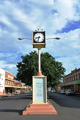
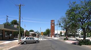
Manilla is a small town in New South Wales, Australia, located on Fossickers Way 45 kilometres northwest of the regional city of Tamworth and 27 kilometres northeast of the historic village Somerton. Manilla is famous for its setting as a fishing, paragliding, and mountain biking area. The name Manilla comes from the Gamilaraay word 'Maneela', which is said to mean 'meeting of the rivers'.[2]
The junction of the Manilla and Namoi Rivers known as 'Maneela', was for generations, a camping ground for the local Indigenous people, members of the large Kamilaroi (Gamilaraay) tribes of northwestern New South Wales.
Thomas Florance led the first British surveying expedition to the region in 1827. The local Aboriginal clan rolled boulders from the hills onto Florance's encampment, whose men then fired upon them. Another skirmish occurred resulting in one of the surveying team being wounded by a spear and Florance shooting an Aboriginal man.[3]
Around 1836, British pastoral squatters arrived in the area looking to establish large sheep and cattle stations on so-called crown land for the small leasehold fee of £10 per annum. Three massive properties were soon established in the Manilla region: Greenhatches formed by Joseph Greenhatch on behalf of Sydney businessman Charles Smith; Dinawirindi formed by Otto Baldwin; and Cuerindi formed by Thomas Simpson Hall and his brothers.[5][6]
Conflict in the area between the colonists and the resident Aboriginal population resulted in the government sending a large detachment of New South Wales Mounted Police under the command of Major James Nunn to the region in early 1838. Nunn's force captured around 100 Aboriginal people just to the west of what is now Manilla, with fifteen taken prisoner and one being shot dead. Frontier conflict in the immediate vicinity appears to have ended after Nunn's operation, who proceeded north-west with his men, later perpetrating the Waterloo Creek massacre.[5]
In the 1840s, the Greenhatches leasehold was sold to William Wentworth and John Charles Lloyd, and was re-named Manilla. Dinawirindi was later reduced in size and re-named as Durham Court with the Baldwin family holding the property right up until 2016. Cuerindi was also held within the Hall family for generations.[6][7]
During the 1850s, teamsters with bullock waggons were regularly transporting goods from the Hunter District through the Manilla area to outlying cattle stations and the northern goldfield settlements of Bingara and Bundarra. Teams were often delayed at the junction of the Namoi and Manilla Rivers by high water. In 1853, enterprising Englishman George Veness arrived at ‘The Junction’ to set up a store and wine shop at the teamsters’ camping ground. In doing so, Veness is acknowledged as the founder of the Manilla township which was located on the boundary of the Manilla and Dinawirindi pastoral properties. The town's early prosperity was founded on the highly productive wheat and pastoral industries.
In 1864, the nascent township was practically wiped out by an immense flood.[8] It took many years for the town to recover, with the first school being built in 1878 and the first post-office in 1880.[9]
Australian singer-songwriter Darren Hanlon produced a song entitled 'Manilla NSW' which appeared on his 2006 record, 'Fingertips and Mountaintops'.[10]
In July 1917 Dally Messenger and his wife, Annie, took over the Royal Hotel in Manilla. Shortly after his arrival Dally established the Manilla Rugby League Club. This was difficult as there was a strong Rugby Union Team and many other young men were at Gallipoli or other theatres of World War I. [14]
Grave of Annie Messenger - Manilla NSW. On the left is Annie and Dally's grandson, Ken Messenger, and on the right Cameron Dally Messenger, the great grandson.
His original team included Jack Hiscox, Roy Blanch, Frank and Norman Chapman, Jack Munro and Ivan Miller. Dally played some games but was more concerned, as coach, into forming these local young men into a quality team. In 1918 in the knockout competition held in Tamworth, Manilla defeated Quirindi 10-6 and Tamworth 14 nil. [15][16]
In June 1919 Both Dally and Annie caught the Spanish flu pandemic. Dally recovered but tragically Annie died on 23 June 1919 and is buried in the Manilla cemetery. On 23 August 1919 Dally returned to Sydney with his five year old son (Dally II).[17]
Marking the history on the very day of its formation, 8 July 2017, the Manilla Rugby League club under captain Coach Mitch Doring celebrated its 100th anniversary (2017) of formation with a hard fought match against the Bendemeer Mountain Men whom they defeated 34-30. Guests of honour at the celebratory dinner afterwards included Dally Messenger’s grandsons Ken and Dally Messenger, and great grandchildren Cameron Dally Messenger and Genevieve Ann Messenger.[18]
Heritage listings
Manilla has a number of heritage-listed sites, including:
In recent years, Manilla has become famous throughout the world as a major sports flying centre supporting hang gliding, paragliding,[20]ultralight aircraft, gyrocopters and gliders (sailplanes).[21] It boasts nearby Mt Borah, one of the world's best paraglider and hang glider launch sites. In 1998 local paragliding instructor and developer of Mt Borah, Godfrey Wenness, gained the world distance record with a flight of 335 kilometres (208mi). Major free-flight competitions are staged annually during the summer months. The 10th FAI Paragliding World Championships were held at the site in 2007, attended by 150 pilots from 41 nations. In the week prior to the event Manilla was in the headlines around the world for the survival of paraglider pilot Ewa Wiśnierska of Germany who was sucked up into a thunderstorm to 9,946 metres (32,631ft). The dramatic story was made into a TV documentary Miracle in the Storm which won an AFI award and was nominated for a Logie Award.
Notable residents
Henry Burrell (1873–1945), an amateur naturalist, photographer & film-maker, began unlocking the secrets of the platypus.
Stan Coster (27 May 1930 – 25 March 1997), an Australian country music singer-songwriter.
Godfrey Wenness ASM (1967), paragliding pilot and instructor, developed the Mt Borah airsports facility and school in 1994. Guinness Book of World Records for the longest flight in a paraglider in 1998 (335km). Australian Sports Medal (2000).
↑ "To the editor". Manilla Express. Vol.XLII, no.94. New South Wales, Australia. 3 December 1940. p.2. Retrieved 18 November 2023– via National Library of Australia.
↑ "Aborigines". The Australian. No.229. New South Wales, Australia. 7 September 1827. p.3. Retrieved 19 November 2023– via National Library of Australia.
↑ "A MANILLA THERE WAS". Manilla Express. Vol.25, no.2168. New South Wales, Australia. 15 May 1923. p.3. Retrieved 19 November 2023– via National Library of Australia.
↑ "A MANILLA THERE WAS". Manilla Express. Vol.25, no.2182. New South Wales, Australia. 3 July 1923. p.1. Retrieved 19 November 2023– via National Library of Australia.
1 2 Fagan, Sean (2007). The master: the life and times of Dally Messenger, Australia's first sporting superstar. Sydney, N.S.W.: Hachette Australia. p.]317ff. ISBN9780733622007.
↑ The Master: Herbert Henry (Dally) Messenger; Historic Plaque, Royal Hotel, Manilla NSW
Tamworth is a city and administrative centre of the north-western region of New South Wales, Australia. Situated on the Peel River within the local government area of the Tamworth Regional Council, it is the largest and most populated city in the region, with a population of 63,920 in 2021, making it the second largest inland city in New South Wales. Tamworth is 318 km (198 mi) from the Queensland border and is located almost midway between Brisbane and Sydney.
New England is a geographical region in the north of the state of New South Wales, Australia, about 60 km inland from the Tasman Sea. The area includes the Northern Tablelands and the North West Slopes regions. As of 2021, New England had a population of 185,560, with over a quarter of the people living in the area of Tamworth Regional Council.
The Waterloo Creek massacre refers to a series of violent clashes between mounted police, civilian vigilantes and Indigenous Gamilaraay peoples, which occurred southwest of Moree, New South Wales, Australia, during December 1837 and January 1838. The Waterloo Creek Massacre site is listed on the New South Wales Heritage Register as a place of significance in frontier violence leading to the murder of Gamilaraay people. The events have been subject to much dispute, due to wildly conflicting accounts by various participants and in subsequent reports and historical analyses, about the nature and number of fatalities and the lawfulness of the actions. Interpretation of the events at Waterloo Creek was raised again during the controversial "history wars" which began in the 1990s in Australia.
Gunnedah is a town in north-eastern New South Wales, Australia and is the seat of the Gunnedah Shire local government area. In the 2021 census the town recorded a population of 8,338. Gunnedah is situated within the Liverpool Plains, a fertile agricultural region, with 80% of the surrounding shire area devoted to farming. The Namoi River flows west then north-west through the town providing water beneficial to agricultural operations in the area.
The Namoi River, a major perennial river that is part of the Barwon catchment of the Murray–Darling basin, is located in the Northern Tablelands and North West Slopes districts of New South Wales, Australia.
Wee Waa is a town located on the north-western slopes of the New England region in New South Wales, Australia. The town is within the Narrabri Shire local government area and is on the Namoi River. Wee Waa is 41 kilometres (25 mi) north-west of Narrabri and 571 kilometres (355 mi) northwest of Sydney on the Kamilaroi Highway. At the 2016 census, Wee Waa had a population of 2,080.
Fossickers Way is a series of country roads located in the Northern Tablelands region of New South Wales, Australia that form a 379-kilometre (235 mi) scenic and tourist drive. The road's southern terminus is located in Nundle with its northwest terminus in Warialda; thereafter the road joins the Gwydir Highway and heads east to Inverell before reaching its eastern terminus in Glen Innes; The name refers to a tourist route overlaid on existing roads, and is not an officially gazetted one. The majority of the Fossickers Way is designated route B95.
Group 4 is a rugby league competition in the New England and north west area of New South Wales, run under the auspices of the Country Rugby League.
Tamworth Regional Council is a local government area in the New England region of New South Wales, Australia. The area under administration is located adjacent to the New England Highway and the Main North railway line. It was established in March 2004 through the amalgamation of the former City of Tamworth with surrounding shires of Barraba, Manilla, Nundle and Parry.
The state parks of New South Wales are 18 protected areas in New South Wales, Australia reserved for camping, water sports and recreational uses. State parks are maintained by the New South Wales Department of Lands and managed by community trust boards.
Bundarra is a small town on the Northern Tablelands of New South Wales, Australia. The town is located on Thunderbolts Way and on the banks of the Gwydir River, in the Uralla Shire local government area, 563 kilometres (350 mi) from the state capital, Sydney. At the 2016 census, Bundarra had a population of 394 and the surrounding area had 676 persons.
Split Rock Dam is a minor ungated concrete faced rock fill embankment dam with concrete chute spillway across the Manilla River upstream of Manilla in the north-western slopes region of New South Wales, Australia. The dam's purpose includes flood mitigation, irrigation, water supply and conservation. The impounded reservoir is called Split Rock Reservoir.
The Barraba branch railway line is a closed railway line in New South Wales, Australia. The line, which was opened on 21 September 1908, ran for 99 kilometres (62 mi) north along the Manilla valley to the town of Barraba from the Main North railway line at West Tamworth.
Manilla River, a perennial stream that is part of the Namoi catchment within the Murray–Darling basin, is located in the Northern Tablelands district of New South Wales, Australia.
Kingstown is a rural village, 40 kilometres (25 mi) north west of Uralla on the Northern Tablelands in the New England region of New South Wales, Australia. At the 2006 census, Kingstown had a population of 137 people. It has a public school, church, general store, Landcare Group and New South Wales Rural Fire Service. The main industries are sheep and beef cattle breeding with some timber production.
Somerton is a village between Tamworth and Gunnedah on the Oxley Highway in northern New South Wales Australia. In the 2016 census, there were 277 people in Somerton. Somerton Village adjoins the plentiful Peel River.
Barraba is a town in the New England region of northern New South Wales, Australia. It was formerly the centre of Barraba Shire local government area, but most of this, including Barraba, was absorbed into Tamworth Regional Council in 2004. On Census night 2016, Barraba had a population of approximately 1,400 people. It is part of the Bundarra-Barraba Important Bird Area which is important for the conservation of the endangered regent honeyeater.
Peel Shire was a local government area, in New South Wales, Australia.
Cockburn Shire was a local government area in the Australia state of New South Wales.
The Manilla railway underbridges are two heritage-listed railway bridges located on the Tamworth-Barraba railway line in the town of Manilla in the Tamworth Regional Council local government area of New South Wales, Australia. The underbridges are owned by Transport Asset Holding Entity, an agency of the Government of New South Wales. The two sites were added to the New South Wales State Heritage Register on 2 April 1999.
This page is based on this Wikipedia article Text is available under the CC BY-SA 4.0 license; additional terms may apply. Images, videos and audio are available under their respective licenses.