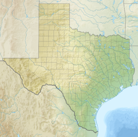
The Edwards Plateau is a geographic region forming the crossroads of Central, South and West Texas, United States. It is bounded by the Balcones Fault to the south and east; the Llano Uplift and the Llano Estacado to the north; and the Pecos River and Chihuahuan Desert to the west. San Angelo, Austin, San Antonio and Del Rio roughly outline the area. The plateau, especially its southeast portion, is also known as the Texas Hill Country.
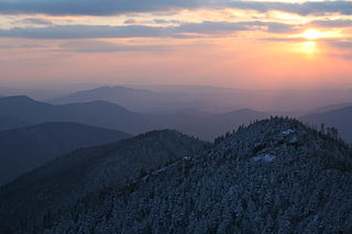
The Great Smoky Mountains are a mountain range rising along the Tennessee–North Carolina border in the southeastern United States. They are a subrange of the Appalachian Mountains and form part of the Blue Ridge Physiographic Province. The range is sometimes called the Smoky Mountains, and the name is commonly shortened to the Smokies. The Smokies are best known as the home of the Great Smoky Mountains National Park, which protects most of the range. The park was established in 1934 and, with over 11 million visits per year, is the most visited national park in the United States.

The Piney Woods is a temperate coniferous forest terrestrial ecoregion in the Southern United States covering 54,400 square miles (141,000 km2) of East Texas, southern Arkansas, western Louisiana, and southeastern Oklahoma. These coniferous forests are dominated by several species of pine as well as hardwoods including hickory and oak. Historically the most dense part of this forest region was the Big Thicket though the lumber industry dramatically reduced the forest concentration in this area and throughout the Piney Woods during the 19th and 20th centuries. The World Wide Fund for Nature considers the Piney Woods to be one of the critically endangered ecoregions of the United States. The United States Environmental Protection Agency (EPA) defines most of this ecoregion as the South Central Plains.

The Big Thicket is the name given to a somewhat imprecise region of a heavily forested area of Southeast Texas in the United States. This area represents a portion of the mixed pine-hardwood forests of the Southeast US. The National Park Service established the Big Thicket National Preserve (BTNP) within the region in 1974 and it is recognized as a biosphere reserve by UNESCO. The diversity of animals in the area is high, with over 500 vertebrates, and it is the complex mosaic of ecosystems and plant diversity that is particularly remarkable. Biologists have identified at least eight, and up to eleven, ecosystems in the Big Thicket area. More than 160 species of trees and shrubs, 800 herbs and vines, and 340 types of grasses are known to occur in the Big Thicket, and estimates as high as over 1000 flowering plant species and 200 trees and shrubs have been made, plus ferns, carnivorous plants, and more. The Big Thicket has historically been the most dense forest region in what is now Texas.

The Talladega National Forest is located in the U.S. state of Alabama and covers 392,567 acres at the southern edge of the Appalachian Mountains.
The trans-Mississippi theater of the American Civil War was the scene of the major military operations west of the Mississippi River. The area is often thought of as excluding the states and territories bordering the Pacific Ocean, which formed the Pacific coast theater of the American Civil War (1861–1865).
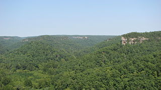
The Appalachian mixed mesophytic forests is an ecoregion of the temperate broadleaf and mixed forests biome, as defined by the World Wildlife Fund. It consists of mesophytic plants west of the Appalachian Mountains in the Southeastern United States.
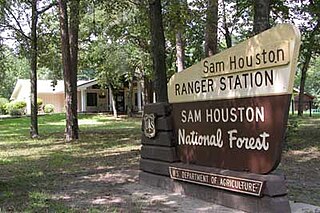
The Sam Houston National Forest, one of four National Forests in Texas, is located 50 miles north of Houston. The forest is administered together with the other three United States National Forests and two National Grasslands located entirely in Texas, from common offices in Lufkin, Texas. The units include Angelina, Davy Crockett, Sabine, and Sam Houston National Forests, plus Caddo National Grassland and Lyndon B. Johnson National Grassland. There are local ranger district offices located in New Waverly. It is located in portions of three Texas counties including Montgomery, San Jacinto, and Walker.
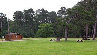
Atlanta State Park is a 1,475 acres (597 ha) state park in northeast Texas in the United States that opened in 1954. It is located on Wright Patman Lake in northern Cass County and is managed by the Texas Parks and Wildlife Department.

The Appalachian–Blue Ridge forests are an ecoregion in the Temperate broadleaf and mixed forests Biome, in the Eastern United States. The ecoregion is located in the central and southern Appalachian Mountains, including the Ridge-and-Valley Appalachians and the Blue Ridge Mountains. It covers an area of about 61,500 square miles (159,000 km2) in: northeast Alabama and Georgia, northwest South Carolina, eastern Tennessee, western North Carolina, Virginia, Maryland, and central West Virginia and Pennsylvania; and small extensions into Kentucky, New Jersey, and New York.

Norris Dam State Park is a state park in Anderson County and Campbell County, Tennessee, in the southeastern United States. The park is situated along the shores of Norris Lake, an impoundment of the Clinch River created by the completion of Norris Dam in 1936. The park consists of 4,038 acres (16.34 km2) managed by the Tennessee Department of Environment and Conservation. The park also administers the Lenoir Museum Complex, which interprets the area's aboriginal, pioneer, and early 20th-century history.

Colt Creek State Park is a Florida State Park in Central Florida, 16 miles (26 km) north of Lakeland off of State Road 471. This 5,067 acre park nestled within the Green Swamp Wilderness Area and named after one of the tributaries that flows through the property was opened to the public on January 20, 2007. Composed mainly of pine flatwoods, cypress domes and open pasture land, this piece of pristine wilderness is home to many animal species including the American bald eagle, Southern fox squirrel, gopher tortoise, white-tailed deer, wild turkey and bobcat.
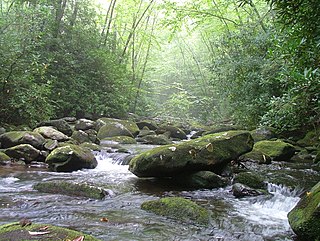
Citico Creek Wilderness is a 16,226-acre (66 km2) wilderness area within the Cherokee National Forest in the U.S. state of Tennessee. The wilderness contains the entire upper drainage of Citico Creek, which consists of the north and south forks and at least eight tributaries. Three steep-sided ridges descend west from the crest of the Unicoi Mountains — Brush Mountain, Pine Ridge, and Sassafras Ridge.

Guadalupe River State Park is a Texas state park located on a section of the Guadalupe River in Kendall and Comal Counties, northwest of Bulverde, Texas United States and is administered by the Texas Parks and Wildlife Department. The land was acquired by deed from private owners in 1974 and was opened to the public in 1983.

The natural environment of Virginia encompasses the physical geography and biology of the U.S. state of Virginia. Virginia has a total area of 42,774.2 square miles (110,784.67 km2), including 3,180.13 square miles (8,236.5 km2) of water, making it the 35th-largest state by area. Forests cover 65% of the state, wetlands and water cover 6% of the land in the state, while 5% of the state is a mixture of commercial, residential, and transitional.

South Llano River State Park is a 2600 acre state park located along the South Llano River in Kimble County, Texas. The park opened to the public in 1990 and is managed by the Texas Parks and Wildlife Department.
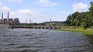
Martin Creek Lake State Park is a 286 acres (116 ha) developed recreational area in East Texas in the United States. The park is located southwest of Tatum on Martin Creek Lake in Rusk County and is managed by the Texas Parks and Wildlife Department. The Texas Utilities Generating Company deeded the park to the state in 1976, and it opened the same year.
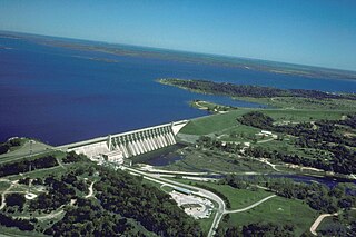
Lake Whitney State Park is a state park located in Hill County, Texas, near Whitney, Texas. The park is 775 acres (314 ha).

I.D. Fairchild State Forest is a 2,760-acre (1,120 ha) nature preserve in Cherokee County, Texas. It is the largest state forest in Texas and includes 10 miles of hiking trails. The main unit is located just west of the community of Maydelle on Texas State Highway 84. It is open to the public for hiking, horseback riding, picnicking, wildlife viewing, and biking. The Texas A&M Forest Service uses the area for demonstration and research as well as to conserve southern yellow pine ecosystems. The Texas State Railroad also runs through the forest.

