Great Texas Coastal Birding Trail

Last updated

Great Texas Coastal Birding Trail
Aransas national wildlife refuge1.jpg
Wetlands at Aransas National Wildlife Refuge looking out from the 40-foot (12 m) observation tower.
LengthOver 500 mi (800 km) from end-to-end [1]
2,100 mi (3,400 km) combined trails [2]
LocationTexas Gulf Coast
UseBird watching / hiking
Sights Gulf of Mexico, numerous bays and forests

The Great Texas Coastal Birding Trail is a state-designated system of trails, bird sanctuaries, and nature preserves along the entire length of the Texas Gulf Coast in the United States. As the state of Texas hosts more bird species than any other state in the U.S. the trail system offers some of the most unusual opportunities for bird-watching in the world. [3] [4] The "trail" is actually 43 separate hiking and driving trails that include 308 birding sites. The sites themselves feature a variety of viewing opportunities with boardwalks, observation decks, and other amenities. The trails boast more than 450 bird species. [5] The trail system is managed by the Texas Parks and Wildlife Department as part of the Great Texas Wildlife Trails which also include the Heart of Texas Wildlife Trail, the Panhandle Plains Wildlife Trail, and the Prairies and Pineywoods Wildlife Trail.

Contents

Apart from bird watching the trail system includes many nature preserves which feature a wide variety of wildlife. In addition, the various sites cover many types of natural terrain and flora including forests, marshes, and beaches.

This trail network was the first of its kind in the U.S. though many states have since followed. [3] [4] [6] [7] The trail system remains the nation's largest. [2] [8] One of the most well-known locations along the trail system is the Aransas National Wildlife Refuge, which holds the winter home of the only natural flock of whooping cranes in the world. [1]

Trail system

Apart from bird watching the trail system includes many nature preserves which feature a wide variety of wildlife. In addition the various sites cover many types of natural terrain and flora including forests, marshes, and beaches.

The trail system is the nation's largest. [2] [8] One of the most well-known locations along the trail system is the Aransas National Wildlife Refuge, which holds the winter home of the only natural flock of whooping cranes in the world. [1]

History

A road sign for the trail system in Newton County The Great Texas Coastal Birding Trail 467.JPG
A road sign for the trail system in Newton County

The Texas coast has been popular among bird watchers in the United States for decades. [7] Located where the Central Flyway meets the Gulf Coast and the Mississippi Flyway, the region sees a large number of migrants; in addition, the southern part of the Texas coast is far enough south to host a number of tropical species. [10] A 1991 American Birding Association (ABA) study by Roland Wauer showed that Texas was the top bird-watching destination in the United States for its members. [11] In 1993 the Texas Parks and Wildlife Department began a $1.5 million project to develop public and private resources to utilize as bird sanctuaries and observation sites. The plan and the concept were largely developed by Ted Eubanks and Madge Lindsay. [2] Site improvements included trail markers, trail development, boardwalks, observation stations, and many others. The goal was both to encourage environmental protection and to establish a tourism network that would benefit businesses throughout the Texas Gulf Coast region catering to ecotourists. [11]

The Central Coast section of the trail network was opened in 1994 with more than 95 sites. The other sections opened soon afterward. [11] The trail system was completed in 2000. [12] Markers featuring a logo with a black skimmer are present on each of the viewing sites. [12] Soon other wildlife trail networks were developed in other parts of Texas, and other states established their own wildlife trail systems patterned after the Texas model.

Sites along the trail systems are popular among birding enthusiasts, both domestic and international. [13] Events such as the state's Great Texas Birding Classic continue to build interest in the trails among nature lovers. [14]

Geography

Snow geese over the wetlands of Anahuac National Wildlife Refuge. AnahuacSnowGeese.jpg
Snow geese over the wetlands of Anahuac National Wildlife Refuge.

The region covered by the trail network is part of the Gulf Coastal Plains. With annual rainfall averages ranging from about 20 to 58 inches (510 to 1,470 mm), this is a nearly level, drained plain dissected by streams and rivers flowing into estuaries and marshes. Windblown sands and dunes, grasslands, oak mottes, and salt marshes make up the seaward areas. [15]

The region stretches from the Piney Woods of East Texas to the Texas Coastal Prairies that dominate the majority of the coast south of Houston. The Piney Woods area features groves of pine and other hardwood trees such as oak, magnolia, and American Sweet Gum ( Liquidambar styraciflua ). This wooded area which has supported Texas' lumber industry since the 19th century is now considered one of the most critically endangered ecosystems in the world. [16] These woodland areas of the trail network stretch from the Big Thicket area in the east to Sam Houston National Forest in the west, with pockets of woodlands stretching down into the area around Galveston Bay near Houston.

The prairie regions feature a variety of grass types, particularly Indiangrass ( Sorghastrum nutans ), big bluestem (Andropogon gerardii), little bluestem (Schizachyrium scoparium), and switchgrass ( Panicum virgatum ). [17] The grasslands around the Laguna Madre near Corpus Christi are considered some of the most important. [17]

Parts of extreme South Texas around Brownsville and the Rio Grande feature forests of sabal palm ( Sabal mexicana ) and Texas ebony ( Ebenopsis ebano ). [18] These forests, once widespread in the region, were mostly cleared during the 1900s though some clusters, particularly the Sabal Palm Audubon Center and Sanctuary, remain. [19] The areas around Zapata and Laredo, which though significantly inland are considered part of the "coastal" trail system, feature a semi-arid climate as they lie near the eastern edge of the Chihuahuan Desert. [20] Scrub vegetation dominates the area with the Rio Grande and lakes supporting substantial wildlife diversity.

The coastline features numerous bays and lakes including Sabine Lake, Galveston Bay, Matagorda Bay, San Antonio Bay, Copano Bay, Corpus Christi Bay, Baffin Bay, and the Laguna Madre. [21]

Wildlife

Black skimmer Black Skimmer Close Flying.jpg
Black skimmer

Typical varieties of birds along the length of the system include ducks, geese, and seagulls with many other species found in particular locations. [22] The endangered whooping cranes that winter in Aransas National Wildlife Refuge are among the most famous. [1] The black skimmer, adopted as a symbol of the trail system, can be found throughout almost the entire coastline. [23]

Apart from the many varieties of bird species, many other types of animals can be found along the trails. American alligators, bobcats, coyotes, and nutria are common in areas of the Upper Coast. [24] [25] Collared peccaries, the Texas spiny lizard, and the Texas indigo snake can be found further south. [26] In the Central Coast, the northern cottonmouth ( Agkistrodon piscivorus ) snake is prominent, not to mention dolphins and other marine mammals along the Gulf. Nine-banded armadillos and white-tailed deer can be seen throughout. [22] The Rio Grande Valley is particularly known for the many varieties of butterflies that inhabit the area (celebrated by the annual Texas Butterfly Festival in Mission). [27] Resident species include the Julia, zebra, Mexican bluewing, and white peacock. [28] [29]

Sections

Counties containing sites in the trail system. Great Texas Coastal Birding Trail Map.png
Counties containing sites in the trail system.

Within each section, there are 43 "loops," hiking and driving trails containing specific birding sites ranging from parks and observatories to nature preserves and wildlife refuges. [3] Individual sites may contain any number of individual hiking trails through a wide variety of terrain. Some venues are particularly well known for specific viewing opportunities. The Bolivar Flats area is especially well known for its abundance of shorebirds. [12] The wetlands of Brazoria National Wildlife Refuge are known for the multitude of waterfowl. [12] High Island is known for its nesting colonies of spoonbills and herons. [12] The Attwater Prairie Chicken National Wildlife Refuge is a major preserve created for the protection of the endangered Attwater's prairie chicken. The loops of the Lower Coast feature a variety of snowbirds from Canada and the northern U.S. which winter in the region. [12]

Along the coast near Port Arthur one can find pelicans, cormorants, horned grebes, orioles, Cape May warblers, and laughing gulls. [30] The area around Galveston Bay and Houston is home to Henslow's sparrows, roseate spoonbills, white-faced ibises, marsh wrens, seaside sparrows, snow geese, yellow and black rails, and northern harriers. [31] The Smith Point peninsula contains a 20-foot observation tower offering views of broad-winged hawks and other hawk species. [32] Closer to the coast seagulls, peregrine falcons, and seaside sparrows may be visible. [33]

Upper Coast

The Upper Texas Coast Wildlife Trail (UTC), also referred to as the Big Thicket Loop, spans the Port Arthur and Big Thicket areas, the Galveston Bay and Houston areas, and the Brazosport areas. [34]

The Piney Woods area of the Upper Coast section is home to species such as red-cockaded woodpeckers, bald eagles, Bachman's sparrows, the great crested flycatcher, the pine warbler, the red-shouldered hawk, and the barred owl among many others. [35]

There are 19 sites listed by the UTC designation number. [36]

UTC sites
UTC site #NameDescription and viewingLocation
001Tony Houseman Wildlife Management Area (WMA) [37] View; extensive boardwalk system that allows access to Blue Elbow Swamp and the surrounding bottomland forest.This state park begins at the Texas line on I-10 at the Sabine River.
002Bon WierThis site is a wildlife management and recreation area privately owned by Louisiana-Pacific Corporation (LPC) and entry is by reservation. View; brown-headed nuthatch and Bachman's sparrowAt the Sabine River (Texas-Louisiana) near Bon Wier
003Wild Azalea CanyonsWild Azalea Canyons and Temple-Inland Wilderness Park. [38] View; azaleas blooming from mid- to late March.From Newton, Tx hwy 87 north to FM 1414 to park
004 Toledo Bend Reservoir View; many species of birds including some waterfowlNorth of Burkeville on FM 692
005Champion Canyon Rim Woodlands TrailView; blue-gray gnatcatchers, red-eyed vireo, yellow-throated vireos, and black-and-white warblers From Burkeville take Texas State Highway 87, through Mayflower.
006 Sam Rayburn Reservoir U.S. Army Corps of Engineers (ACOE) operates a number of recreational sites along the south shore of the lake, including Twin Dikes Park, Overlook Park, Ebenezer Park, and the Sandy Creek Recreation Area. View; flocks of waterfowl in migration and winter, as well as a scattering of loons, grebes, gulls, and terns From Jasper U.S. Route 96 north R255 west to reservoir
007 Angelina NF Boykin Springs Recreation AreaView; Henslow's sparrows in winter. Brown-headed nuthatches throughout the year, Kentucky warblers, yellow-breasted chats, painted buntings, and chipping sparrows. There are also a number of red-cockaded woodpeckers From Jasper, Texas State Highway 63 to FR 313 to NF.
008Angelina National Forest Upland Island Wilderness, Bouton Lake, and Sawmill TrailView; Louisiana waterthrush From Jasper, Tx hwy 63, northwest towards Zavalla to Angelina CR 348. Travel south on CR 348 (also FR 303) to the wilderness area
009Champion Woodland TrailView; longleaf pines estimated to be in excess of 250 years old and a variety of woodland birdsWest on FM 1745 from Colmesneil to US 287, then north on US 287 to FM 62.
010LPC Dogwood Trail'View;' dogwoods bloom from mid-to-late March.From Woodville travel east on US 190 to LPC Dogwood Trail
011Jasper State Fish HatcheryView; eastern bluebirds and assorted waterfowlNear Jasper
012East B.A. Steinhagen ReservoirView; opportunities for woodland birdingFrom Jasper, US 190 west to FM 777 south to CR 155 west.
013Martin Dies State ParkThree units; The Hen House Ridge, Walnut Ridge, and Cherokee units View; heron and egret nesting colonies in and around this reservoir, anhingas, and various woodpeckersFrom Jasper, US 190 west to PR 48. Park headquarters, park is on the north and south side of US 190.
014 West B.A. Steinhagen Reservoir View; yellow-throated warblers and indigo buntings From Jasper, US 190 west to reservoir
015 Big Thicket National Preserve View; many different types of birds at Cook's Lake, Hickory Creek Savannah, Kirby Nature Trail, Lance Rosier Unit, McQueen's Landing, Pitcher Plant Trail, Turkey Creek Trail, and Village CreekFrom Kountze, US 69 to BTNP
016Gore Store Road and Turkey CreekView; red-cockaded woodpecker and Bachman's sparrow (quite difficult to find), prairie warbler and Swainson's warblers, yellow-breasted chat, and indigo and painted buntings. Camp Waluta Road (0.2 mile) is often worth a try to view eastern towhees. Also FM 418 to FM 92 in late spring through early summer, there are eastern screech owls, barred owls, and chuck-will's-widows. These are nocturnal and almost impossible to view without equipment.From Kountze, U.S. Route 69 /U.S. Route 287 north through Village Mills to Gore Store Road east.
017TNCT Roy E. Larson Sandyland SanctuaryView; eastern woodland birds, as well as experience the arid pine sandhillsFrom Silsbee, west on FM 327 to The Nature Conservancy of Texas.
018 Village Creek State Park View; eastern woodland birdsFrom Beaumont, U.S. Route 96 north to park
019Tyrrell Park and Cattail MarshView; fish crow From Beaumont, I-10 west to Walden road south (becomes Tyrrell Park Road) to park.

Central Coast

The Central section spans the Matagorda Bay and Victoria areas down to the Port Aransas and Corpus Christi areas. [39]

The Central Coast section offers many bird species of its own. The Matagorda Bay area contains American oystercatchers, Hudsonian godwits, and white-rumped sandpipers. The Corpus Christi area features groove-billed anis, olive sparrows, long-billed thrashers, Couch's kingbirds, black skimmers, and black-crowned night herons. [39]

Lower Coast

The Lower section spans the South Padre Island and Brownsville areas up the Rio Grande to Laredo. [26]

The Lower Coast section which lies around the Rio Grande offers its own species diversity. South Padre Island and the Laguna Madre areas feature magnificent frigatebirds, bridled terns, and Cory's shearwater. Further up the Rio Grande around Santa Ana and McAllen one can find elf owls, white-tipped doves, green jays, green kingfishers, and Mississippi kite. [39] The brown pelican is found especially on South Padre Island in addition to other locations on the coast. The inland areas around Zapata are home to Morelet's seedeaters, lesser goldfinch, ash-throated flycatchers, and black-tailed gnatcatchers. [40]

Nature preserves

The Aransas National Wildlife Refuge is the largest of the national refuges in Texas. [41] The Big Thicket National Preserve features the largest number of wetlands boardwalks in the state (75). [42]

Other major nature preserves along the trail system include Anahuac National Wildlife Refuge, Attwater Prairie Chicken National Wildlife Refuge, Big Boggy National Wildlife Refuge, Brazoria National Wildlife Refuge, Laguna Atascosa National Wildlife Refuge, Texas Point National Wildlife Refuge. [24]

Ecotourism

The trail systems lie in and around numerous communities along the coast, many of which specifically cater to ecotourists. Annual nature festivals are held in Rockport, Port Aransas, McAllen, Galveston, Harlingen, and Mission attracting large numbers of visitors each year. [12] [27] The system includes numerous important urban nature centers including the Armand Bayou Nature Center, Baytown Nature Center, Beaumont Botanical Gardens and Cattail Marsh [43] located in Tyrrell Park, the Corpus Christi Botanical Gardens and Nature Center, the South Padre Island Birding and Nature Center, and the Texas City Prairie Preserve.

See also

Notes

  1. 1 2 3 4 Schultz (2007), p. 780.
  2. 1 2 3 4 "Birding Trails in North America". American Birding Association. Archived from the original on October 10, 2009. Retrieved November 11, 2009.
  3. 1 2 3 4 Schultz (2007), pp. 779780.
  4. 1 2 Wauer (1998), p. 1.
  5. White (2003), pg. 2.
  6. "Visitors Flock to Great Texas Coastal Birding Trail". NOAA Coastal Services Center. May–June 2000. Archived from the original on May 14, 2009. Retrieved November 11, 2009.
  7. 1 2 Stewart, Doug. "Getting on the Trail of America's Birds". National Wildlife Federation. Archived from the original on 13 February 2009. Retrieved 11 November 2009.
  8. 1 2 Bigony, Mary-Love. "Destinations: Hail to the Trail!: The Great Texas Coastal Birding Trail". Orbitz Away LLC. Archived from the original on May 16, 2010. Retrieved November 12, 2009.
  9. The UTC sign has an add-on that denotes the site number which is the location of the sign. The location of this sign and site is on the westbound side of U.S. Route 190 just west of the "Welcome to Texas" sign near the Sabine River.
  10. Ritter (2007), p. 1.
  11. 1 2 3 Lindsay, Madge (Texas Parks and Wildlife). "The Great Texas Coastal Birding Trail: A Tool for Avitourism". Cornell Lab of Ornithology, Cornell University. Retrieved November 10, 2009.
  12. 1 2 3 4 5 6 7 "North America's New Birding Trails". Bird Watcher's Digest. Retrieved November 11, 2009.
  13. "Bird Watching". Chambers County. Archived from the original on June 8, 2011. Retrieved November 11, 2009.
  14. "Great Texas Birding Class". Gulf Coast Bird Observatory. Archived from the original on August 2, 2012. Retrieved November 11, 2009.
    "Great Texas Birding Class". Texas Parks and Wildlife. Retrieved November 11, 2009.
  15. "LoneStarInternet" . Retrieved July 14, 2006.
  16. "Piney Woods forests". Terrestrial Ecoregions. World Wildlife Fund. Retrieved June 14, 2009.
  17. 1 2 "Western Gulf Coastal grasslands". Terrestrial Ecoregions. World Wildlife Fund. Retrieved November 11, 2009.
  18. Schmidly (2002), p. 319.
  19. "Sabal Palm Audubon Center". Audubon Texas. Retrieved January 24, 2010.
  20. "Laredo, Texas Birding Guide". City of Laredo. Archived from the original on July 7, 2009. Retrieved November 11, 2009.
  21. Blackburn (2004), p. 6163.
  22. 1 2 "Texas Coastal Bend: Land of the Birds (Texas Less Traveled)". Lost Planet Media. Retrieved November 11, 2009.
  23. Lockwood (2007), p. 154.
  24. 1 2 "Great Texas Coastal Birding Trails". Texas Parks and Wildlife Department. Retrieved November 10, 2009.
  25. Ramos (2004), p. 141.
  26. 1 2 "Great Texas Coastal Birding Trail - Lower Texas Coast (LTC)". Texas Parks and Wildlife Division. Retrieved November 10, 2009.
  27. 1 2 Wauer (2004), p. 19.
  28. "Santa Ana Loop". Texas Parks and Wildlife. Retrieved November 11, 2009.
  29. "Texas Butterfly Festival". Mission Chamber of Commerce. Retrieved November 11, 2009.
  30. White (2003), p. 2326.
  31. White (2003), p. 2332.
  32. White (2003), p. 30.
  33. White (2003), p. 36.
  34. "Great Texas Coastal Birding Trail - Upper Texas Coast (UTC)". Texas Parks and WildLife Division. Retrieved November 10, 2009.
  35. White (2003), p. 1314, 17.
  36. "Texas Parks & Wildlife Department: Great Texas Wildlife Trails".
  37. "Wildlife Management Areas of Texas".
  38. This site is owned privately owned by Temple-Inland Forest Products Corporation
  39. 1 2 3 "Great Texas Coastal Birding Trail - Central Texas Coast (CTC)". Texas Parks and Wildlife Division. Retrieved November 10, 2009.
  40. "Lower Texas Coast Wildlife Trail (LTC): Zapata Loop". Texas Parks and Wildlife Department. Retrieved November 11, 2009.
  41. "Annual Report of Lands Under Control of the U.S. Fish & Wildlife Service" (PDF). U.S. Fish and Wildlife Service. September 30, 2008. pp. 15–27.
  42. Smith-Rodgers, Sheryl (July 2006). "Top 10 Boardwalks". Texas Parks & Wildlife Magazine.
  43. "Cattail Marsh". Golden Triangle Audubon. Retrieved October 30, 2015. Tyrrell Park has a nature center and botanical gardens, a golf course, stables, and several facilities for picnicking, walking and biking, and other activities.

Related Research Articles

<span class="mw-page-title-main">Matagorda Bay</span> Bay on the Texas coast, United States of America

Matagorda Bay is a large Gulf of Mexico bay on the Texas coast, lying in Calhoun and Matagorda counties and located approximately 80 miles (130 km) northeast of Corpus Christi, 143 miles (230 km) east-southeast of San Antonio, 108 miles (174 km) south-southwest of Houston, and 167 miles (269 km) south-southeast of Austin. It is one of seven major estuaries along the Gulf Coast of Texas and serves as the mouth of numerous streams, most notably the Lavaca and Colorado Rivers. The Texas seaport of Port Lavaca is located on the system's northwestern extension of Lavaca Bay. The city of Palacios is found on northeastern extension of Tres Palacios Bay, and Port O'Connor is located on the southwestern tip of the main bay's shore. The ghost town of Indianola, which was a major port before it was destroyed by two hurricanes in the late 19th century, is also found on the bay.

<span class="mw-page-title-main">South Texas</span> Region of the U.S. state of Texas

South Texas is a region of the U.S. state of Texas that lies roughly south of—and includes—San Antonio. The southern and western boundary is the Rio Grande, and to the east it is the Gulf of Mexico. The population of this region is about 4.96 million according to the 2017 census estimates. The southern portion of this region is often referred to as the Rio Grande Valley. The eastern portion along the Gulf of Mexico is also referred to as the Coastal Bend.

<span class="mw-page-title-main">Aransas National Wildlife Refuge</span> National Wildlife Refuge in Texas, US

Aransas National Wildlife Refuge is a 115,324-acre (466.7 km2) protected area situated on the southwest side of San Antonio Bay along the Gulf Coast of the U.S. state of Texas. It is located in parts of Aransas, Refugio, and Calhoun Counties. It is situated on the southwest side of the San Antonio Bay, formed by the mouth of the Guadalupe River. It also includes nearly the entirety of Matagorda Island, a 38-mile barrier island. The Aransas National Wildlife Refuge was established by Executive Order 7784 on 31 December 1937 by President Franklin D. Roosevelt as the Aransas Migratory Waterfowl Refuge as a refuge and breeding ground for migratory birds and other wildlife. Roosevelt issued a proclamation in 1940 changing the name to the Aransas National Wildlife Refuge.

<span class="mw-page-title-main">Western Gulf coastal grasslands</span> Subtropical grassland ecoregion of Mexico and the United States

The Western Gulf coastal grasslands are a subtropical grassland ecoregion of the southern United States and northeastern Mexico. It is known in Louisiana as the "Cajun Prairie", Texas as "Coastal Prairie," and as the Tamaulipan pastizal in Mexico.

<span class="mw-page-title-main">Aransas Bay</span> Bay on the Gulf Coast in Texas, United States

Aransas Bay is a bay on the Texas Gulf Coast, approximately 30 miles (48 km) northeast of Corpus Christi, and 173 miles (278 km) south of San Antonio. It is separated from the Gulf of Mexico by San José Island. Aransas Pass is the most direct navigable outlet into the Gulf of Mexico from the bay. The cities of Aransas Pass and Port Aransas are located at the southern end, and Rockport is found on the central western shore. The bay is oriented laterally northeast–southwest, and is extended by Redfish Bay to the southwest, Copano Bay to the west, Saint Charles Bay to the north, and Mesquite Bay to the northeast. Aransas Bay is part of the Mission-Aransas National Estuarine Research Reserve.

<span class="mw-page-title-main">Texas Coastal Bend</span> Geographical region in Texas, USA

The Texas Coastal Bend, or just the Coastal Bend, is a geographical region in the US state of Texas. The name refers to the area being a curve along the Texas Gulf Coast of the Gulf of Mexico. The largest city of the Coastal Bend is Corpus Christi. It includes the Nueces Estuary and the Mission–Aransas Estuary, as well as part of Laguna Madre. The coastline is paralleled by several of the Texas barrier islands, including North Padre Island, Mustang Island, and San José Island.

<span class="mw-page-title-main">Corpus Christi Bay</span> Estuary bay on the Texas coast

Corpus Christi Bay is a scenic semi-tropical bay on the Texas coast found in San Patricio and Nueces counties, next to the major city of Corpus Christi. It is separated from the Gulf of Mexico by Mustang Island, and is fed by the Nueces River and Oso Creek from its western and southern extensions, Nueces Bay and Oso Bay. The bay is located approximately 136 miles (219 km) south of San Antonio, and 179 miles (288 km) southwest of Houston.

<span class="mw-page-title-main">San Antonio Bay</span> Estuary bay on the Texas coast

San Antonio Bay is a bay on the Texas Gulf Coast situated between Matagorda and Aransas Bay. It consists mainly of the combined waters of the San Antonio and Guadalupe rivers, and is located at the mouth of the Guadalupe River, about 55 miles (89 km) northeast of Corpus Christi and 130 miles (209 km) southeast of San Antonio. It is protected from the Gulf of Mexico by Matagorda Island, leaving only relatively small and distant outlets to the Gulf for little mixing of bay and Gulf waters. The remoteness of the bay has prevented the establishment of major ports as seen on Aransas Bay and Corpus Christi Bay, to the south.

<span class="mw-page-title-main">Mustang Island State Park</span> State park in Texas, United States

Mustang Island State Park is a state park located south of the city of Port Aransas, Texas, United States on the coast of the Gulf of Mexico that covers 3,954 acres (1,600 ha) and has a 5-mile (8.0 km) beachfront. The land was acquired from private owners in 1972 and opened to the public in 1979. The island takes its name from wild mustangs that roamed the island which eventually succumbed to ranching in the late 1800s.

<span class="mw-page-title-main">Galveston Bay Area</span> Region in Texas, United States of America

The Galveston Bay Area, also known as Bay Area Houston or simply the Bay Area, is a region that surrounds the Galveston Bay estuary of Southeast Texas in the United States, within Houston–The Woodlands–Sugar Land metropolitan area. Normally the term refers to the mainland communities around the bay and excludes Galveston as well as most of Houston.

<span class="mw-page-title-main">Tamaulipan mezquital</span> Xeric shrublands ecoregion in Mexico and the United States

The Tamaulipan mezquital is a deserts and xeric shrublands ecoregion in the Southern United States and northeastern Mexico. It covers an area of 141,500 km2 (54,600 sq mi), encompassing a portion of the Gulf Coastal Plain in southern Texas, northern Tamaulipas, northeastern Coahuila, and part of Nuevo León.

<span class="mw-page-title-main">Armand Bayou Nature Center</span>

Armand Bayou Nature Center is an urban preserve located in Pasadena and southeast Houston between the Johnson Space Center and the Bayport Industrial District. The 2,500-acre (10 km2) nature center is the largest urban wilderness preserve in the United States.

<span class="mw-page-title-main">Baytown Nature Center</span>

The Baytown Nature Center is located in Baytown, Texas, 20 miles (32 km) east of Houston. It is located on a 450-acre (1.8 km2) peninsula along the Houston Ship Channel and surrounded on three sides by Burnet Bay, Crystal Bay, and Scott Bay.

<span class="mw-page-title-main">Anahuac National Wildlife Refuge</span> National Wildlife Refuge near Anahuac, Texas

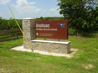
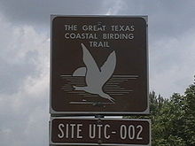
The Anahuac National Wildlife Refuge (NWR) is a wildlife conservation area along the coast of Texas (USA), west of the town of High Island, Texas. It borders East Bay, part of the Galveston Bay complex, behind Bolivar Peninsula at the Gulf of Mexico.

<span class="mw-page-title-main">Pine Gully Park, Seabrook, Texas</span>

Pine Gully Park is a 52-acre (21 ha) park located in Seabrook, Texas in the United States, near Houston. It is located on the shore of Galveston Bay. The park belongs to the Seabrook Trail System and includes undeveloped and restored woodlands, salt marshes and several species of wildlife.

The Texas City Prairie Preserve is a 2,300-acre (9.3 km2) nature preserve located on the shores of Moses Lake and Galveston Bay in Texas City, Texas in the United States, near Houston. The preserve was created in 1995 by the Nature Conservancy thanks to a $2.2 million donation of land by ExxonMobil. The primary goal in creating the preserve was to save the endangered Attwater's prairie chicken, though the preserve protects coastal prairie and supports a wide variety of wildlife.

St. Charles Bay is an inlet of Aransas Bay in Aransas County, Texas. It is flanked by Lamar peninsula on the west and Blackjack peninsula on the east. The bay hosts a valued ecosystem for the endangered whooping crane, and is a prime location for birding and fishing. Goose Island State Park and the Aransas National Wildlife Refuge are located along the bay's shores, attracting nature enthusiasts year-round.

<span class="mw-page-title-main">Estuaries of Texas</span> Estuaries on the Gulf coast of Texas

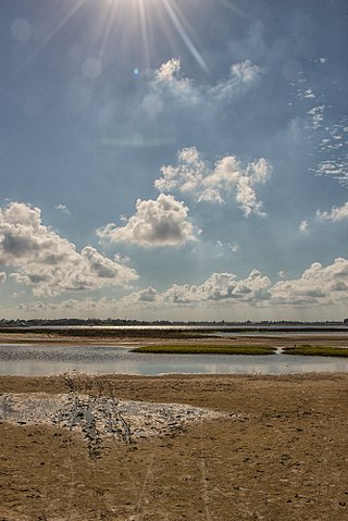
The U.S. state of Texas has a series of estuaries along its coast on the Gulf of Mexico, most of them bounded by the Texas barrier islands. Estuaries are coastal bodies of water in which freshwater from rivers mixes with saltwater from the sea. Twenty-one drainage basins terminate along the Texas coastline, forming a chain of seven major and five minor estuaries: listed from southwest to northeast, these are the Rio Grande Estuary, Laguna Madre, the Nueces Estuary, the Mission–Aransas Estuary, the Guadalupe Estuary, the Colorado–Lavaca Estuary, East Matagorda Bay, the San Bernard River and Cedar Lakes Estuary, the Brazos River Estuary, Christmas Bay, the Trinity–San Jacinto Estuary, and the Sabine–Neches Estuary. Each estuary is named for its one or two chief contributing rivers, excepting Laguna Madre, East Matagorda Bay, and Christmas Bay, which have no major river sources. The estuaries are also sometimes referred to by the names of their respective primary or central water bodies, though each also includes smaller secondary bays, inlets, or other marginal water bodies.

<span class="mw-page-title-main">Christmas Bay (Texas)</span> Estuary bay in Brazoria County, Texas

Christmas Bay is a small bay located on the Texas Gulf Coast in Brazoria County, Texas, immediately southwest of West Bay, near the Galveston Bay system's southwest corner. It is a minor estuary, one of a series of estuaries along the Gulf Coast of Texas, and receives the discharge from Bastrop Bayou, along with the adjacent coastal watershed. The bay is separated from the Gulf of Mexico by Follet's Island and connects with it through San Luis Pass and Cold Pass. Its minor extensions are Bastrop Bay to the north and Drum Bay to the southwest. The nearest city is Freeport, about 10 miles (16 km) to the southwest at the mouth of the Brazos River.

References

29°N96°W / 29°N 96°W / 29; -96