Williamson County is a county in the U.S. state of Texas. As of the 2020 census, its population was 609,017. Its county seat is Georgetown. The county is named for Robert McAlpin Williamson (1804?–1859), a community leader and a veteran of the Battle of San Jacinto.

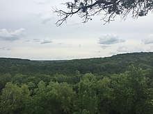
The Texas Hill Country is a geographic region of Central and South Texas, forming the southeast part of the Edwards Plateau. Given its location, climate, terrain, and vegetation, the Hill Country can be considered the border between the American Southeast and Southwest. The region represents the very remote rural countryside of Central Texas, but also is home to growing suburban neighborhoods and affluent retirement communities.

The Balcones Fault or Balcones Fault Zone is an area of largely normal faulting in the U.S. state of Texas that runs roughly from the southwest part of the state near Del Rio to the north-central region near Dallas along Interstate 35. The Balcones Fault zone is made up of many smaller features, including normal faults, grabens, and horsts. One of the obvious features is the Mount Bonnell Fault.

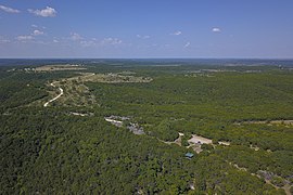
The Edwards Plateau is a geographic region forming the crossroads of Central, South, and West Texas. It is bounded by the Balcones Fault to the south and east, the Llano Uplift and the Llano Estacado to the north, and the Pecos River and Chihuahuan Desert to the west. San Angelo, Austin, San Antonio, and Del Rio roughly outline the area. The southeast portion of the plateau is known as the Texas Hill Country.
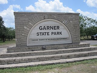
Garner State Park is a state park in the community of Concan, Texas located in Uvalde County, Texas in the United States. Garner State Park, in the Texas Hill Country, is the most popular state park in Texas for overnight camping. It often fills by noon in peak parts of the season. The park is popular with campers and local residents for its activities on the Frio River and the dances held nightly during the spring and summer.

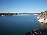
Mount Bonnell, also known as Covert Park, is a prominent point alongside the Lake Austin portion of the Colorado River in Austin, Texas. It has been a popular tourist destination since the 1850s. The mount provides a vista for viewing the city of Austin, Lake Austin, and the surrounding hills. It was designated a Recorded Texas Historic Landmark in 1969, bearing Marker number 6473, and was listed on the National Register of Historic Places in 2015.
Wild Basin Wilderness Preserve consists of 227 acres of native Texas Hill Country habitat west of Austin, Texas in West Lake Hills. The preserve was founded in 1974 by seven women who were members of an environmentalist group called Now or Never, and it was Austin's first nature preserve. The preserve maintains 2.5 miles (4 km) of hiking trails.

Barton Creek is a tributary that feeds the Colorado River as it flows through the Texas Hill Country. The creek passes through some of the more scenic areas in Greater Austin, surrounded in many parts by a greenbelt of protected lands that serves as a habitat for many indigenous species of flora and fauna. The creek passes through Barton Creek Greenbelt and is fed by Barton Springs.
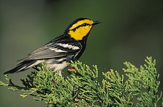
The golden-cheeked warbler is an endangered species of bird that breeds in Central Texas, from Palo Pinto County southwestward along the eastern and southern edge of the Edwards Plateau to Kinney County. The golden-cheeked warbler is the only bird species with a breeding range endemic to Texas.

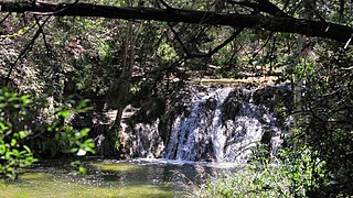
Lost Maples State Natural Area is a 2,906-acre (1,176 ha) area of hills and canyons on the upper Sabinal River in the Edwards Plateau Region of Texas. It is designated a Natural Area, rather than a State Park, which means the primary focus is the maintenance and protection of the property's natural state. Accordingly, access and recreational activities may be restricted if the Texas Parks & Wildlife Department (TPWD) deems such action necessary to protect the environment.

Colorado Bend State Park is a 5,328.3-acre (2,156 ha) state park located in the Hill Country region of the U.S. state of Texas, mostly in San Saba County. It was purchased by the state in 1984 and opened to the public in 1987. It is representative of the karst features typically seen in the Hill Country, with many sinkholes, caves, and springs.

The Edwards Aquifer is one of the most prolific artesian aquifers in the world. Located on the eastern edge of the Edwards Plateau in the U.S. state of Texas, it is the source of drinking water for two million people, and is the primary water supply for agriculture and industry in the aquifer's region. Additionally, the Edwards Aquifer feeds the Comal and San Marcos Springs, provides springflow for recreational and downstream uses in the Nueces, San Antonio, Guadalupe, and San Marcos river basins, and is home to several unique and endangered species.

The black-capped vireo is a small bird native to the United States and Mexico. It was listed as an endangered species in the United States in 1987. Successful conservation efforts on the U.S. Army's Fort Hood and Fort Sill contributed to delisting of the black-capped vireo in 2018. The IUCN lists the species as "near threatened."
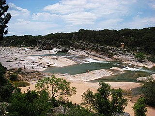
Pedernales Falls State Park is a 5,212-acre state park situated along the banks of the Pedernales River in Blanco County, Texas in the United States.
Palaemon antrorum, also known as the Balcones cave shrimp and the Texas cave shrimp, is a species of palaemonid shrimp endemic to Texas. It is listed as an endangered species on the IUCN Red List, and as a Species of Concern by the United States Endangered Species Act.
Canyon Creek is a residential neighborhood located in far northwest Austin, Texas. The neighborhood is located in ZIP Code 78726 and is bordered by Ranch to Market Road 2222 (RM2222) on the south, Ranch to Market Road 620 North (RR620) on the west, Anderson Mill Road on the north, and a major headwater tributary of Bull Creek to the east as well as the Balcones Canyonlands National Wildlife Refuge. The wildlife refuge gives the neighborhood of over 1300 homes a semi-rural feeling despite being less than four miles to major shopping and employment centers. The major bisecting road is Boulder Lane, which winds its way through the picturesque, upper-middle-class neighborhood of single-family homes. Boulder Lane is a loop, and crosses RR620 in two places. The neighborhood is approximately 5 miles from Lake Travis and Lake Austin. Ranch Road 620 runs into the new toll roads of State Highway 45 at Lakeline Mall. Fast ways to get downtown is by taking 620 to 183 and going south. Another fast route is taking 620 to 2222 and then onto 360 to the left or the right. Left will take you to Gateway Theater on 183 and right will take you out to southern Austin and that is also a good route to the airport and San Antonio.

Bull Creek is a tributary of the Colorado River originating in the Texas Hill Country. The creek passes through some of the more scenic areas in the Austin region and forms a greenbelt that is the habitat for many indigenous species of flora and fauna. It runs beneath steep slopes and benches surfaced with shallow clay loams that support ashe juniper, escarpment live oak, mesquite, and grasses.

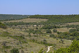
Hill Country State Natural Area (HCSNA) preserves 5,369 acres (21.73 km2) of rugged, relatively pristine Hill Country terrain in Bandera County, Texas. It was opened to the public in 1984. Since HCSNA is designated a "Natural Area" rather than a "State Park", the first priority of the Texas Parks and Wildlife Department (TPWD) is the maintenance and preservation of the property's natural state. Accordingly, facilities are purposely somewhat primitive and recreational activities may be curtailed if the TPWD deems it necessary to protect the environment.
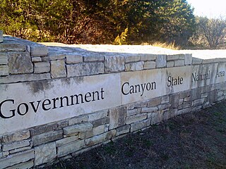
First opened to the public in October, 2005, Government Canyon State Natural Area (GCSNA) preserves 12,244 acres of rugged hills and canyons typical of the Texas Hill Country. It is designated a Natural Area, rather than a State Park, and therefore the primary focus is maintenance and protection of the property's natural state. Accordingly, access and recreational activities may be restricted if the Texas Parks & Wildlife Department (TPWD) deems such action necessary to protect the environment.

Croton alabamensis var. texensis is a variety of Croton alabamensis that is endemic to the state of Texas in the United States. It is commonly known as the Texabama croton.