Panhandle Plains Wildlife Trail

Last updated
Panhandle Plains Wildlife Trail
Location Texas Pandandle
Use Bird watching / hiking

The Panhandle Plains Wildlife Trail is a state-designated system of trails and wildlife sanctuaries in the Texas Panhandle in the United States. It is one of the four major wildlife trail systems designated by the State of Texas.

Texas Panhandle Region in Texas, United States

The Texas Panhandle is a region of the U.S. state of Texas consisting of the northernmost 26 counties in the state. The panhandle is a rectangular area bordered by New Mexico to the west and Oklahoma to the north and east. The Handbook of Texas defines the southern border of Swisher County as the southern boundary of the Texas Panhandle region.

United States Federal republic in North America

The United States of America (USA), commonly known as the United States or America, is a country comprising 50 states, a federal district, five major self-governing territories, and various possessions. At 3.8 million square miles, the United States is the world's third or fourth largest country by total area and is slightly smaller than the entire continent of Europe's 3.9 million square miles. With a population of over 327 million people, the U.S. is the third most populous country. The capital is Washington, D.C., and the largest city by population is New York City. Forty-eight states and the capital's federal district are contiguous in North America between Canada and Mexico. The State of Alaska is in the northwest corner of North America, bordered by Canada to the east and across the Bering Strait from Russia to the west. The State of Hawaii is an archipelago in the mid-Pacific Ocean. The U.S. territories are scattered about the Pacific Ocean and the Caribbean Sea, stretching across nine official time zones. The extremely diverse geography, climate, and wildlife of the United States make it one of the world's 17 megadiverse countries.

The trail system forms a loop that runs from Abilene to Lubbock and Amarillo, around to Canadian and Shamrock, and back to Abilene.

Abilene, Texas City in Texas, United States

Abilene is a city in Taylor and Jones counties in Texas, United States. The population was 117,463 at the 2010 census, making it the 27th-most populous city in the state of Texas. It is the principal city of the Abilene Metropolitan Statistical Area, which had a 2017 estimated population of 170,219. It is the county seat of Taylor County. Dyess Air Force Base is located on the west side of the city.

Lubbock, Texas City in Texas, United States

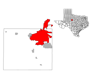
Lubbock is the 11th-most populous city in the U.S. state of Texas and the county seat of Lubbock County. With a population of 256,042 in 2015, the city is also the 83rd-most populous in the United States. The city is in the northwestern part of the state, a region known historically and geographically as the Llano Estacado, and ecologically is part of the southern end of the High Plains, lying at the economic center of the Lubbock metropolitan area, which has a projected 2020 population of 327,424.

Amarillo, Texas City in Texas, United States

Amarillo is the 14th-most populous city in the state of Texas, United States. It is also the largest city in the Texas Panhandle, and the seat of Potter County. A portion of the city extends into Randall County. The estimated population was 199,826 as of 2017. The Amarillo metropolitan area has an estimated population of 276,020 in four counties as of 2017. The metro population is projected to surpass 310,000 in 2020.

Notes

    Coordinates: 33°N100°W / 33°N 100°W / 33; -100


    Related Research Articles

    Texas County, Oklahoma County in the United States

    Texas County is a county located in the panhandle of the U.S. state of Oklahoma. Its county seat is Guymon. As of the 2010 census, the population was 20,640. It is the second-largest county in the state, based on land area, and is named for Texas, the state that adjoins the county to its south.

    Abilene, Kansas City and County seat in Kansas, United States

    Abilene is a city in and the county seat of Dickinson County, Kansas, United States. As of the 2010 census, the city population was 6,844. The Dwight D. Eisenhower Presidential Library and Museum is located in Abilene.

    Panhandle, Texas Town in Texas, United States

    Panhandle is the county seat of Carson County, Texas, United States. The population of the town was 2,452 at the 2010 census. Panhandle is part of the Amarillo metropolitan statistical area.

    West Texas Region in Texas, United States

    West Texas is a loosely defined part of the U.S. state of Texas, generally encompassing the arid and semiarid lands west of a line drawn between the cities of Wichita Falls, Abilene, and Del Rio.

    Oklahoma Panhandle panhandle in north-western Oklahoma

    The Oklahoma Panhandle is the extreme northwestern region of the U.S. state of Oklahoma, consisting of Cimarron County, Texas County and Beaver County, from west to east. As with other salients in the United States, its name comes from the similarity of its shape to the handle of a pan.

    Attwater Prairie Chicken National Wildlife Refuge

    Attwater Prairie Chicken National Wildlife Refuge, is a federally protected refugium encompassing one of the largest remnants of coastal prairie habitat remaining in southeast Texas, United States and home to one of the last populations of the critically endangered Attwater's prairie chicken, a ground-dwelling grouse of the coastal prairie ecosystem.

    Texass 13th congressional district Congressional district in the state of Texas

    Texas District 13 of the United States House of Representatives is a Congressional District of the U.S. state of Texas that includes most of the Texas Panhandle, parts of Texoma and northeastern parts of North Texas. It winds across the Panhandle into the South Plains, then runs east across the Red River Valley. Covering over 40,000 square miles (100,000 km2), it is the second-largest district geographically in Texas and larger in area than thirteen entire states. The principal cities in the district are Amarillo and Wichita Falls. The current Representative is Republican Mac Thornberry.

    Wildcat Hills

    The Wildcat Hills are an escarpment between the North Platte River and Pumpkin Creek in the western Panhandle, in the state of Nebraska in the Great Plains region of the United States. Located in Banner, Morrill, and Scotts Bluff counties, the high tableland between the streams has been eroded by wind and water into a region of forested buttes, ridges and canyons that rise 150 to 300 m above the surrounding landscape.

    Fort Worth and Denver Railway

    The Fort Worth and Denver Railway, nicknamed "the Denver Road," was a Class I American railroad company that operated in the northern part of Texas from 1881 to 1982, and had a profound influence on the early settlement and economic development of the region.

    Geography of Texas

    The geography of Texas is diverse and large. Occupying about 7% of the total water and land area of the U.S., it is the second largest state after Alaska, and is the southernmost part of the Great Plains, which end in the south against the folded Sierra Madre Oriental of Mexico. Texas is in the south-central part of the United States of America, and is considered to form part of the U.S. South and also part of the U.S. Southwest.

    The Beaver River is the historic name for an intermittent river in Oklahoma that drains most of the Oklahoma Panhandle. It is also known as the North Canadian River; both names are in common use. The Beaver River flows from Union County, New Mexico, entering the Oklahoma Panhandle in Cimarron County, then flowing out of state through Sherman County in the Texas Panhandle for about 15 miles (24 km), then back to the Oklahoma panhandle in Texas County, where it is impounded in Optima Lake near Guymon. Downstream of the dam, it continues through the Oklahoma counties of Beaver and Harper before ending in Woodward County.

    U.S. Route 60 in Texas highway in Texas

    The portion of U.S. Highway 60 in Texas is a highway that runs southwest to northeast through the Texas Panhandle. The highway spends 210.698 miles (339.086 km) in Texas.

    Harold Dow Bugbee was an American Western artist, illustrator, painter, and curator of the Panhandle-Plains Historical Museum in Canyon, Texas. Bugbee sought with considerable success to become the dominant artist of the Texas South Plains, as his role model, Charles M. Russell of Montana, accordingly sketched life of the northern Great Plains.

    The West Texas Historical Association is an organization of both academics and laypersons dedicated to the preservation and dissemination of the total history of West Texas, loosely defined geographically as all Texas counties and portions of counties located west of Interstate 35.

    Great Texas Coastal Birding Trail

    The Great Texas Coastal Birding Trail is a state-designated system of trails, bird sanctuaries, and nature preserves along the entire length of the Texas Gulf Coast in the United States. As the state of Texas hosts more bird species than any other in the U.S. the trail system offers some of the most unusual opportunities for bird-watching in the world. The "trail" is actually 43 separate hiking and driving trails that include 308 birding sites. The sites themselves feature a variety of viewing opportunities with boardwalks, observation decks, and other amenities. The trails boast more than 450 bird species. The trail system is managed by the Texas Parks and Wildlife Department as part of the Great Texas Wildlife Trails which also include the Heart of Texas Wildlife Trail, the Panhandle Plains Wildlife Trail, and the Prairies and Pineywoods Wildlife Trail.

    The Heart of Texas Wildlife Trail is a state-designated system of trails and wildlife sanctuaries in Central Texas in the United States. It is one of the four major wildlife trail systems designated by the State of Texas.

    The Prairies and Pineywoods Wildlife Trail is a state-designated system of trails and wildlife sanctuaries in the Texas Panhandle in the United States. It is one of the four major wildlife trail systems designated by the State of Texas.

    State wildlife trails in the United States are state-sponsored systems of hiking and driving trails developed for the benefit of birdwatching and wildlife enthusiasts. They have been created and maintained by state governments or other state-level entities, both to promote ecology and to promote tourism. The term "trail" used in the names of most of these systems is, in general, a misnomer as that these trail networks are not single routes and are connected by motorways.