Milecastle 48 , is a milecastle on Hadrian's Wall. Its remains lie near the village of Gilsland in Cumbria where it was historically known as "The King's Stables", owing to the well-preserved interior walls. Unusually a substantial section of stone stairs has survived within the milecastle. The two turrets associated with this milecastle have also survived as above-ground masonry.
Milecastle 49 was a milecastle on Hadrian's Wall.
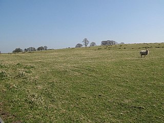
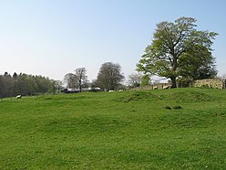
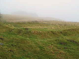
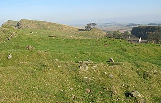
Milecastle 50 was a milecastle on Hadrian's Wall.

Milecastle 52 (Bankshead) was a milecastle on Hadrian's Wall.

Milecastle 53 was a milecastle on Hadrian's Wall.
Milecastle 39 is a milecastle on Hadrian's Wall.
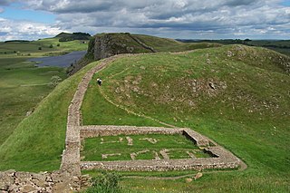
Milecastle 38 (Hotbank) was a milecastle on Hadrian's Wall in the vicinity of Hotbank Farm,. It is notable for the joint inscription bearing the names of the emperor Hadrian and Aulus Platorius Nepos, the governor of Brittania at the time the Wall was built.
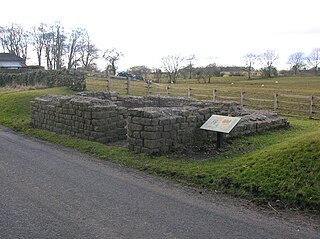
Leahill Turret is a typical example of one of the lookout towers located between the milecastles on Hadrian's Wall in Cumbria; located on the Lanercost Road near Banks, Parish of Waterhead. It is designated turret 51b and lies east of the Signal Tower at Pike Hill.

Milecastle 20 was one of the milecastles on Hadrian's Wall. It is situated in the hamlet of Halton Shields, and was excavated in 1935. There is no visible trace of the milecastle above ground.

Milecastle 79 was one of a series of Milecastles or small fortlets built at intervals of approximately one Roman mile along Hadrian's Wall.

Milecastle 72 was one of a series of Milecastles or small fortlets built at intervals of approximately one Roman mile along Hadrian's Wall.
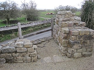
Pike Hill Signal Tower was one of a number of signal stations that were built on high ground overlooking the line of the Roman Stanegate road in northern Britannia during the early 2nd century. It later became incorporated into Hadrian's Wall. Its remains, a 2-metre long fragment of the south-east wall, lie south of a modern road cutting and field wall, and are located in the parish of Waterhead in Cumbria, United Kingdom. The tower is located between Turret 51B and Turret 52A with the fort of Banna located to the east.

Milecastle 33 was a milecastle of the Roman Hadrian's Wall, one of a series of small fortlets built at intervals of approximately one Roman mile along the length of the UNESCO World Heritage Site in northern England.

Milecastle 34 (Grindon) was a milecastle of the Roman Hadrian's Wall. There are no visible remains, but the site is within a small, tree-filled, walled enclosure located around 0.5 kilometres (0.31 mi) east of Sewingshields farm.
Milecastle 44 (Allolee) was a milecastle on Hadrian's Wall.

Milecastle 37 is one of the milecastles on Hadrian's Wall. It is immediately west of the Housesteads Roman Fort.

Milecastle 35 (Sewingshields) is one of the milecastles on Hadrian's Wall. The remains still exist as exposed masonry.

Milecastle 36 was one of the milecastles on Hadrian's Wall. There is little to see on the ground as most of the walls have been robbed and quarried away.
Milecastle 45 (Walltown) was a milecastle on Hadrian's Wall.

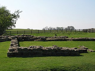
Milecastle 50TW was a milecastle on the Turf Wall section of Hadrian's Wall. The milecastle is located close to the Birdoswald Roman Fort and is unique in that it was not replaced by a stone milecastle when the turf wall was upgraded to stone, the replacement wall instead running some 200m to the north. The milecastle was partially demolished by the Romans after it was abandoned. The milecastle was excavated in 1934 and several Roman rubbish pits discovered. The remains of the two turrets associated with this milecastle have also been located. As the turf wall lies some distance from the stone wall, the sites are not accessible from the Hadrian's Wall Path.