Milecastle 53

Last updated

Milecastle 53
Hadrian's Wall at Hare Hill - geograph.org.uk - 2886878.jpg
Hadrian's Wall at Hare Hill, just west of the site of Milecastle 53
Cumbria UK location map.svg
Red pog.svg
Location within Cumbria
Type Milecastle
Location
Coordinates 54°58′27″N2°40′53″W / 54.974146°N 2.681336°W / 54.974146; -2.681336 Coordinates: 54°58′27″N2°40′53″W / 54.974146°N 2.681336°W / 54.974146; -2.681336
CountyCumbria
CountryEngland
Reference
UK-OSNG reference NY56486460

Milecastle 53 (Banks Burn) was a milecastle on Hadrian's Wall (grid reference NY56486460 ).

Contents

Description

Milecastle 53 is west of the hamlet of Banks, Cumbria and northeast of Lanercost Priory. It lies 1520 metres west of Milecastle 52 and 1436 metres east of Milecastle 54. There is no trace of the milecastle visible. [1]

The tall section of Hadrian's Wall at Hare Hill (standing to a height of about 2.7 metres) is just 80 metres west of Milecastle 53 (grid reference NY56406462 ). [2]

Excavations

Milecastle 53 was excavated in 1932. It measured 21.9 metres east to west by 23.3 metres north to south. It had Type III gateways.

The excavation found that most of the milecastle had been robbed of masonry and the original floor had been removed so that no internal buildings remained. [1] Some remnants of the earlier Turf Wall milecastle remained in the northeast corner and south section. [1]

Associated turrets

Each milecastle on Hadrian's Wall had two associated turret structures. These turrets were positioned approximately one-third and two-thirds of a Roman mile to the west of the Milecastle, and would probably have been manned by part of the milecastle's garrison. The turrets associated with Milecastle 53 are known as Turret 53A and Turret 53B.

Turret 53A

Turret 53A (Hare Hill) (grid reference NY56126461 ) survives as a slight earthwork platform. The turret was found in 1854 or 1855, and excavated in 1932. [3] The interior was found to be full of ashes. [3]

Turret 53B

Turret 53B (Craggle Hill) (grid reference NY55536453 ) also survives as a slight earthwork platform. It was excavated in 1932. [4] The turret was the most easterly structure in Hadrian's Wall to use red sandstone. [4]

Related Research Articles

Milecastle 48

Milecastle 48 , is a milecastle on Hadrian's Wall. Its remains lie near the village of Gilsland in Cumbria where it was historically known as "The King's Stables", owing to the well-preserved interior walls. Unusually a substantial section of stone stairs has survived within the milecastle. The two turrets associated with this milecastle have also survived as above-ground masonry.

Milecastle 50

Milecastle 50 was a milecastle on Hadrian's Wall.

Milecastle 51

Milecastle 51 was a milecastle on Hadrian's Wall.

Milecastle 52

Milecastle 52 (Bankshead) was a milecastle on Hadrian's Wall.

Milecastle 39

Milecastle 39 is a milecastle on Hadrian's Wall.

Milecastle 38

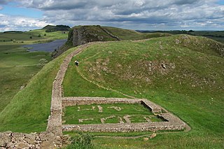
Milecastle 38 (Hotbank) was a milecastle on Hadrian's Wall in the vicinity of Hotbank Farm,. It is notable for the joint inscription bearing the names of the emperor Hadrian and Aulus Platorius Nepos, the governor of Brittania at the time the Wall was built.

Milecastle 20

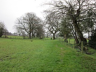
Milecastle 20 was one of the milecastles on Hadrian's Wall. It is situated in the hamlet of Halton Shields, and was excavated in 1935. There is no visible trace of the milecastle above ground.

Milecastle 79

Milecastle 79 was one of a series of Milecastles or small fortlets built at intervals of approximately one Roman mile along Hadrian's Wall.

Milecastle 42

Milecastle 42 (Cawfields) is a milecastle on Hadrian's Wall.

Milecastle 47

Milecastle 47 was a milecastle on Hadrian's Wall.

Milecastle 32

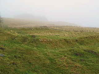
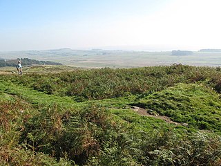
Milecastle 32 (Carraw) was a milecastle of the Roman Hadrian's Wall. Its remains exist as earthworks and with no exposed masonry. The layout of the milecastle walls is defined by robber trenches (to a maximum depth of 0.3 metres. The north wall is beneath a modern wall.

Milecastle 44

Milecastle 44 (Allolee) was a milecastle on Hadrian's Wall.

Milecastle 37

Milecastle 37 is one of the milecastles on Hadrian's Wall. It is immediately west of the Housesteads Roman Fort.

Milecastle 35

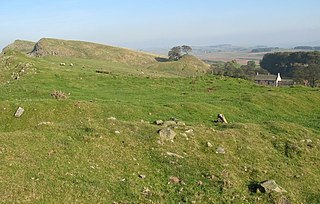
Milecastle 35 (Sewingshields) is one of the milecastles on Hadrian's Wall. The remains still exist as exposed masonry.

Milecastle 36

Milecastle 36 was one of the milecastles on Hadrian's Wall. There is little to see on the ground as most of the walls have been robbed and quarried away.

Milecastle 45

Milecastle 45 (Walltown) was a milecastle on Hadrian's Wall.

Milecastle 46

Milecastle 46 (Carvoran) was a milecastle on Hadrian's Wall.

Milecastle 54

Milecastle 54 (Randylands) was a milecastle on Hadrian's Wall.

Milecastle 55

Milecastle 55 was a milecastle on Hadrian's Wall.

Milecastle 57

Milecastle 57 (Cambeckhill) was a milecastle on Hadrian's Wall.

References

  1. 1 2 3 MILECASTLE 53, Pastscape, retrieved 5 December 2013
  2. HARE HILL, Pastscape, retrieved 5 December 2013
  3. 1 2 TURRET 53A, Pastscape, retrieved 5 December 2013
  4. 1 2 TURRET 53B, Pastscape, retrieved 5 December 2013