
Milecastle 79 (Solway House) was one of a series of Milecastles or small fortlets built at intervals of approximately one Roman mile along Hadrian's Wall (grid reference NY23596224).

Milecastle 77 (Raven Bank) was one of a series of Milecastles or small fortlets built at intervals of approximately one Roman mile along Hadrian's Wall (grid reference NY25666068).
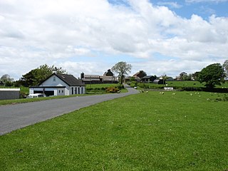
Milecastle 76 (Drumburgh) was one of a series of Milecastles or small fortlets built at intervals of approximately one Roman mile along Hadrian's Wall (grid reference NY26685987).

Milecastle 72 (Fauld Farm) was one of a series of Milecastles or small fortlets built at intervals of approximately one Roman mile along Hadrian's Wall (grid reference NY32415913).
Milecastle 71 (Wormanby) was one of a series of Milecastles or small fortlets built at intervals of approximately one Roman mile along Hadrian's Wall (grid reference NY33805920).

A turret was a small watch tower, incorporated into the curtain wall of Hadrian's Wall. The turrets were normally spaced at intervals of one third of a Roman mile between Milecastles, giving two Turrets between each Milecastle.

Milefortlet 1 (Biglands House) was a milefortlet of the Roman Cumbrian Coast defences. These milefortlets and intervening stone watchtowers extended from the western end of Hadrian's Wall, along the Cumbrian coast and were linked by a wooden palisade. They were contemporary with defensive structures on Hadrian's Wall. The remains of Milefortlet 1 survive as a slight earthwork.

Milefortlet 3 (Pasture House) was a Milefortlet of the Roman Cumbrian Coast defences. These milefortlets and intervening stone watchtowers extended from the western end of Hadrian's Wall, along the Cumbrian coast and were linked by a wooden palisade. They were contemporary with defensive structures on Hadrian's Wall. There is little to see on the ground but Milefortlet 3 has been located on aerial photographs.

Milefortlet 4 (Herd Hill) was a Milefortlet of the Roman Cumbrian Coast defences. These milefortlets and intervening stone watchtowers extended from the western end of Hadrian's Wall, along the Cumbrian coast and were linked by a wooden palisade. They were contemporary with defensive structures on Hadrian's Wall. There is little to see on the ground but Milefortlet 4 has been located by archaeologists.

Milefortlet 9 (Skinburness) was a Milefortlet of the Roman Cumbrian Coast defences. These milefortlets and intervening stone watchtowers extended from the western end of Hadrian's Wall, along the Cumbrian coast and were linked by a wooden palisade. They were contemporary with defensive structures on Hadrian's Wall. There is little to see on the ground but Milefortlet 9 has been located on aerial photographs.

Milefortlet 22 (Brownrigg) was a Milefortlet of the Roman Cumbrian Coast defences. These milefortlets and intervening stone watchtowers extended from the western end of Hadrian's Wall, along the Cumbrian coast and were linked by a wooden palisade. They were contemporary with defensive structures on Hadrian's Wall. There is little to see on the ground, but Milefortlet 22 has been located and excavated.

Milefortlet 23 (Sea Brows) was a Milefortlet of the Roman Cumbrian Coast defences. These milefortlets and intervening stone watchtowers extended from the western end of Hadrian's Wall, along the Cumbrian coast and were linked by a wooden palisade. They were contemporary with defensive structures on Hadrian's Wall. There is nothing to see on the ground, but Milefortlet 23 has been located and surveyed.

Milefortlet 2 was a Milefortlet of the Roman Cumbrian Coast defences. These milefortlets and intervening stone watchtowers extended from the western end of Hadrian's Wall, along the Cumbrian coast and were linked by a wooden palisade. They were contemporary with defensive structures on Hadrian's Wall. The exact location of Milefortlet 2 is unknown, although one of the nearby turrets has been located and excavated.

Milefortlet 15 was a Milefortlet of the Roman Cumbrian Coast defences. These milefortlets and intervening stone watchtowers extended from the western end of Hadrian's Wall, along the Cumbrian coast and were linked by a wooden palisade. They were contemporary with defensive structures on Hadrian's Wall. The site of Milefortlet 15 has been probably been destroyed by coastal erosion. A 3rd-century Roman cemetery, associated with a nearby fort at Beckfoot, was located in the area of the milefortlet.

Milefortlet 14 was a Milefortlet of the Roman Cumbrian Coast defences. These milefortlets and intervening stone watchtowers extended from the western end of Hadrian's Wall, along the Cumbrian coast and were linked by a wooden palisade. They were contemporary with defensive structures on Hadrian's Wall. The site of Milefortlet 14 has never been identified and it may lie beneath the village of Beckfoot. A larger fort known as Bibra Roman Fort was located 500 metres south-west of Milefortlet 14.

Milefortlet 25 was a Milefortlet of the Roman Cumbrian Coast defences. These milefortlets and intervening stone watchtowers extended from the western end of Hadrian's Wall, along the Cumbrian coast and were linked by a wooden palisade. They were contemporary with defensive structures on Hadrian's Wall. Milefortlet 25 is the southernmost known of the fortlets of the Cumberland coast, but there is nothing to see on the ground, as Milefortlet 25 lies in an industrial area of Maryport.

Milefortlet 11 was a Milefortlet of the Roman Cumbrian Coast defences. These milefortlets and intervening stone watchtowers extended from the western end of Hadrian's Wall, along the Cumbrian coast and were linked by a wooden palisade. They were contemporary with defensive structures on Hadrian's Wall. Milefortlet 11 has never been accurately located on the ground although other Roman remains have been found in the area.

Milecastle 56 (Walton) was a milecastle on Hadrian's Wall (grid reference NY522643).

Milecastle 57 (Cambeckhill) was a milecastle on Hadrian's Wall (grid reference NY50816368).
Milecastle 65 (Tarraby) was a milecastle on Hadrian's Wall (grid reference NY40855793).


